This past month I partook in camping out in Sierra National Forest. My route into Sierra National Forest was on Forest Route 10 which is a segment of the Sierra Vista Scenic Byway.

Sierra Vista Scenic Byway is an 82.7 mile loop of much of Sierra National Forest along the western flank of the San Joaquin River basin. The Sierra Vista Scenic Byway was created in 1989 from the following Forest Routes:
- From CA 41; northeast on Road 632/Sky Ranch Road to the boundary of Sierra National Forest where the road becomes Forest Route 10/Forest Road 6S10.
- Forest Route 10 north of Fresno Dome to where the designation moves to Forest Road 6S10X/Beasore Loop.
- Forest Route 10 to Forest Route 7/Beasore Road on Forest Road 5S07.
- Forest Route 7 northeast Forest Route 81/Minarets Road on Forest Road 4S81 at Clover Meadow.
- Forest Route 81 to the boundary of Sierra National Forest where it becomes Road 225 near North Fork.
The Sierra Vista Scenic Byway has several lengthy dirt segments in the following sections:
- Forest Route 10 from Forest Road 6S40 northeast to Forest Route 7.
- Forest Route 7 from Globe Rock northeast to Clover Meadow.
Despite a sizeable portion of the Sierra Vista Scenic Byway not being paved it is advertised as accessible by all vehicles. A full map of the Sierra Vista Scenic Byway can be found below.
Sierra Vista Scenic Byway Map
For simplicity I snipped images of the Sierra Vista Scenic Byway Map:


The Sierra Vista Scenic Byway also has it's own website:
https://www.sierravistascenicbyway.com/
The National Forest Service interactive map can be found below which goes into far more detail regarding roadways in all National Forests.
National Forest Service Interactive Visitor Road Map
Sierra National Forest dates back to 1893. That being the case some of the roadways that are part of the Sierra Vista Scenic Byway are quite old. On the 1935 California Division of Highways Map of Madera County the following roadways appear:
- Much of Forest Route 10 on Forest Roads 6S10 and 6S10X.
- Forest Route 7 on Forest Road 5S07 from the terminus of Forest Route 10/Forest Road 6S10X to Clover Meadow.
- Some of Road 225 and Forest Route 81 on Forest Road 4S81 to Ross Creek.
Said Division of Highways Map can be found below:
1935 Madera County Highway Map
My approach to Road 632/Sky Ranch Road was from CA 41 north of Oakhurst approximately 3,000 feet above elevation at Post Mile MAD 39.629. Interestingly there is no Sierra Scenic Byway Signage directing traffic eastward into Sierra National Forest from Oakhurst. I find the lack of signage for the Sierra Vista Scenic Byway on CA 41 north of Oakhurst surprising given it is one of the primary entry points for nearby Yosemite National Park. At Post Mile MAD 17.909 there is a large sign for the Sierra Scenic Byway at Road 200/North Fork Road directing traffic toward Forest Route 81. The Sierra Sky Ranch is signed just off of CA 41. The Sky Ranch dates back to 1875 when it was a working ranch supplying the saw mills in Sugar Pine but was converted into a hotel circa 1945.


Road 632/Sky Ranch Road eastbound almost immediately crosses Lewis Creek.


East of the Yosemite Bible Camp Road 632/Sky Ranch Road enters Sierra National Forest and becomes Forest Route 10 (Forest Road 6S10). There isn't an immediate reassurance shields but the giveaway for the boundary is a guide sign which displays the Nelder Redwood Grove.


The first Forest Route 10 shield appears just past Buckskin Lane along with a large sign displaying the Sierra Vista Scenic Byway.
Traffic is advised of weight restrictions up ahead on Forest Route 10/6S10 which are quite hefty. In addition to large campers it isn't uncommon to see cattle drives on Forest Route 10/6S10.

Forest Route 10/6S10 makes a shift climb through a series of switch backs to approximately 5,000 feet above sea level.


At 5,000 feet above sea level there is a large burn area which provides a overlook of Oakhurst and Madera out in San Joaquin Valley.


From the overlook there is signed access to Calvin Crest via Calvin Crest Road.


Forest Route 10/6S10 enters a wooded area and access to the Nelder Redwood Grove is signed via Forest Road 6S47Y.


Forest Road 6S47Y makes a steep climb on a grade suitable for cars up and intersects Forest Road 6S90 in the Nelder Grove.


A legend for the Nelder Grove can be found at the terminus of Forest Road 6S47Y.

Forest Road 6S90 westward heads towards Sugar Pine and CA 41. Heading east on Forest Road 6S90 will loop traffic back to Forest Route 10/6S10.

As of July 2020 Forest Road 6S90 west of Forest Road 6S47Y is closed due to damage from forest fires of previous years.

Forest Road 6S90 east quickly intersects Forest Road 5S19. Traffic headed to the Nelder Grove Interpretive Area & Campground is directed to take Forest Road 5S19.


Forest Road 5S19 makes a steep climb to two historic cabins near the Nelder Grove Campground Host site.


The two cabins were originally located in Biledo Meadows on the southwest side of Mount Raymond. The Biledo Meadow Cabins were constructed during the late 19th Century and were brought to Nelder Grove during the early 1980s to ensure their preservation. The Friends of the Nelder Grove provides much of the historic placard information found at the Biledo Meadow Cabins.


Numerous Redwood Sequoia stumps can be found around the Biledo Meadow Cabins which is evidence of the Nelder Grove's logging history. The Nelder Grove was logged beginning in the 1870s by the California Lumber Company which based it's operations out of the site of present Camp Redwood.


Replicas of the Madera Flume & Trading Company two-pole chute can be found at the Biledo Meadow Cabins.


A replica of the Madera Flume & Trading Company tramway can also be found at the Biledo Meadow Cabins.


Forest Road 5S19 terminates at the Nelder Grove Campground. The site of the Nelder Grove Campground once was the location of California Lumber Company Mill #4 between 1888-1892. The Chimney Tree Trail can be found in the Nelder Grove Campground.


The Bull Buck Loop can be found at the end of the Nelder Grove Campground. The Bull Buck Loop is cited at the Biledo Meadow Cabins as being the original logging road.


The Bull Buck Loop accesses the Bull Buck Tree which is noted for it's 100 foot circumference.


Returning from the Nelder Grove via Forest Road 6S47Y; the route of Forest Route 10/6S10 traverses a couple more switchbacks before becoming unpaved.


I made a turn off of Forest Route 10/6S10 onto Forest Road 6S40 towards Greys Mountain Campground.


Unlike Forest Route 10/6S10 there is very little grading on Forest Road 6S40. Forest Road 6S40 can be traversed via a low clearance vehicle but it isn't very easy (I should note that Forest Service maps outright don't recommend it) and requires paying attention to spot large ruts. Forest Road 6S40 travels southeast towards Forest Route 7.


Forest Road 6S40 intersects Forest Road 6S11X and crosses North Fork Willow Creek on a bridge dated from 1955. There appears to be a automated flood gauge located on the west bank of North Fork Willow Creek.


Greys Mountain Campground is located on North Fork Willow Creek at the intersection of Forest Road 6S40 and Forest Road 6S08. Forest Road 6S40 heads right at the fork in the road towards Forest Route 7.


My camp spot was located directly on North Fork Willow Creek off a campground side road.


Suffice to say having a quite little creek to myself with no cellular service (it stops near the Nelder Grove turn off) was a nice change of pace. Really I don't have much to say other than it was nice to be unreachable for a couple days, but I suppose that is what camping deep in a National Forest is for.


Staying out on Forest Routes usually has it's own oddities. I wouldn't exactly qualify Forest Road 6S40 as a "dirt superhighway" per se but it is an active road for cattle drives.

Forest Road 6S11X can be taken south from Grey's Mountain Campground towards the Bass Lake Vista.


An eroded path from Forest Road 6S11X descends down to a cascade on North Fork Willow Creek.


Forest Road 6S11X is a very rough road that strewn with loose rock as it ascends atop a cliff above North Fork Willow Creek.


Looking northward offers a clear indication how high Forest Road 6S11X is above North Fork Willow Creek.

Forest Road 6S11X is observable from Forest Road 6S40 east of Grey's Mountain Campground.

Forest Road 6S11X southbound terminates at it's parent Forest Road 6S11. Forest Road 6S11 is the normal route of access to the Bass Lake Vista from Forest Route 10/6S10.


The route to the Bass Lake Vista follows Forest Road 6S11 and continues south on Forest Road 6S88.


Forest Road 6S88 continues southward on a high clearance grade. Forest Road 6S88 is fairly flat until a final ascent at it's terminus at Bass Lake Vista.


The Bass Lake Vista is located at 5,276 feet above sea level. The Bass Lake Vista overlooks the namesake Bass Lake which can be found at an elevation of 3,369 feet above sea level. More regarding the history of Bass Lake can be found in the Gribblenation article regarding the Minarets & Western Railroad.

In August I made a return to the Sierra Vista Scenic Byway to complete the entire 82.7 mile circuit. I began from CA 41 at Sky Ranch as I had in the previous month when camping. From CA 41 at Sky Ranch the route on Road 632/Sky Ranch Road and Forest Route 10/6S10 is approximately 11 miles. I resumed taking photos at the junction of Forest Route 10/6S10 and Forest Road 6S40. From Forest Road 6S40 the Fresno Dome Campground is signed as being 5 miles away on Forest Route 10/6S10.

As noted above Forest Route 10/6S10 drops to a dirt surface north of Forest Road 6S40. The road surface of Forest Route 10 was clearly once paved as the top layer of dirt makes for a somewhat bumpy drive. Near Forest Road 6S10A the mainline Forest Route 10 crosses over Siphon Mid Ditch on the 1950 Fresno Dome Bridge.


Approaching the Fresno Dome Vista the path of Forest Route 10/6S10 enters Soquel Meadow with an abandoned ranch being located right alongside the roadway. Entering the meadow the Fresno Dome can clearly be seen in full view from Forest Route 10.


Beyond Soquel Meadow there is a poorly marked pull-out for Fresno Dome. Fresno Dome is granite dome formation which rises above Soquel Meadow and is located at an elevation of 7,544 feet above sea level.


North of the Fresno Dome Vista the alignment of Forest Route 10/6S10 becomes paved again and has an access point for Kelty Meadow Campground. North of Kelty Meadow Campground Forest Route 10 meets Forest Road 6S10X/Beasore Loop. The Sierra Vista Scenic Byway and Forest Route 10 make an eastern turn on Forest Road 6S10X which connects to Forest Route 7/Beasore Road 6 miles away. As evidenced by the third photo below there was logging operations ongoing at the junction of Forest Road 6S10 and Forest Road 6S10X.


Of note; Forest Route numbers generally follow a convention based off the Township they originate in. All National Forests are charted in a Township and Range grid, in the case of the former they span 6 mile sectors. For roads like Forest Route 10 they also carry a Forest Road Number which denotes it's Township point of origin. Much of Forest Route 10 is internally numbered as Forest Road 6S10 denoting it's point of origin is in Township 6S of Sierra National Forest. Forest Service Roads are given numbers based off where what Township the north terminus is located in. Spur routes of a mainline Forest Route carry a letter designation at the end hence why Beasore Loop is signed is numbered Forest Road 6S10X. Most National Forests tend to place two digit route shields on Forest Routes which are suited to travel by conventional vehicles which includes run of the mill cars. In the case of the Sierra Vista Scenic Byway while there are rough roads in it's alignment all of them can be traversed by a normal low clearance car.

It should be noted that Sierra National Forest shares a Township and Range grid with; Sequoia National Forest, Stanislaus National Forest and Inyo National Forest. The reason likely for this convention is that four National Forests were once part of Sierra National Forest. In 1897 Stanislaus National Forest was split away from Sierra National Forest. In 1907 Inyo National Forest and Toiyabe National Forest (presently Humboldt-Toiyabe National Forest) were spun off from Sierra National Forest. Sequoia National Forest was spun off from the southern segment of Sierra National Forest in 1908.
Almost all of Forest Route 10/6S10X is a narrow but very high quality dirt surface. The dirt surface on Forest Route 10 on Forest Route 6S10X is graded well enough to maintain speeds of 35-40 MPH on straight stretches and was a lot of fun to drive in an All Wheel Drive Subaru Impreza. Forest Route 10/6S10X crosses North Fork Willow Creek, climbs above 7,000 feet in elevation and meets Forest Road 6S08 which provides access to Greys Mountain Campground.


Forest Route 10/6S10X continues eastward towards Forest Route 7/5S07. Interestingly there is very little evidence of Forest Route 10 being signed on Forest Road 6S10X. The only shield I could find was at a severely weather guide sign at the junction of Forest Route 10/6S10X and Forest Road 5S39 looking westbound.


East of Forest Road 5S39 the route of Forest Route 10/6S10X becomes dirt top layering weathered asphalt. Forest Route 10/6S10X becomes a fully paved surface near it's terminus at Forest Route 7/5S07 on Beasore Road at Cold Springs Summit. Cold Springs Summit is the highest point on the Sierra Vista Scenic Byway at 7,308 feet above sea level. From Cold Springs Summit the Sierra Vista Scenic Byway turns northeast on Forest Route 7/5S07.


Part 2 of the Sierra Vista Scenic Byway continues onto Forest Route 7/5S07 on Beasore Road northeast to Forest Route 81/4S81 and be found on the blog below:
Sierra Vista Scenic Byway Part 2; a bumpy ride on Sierra National Forest Route 7

Sierra Vista Scenic Byway is an 82.7 mile loop of much of Sierra National Forest along the western flank of the San Joaquin River basin. The Sierra Vista Scenic Byway was created in 1989 from the following Forest Routes:
- From CA 41; northeast on Road 632/Sky Ranch Road to the boundary of Sierra National Forest where the road becomes Forest Route 10/Forest Road 6S10.
- Forest Route 10 north of Fresno Dome to where the designation moves to Forest Road 6S10X/Beasore Loop.
- Forest Route 10 to Forest Route 7/Beasore Road on Forest Road 5S07.
- Forest Route 7 northeast Forest Route 81/Minarets Road on Forest Road 4S81 at Clover Meadow.
- Forest Route 81 to the boundary of Sierra National Forest where it becomes Road 225 near North Fork.
The Sierra Vista Scenic Byway has several lengthy dirt segments in the following sections:
- Forest Route 10 from Forest Road 6S40 northeast to Forest Route 7.
- Forest Route 7 from Globe Rock northeast to Clover Meadow.
Despite a sizeable portion of the Sierra Vista Scenic Byway not being paved it is advertised as accessible by all vehicles. A full map of the Sierra Vista Scenic Byway can be found below.
Sierra Vista Scenic Byway Map
For simplicity I snipped images of the Sierra Vista Scenic Byway Map:


The Sierra Vista Scenic Byway also has it's own website:
https://www.sierravistascenicbyway.com/
The National Forest Service interactive map can be found below which goes into far more detail regarding roadways in all National Forests.
National Forest Service Interactive Visitor Road Map
Sierra National Forest dates back to 1893. That being the case some of the roadways that are part of the Sierra Vista Scenic Byway are quite old. On the 1935 California Division of Highways Map of Madera County the following roadways appear:
- Much of Forest Route 10 on Forest Roads 6S10 and 6S10X.
- Forest Route 7 on Forest Road 5S07 from the terminus of Forest Route 10/Forest Road 6S10X to Clover Meadow.
- Some of Road 225 and Forest Route 81 on Forest Road 4S81 to Ross Creek.
Said Division of Highways Map can be found below:
1935 Madera County Highway Map
My approach to Road 632/Sky Ranch Road was from CA 41 north of Oakhurst approximately 3,000 feet above elevation at Post Mile MAD 39.629. Interestingly there is no Sierra Scenic Byway Signage directing traffic eastward into Sierra National Forest from Oakhurst. I find the lack of signage for the Sierra Vista Scenic Byway on CA 41 north of Oakhurst surprising given it is one of the primary entry points for nearby Yosemite National Park. At Post Mile MAD 17.909 there is a large sign for the Sierra Scenic Byway at Road 200/North Fork Road directing traffic toward Forest Route 81. The Sierra Sky Ranch is signed just off of CA 41. The Sky Ranch dates back to 1875 when it was a working ranch supplying the saw mills in Sugar Pine but was converted into a hotel circa 1945.


Road 632/Sky Ranch Road eastbound almost immediately crosses Lewis Creek.


East of the Yosemite Bible Camp Road 632/Sky Ranch Road enters Sierra National Forest and becomes Forest Route 10 (Forest Road 6S10). There isn't an immediate reassurance shields but the giveaway for the boundary is a guide sign which displays the Nelder Redwood Grove.


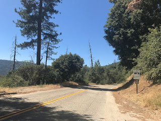
The first Forest Route 10 shield appears just past Buckskin Lane along with a large sign displaying the Sierra Vista Scenic Byway.

Traffic is advised of weight restrictions up ahead on Forest Route 10/6S10 which are quite hefty. In addition to large campers it isn't uncommon to see cattle drives on Forest Route 10/6S10.

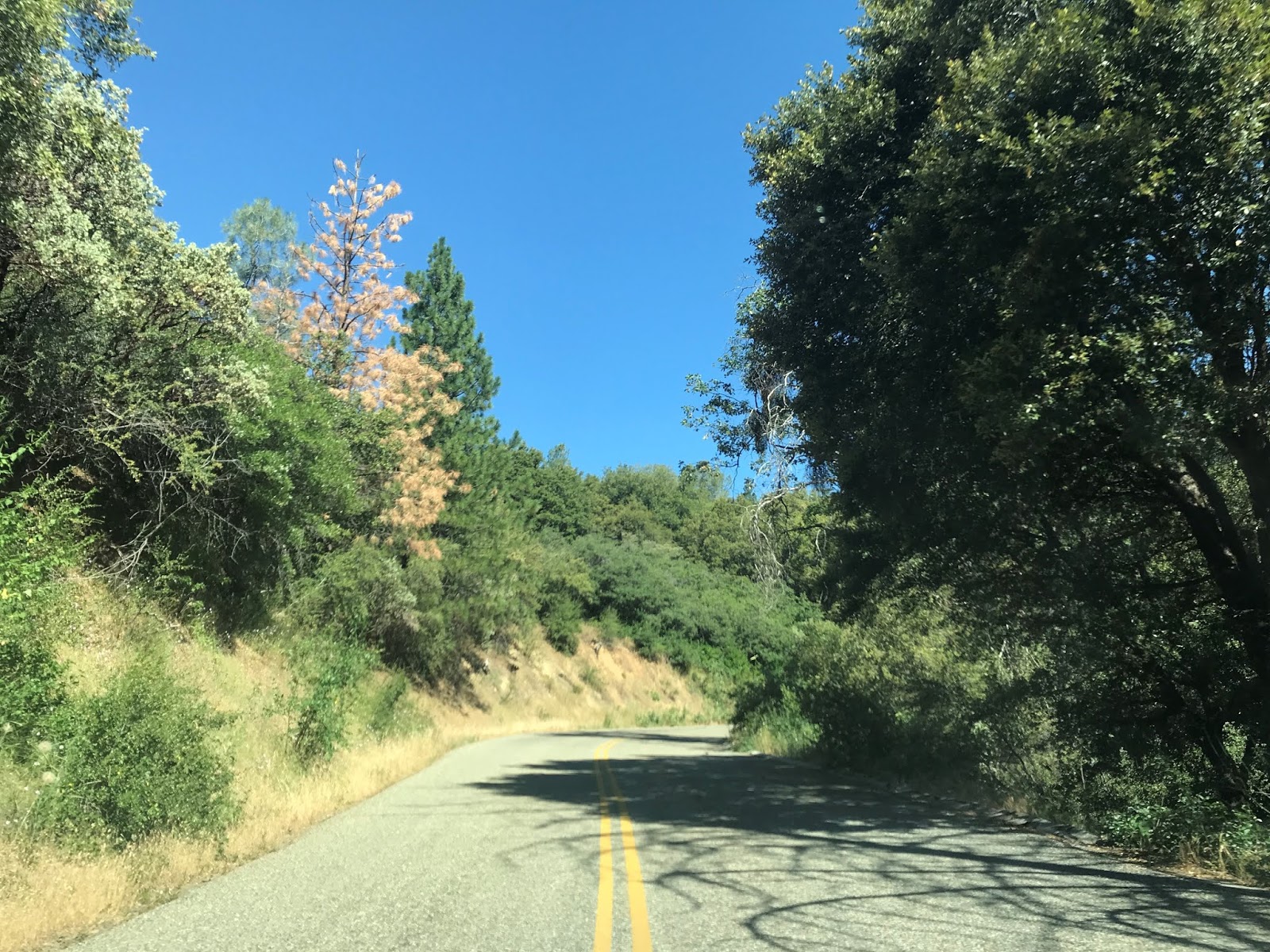
Forest Route 10/6S10 makes a shift climb through a series of switch backs to approximately 5,000 feet above sea level.


At 5,000 feet above sea level there is a large burn area which provides a overlook of Oakhurst and Madera out in San Joaquin Valley.


From the overlook there is signed access to Calvin Crest via Calvin Crest Road.


Forest Route 10/6S10 enters a wooded area and access to the Nelder Redwood Grove is signed via Forest Road 6S47Y.


Forest Road 6S47Y makes a steep climb on a grade suitable for cars up and intersects Forest Road 6S90 in the Nelder Grove.


A legend for the Nelder Grove can be found at the terminus of Forest Road 6S47Y.

Forest Road 6S90 westward heads towards Sugar Pine and CA 41. Heading east on Forest Road 6S90 will loop traffic back to Forest Route 10/6S10.
As of July 2020 Forest Road 6S90 west of Forest Road 6S47Y is closed due to damage from forest fires of previous years.

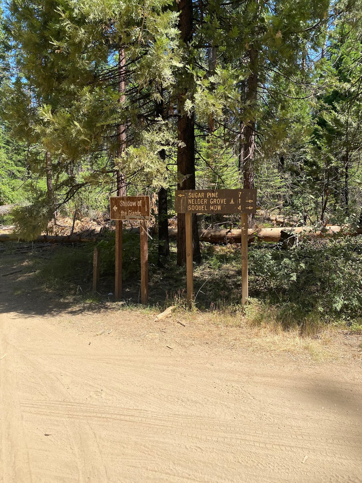
Forest Road 6S90 east quickly intersects Forest Road 5S19. Traffic headed to the Nelder Grove Interpretive Area & Campground is directed to take Forest Road 5S19.


Forest Road 5S19 makes a steep climb to two historic cabins near the Nelder Grove Campground Host site.


The two cabins were originally located in Biledo Meadows on the southwest side of Mount Raymond. The Biledo Meadow Cabins were constructed during the late 19th Century and were brought to Nelder Grove during the early 1980s to ensure their preservation. The Friends of the Nelder Grove provides much of the historic placard information found at the Biledo Meadow Cabins.


Numerous Redwood Sequoia stumps can be found around the Biledo Meadow Cabins which is evidence of the Nelder Grove's logging history. The Nelder Grove was logged beginning in the 1870s by the California Lumber Company which based it's operations out of the site of present Camp Redwood.


Replicas of the Madera Flume & Trading Company two-pole chute can be found at the Biledo Meadow Cabins.


A replica of the Madera Flume & Trading Company tramway can also be found at the Biledo Meadow Cabins.


Forest Road 5S19 terminates at the Nelder Grove Campground. The site of the Nelder Grove Campground once was the location of California Lumber Company Mill #4 between 1888-1892. The Chimney Tree Trail can be found in the Nelder Grove Campground.


The Bull Buck Loop can be found at the end of the Nelder Grove Campground. The Bull Buck Loop is cited at the Biledo Meadow Cabins as being the original logging road.


The Bull Buck Loop accesses the Bull Buck Tree which is noted for it's 100 foot circumference.


Returning from the Nelder Grove via Forest Road 6S47Y; the route of Forest Route 10/6S10 traverses a couple more switchbacks before becoming unpaved.


I made a turn off of Forest Route 10/6S10 onto Forest Road 6S40 towards Greys Mountain Campground.


Unlike Forest Route 10/6S10 there is very little grading on Forest Road 6S40. Forest Road 6S40 can be traversed via a low clearance vehicle but it isn't very easy (I should note that Forest Service maps outright don't recommend it) and requires paying attention to spot large ruts. Forest Road 6S40 travels southeast towards Forest Route 7.


Forest Road 6S40 intersects Forest Road 6S11X and crosses North Fork Willow Creek on a bridge dated from 1955. There appears to be a automated flood gauge located on the west bank of North Fork Willow Creek.


Greys Mountain Campground is located on North Fork Willow Creek at the intersection of Forest Road 6S40 and Forest Road 6S08. Forest Road 6S40 heads right at the fork in the road towards Forest Route 7.


My camp spot was located directly on North Fork Willow Creek off a campground side road.


Suffice to say having a quite little creek to myself with no cellular service (it stops near the Nelder Grove turn off) was a nice change of pace. Really I don't have much to say other than it was nice to be unreachable for a couple days, but I suppose that is what camping deep in a National Forest is for.


Staying out on Forest Routes usually has it's own oddities. I wouldn't exactly qualify Forest Road 6S40 as a "dirt superhighway" per se but it is an active road for cattle drives.

Forest Road 6S11X can be taken south from Grey's Mountain Campground towards the Bass Lake Vista.


An eroded path from Forest Road 6S11X descends down to a cascade on North Fork Willow Creek.


Forest Road 6S11X is a very rough road that strewn with loose rock as it ascends atop a cliff above North Fork Willow Creek.


Looking northward offers a clear indication how high Forest Road 6S11X is above North Fork Willow Creek.

Forest Road 6S11X is observable from Forest Road 6S40 east of Grey's Mountain Campground.

Forest Road 6S11X southbound terminates at it's parent Forest Road 6S11. Forest Road 6S11 is the normal route of access to the Bass Lake Vista from Forest Route 10/6S10.


The route to the Bass Lake Vista follows Forest Road 6S11 and continues south on Forest Road 6S88.


Forest Road 6S88 continues southward on a high clearance grade. Forest Road 6S88 is fairly flat until a final ascent at it's terminus at Bass Lake Vista.


The Bass Lake Vista is located at 5,276 feet above sea level. The Bass Lake Vista overlooks the namesake Bass Lake which can be found at an elevation of 3,369 feet above sea level. More regarding the history of Bass Lake can be found in the Gribblenation article regarding the Minarets & Western Railroad.

In August I made a return to the Sierra Vista Scenic Byway to complete the entire 82.7 mile circuit. I began from CA 41 at Sky Ranch as I had in the previous month when camping. From CA 41 at Sky Ranch the route on Road 632/Sky Ranch Road and Forest Route 10/6S10 is approximately 11 miles. I resumed taking photos at the junction of Forest Route 10/6S10 and Forest Road 6S40. From Forest Road 6S40 the Fresno Dome Campground is signed as being 5 miles away on Forest Route 10/6S10.

As noted above Forest Route 10/6S10 drops to a dirt surface north of Forest Road 6S40. The road surface of Forest Route 10 was clearly once paved as the top layer of dirt makes for a somewhat bumpy drive. Near Forest Road 6S10A the mainline Forest Route 10 crosses over Siphon Mid Ditch on the 1950 Fresno Dome Bridge.


Approaching the Fresno Dome Vista the path of Forest Route 10/6S10 enters Soquel Meadow with an abandoned ranch being located right alongside the roadway. Entering the meadow the Fresno Dome can clearly be seen in full view from Forest Route 10.


Beyond Soquel Meadow there is a poorly marked pull-out for Fresno Dome. Fresno Dome is granite dome formation which rises above Soquel Meadow and is located at an elevation of 7,544 feet above sea level.


North of the Fresno Dome Vista the alignment of Forest Route 10/6S10 becomes paved again and has an access point for Kelty Meadow Campground. North of Kelty Meadow Campground Forest Route 10 meets Forest Road 6S10X/Beasore Loop. The Sierra Vista Scenic Byway and Forest Route 10 make an eastern turn on Forest Road 6S10X which connects to Forest Route 7/Beasore Road 6 miles away. As evidenced by the third photo below there was logging operations ongoing at the junction of Forest Road 6S10 and Forest Road 6S10X.


Of note; Forest Route numbers generally follow a convention based off the Township they originate in. All National Forests are charted in a Township and Range grid, in the case of the former they span 6 mile sectors. For roads like Forest Route 10 they also carry a Forest Road Number which denotes it's Township point of origin. Much of Forest Route 10 is internally numbered as Forest Road 6S10 denoting it's point of origin is in Township 6S of Sierra National Forest. Forest Service Roads are given numbers based off where what Township the north terminus is located in. Spur routes of a mainline Forest Route carry a letter designation at the end hence why Beasore Loop is signed is numbered Forest Road 6S10X. Most National Forests tend to place two digit route shields on Forest Routes which are suited to travel by conventional vehicles which includes run of the mill cars. In the case of the Sierra Vista Scenic Byway while there are rough roads in it's alignment all of them can be traversed by a normal low clearance car.

It should be noted that Sierra National Forest shares a Township and Range grid with; Sequoia National Forest, Stanislaus National Forest and Inyo National Forest. The reason likely for this convention is that four National Forests were once part of Sierra National Forest. In 1897 Stanislaus National Forest was split away from Sierra National Forest. In 1907 Inyo National Forest and Toiyabe National Forest (presently Humboldt-Toiyabe National Forest) were spun off from Sierra National Forest. Sequoia National Forest was spun off from the southern segment of Sierra National Forest in 1908.
Almost all of Forest Route 10/6S10X is a narrow but very high quality dirt surface. The dirt surface on Forest Route 10 on Forest Route 6S10X is graded well enough to maintain speeds of 35-40 MPH on straight stretches and was a lot of fun to drive in an All Wheel Drive Subaru Impreza. Forest Route 10/6S10X crosses North Fork Willow Creek, climbs above 7,000 feet in elevation and meets Forest Road 6S08 which provides access to Greys Mountain Campground.


Forest Route 10/6S10X continues eastward towards Forest Route 7/5S07. Interestingly there is very little evidence of Forest Route 10 being signed on Forest Road 6S10X. The only shield I could find was at a severely weather guide sign at the junction of Forest Route 10/6S10X and Forest Road 5S39 looking westbound.


East of Forest Road 5S39 the route of Forest Route 10/6S10X becomes dirt top layering weathered asphalt. Forest Route 10/6S10X becomes a fully paved surface near it's terminus at Forest Route 7/5S07 on Beasore Road at Cold Springs Summit. Cold Springs Summit is the highest point on the Sierra Vista Scenic Byway at 7,308 feet above sea level. From Cold Springs Summit the Sierra Vista Scenic Byway turns northeast on Forest Route 7/5S07.


Part 2 of the Sierra Vista Scenic Byway continues onto Forest Route 7/5S07 on Beasore Road northeast to Forest Route 81/4S81 and be found on the blog below:
Sierra Vista Scenic Byway Part 2; a bumpy ride on Sierra National Forest Route 7
Comments