California State Route 244 and the un-built highways of Metro Sacramento (CA 65, CA 102, CA 143 and CA 148)
This past Fourth of July Weekend I drove the entirety of the short California State Route 244 freeway in Sacramento. CA 244 is a short segment of a freeway that was intended to reach US Route 50 and being a major connecting highway for Metro Sacramento. This blog will examine the other planned highways of Metro Sacramento which were never fully completed or never built at all; CA 65 south of I-80, CA 102, CA 143 and CA 148. Most un-built highways around Metro Sacramento are tied to Legislative hurdles dating back to 1975.

Since the focus of the driving portion of this blog pertains mostly to CA 244 I'll begin with said route. The present route of CA 244 is a single unsigned one mile segment of freeway connecting I-80 and CA 51 (signed as I-80 Business) on the outskirts of eastern Sacramento to Auburn Boulevard. As of 1995 CA 244 carried a peak traffic count of 28,500 vehicles a day according to CAhighways.org.
CAhighways.org on CA 244
The present route of CA 244 was originally part of Legislative Route Number 288 before the 1964 State Highway Renumbering. LRN 288 was defined in 1959 according to CAhighways and was originally intended to connect from LRN 3 (US 40/US 99E) in Sacramento to the planned route LRN 249 near Fair Oaks.
CAhighways.org on LRN 288
The planned route of LRN 288 makes it's first appearance on the 1960 State Highway Map. The planned route of LRN 288 on the City Insert shows a planned connection to LRN 247 near Cypress Avenue and Walnut Avenue east of US 40/US 99E/LRN 3. The overview of the entire State shows the planned route of LRN 288 connecting to the planned route of LRN 249 near Fair Oaks.
1960 State Highway Map City Insert
1960 State Highway Map
During the 1964 State Highway Renumbering LRN 288 was assigned CA 244. LRN 249 was changed to it's intended designation as an extension of CA 65 and LRN 247 was reassigned as CA 143. All said changes can be observed by comparing the 1963 State Highway Map to the 1964 Edition.
1963 State Highway Map City Insert
1963 State Highway Map
1964 State Highway Map City Insert
1964 State Highway Map
According to CAhighways.org the legislative definition of CA 244 was extended from CA 65 to US 50 near Fair Oaks in 1965. This planned extension of CA 244 to US 50 appears to have been made due to an altered planned route of CA 65. This new planned route of CA 244 can be first seen on the 1967 State Highway Map.
1967 State Highway Map
According to CAhighways.org in 1975 the planned route of CA 244 was truncated from US 50 to near Fair Oaks Boulevard and San Juan Avenue in Fair Oaks. This truncation appears to have been done due to the extension of CA 65 being truncated to CA 104 near Ione. The 1977 State Highway Map shows a hanging eastern terminus of the planned route of CA 244 near Fair Oaks.
1977 State Highway Map
The completed segment of CA 244 from I-80/I-880 (note; I-80 became CA 51/I-80 Business and I-880 is presently I-80) east to Auburn Boulevard can be seen on the 1979 State Highway.Map.
1979 State Highway Map
According to CAhighways.org the definition of CA 244 was changed in 1984 to I-80 east to Fair Oaks Avenue near San Juan Avenue. The 1990 definition of CA 244 was altered slightly to have an eastern terminus at Fair Oaks Avenue near San Juan Avenue in Carmichael. In 1994 the Legislature deleted the planned route of CA 244 east of Auburn Boulevard leaving the present freeway as is. Interestingly the 2005 State Highway Map shows the route of CA 244 still connecting to the truncated north terminus of CA 143.
2005 State Highway Map
My approach to CA 244 was from CA 51 (I-80 Business) where made my approach via Exit 14A which is signed as access to Auburn Boulevard.


CA 51 Exit 14A joins CA 244 eastbound at approximately Post Mile SAC 0.250. To drive the full route of CA 244 traffic much travel completely between I-80 and Auburn Boulevard in both travel directions.

Despite not having reassurance shields the route of CA 244 is signed with Post Mile paddles. One such Post Mile Paddle can be seen on CA 244 eastbound approaching the eastbound overpass of CA 51 at approximately Post Mile SAC 0.420.


1963 State Highway Map
During the 1964 State Highway Renumbering CA 65 north of Wood Lake became CA 69 (CA 245 since 1972). US 99E was assigned as part of CA 65 legislatively starting in 1964. These changes can be seen on the 1964 State Highway Map. CA 65 was signed on a part of US 99E which was legislatively defined as CA 256 during the 1964 State Highway Renumbering.
1964 State Highway Map
The original corridor of CA 65 between US 99/US 466 and CA 180 can be seen in far more detail on the blogs below.
California State Route 245
California State Route 65; South Segment
For reference LRN 249 was defined in 1959 according to CAhighways.org between CA 198/LRN 10 near Exeter north to US 40/LRN 17 near Roseville. LRN 249 from the outset was intended as a freeway east of US 99 which would closely follow the corridor of the historic Stockton-Los Angeles Road in the Sierra Foothills.
CAhighways.org on LRN 249
Much like LRN 288 the planned route of LRN 249 first appears on the 1960 State Highway Map.
1960 State Highway Map
The 1965 State Highway Map shows US 99E north of Roseville to Marysville co-signed as CA 65.
1965 State Highway Map
The 1967 State Highway Map is the first to show CA 65 signed exclusively between Roseville and Marysville.
1967 State Highway Map
The 1970 State Highway Map shows CA 65 under State Maintenance on Sunrise Boulevard just south of CA 16 north to US 50. This alignment of CA 65 appears to have been a temporary routing that was adopted in anticipation of a new freeway being built.
1970 State Highway Map
The 1975 State Highway Map shows the Sunrise Boulevard alignment of CA 65 in clearer detail.
1975 State Highway Map
According to CAhighways.org the legislative definition of CA 65 was deleted legislatively between CA 104 and I-80 in 1975. Said legislative action was to take begin taking effect by July 1976 and be complete by January of 1977.
CAhighways.org on CA 65
CA 65 no longer appears on Sunrise Boulevard on the 1977 State Highway Map.
1977 State Highway Map
According to CAhighways.org the Legislative definition of CA 65 was restored between CA 104 and I-80 which can first be seen on the 1986 State Highway Map.
1986 State Highway Map
Interestingly the old route of US 99E which was signed as CA 65 but was legislatively CA 256 remained in the State Highway System until 1994 according to CAhighways.org. CA 65 was moved to a new limited access alignment through Roseville between I-80 and CA 256/Old US 99E sometime between 1986 and 1988. The change in alignment of CA 65 can be seen by comparing the 1986 State Highway Map above to the 1988 Edition below.
1988 State Highway Map
CAhighways.org on CA 256
Regarding the planned CA 102 the original routing dates back to 1959 when it was defined as LRN 246 between LRN 238/CA 16 in Elkhorn to LRN 17/US 40 in Auburn.
CAhighways.org on LRN 246
LRN 246 can be first seen on the 1960 State Highway Map. The planned alignment traveled east from CA 16 (this junction is located near the present split of I-5 and CA 99) as a north bypass of Sacramento and crossed US 40/US 99E near Roseville. From Roseville LRN 246 traveled northeast to Auburn where it appears to have been intended to terminate near downtown close to Auburn-Folsom Road.
1960 State Highway Map
LRN 246 was changed to CA 102 during the 1964 State Highway Renumbering. This change can be viewed by comparing the 1963 State Highway Map to the 1964 Edition.
1963 State Highway Map
1964 State Highway Map
Unlike CA 244 and CA 65 the planned routing of CA 102 had very little change until circa 2000. According to CAhighways.org the planned route of CA 102 was altered around 2000 to a more northern bypass of much of Metro Sacramento. The planned route of CA 102 is shown on the 2005 State Highway map originating near the junction of CA 99/I-5 and heading northeast towards Newcastle. East of Newcastle the planned route of CA 102 appears to be on a parallel alignment north of I-80 towards Auburn terminating near CA 49 on the Grass Valley Highway.
2005 State Highway Map City Insert
2005 State Highway Map
CAhighways.org on CA 102
Regarding CA 143 the planned alignment was first adopted into the State Highway System as LRN 247 in 1959 between LRN 4/US 99 in Elk Grove north to LRN 246 near Antelope according to CAhighways.org. LRN 247 was meant to serve as an eastern bypass route of Sacramento.
CAhighways.org on LRN 247
LRN 247 first appears on the 1960 State Highway Map.
1960 State Highway Map City Insert
1960 State Highway Map
LRN 247 was assigned CA 143 during the 1964 State Highway Renumbering. This change can be seen on by comparing the 1963 State Highway Map to the 1964 Edition.
1963 State Highway Map City Insert
1963 State Highway Map
1964 State Highway Map City Insert
1964 State Highway Map
According to CAhighways.org the planned routing of CA 143 between CA 244 and CA 102 was deleted in 1965.
CAhighways.org on CA 143
The truncation of the planned route of CA 143 to CA 244 can be first seen on the 1966 State Highway Map City Insert.
1966 State Highway Map City Insert
According to CAhighways.org the planned route of CA 143 was conceived as a freeway. Any facilities/right-of-way obtained for the CA 143 were relinquished following the same 1975 Legislation which affected both CA 244 and CA 65. The planned route of CA 143 is clearly displayed on the 1975 State Highway Map.
1975 State Highway Map
As noted above the planned route CA 244 was truncated to Auburn Boulevard in 1994. Consequently part of the planned route of CA 244 east of Auburn Boulevard was transferred to CA 143 which can be seen on the 2005 State Highway Map City Insert.
2005 State Highway Map City Insert
Regarding the planned route of CA 148 it has origins once again in 1959 when LRN 248 was defined as a highway between LRN 238 (future I-5) and LRN 247 south of Sacramento.
CAhighways.org on LRN 248
LRN 248 can be seen for the first time on the 1960 State Highway Map City Insert.
1960 State Highway Map City Insert
LRN 248 was assigned CA 148 during the 1964 State Highway Renumbering. CA 148 was planned to connect I-5 to the planned route of CA 143. These changes can be seen by comparing the 1963 State Highway City Insert to the 1964 Edition.
1963 State Highway Map City Insert
1964 State Highway Map City Insert
According to CAhighways.org in 1974 the Sacramento Department of Public Works made a recommendation that the City maintain any roadways along the planned corridor of CA 148 built as anything less than a freeway grade. Apparently the planned freeway route of CA 148 was deleted in 1975 much like CA 143, parts of CA 65 and parts of CA 244. In 1981 the City of Sacramento adopted a planned roadway over planned route of CA 148 between I-5 and CA 99 which was built as Consumnes River Boulevard.
CAhighways.org on CA 148
Interestingly when the planned route of CA 65 was renewed between CA 104 and I-80 the planned route of CA 148 was extended east to meet it. This new planned extension of CA 148 can be seen on the 1986 State Highway Map.
1986 State Highway Map City Insert
According to CAhighways.org Caltrans recommended to the Legislature deleting the planned route of CA 148, this has yet to be taken for action.

Since the focus of the driving portion of this blog pertains mostly to CA 244 I'll begin with said route. The present route of CA 244 is a single unsigned one mile segment of freeway connecting I-80 and CA 51 (signed as I-80 Business) on the outskirts of eastern Sacramento to Auburn Boulevard. As of 1995 CA 244 carried a peak traffic count of 28,500 vehicles a day according to CAhighways.org.
CAhighways.org on CA 244
The present route of CA 244 was originally part of Legislative Route Number 288 before the 1964 State Highway Renumbering. LRN 288 was defined in 1959 according to CAhighways and was originally intended to connect from LRN 3 (US 40/US 99E) in Sacramento to the planned route LRN 249 near Fair Oaks.
CAhighways.org on LRN 288
The planned route of LRN 288 makes it's first appearance on the 1960 State Highway Map. The planned route of LRN 288 on the City Insert shows a planned connection to LRN 247 near Cypress Avenue and Walnut Avenue east of US 40/US 99E/LRN 3. The overview of the entire State shows the planned route of LRN 288 connecting to the planned route of LRN 249 near Fair Oaks.
1960 State Highway Map City Insert
1960 State Highway Map
During the 1964 State Highway Renumbering LRN 288 was assigned CA 244. LRN 249 was changed to it's intended designation as an extension of CA 65 and LRN 247 was reassigned as CA 143. All said changes can be observed by comparing the 1963 State Highway Map to the 1964 Edition.
1963 State Highway Map City Insert
1963 State Highway Map
1964 State Highway Map City Insert
1964 State Highway Map
According to CAhighways.org the legislative definition of CA 244 was extended from CA 65 to US 50 near Fair Oaks in 1965. This planned extension of CA 244 to US 50 appears to have been made due to an altered planned route of CA 65. This new planned route of CA 244 can be first seen on the 1967 State Highway Map.
1967 State Highway Map
According to CAhighways.org in 1975 the planned route of CA 244 was truncated from US 50 to near Fair Oaks Boulevard and San Juan Avenue in Fair Oaks. This truncation appears to have been done due to the extension of CA 65 being truncated to CA 104 near Ione. The 1977 State Highway Map shows a hanging eastern terminus of the planned route of CA 244 near Fair Oaks.
1977 State Highway Map
The completed segment of CA 244 from I-80/I-880 (note; I-80 became CA 51/I-80 Business and I-880 is presently I-80) east to Auburn Boulevard can be seen on the 1979 State Highway.Map.
1979 State Highway Map
According to CAhighways.org the definition of CA 244 was changed in 1984 to I-80 east to Fair Oaks Avenue near San Juan Avenue. The 1990 definition of CA 244 was altered slightly to have an eastern terminus at Fair Oaks Avenue near San Juan Avenue in Carmichael. In 1994 the Legislature deleted the planned route of CA 244 east of Auburn Boulevard leaving the present freeway as is. Interestingly the 2005 State Highway Map shows the route of CA 244 still connecting to the truncated north terminus of CA 143.
2005 State Highway Map
My approach to CA 244 was from CA 51 (I-80 Business) where made my approach via Exit 14A which is signed as access to Auburn Boulevard.


CA 51 Exit 14A joins CA 244 eastbound at approximately Post Mile SAC 0.250. To drive the full route of CA 244 traffic much travel completely between I-80 and Auburn Boulevard in both travel directions.

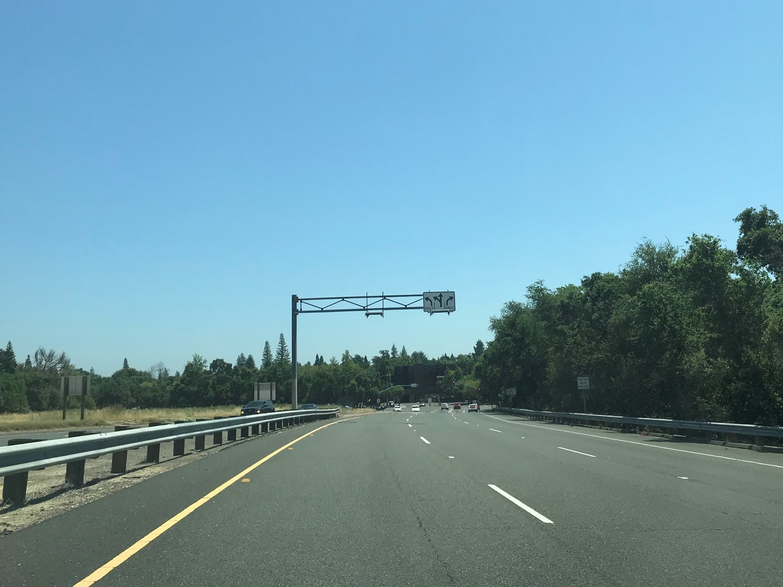
Despite not having reassurance shields the route of CA 244 is signed with Post Mile paddles. One such Post Mile Paddle can be seen on CA 244 eastbound approaching the eastbound overpass of CA 51 at approximately Post Mile SAC 0.420.

Traffic on CA 244 eastbound is advised the freeway ends in a half mile. At Post Mile SAC T1.077 CA 244 east terminates a Auburn Boulevard.


From Auburn Boulevard I doubled back to the western start of CA 244 which is signed simply as a connector to I-80/I-80 Business.


Traffic headed to I-80 west on CA 244 west is advised to stay in the left lanes. CA 51/I-80 Business along I-80 east traffic is advised to stay in the right lanes at Post Mile approximately Post Mile SAC T0.876. Since my next destination was in downtown Sacramento I headed on CA 51/I-80 Business.


Regarding CA 65 as stated above the route of LRN 249 was changed legislatively in 1964 to be a planned extension of the highway from Wood Lake. CA 65 before the 1964 State Highway Renumbering was routed from US 99/US 466 near Bakersfield north to CA 180 near the Entrance to Kings Canyon National Park which can be seen on the 1963 State Highway Map
1963 State Highway Map
During the 1964 State Highway Renumbering CA 65 north of Wood Lake became CA 69 (CA 245 since 1972). US 99E was assigned as part of CA 65 legislatively starting in 1964. These changes can be seen on the 1964 State Highway Map. CA 65 was signed on a part of US 99E which was legislatively defined as CA 256 during the 1964 State Highway Renumbering.
1964 State Highway Map
The original corridor of CA 65 between US 99/US 466 and CA 180 can be seen in far more detail on the blogs below.
California State Route 245
California State Route 65; South Segment
For reference LRN 249 was defined in 1959 according to CAhighways.org between CA 198/LRN 10 near Exeter north to US 40/LRN 17 near Roseville. LRN 249 from the outset was intended as a freeway east of US 99 which would closely follow the corridor of the historic Stockton-Los Angeles Road in the Sierra Foothills.
CAhighways.org on LRN 249
Much like LRN 288 the planned route of LRN 249 first appears on the 1960 State Highway Map.
1960 State Highway Map
The 1965 State Highway Map shows US 99E north of Roseville to Marysville co-signed as CA 65.
1965 State Highway Map
The 1967 State Highway Map is the first to show CA 65 signed exclusively between Roseville and Marysville.
1967 State Highway Map
The 1970 State Highway Map shows CA 65 under State Maintenance on Sunrise Boulevard just south of CA 16 north to US 50. This alignment of CA 65 appears to have been a temporary routing that was adopted in anticipation of a new freeway being built.
1970 State Highway Map
The 1975 State Highway Map shows the Sunrise Boulevard alignment of CA 65 in clearer detail.
1975 State Highway Map
According to CAhighways.org the legislative definition of CA 65 was deleted legislatively between CA 104 and I-80 in 1975. Said legislative action was to take begin taking effect by July 1976 and be complete by January of 1977.
CAhighways.org on CA 65
CA 65 no longer appears on Sunrise Boulevard on the 1977 State Highway Map.
1977 State Highway Map
According to CAhighways.org the Legislative definition of CA 65 was restored between CA 104 and I-80 which can first be seen on the 1986 State Highway Map.
1986 State Highway Map
Interestingly the old route of US 99E which was signed as CA 65 but was legislatively CA 256 remained in the State Highway System until 1994 according to CAhighways.org. CA 65 was moved to a new limited access alignment through Roseville between I-80 and CA 256/Old US 99E sometime between 1986 and 1988. The change in alignment of CA 65 can be seen by comparing the 1986 State Highway Map above to the 1988 Edition below.
1988 State Highway Map
CAhighways.org on CA 256
Regarding the planned CA 102 the original routing dates back to 1959 when it was defined as LRN 246 between LRN 238/CA 16 in Elkhorn to LRN 17/US 40 in Auburn.
CAhighways.org on LRN 246
LRN 246 can be first seen on the 1960 State Highway Map. The planned alignment traveled east from CA 16 (this junction is located near the present split of I-5 and CA 99) as a north bypass of Sacramento and crossed US 40/US 99E near Roseville. From Roseville LRN 246 traveled northeast to Auburn where it appears to have been intended to terminate near downtown close to Auburn-Folsom Road.
1960 State Highway Map
LRN 246 was changed to CA 102 during the 1964 State Highway Renumbering. This change can be viewed by comparing the 1963 State Highway Map to the 1964 Edition.
1963 State Highway Map
1964 State Highway Map
Unlike CA 244 and CA 65 the planned routing of CA 102 had very little change until circa 2000. According to CAhighways.org the planned route of CA 102 was altered around 2000 to a more northern bypass of much of Metro Sacramento. The planned route of CA 102 is shown on the 2005 State Highway map originating near the junction of CA 99/I-5 and heading northeast towards Newcastle. East of Newcastle the planned route of CA 102 appears to be on a parallel alignment north of I-80 towards Auburn terminating near CA 49 on the Grass Valley Highway.
2005 State Highway Map City Insert
2005 State Highway Map
CAhighways.org on CA 102
Regarding CA 143 the planned alignment was first adopted into the State Highway System as LRN 247 in 1959 between LRN 4/US 99 in Elk Grove north to LRN 246 near Antelope according to CAhighways.org. LRN 247 was meant to serve as an eastern bypass route of Sacramento.
CAhighways.org on LRN 247
LRN 247 first appears on the 1960 State Highway Map.
1960 State Highway Map City Insert
1960 State Highway Map
LRN 247 was assigned CA 143 during the 1964 State Highway Renumbering. This change can be seen on by comparing the 1963 State Highway Map to the 1964 Edition.
1963 State Highway Map City Insert
1963 State Highway Map
1964 State Highway Map City Insert
1964 State Highway Map
According to CAhighways.org the planned routing of CA 143 between CA 244 and CA 102 was deleted in 1965.
CAhighways.org on CA 143
The truncation of the planned route of CA 143 to CA 244 can be first seen on the 1966 State Highway Map City Insert.
1966 State Highway Map City Insert
According to CAhighways.org the planned route of CA 143 was conceived as a freeway. Any facilities/right-of-way obtained for the CA 143 were relinquished following the same 1975 Legislation which affected both CA 244 and CA 65. The planned route of CA 143 is clearly displayed on the 1975 State Highway Map.
1975 State Highway Map
As noted above the planned route CA 244 was truncated to Auburn Boulevard in 1994. Consequently part of the planned route of CA 244 east of Auburn Boulevard was transferred to CA 143 which can be seen on the 2005 State Highway Map City Insert.
2005 State Highway Map City Insert
Regarding the planned route of CA 148 it has origins once again in 1959 when LRN 248 was defined as a highway between LRN 238 (future I-5) and LRN 247 south of Sacramento.
CAhighways.org on LRN 248
LRN 248 can be seen for the first time on the 1960 State Highway Map City Insert.
1960 State Highway Map City Insert
LRN 248 was assigned CA 148 during the 1964 State Highway Renumbering. CA 148 was planned to connect I-5 to the planned route of CA 143. These changes can be seen by comparing the 1963 State Highway City Insert to the 1964 Edition.
1963 State Highway Map City Insert
1964 State Highway Map City Insert
According to CAhighways.org in 1974 the Sacramento Department of Public Works made a recommendation that the City maintain any roadways along the planned corridor of CA 148 built as anything less than a freeway grade. Apparently the planned freeway route of CA 148 was deleted in 1975 much like CA 143, parts of CA 65 and parts of CA 244. In 1981 the City of Sacramento adopted a planned roadway over planned route of CA 148 between I-5 and CA 99 which was built as Consumnes River Boulevard.
CAhighways.org on CA 148
Interestingly when the planned route of CA 65 was renewed between CA 104 and I-80 the planned route of CA 148 was extended east to meet it. This new planned extension of CA 148 can be seen on the 1986 State Highway Map.
1986 State Highway Map City Insert
According to CAhighways.org Caltrans recommended to the Legislature deleting the planned route of CA 148, this has yet to be taken for action.
Comments