California State Route 173; former California State Route 2 and the last stand of the dirt State Highway
This past weekend I drove a portion of California State Route 173 east of CA 138 to the closure gate near Mojave River Forks Reservoir. CA 173 is notable for being a former portion of CA 2 and having the last four miles of dirt State Highway still on the books in California.

CA 173 is a 25 mile State Highway which begins at CA 138 near Cajon Pass and ascends to CA 18 in the San Bernardino Mountains. Presently CA 173 is the only State Highway that has a segment that has a dirt surface between Post Miles SBD 7.5 to SBD 11.5 near Mojave River Forks Reservoir. Unfortunately said four mile segment of CA 173 has been closed to traffic since 2011.
Reportedly the route of CA 173 was originally built as an alternate haul road to Crest Drive through Waterman Canyon for the Lake Arrowhead Reservoir Project. Lake Arrowhead Reservoir began construction in 1904 and wasn't completed until 1922.
Lake Arrowhead History
Part of what became CA 173 appears on this 1908 USGS Map east of Cajon Pass.
1908 USGS Area Map
The present route of CA 173 was adopted into the State Highway system in 1933 when Legislative Route Number 59 was extended east of Cajon Pass.
CAhighways.org on CA 173
In 1934 the route of LRN 59 east of LRN 61 near Wrightwood to CA 18 was signed as CA 2. The original description of CA 2 between Santa Monica to Lake Arrowhead can be seen in a 1934 Department of Public Works document on Page 20.
1934 Department of Public Works announcement of the Signed State Highways
CA 2 appears over the present route of CA 173 on the 1938 State Highway Map.
1938 State Highway Map
CA 2 was shifted off of LRN 59 east of Cajon Pass onto LRN 188 by 1958 leaving the future route of CA 173 as an unsigned State Highway. This change can be seen by comparing the 1957 State Highway Map to the 1958 Edition.
1957 State Highway Map
1958 State Highway Map
During the 1964 State Highway Renumbering CA 2 was truncated to CA 138 near Wrightwood. What was CA 2 eastward was signed as CA 138 to CA 18 near Crestline. CA 173 was designated over the remainder of LRN 59 to CA 18 near Lake Arrowhead. These changes can be seen by comparing the 1963 State Highway Map to the 1964 Edition.
Reportedly the dirt segment of CA 173 was heavily damaged in the 2003 Willow Fire. The Willow Fire eroded the dirt portion of CA 173 to a degree that it was ultimately permanently closed in 2011 with two steel gates being erected at both ends. Supposedly Caltrans still grades the dirt portion of CA 173 but I find that highly unlikely, but I'll explain below.
My approach to CA 173 east was from CA 138 west near Silverwood Lake.

CA 173 follows the course of the West Fork Mojave River and barely resembles a State Highway with very thin shoulders and asphalt of poor quality. The route of CA 173 picks up the West Fort Mojave River at the face of Silverwood Lake Reservoir. Silverwood Lake was impounded in 1971.


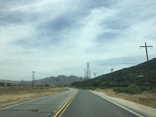


CA 173 east closely follows the terrain of the Mojave Desert to Lake Arrowhead Road. Lake Arrowhead Road continues north to Hesperia whereas CA 173 continues directly east towards the San Bernardino Mountains.


Traffic on CA 173 eastbound is advised of the closure ahead.


The Mojave Forks Dam can be seen ahead as CA 173 approaches it's closed dirt segment. Mojave Forks Dam was constructed in 1974 at the confluence of the West Fork Mojave River and Deep Creek.


The pavement of CA 173 ends at a junction trailhead for the Pacific Crest Trail.


The closure gate of the dirt segment of CA 173 has some heavy erosion that appears not to have been touched for several years (hence my statement above). Interestingly the dirt segment of CA 173 appears to have an oiled earth base that is top layered with dirt. Its kind of a shame not being able to drive the dirt portion. Dirt State Highways were a common occurrence when I lived in Arizona and I would be up for trying the closed segment of CA 173 if it were to ever reopen. .


CA 173 is a 25 mile State Highway which begins at CA 138 near Cajon Pass and ascends to CA 18 in the San Bernardino Mountains. Presently CA 173 is the only State Highway that has a segment that has a dirt surface between Post Miles SBD 7.5 to SBD 11.5 near Mojave River Forks Reservoir. Unfortunately said four mile segment of CA 173 has been closed to traffic since 2011.
Reportedly the route of CA 173 was originally built as an alternate haul road to Crest Drive through Waterman Canyon for the Lake Arrowhead Reservoir Project. Lake Arrowhead Reservoir began construction in 1904 and wasn't completed until 1922.
Lake Arrowhead History
Part of what became CA 173 appears on this 1908 USGS Map east of Cajon Pass.
1908 USGS Area Map
The present route of CA 173 was adopted into the State Highway system in 1933 when Legislative Route Number 59 was extended east of Cajon Pass.
CAhighways.org on CA 173
In 1934 the route of LRN 59 east of LRN 61 near Wrightwood to CA 18 was signed as CA 2. The original description of CA 2 between Santa Monica to Lake Arrowhead can be seen in a 1934 Department of Public Works document on Page 20.
1934 Department of Public Works announcement of the Signed State Highways
CA 2 appears over the present route of CA 173 on the 1938 State Highway Map.
1938 State Highway Map
CA 2 was shifted off of LRN 59 east of Cajon Pass onto LRN 188 by 1958 leaving the future route of CA 173 as an unsigned State Highway. This change can be seen by comparing the 1957 State Highway Map to the 1958 Edition.
1957 State Highway Map
1958 State Highway Map
During the 1964 State Highway Renumbering CA 2 was truncated to CA 138 near Wrightwood. What was CA 2 eastward was signed as CA 138 to CA 18 near Crestline. CA 173 was designated over the remainder of LRN 59 to CA 18 near Lake Arrowhead. These changes can be seen by comparing the 1963 State Highway Map to the 1964 Edition.
Reportedly the dirt segment of CA 173 was heavily damaged in the 2003 Willow Fire. The Willow Fire eroded the dirt portion of CA 173 to a degree that it was ultimately permanently closed in 2011 with two steel gates being erected at both ends. Supposedly Caltrans still grades the dirt portion of CA 173 but I find that highly unlikely, but I'll explain below.
My approach to CA 173 east was from CA 138 west near Silverwood Lake.

CA 173 follows the course of the West Fork Mojave River and barely resembles a State Highway with very thin shoulders and asphalt of poor quality. The route of CA 173 picks up the West Fort Mojave River at the face of Silverwood Lake Reservoir. Silverwood Lake was impounded in 1971.


CA 173 east closely follows the terrain of the Mojave Desert to Lake Arrowhead Road. Lake Arrowhead Road continues north to Hesperia whereas CA 173 continues directly east towards the San Bernardino Mountains.


Traffic on CA 173 eastbound is advised of the closure ahead.


The Mojave Forks Dam can be seen ahead as CA 173 approaches it's closed dirt segment. Mojave Forks Dam was constructed in 1974 at the confluence of the West Fork Mojave River and Deep Creek.


The pavement of CA 173 ends at a junction trailhead for the Pacific Crest Trail.
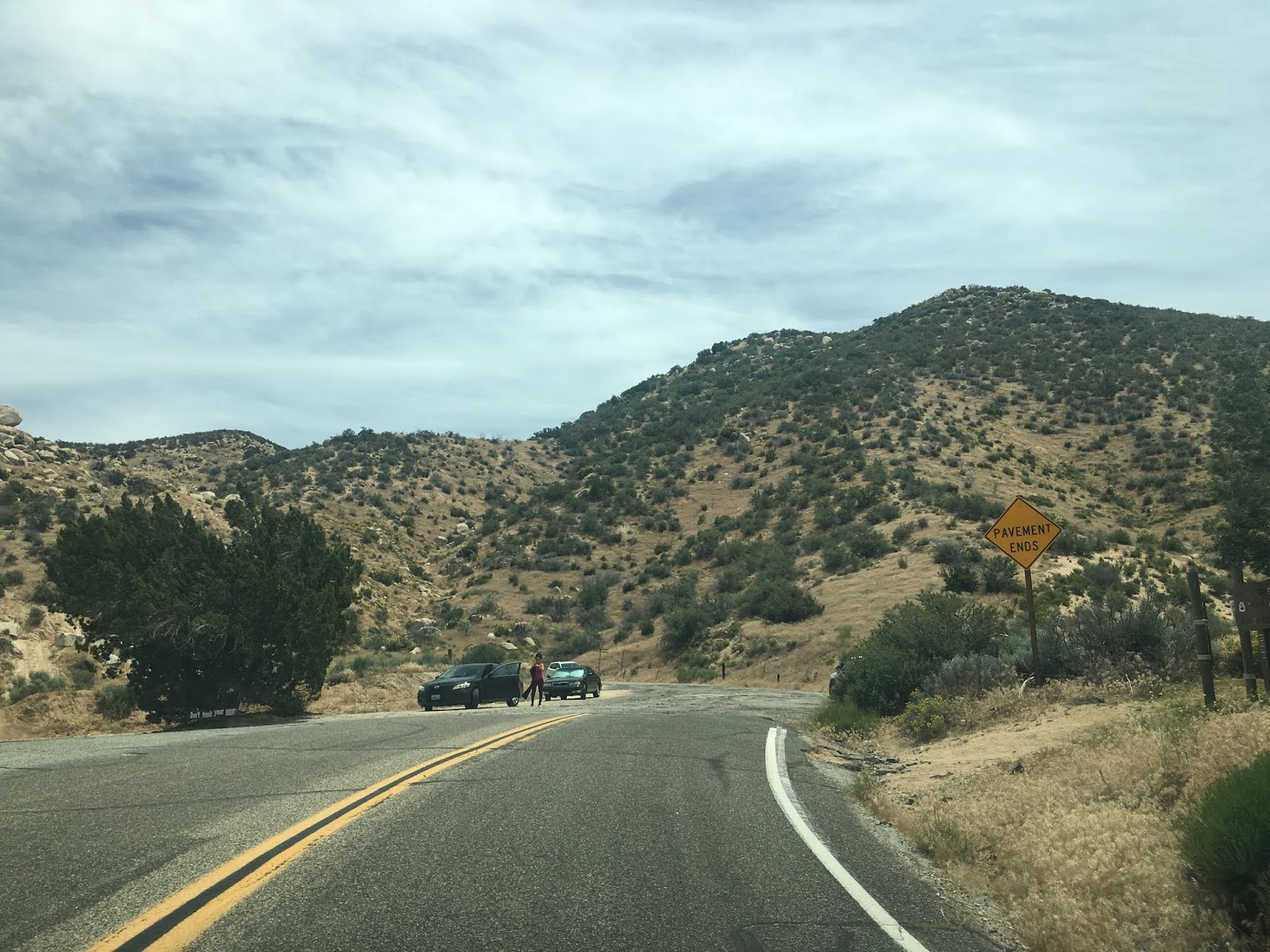


The closure gate of the dirt segment of CA 173 has some heavy erosion that appears not to have been touched for several years (hence my statement above). Interestingly the dirt segment of CA 173 appears to have an oiled earth base that is top layered with dirt. Its kind of a shame not being able to drive the dirt portion. Dirt State Highways were a common occurrence when I lived in Arizona and I would be up for trying the closed segment of CA 173 if it were to ever reopen. .

Comments
https://pbase.com/pderocco/image/111204647