
Travel New England: East Haddam, CT


The village of East Haddam, viewed from the Connecticut River and looking northeasterly along Route 82

The lower Connecticut River valley is among the most scenic and quiet areas in all of southern New England. It is hard to imagine that this area is actually right in the center of the busy New York to Boston segment of the sprawling Northeast Corridor. Of all the small towns and tiny villages that dot the landscape of this region, one seems to stand out above all the rest – a town located on the Connecticut River full of important landmarks and scenic attractions of all kinds that are bound to leave a memorable impression on travelers alike.


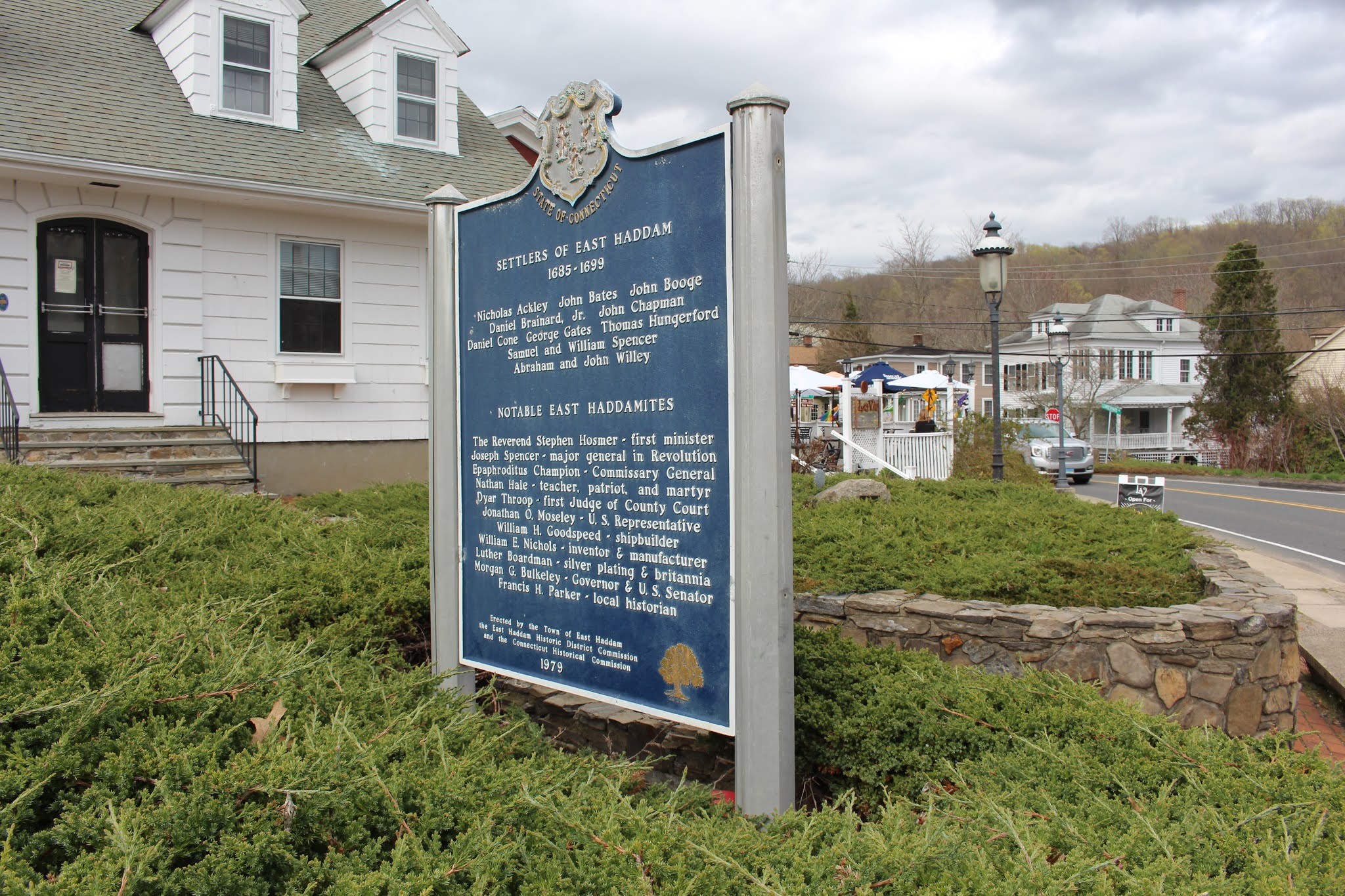
Above: East Haddam's Village Hall and historic markers

The village of East Haddam was incorporated in 1734 and is home to several historic buildings & structures that have been central to the town’s identity since colonial times. The Gelston House is a historic hotel & restaurant establishment dating as far back as 1853. The House offers an upscale lodging & dining experience for travelers of all kinds and operates year-round. A short distance north of the main village is the Nathan Hale School House, a historic one-room schoolhouse site notable for being a location where Connecticut’s official “state hero” briefly taught in 1773. Hale went on to serve as an American soldier and spy for the Continental Army during the American Revolutionary War. He was captured by the British during an intelligence-gathering mission behind enemy lines (while attempting to gather information about British troop movements in the New York City area) and was executed in 1776.

Above: The Gelston House

Built in 1877, the Goodspeed Opera House is among the most distinguishable structures in town and is the epicenter for the area’s performing arts activities. The building’s construction was financed by a local merchant and banker named William Goodspeed. Contrary to its name, this building has never actually played host to opera performances but rather has been utilized for smaller-scale play & musical productions. In fact, some of Broadway’s most famous musical productions had their pre-Broadway trial runs at Goodspeed Theater, including Annie, Man of La Mancha, and Shenandoah. The building is clearly visible and distinguishable from the river and is a favorite landmark for tourists on the road or on the water.

Above: The Goodspeed Opera House

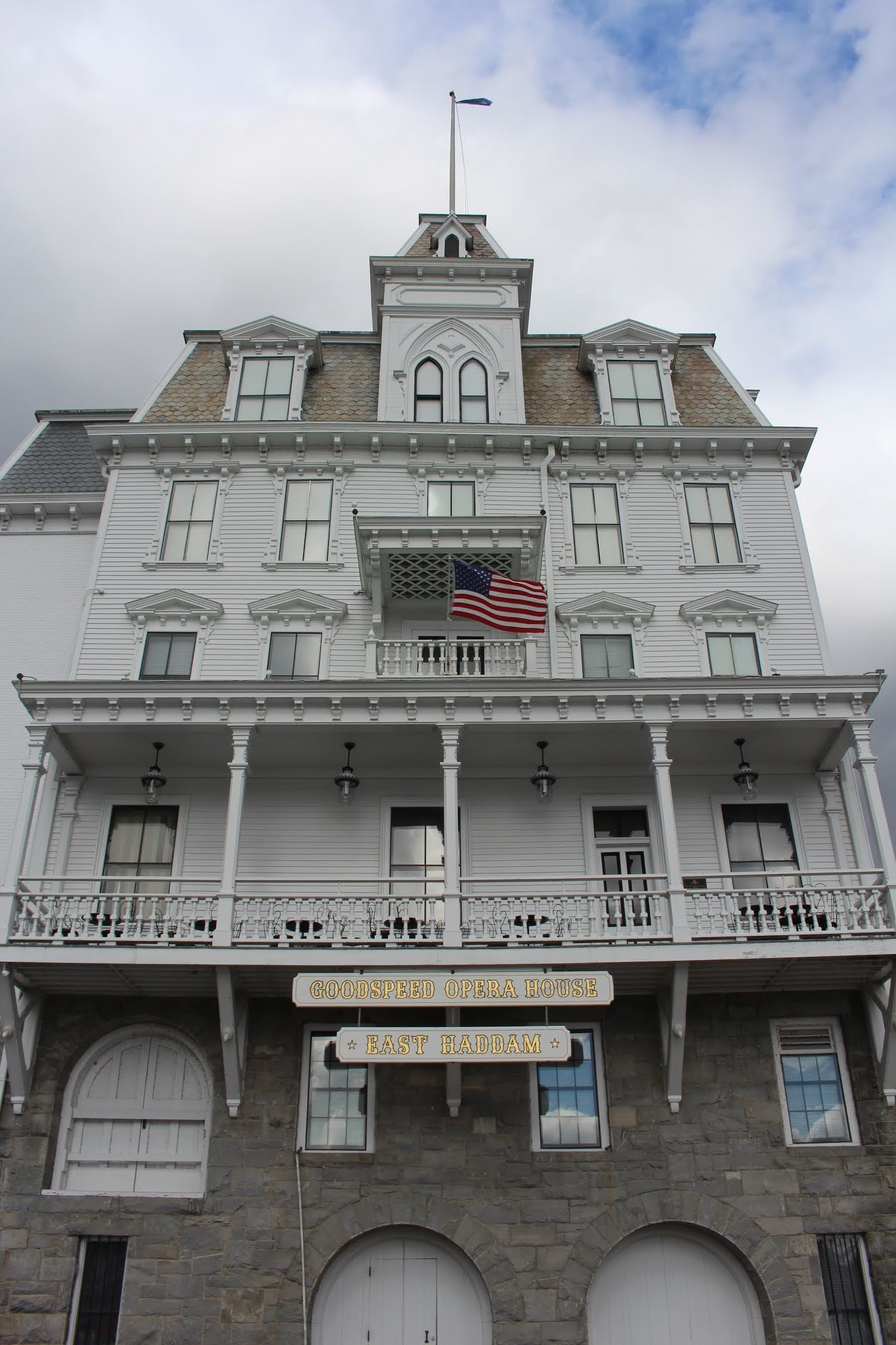
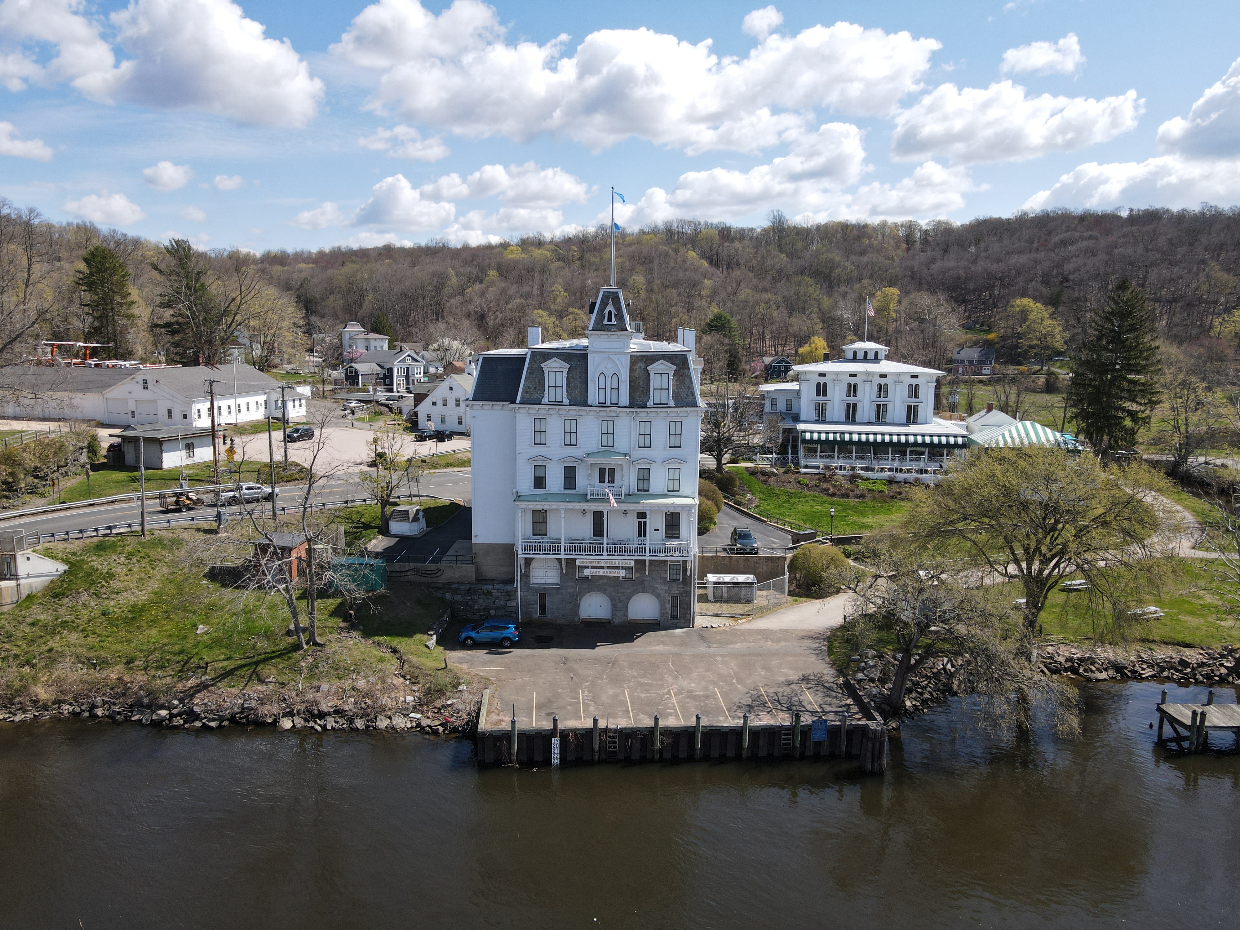
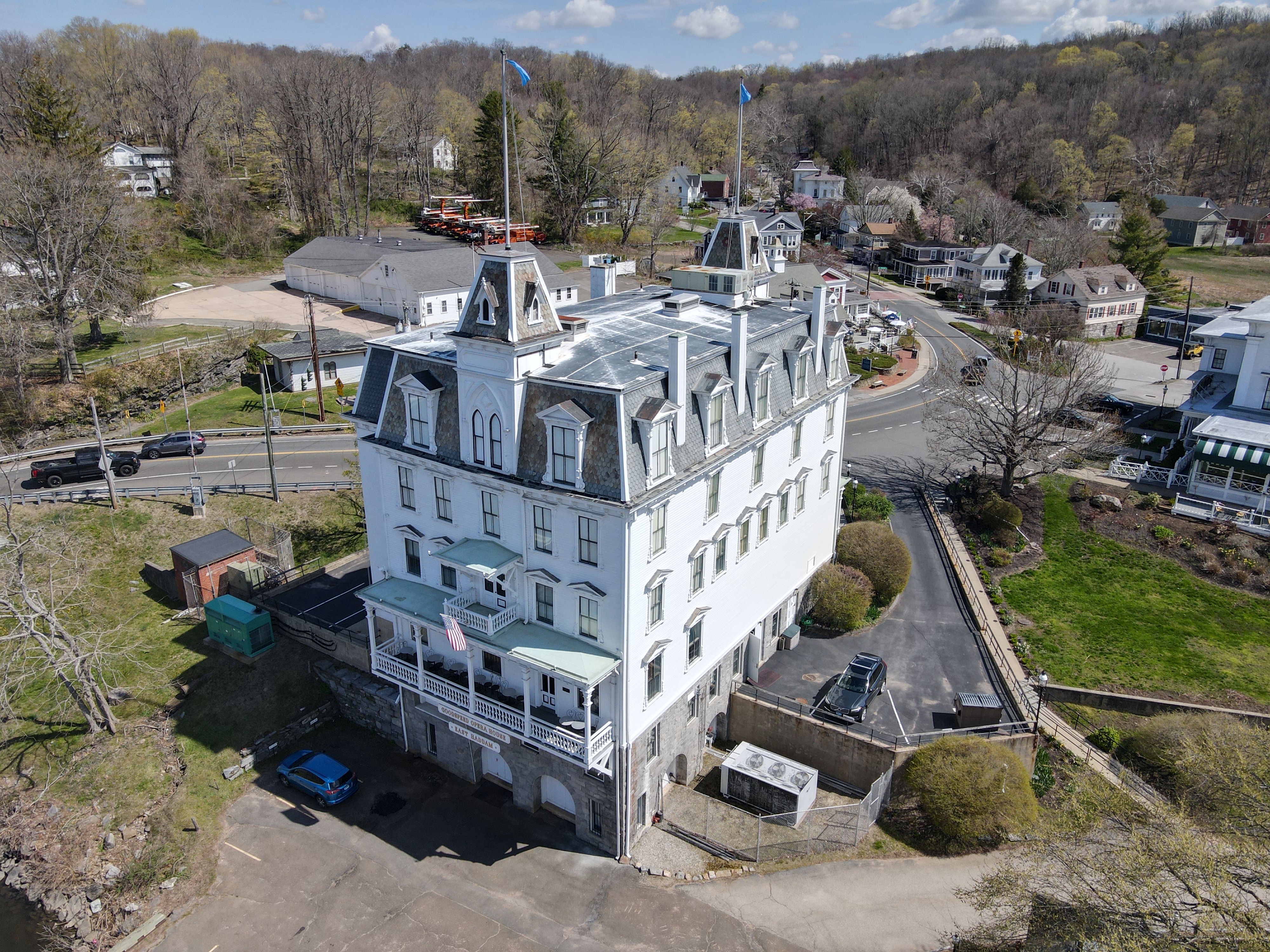
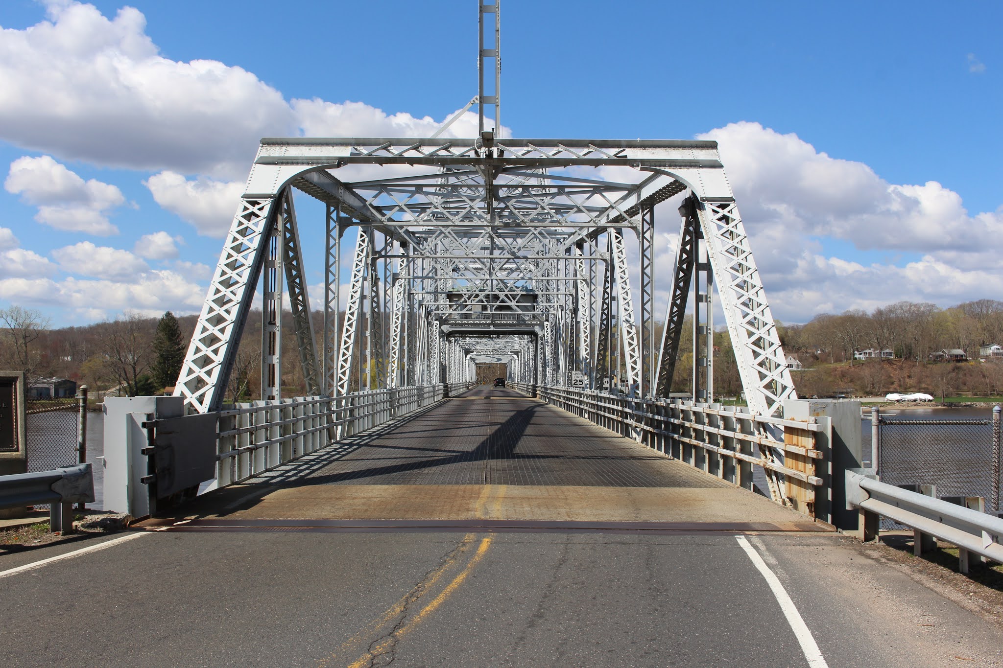
Aside from the Opera House, the most recognizable landmark in the village is the bridge spanning the Connecticut River nearby. The East Haddam Bridge was built in 1913 and is an impressive steel truss swing bridge built in an ornate style that easily blends in with the surrounding natural and man-made landmarks. A link to an additional blog post about this bridge (including other information and photos) will be found at the bottom of this article.

Above: The East Haddam Bridge carries CT Route 82 across the Connecticut River

Located on the west bank of the river immediately across the bridge is the historic Goodspeed Train Station, built as a stop on the old Connecticut Valley Railroad. Nowadays, it’s home to an antique/general store and is the starting point for a unique railbike attraction run by the Valley Railroad Company. Steam train and riverboat excursion tours are offered in this area, some of which originate their journey here in East Haddam at the Goodspeed Station and/or at the nearby Eagle Landing State Park; all can often be spotted along the tracks and the nearby Connecticut River during the warm months of the year.

Above: The Goodspeed Station, plus an excursion train and riverboat sighting in town


How to Get There:


Comments

Popular posts from this blog

Did Caltrans just kill the G26 cutout US Route shields?

The US Route System was formally created by the American Association of State Highway Officials during November 1926.  Through the history of the system the only state to which has elected to maintain cutout US Route shields has been California.  The G26 series cutout US Route shields have become a favorite in the road enthusiast hobby and are generally considered to be much more visually pleasing than the standard Federal Highway Administration variant.  However, the G26 shield series appears to have been killed off on January 18, 2026, when Caltrans updated their Manual of Uniform Traffic Control Devices.  This blog will examine the history of the US Route shield specifications in California and what is happening with the 2026 changes.  The blog cover photo is facing towards the terminus of California State Route 136 and at a G26-2 specification US Route 395 shield.  In the background Mount Whitney can be seen in the Sierra Nevada range.   ...

Hawaii Route 50

Hawaii Route 50 is the longest Sign Route on the island of Kauai at 32.6 miles.  The entirety of Hawaii Route 50 is overlaid atop Kaumualii Highway from Lihue west to the Pacific Missile Range Facility at Barking Sands. Hawaii Route 50 is one of the original 1955-era State Highway designations on Kauai.  Much of the Kaumualii Highway corridor was constructed during the sugar plantation boom of the late Hawaiian Kingdom.  The first tee beam bridge in Hawaii would be constructed along the Kaumualii Highway in 1911 at the Hanapepe.  Much of this highway would be modernized to two-lane standards through the 1930s and 1940s. This page is part of the Gribblenation Hawaii Roads series.  A compellation of all Hawaii-related media from both Gribblenation and RoadwayWiz can be found by clicking  here .  Part 1; the history of Hawaii Route 50 and Kaumualii Highway Hawaii Route 50 is the longest highway on Kauai at 32.6 miles.  The highway begins at Rice Str...

Ghost Town Tuesday; Nichols, FL

A couple years ago I spent a lot of spare time exploring phosphate mining ghost towns in the Bone Valley of Polk County, Florida.  One ghost town in particular called Nichols on Polk County Route 676 west of Mulberry caught my eye due to a relative lack of documentation on ghosttowns.com. Nichols was created in 1905 during the early phosphate mining boom in the Bone Valley region.  For the time Nichols was unusual since it had company housing in the Nichols Mine site and private residences outside the gate.  Nichols is only about two miles west of Mulberry which probably made it a somewhat reasonable commute even by the wonky standards of the early 20th Century.  Most of the Bone Valley region was relatively remote which made commuting or homesteading impractical which is why there are so many ghost towns in the area.  The company housing section of Nichols was phased out and abandoned by 1950. The Nichols town site is largely abandoned and could "possibl...