
Thursday Jersday: Beesleys Point Bridge

Here's a feature that I plan on doing every Thursday for the next few months. I'll be posting a link to a New Jersey collection of photos I've taken and posted onto Flickr, for your enjoyment.

The first week's installment will take us to the controversial Beesleys Point Bridge, which crosses over the Great Egg Harbor in South Jersey. Enjoy!


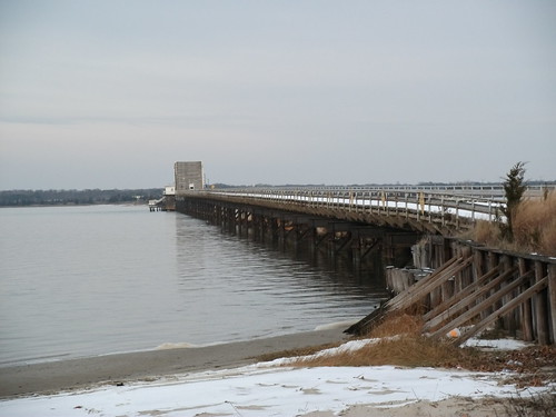
Beesleys Point Bridge (December 2011 photos)

Beesleys Point Bridge (February 2005 photos, as a bonus)

Comments

Did not this blog link to "A Trip Within The Beltway"

I recall seeing it here previously...

Popular posts from this blog

What's In a Name?: When the Roads Really Do Tell a Story

  Our tagline on the Gribblenation blog is "because every road tells a story". Some roads tell different stories than others. Along our travels, we may see historic markers that tell us a little story about the roads we travel or the places we pass by. Some historic markers are more general, as to telling us who lived where or what old trail traversed between two towns. During my travels across New York State and other states or provinces, I pass by many historic markers, some with interesting or amusing references to roads. I wanted to highlight a few of the markers I've seen along my travels around the Empire State and help tell their stories. Those stories may be as specific as explaining the tales of a tree that was used to help measure a distance of eight miles from Bath to Avoca in Steuben County, as referenced on the Eight Mile Tree historical marker above. They may also help point the way along historical roads first used centuries ago, or may help tell a local l...

Abandoned Fowler Avenue in Clovis, California

Originally Fowler Avenue in the city of Clovis had a brief discontinuation approaching Herndon Avenue.  Fowler Avenue traffic heading northbound was required to detour briefly onto westbound Herndon Avenue.  During 2001 this discontinuation was removed when Fowler Avenue was reconfigured to access the Sierra Freeway (California State Route 168) via an interchange.  This led to a segment of the original alignment of Fowler Avenue just south of Herndon Avenue to be abandoned.  Despite a shopping center opening over part of the original Fowler Avenue alignment in 2016 much of the abandoned roadway remains.   The history of the abandoned original alignment of Fowler Avenue in Clovis The original alignment of California State Route 168 departed downtown Clovis eastbound along Tollhouse Road.  This original alignment did not interact with Fowler Avenue at the Herndon Avenue intersection.  Fowler Avenue north of Tollhouse Road ran north to Herndon Avenue...

Zayante Road and Upper Zayante Road

The combined 11-mile corridor Zayante Road and Upper Zayante Road is located in the Santa Cruz Mountains near Felton in Santa Cruz County.  The corridor begins as Zayante Road at Graham Hill Road near the Felton Covered Bridge.  Zayante Road passes through the namesake community of Zayante where it becomes Upper Zayante Road upon intersecting Old Mountain Road.  Upper Zayante Road makes a final ascent to California State Route 35 at Summit Road via a grade which peaks at an incline of 11%. Zayante Road was built as a frontage of the South Pacific Coast Railroad in 1879.  As originally configured Zayante Road terminated a short distance north of Zayante Station.  Zayante Station itself was commissioned in 1891 to service the resort at Gibbs Ranch.  Upper Zayante Road would later be constructed in the first decade of the Twentieth Century as a continuation of Zayante Road to Summit Road.   Part 1; the history of Zayante Road and Upper Zayante Road B...