
A few weeks ago, I traveled to Southern Maryland for work. On the way home, I took a quick trip down MD 257 and 254 to Cobb Island. It's a quick little ride off of US 301 just north of the Nice Bridge.
The entire Flickr Set is here.
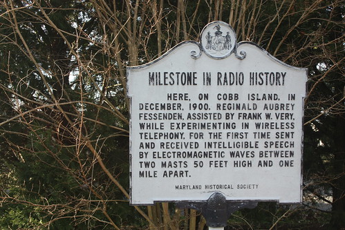
I drove MD 257 all the way to where MD 254 branches off towards Cobb Island. Cobb Island has an important place in the history of radio.
I was actually surprised that there wasn't more in Cobb Island. The entire island is home to numerous residential homes (it appears the people actually live here vs. vacation here) with no room for an easy pull of to take photos of the Potomac. Oh well, the surprises were soon to begin.
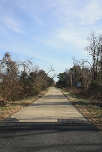
Back at MD 257, I took a right to head towards Rock Point. The views also were not available. But there's a neat narrow concrete road once MD 257 ends.
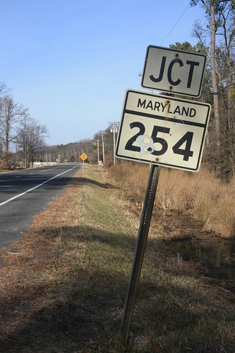
When you head away from Rock Point on MD 257 to head back towards MD 254, you come across this old sign gem.
Heading back to US 301, there are a few older building that tell of a busier past. In the community of Issue, there's this old corner country store that I have a feeling did a lot of seafood business.
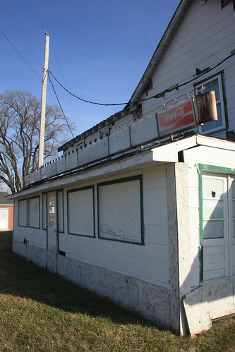
In addition to selling Coca-Cola.

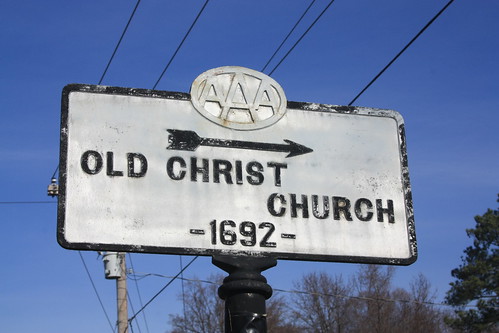
Near US 301, there's a historic Lutheran Church in Wayside.
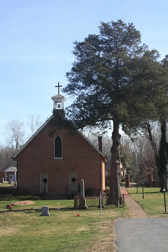
Christ Church Wayside - William and Mary Parish - has been in existence since 1692. Interestingly enough, an old embossed AAA cast iron sign is also located here.
Some pretty good finds on an otherwise quiet drive.
The entire Flickr Set is here.
I drove MD 257 all the way to where MD 254 branches off towards Cobb Island. Cobb Island has an important place in the history of radio.
I was actually surprised that there wasn't more in Cobb Island. The entire island is home to numerous residential homes (it appears the people actually live here vs. vacation here) with no room for an easy pull of to take photos of the Potomac. Oh well, the surprises were soon to begin.
Back at MD 257, I took a right to head towards Rock Point. The views also were not available. But there's a neat narrow concrete road once MD 257 ends.
When you head away from Rock Point on MD 257 to head back towards MD 254, you come across this old sign gem.
Heading back to US 301, there are a few older building that tell of a busier past. In the community of Issue, there's this old corner country store that I have a feeling did a lot of seafood business.
In addition to selling Coca-Cola.
Near US 301, there's a historic Lutheran Church in Wayside.
Christ Church Wayside - William and Mary Parish - has been in existence since 1692. Interestingly enough, an old embossed AAA cast iron sign is also located here.
Some pretty good finds on an otherwise quiet drive.
Comments