
On the morning of the 4th of July, I took a quick but very enjoyable jaunt into rural areas of Washington County.
Route: I-70, PA 18, PA 231, US 40, I-70.
For the full set of photos - head over to flickr.
I picked up PA 18 in Washington; and after Route 18 leaves US 40, I came across this semi-abandoned building.
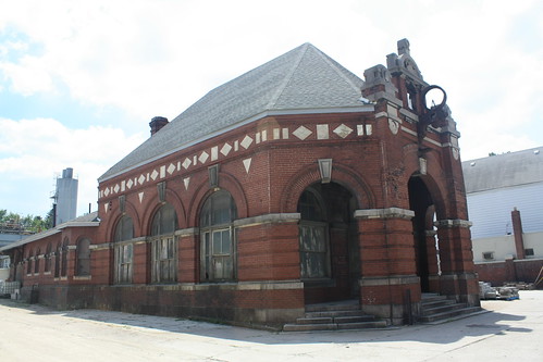
I believe this was once a train station, but there are no tracks nearby. The grounds around this building are being used for a brick and concrete forming yard. If anyone knows what this old building was, please leave a comment!
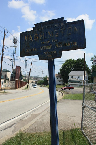
Just down the road from the building was a Keystone Town Marker for Washington.
South of Prosperity is where the goodies on PA 18 really start to show up.
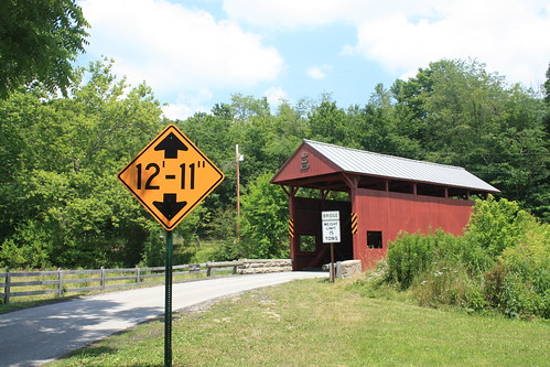
First, Day Covered Bridge. Like many of the covered bridges in Washington County, the Day Bridge is a short queenpost truss, and is over a century old. The Day Bridge has been in place since 1875.
A little further down the road was the first Chew Mail Pouch Tobacco Barn that I have photographed. One of my photographic influences, Fred Yenerall, took photos of hundreds of these barns in the 1960s and 70s.
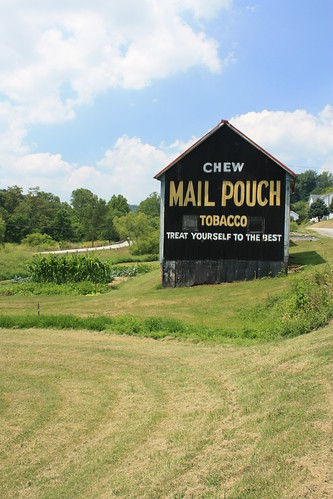
This is the first of hopefully many of these barns and more.
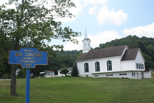
Just up the road, an old oxbow alignment of PA 18 goes through the village of Old Concord. Surprisingly, or maybe not, there is a Keystone Town Marker there.
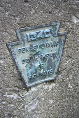
Along PA 231, there are a number of old concrete bridges over small creeks and tributaries. On most of these bridges there are slightly different bridge plates - at least compared to others of that era. Most of the bridges have a keystone as the plate, like this one below. (It's found on the 1940 truss bridge over Slippery Rock Creek from the day before.)
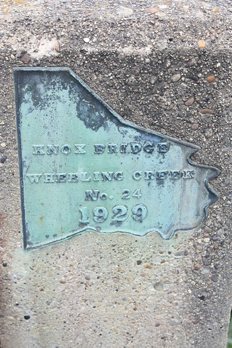
The ones on PA 231 are actually in the shape of Washington County. What is also different is that the bridge plate names the bridge and body of water it crosses.
PA 231 meets US 40 and the National Road in Claysville. Claysville is truly a product of the National Road. Founded by John Purviance in 1817 as a wagon stop on the road, Claysville is named in honor of Henry Clay.
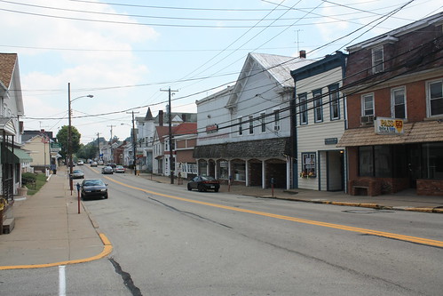
Claysville has numerous homes and buildings that date back to the 1800s.
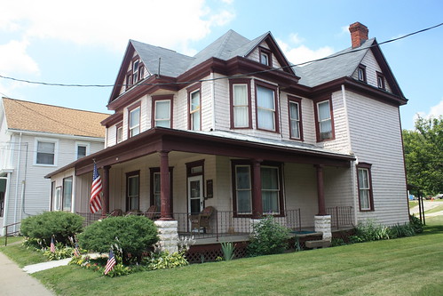
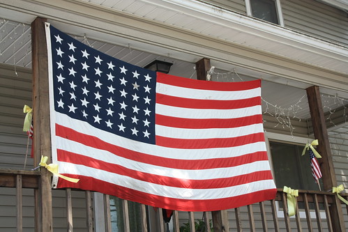
Oddly, the best find in Claysville wasn't an item that dates back to the 19th century. On one of the old homes on Main Street, I found a 48 star United States flag.
From there, I took US 40 back towards Washington where I picked up I-70 and headed home. And that's it from the trip home to Pennsylvania.
Route: I-70, PA 18, PA 231, US 40, I-70.
For the full set of photos - head over to flickr.
I picked up PA 18 in Washington; and after Route 18 leaves US 40, I came across this semi-abandoned building.
I believe this was once a train station, but there are no tracks nearby. The grounds around this building are being used for a brick and concrete forming yard. If anyone knows what this old building was, please leave a comment!
Just down the road from the building was a Keystone Town Marker for Washington.
South of Prosperity is where the goodies on PA 18 really start to show up.
First, Day Covered Bridge. Like many of the covered bridges in Washington County, the Day Bridge is a short queenpost truss, and is over a century old. The Day Bridge has been in place since 1875.
A little further down the road was the first Chew Mail Pouch Tobacco Barn that I have photographed. One of my photographic influences, Fred Yenerall, took photos of hundreds of these barns in the 1960s and 70s.
This is the first of hopefully many of these barns and more.
Just up the road, an old oxbow alignment of PA 18 goes through the village of Old Concord. Surprisingly, or maybe not, there is a Keystone Town Marker there.
Along PA 231, there are a number of old concrete bridges over small creeks and tributaries. On most of these bridges there are slightly different bridge plates - at least compared to others of that era. Most of the bridges have a keystone as the plate, like this one below. (It's found on the 1940 truss bridge over Slippery Rock Creek from the day before.)
The ones on PA 231 are actually in the shape of Washington County. What is also different is that the bridge plate names the bridge and body of water it crosses.
PA 231 meets US 40 and the National Road in Claysville. Claysville is truly a product of the National Road. Founded by John Purviance in 1817 as a wagon stop on the road, Claysville is named in honor of Henry Clay.
Claysville has numerous homes and buildings that date back to the 1800s.
Oddly, the best find in Claysville wasn't an item that dates back to the 19th century. On one of the old homes on Main Street, I found a 48 star United States flag.
From there, I took US 40 back towards Washington where I picked up I-70 and headed home. And that's it from the trip home to Pennsylvania.
Comments
http://mapper.acme.com/?ll=40.17504,-80.25500&z=16&t=T
The W&WRR was a narrow gauge steam loco RR that meet the Penn RR as the B&O RR was one block north. Building is currently used by Judsen and Willey Cement for storage