
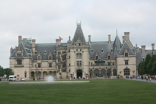
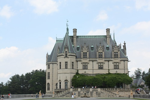
The second day of Maggie's and I trip to Asheville was a day at the historic Biltmore Estate. It was my first time to the famous Vanderbilt home, and had been on my 'to do' list for sometime.
My photoset from the Biltmore is on flickr.
Maggie has her own blog entry from our trip and it's here.
We arrived soon after the estate opened and headed to the home for the main tour. For the main tour, you have the option of taking an audio tour or walk through at your leisure. The audio tour costs $10 for a set of programmable earphones that accompanies the guide book. We both paid for the audio tour and it is worth it if you are a first time visitor. The tour can take anywhere from 2-3 hours to walk through the home. You go through three floors of the house and photography is not allowed inside the building.
If you want to see the Biltmore home more in detail, there are a number of additional tours you can take on. One of the more popular tours is the Rooftop Tour. The tour lasts about an hour, costs $17, and along with visiting the observatory, the tour takes you to three different rooftop views.
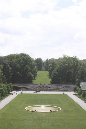
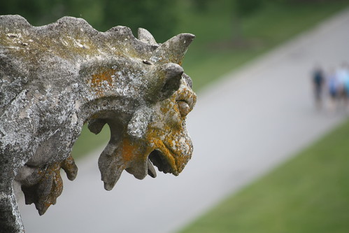
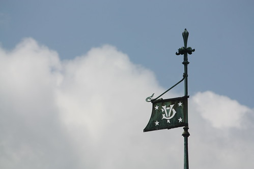
The first stop is the view of the front lawn (above) from the Observatory. Guests are able to walk the narrow balcony and really get a close-up view of the various gargoyles and other pieces of the roof architecture.
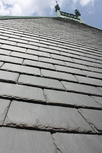
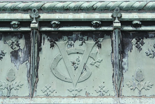
The second stop is another fourth floor Observatory accessible view - this time with a little more room. From here, you can get a close and detailed view of the detailed work of the copper flashing.
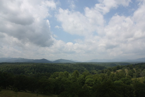
The last stop of the rooftop tour is easily the most impressive. From a westwards facing second floor balcony, an expansive view of the mountains of North Carolina awaits.
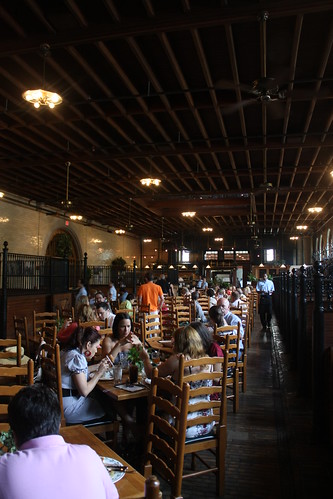
After the rooftop tour, Maggie and I headed to the stable area for lunch. We ate at the Stable Cafe - which is obviously a restaurant located within the former stables of the Biltmore. The meal was tatsy and its rather interesting to eat in a former horse stall within the stable.
After lunch, we took a stroll through the gardens and down to the Bass Pond. It's amazing that this view is only the side profile of the house!
The gardens and conservatory is home to an endless variety of flowers from roses and lillies to tropical varieties the color and beauty is simply amazing.


After a relaxing stroll around the Bass Pond, we headed to the newly opened Antler Hill Village. Antler Hill Village is now the gateway to the estate's numerous recreational activities from biking, to guided hikes, fly-fishing, horseback riding tours, among many others.
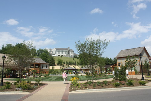
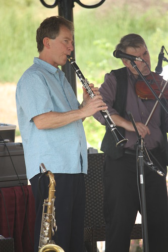
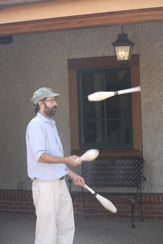
Antler Hill Village is also the site of the Biltmore Winery. Be sure to take the tour and the wine tasting! It's worth it! The village is also home to additional restaurants, gift shops, and a public square complete with live music and entertainment.
To really experience the Biltmore, it is definitely a two day visit! There's just not enough time to experience all that there is to offer!
My photoset from the Biltmore is on flickr.
Maggie has her own blog entry from our trip and it's here.
We arrived soon after the estate opened and headed to the home for the main tour. For the main tour, you have the option of taking an audio tour or walk through at your leisure. The audio tour costs $10 for a set of programmable earphones that accompanies the guide book. We both paid for the audio tour and it is worth it if you are a first time visitor. The tour can take anywhere from 2-3 hours to walk through the home. You go through three floors of the house and photography is not allowed inside the building.
If you want to see the Biltmore home more in detail, there are a number of additional tours you can take on. One of the more popular tours is the Rooftop Tour. The tour lasts about an hour, costs $17, and along with visiting the observatory, the tour takes you to three different rooftop views.
The first stop is the view of the front lawn (above) from the Observatory. Guests are able to walk the narrow balcony and really get a close-up view of the various gargoyles and other pieces of the roof architecture.
The second stop is another fourth floor Observatory accessible view - this time with a little more room. From here, you can get a close and detailed view of the detailed work of the copper flashing.
The last stop of the rooftop tour is easily the most impressive. From a westwards facing second floor balcony, an expansive view of the mountains of North Carolina awaits.
After the rooftop tour, Maggie and I headed to the stable area for lunch. We ate at the Stable Cafe - which is obviously a restaurant located within the former stables of the Biltmore. The meal was tatsy and its rather interesting to eat in a former horse stall within the stable.
After lunch, we took a stroll through the gardens and down to the Bass Pond. It's amazing that this view is only the side profile of the house!
The gardens and conservatory is home to an endless variety of flowers from roses and lillies to tropical varieties the color and beauty is simply amazing.
After a relaxing stroll around the Bass Pond, we headed to the newly opened Antler Hill Village. Antler Hill Village is now the gateway to the estate's numerous recreational activities from biking, to guided hikes, fly-fishing, horseback riding tours, among many others.
Antler Hill Village is also the site of the Biltmore Winery. Be sure to take the tour and the wine tasting! It's worth it! The village is also home to additional restaurants, gift shops, and a public square complete with live music and entertainment.
To really experience the Biltmore, it is definitely a two day visit! There's just not enough time to experience all that there is to offer!

Comments