
Day 5 would see the start of the journey back east, but more on that in my next entry. On the way towards Midland, TX from Albuquerque, we scheduled a stop at White Sands National Monument - located on US 70 just southwest of Alamogordo. I'm beginning to think I have this attraction to sand dunes as this is the third sand dune oriented park I have been to. (Jockey's Ridge State Park along North Carolina's Outer Banks and Sleeping Bear Dunes National Lake Shore in Michigan.)
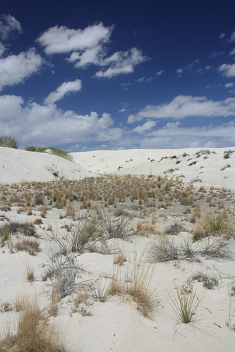
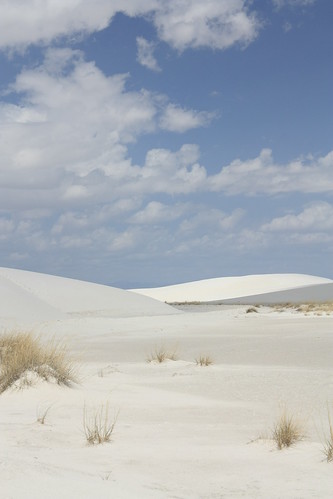
White Sands National Monument was strikingly different. The first reason is obvious, the white sand. But the second difference is at White Sands you really are surrounded by what seems to be endless sand dunes.
I have some of my favorite shots from White Sands below. The entire set (88 photos) are located on flickr.
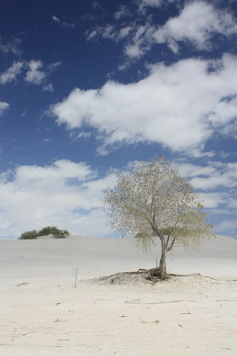
One of the first stops is the Dune Life Trail. The one mile loop trail is well marked and it is really the first opportunity to walk on the sand. It is an interpretive trail with many markers explaining details about the dune's habitat along the way.
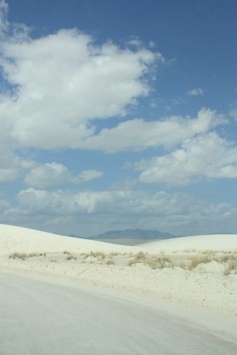
After the mile or so hike - it did seem longer - it was back onto Dunes Drive. Dunes Drive leads to the heart of the sand dunes. After awhile, the pavement ends and you are driving on what pretty much is compacted sand and gypsum.
The road looks like this!

From there there are many stops for you to explore the sand dunes including the Alkali Flat Trail. When hiking the Alkaki Flat Trail, individuals are required to sign in and sign out. This is because of the extreme conditions - sand storms, low visibility and heat - can leave a hiker stranded.
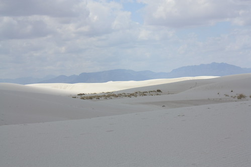
One of the amazing things about being on the dunes is that you have a top of the world, last man standing feeling. Though others are nearby, you can have a rather comforting feeling of isolation on the dunes. It is quite an experience.
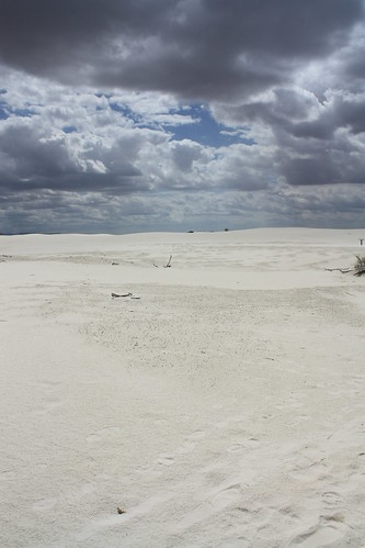
The white dunes also put on a show. Depending on the amount of clouds, the dunes can be a blinding white or a soft off-white. With variable cloud cover, the colors of the dunes dance with the passing clouds.
From here it was back into Alamogordo for lunch and then east onto US 82 for an amazing drive.
White Sands National Monument was strikingly different. The first reason is obvious, the white sand. But the second difference is at White Sands you really are surrounded by what seems to be endless sand dunes.
I have some of my favorite shots from White Sands below. The entire set (88 photos) are located on flickr.
One of the first stops is the Dune Life Trail. The one mile loop trail is well marked and it is really the first opportunity to walk on the sand. It is an interpretive trail with many markers explaining details about the dune's habitat along the way.
After the mile or so hike - it did seem longer - it was back onto Dunes Drive. Dunes Drive leads to the heart of the sand dunes. After awhile, the pavement ends and you are driving on what pretty much is compacted sand and gypsum.
The road looks like this!
From there there are many stops for you to explore the sand dunes including the Alkali Flat Trail. When hiking the Alkaki Flat Trail, individuals are required to sign in and sign out. This is because of the extreme conditions - sand storms, low visibility and heat - can leave a hiker stranded.
One of the amazing things about being on the dunes is that you have a top of the world, last man standing feeling. Though others are nearby, you can have a rather comforting feeling of isolation on the dunes. It is quite an experience.
The white dunes also put on a show. Depending on the amount of clouds, the dunes can be a blinding white or a soft off-white. With variable cloud cover, the colors of the dunes dance with the passing clouds.
From here it was back into Alamogordo for lunch and then east onto US 82 for an amazing drive.
Comments