
Prior to the DC Road Meet, I spent some time at Manassas National Battlefield Park. This was my second visit to the park, and it was my first since October 2001. On that trip, the photos I took with a $30 camera was ruined by a piece of film lodged inside. Since then, I had been wanting to get back to some of the sights on that trip to retake photos and enjoy everything again.
I only had about 90 minutes to two hours before I needed to get to the meet site, so I didn't see everything I wanted to, but I can always come back.
The National Park Service recommends that if you do not have a lot of time to spend to take a hike on roughly mile long Henry Hill loop. So that is part of what I did. The Henry Hill loop highlights the First Battle of Manassas and some of the key figures, events, and locations in that battle.
For the entire set on flick (even a few signs), head here.

A view of the Henry House. Judith Henry, who lived here, was the first civilian casualty of the war. She was bedridden and refused to leave. Her house was destroyed by Union cannon who believe sniper fire was coming from her building. She would pass away the day following the battle.
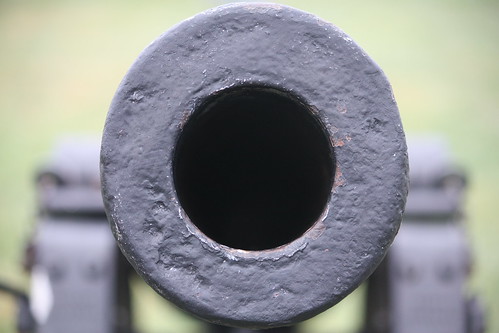
A neat look at one of the Union cannons.
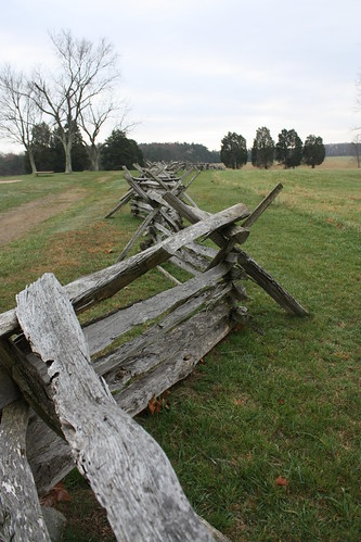
Fence along Robinson Farm Lane
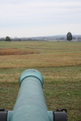
A Confederate gunner's view on Henry Hill.
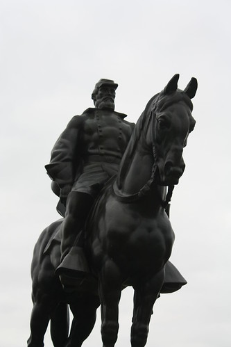
The Stonewall Jackson Statue - It looks a bit modern, almost super hero like, but the 1st battle of Manassas is where Jackson earned his 'Stonewall' nickname.
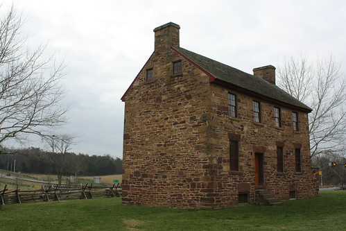
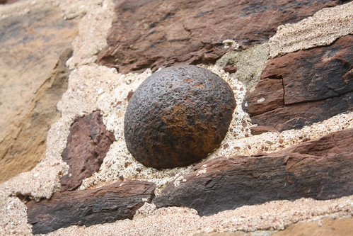
I took a look at the Stone House - which stood along the Warrenton Turnpike (now US 29) at the time of the war. The Stone House is closed for the winter. One of the neat things about the Stone House is the unexploded artillery that is lodged in the exterior walls - sitting there now for nearly 150 years.
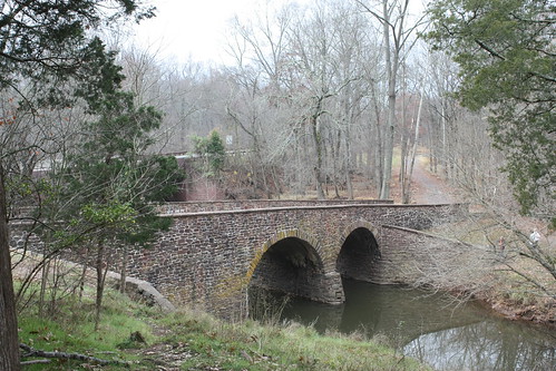
My final stop was the stone bridge. The bridge which was damaged during both battles and was restored sometime after the end of the war. It most likely carried US 29 traffic at one point. The bridge that carries US 29 now was built in the 1960s.
There is plenty more to see and explore at the battlefield, a few monuments, the visitor's center, cemetery, and a number of hiking trails along parts of both battles. If you are visiting there, I would suggest 4-6 hours to explore and really appreciate the history.
I only had about 90 minutes to two hours before I needed to get to the meet site, so I didn't see everything I wanted to, but I can always come back.
The National Park Service recommends that if you do not have a lot of time to spend to take a hike on roughly mile long Henry Hill loop. So that is part of what I did. The Henry Hill loop highlights the First Battle of Manassas and some of the key figures, events, and locations in that battle.
For the entire set on flick (even a few signs), head here.
A view of the Henry House. Judith Henry, who lived here, was the first civilian casualty of the war. She was bedridden and refused to leave. Her house was destroyed by Union cannon who believe sniper fire was coming from her building. She would pass away the day following the battle.
A neat look at one of the Union cannons.
Fence along Robinson Farm Lane
A Confederate gunner's view on Henry Hill.
The Stonewall Jackson Statue - It looks a bit modern, almost super hero like, but the 1st battle of Manassas is where Jackson earned his 'Stonewall' nickname.
I took a look at the Stone House - which stood along the Warrenton Turnpike (now US 29) at the time of the war. The Stone House is closed for the winter. One of the neat things about the Stone House is the unexploded artillery that is lodged in the exterior walls - sitting there now for nearly 150 years.
My final stop was the stone bridge. The bridge which was damaged during both battles and was restored sometime after the end of the war. It most likely carried US 29 traffic at one point. The bridge that carries US 29 now was built in the 1960s.
There is plenty more to see and explore at the battlefield, a few monuments, the visitor's center, cemetery, and a number of hiking trails along parts of both battles. If you are visiting there, I would suggest 4-6 hours to explore and really appreciate the history.
Comments