
Last weekend, Adam Froehlig hosted the first Washington DC roadmeet. So I decided to head up and attend the meet and visit family at the same time.
For the entire meet set - head here.
There's a lot going on in the Metro DC area - and the first part of the meet took a look at the recently completed Woodrow Wilson Bridge. We took a brief walk across the newly opened pedestrian and bikeway. The views of the traffic and upstream on the Potomac are impressive.
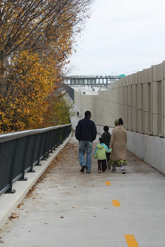
The beginning of the walkway on the Alexandria, VA side.
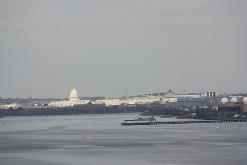
The US Capitol viewed from the bridge.
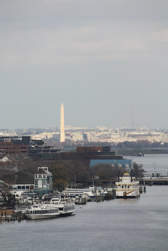
Washington Monument
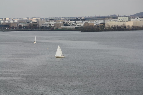
Sailboats were out
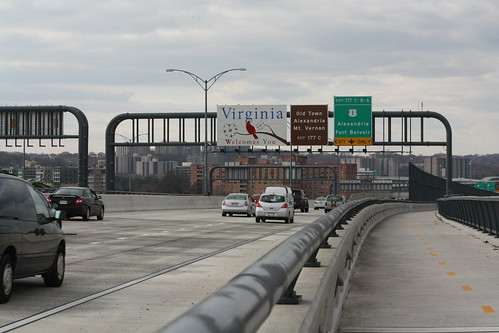
A look at the inner loop's newly opened local lanes.
We did a driving tour of the Springfield (I-95/I-395/I-495) Interchange construction's final phase - HOV lane connections and of the construction of the missing piece of the Fairfax County Parkway. I was driving - and I didn't take any photos of that.
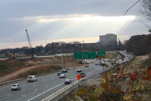
Next, was a driving tour of the 495 HOT (High Occupancy Toll) construction with a stop along a local rail trail. The rail trail gave a great look at the construction in and around the Beltway's interchange with I-66.
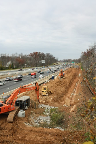
Construction on the Outer Loop.
Inner Loop construction.
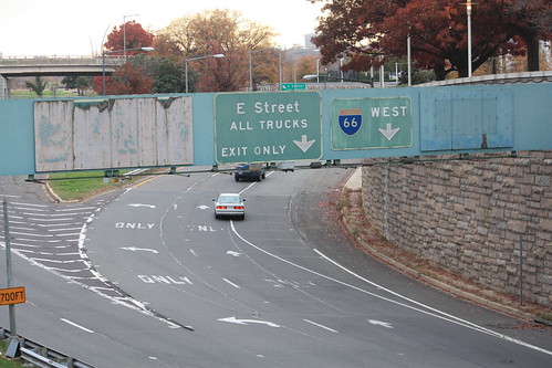
Next, we headed into DC. One of the stops was a sign stop to see maybe one of the oldest freeway signs in DC. A pair of button copy overheads for E Street and I-66.
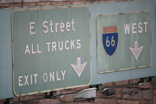
The biggest question was - what's behind the plywood covered signs?
After this stop, we weaved our way through DC towards Barney Circle and the incomplete freeway connections there. Unfortunately, it was getting quite dark, and the photo opportunities were fleeting. Along the way, we passed by the Vietnam, World War II, Lincoln and Washington Monuments along the way. This trip was my first time into DC since 1997 (and that was for a RMC football game at Georgetown), and I am itching to go back. I haven't really had the chance to see the monuments and all of the history - and would love to really explore the city once again.
Finally, a tip of the cap to Adam Froehlig. He did a wonderful job in planning the meet ahead of time. His knowledge of DC and the traffic was extremely helpful in a three car caravan. The maps printed for turn by turn navigation allowed the entire crew of 14 attendees to take the circuitous route without incident or getting lost.
For the entire meet set - head here.
There's a lot going on in the Metro DC area - and the first part of the meet took a look at the recently completed Woodrow Wilson Bridge. We took a brief walk across the newly opened pedestrian and bikeway. The views of the traffic and upstream on the Potomac are impressive.
The beginning of the walkway on the Alexandria, VA side.
The US Capitol viewed from the bridge.
Washington Monument
Sailboats were out
A look at the inner loop's newly opened local lanes.
We did a driving tour of the Springfield (I-95/I-395/I-495) Interchange construction's final phase - HOV lane connections and of the construction of the missing piece of the Fairfax County Parkway. I was driving - and I didn't take any photos of that.
Next, was a driving tour of the 495 HOT (High Occupancy Toll) construction with a stop along a local rail trail. The rail trail gave a great look at the construction in and around the Beltway's interchange with I-66.
Construction on the Outer Loop.
Inner Loop construction.
Next, we headed into DC. One of the stops was a sign stop to see maybe one of the oldest freeway signs in DC. A pair of button copy overheads for E Street and I-66.
The biggest question was - what's behind the plywood covered signs?
After this stop, we weaved our way through DC towards Barney Circle and the incomplete freeway connections there. Unfortunately, it was getting quite dark, and the photo opportunities were fleeting. Along the way, we passed by the Vietnam, World War II, Lincoln and Washington Monuments along the way. This trip was my first time into DC since 1997 (and that was for a RMC football game at Georgetown), and I am itching to go back. I haven't really had the chance to see the monuments and all of the history - and would love to really explore the city once again.
Finally, a tip of the cap to Adam Froehlig. He did a wonderful job in planning the meet ahead of time. His knowledge of DC and the traffic was extremely helpful in a three car caravan. The maps printed for turn by turn navigation allowed the entire crew of 14 attendees to take the circuitous route without incident or getting lost.
Comments