US Route 99 in the Los Angeles-Redlands corridors was originally aligned on a multiplex of US Route 66 from Pasadena east to San Bernardino via Legislative Route Number 9. During September of 1934 the American Association of State Highway Officials approved a request from the California Highway Commission to move US Route 99 onto a new alignment in the Los Angeles-Redlands corridor following the recently extended Legislative Route Number 26. This blog explores the alignment of US Route 99 in the Los Angeles-Redlands corridor from 1935 to 1963 when the highway was truncated to the end of the Golden State Freeway. Featured as the blog cover is the Arroyo Seco Parkway as seen in the January/February 1944 California Highways & Public Works shortly after it had been extended from Avenue 22 to downtown Los Angeles during December 1943.

This blog is part of the larger Gribblenation US Route 99 Page. For more information pertaining to the other various segments of US Route 99 and it's three-digit child routes check out the link the below.
Part 1; the history of the 1935-1963 Los Angeles-Redlands Corridor of US Route 99
1933 was a landmark year in terms of Statewide transportation. The State Legislature removed restrictions that prevented State Funds from being used to maintain urban roadways. This change by the Legislature led to the addition of numerous urban highways being adopted.
California Highways Highway Chronology Chapter 3; A Significant System is Created 1933-1946
One of the 1933 additions to the State Highway system was Legislative Route Number 165 (LRN 165) which was routed from San Pedro to La Canada via Figueroa Street. The addition of LRN 165 made the three completed Figueroa Street Tunnels part of the State Highway System and led into the construction of the fourth and southernmost tunnel. Figueroa Street Tunnels once completed between Pasadena and downtown Los Angeles would serve as a much more direct corridor with more traffic capacity than early alignments of US Route 99 (US 99) and US Route 66 (US 66). State Maintenance of LRN 26 and US 60 was extended to downtown Los Angeles to Aliso Street during 1933. A series of September 1934, letters by the California State Highway Engineer to the American Association of State Highway Officials (AASHO) Executive Secretary noted a recommendation to move US 99 from Los Angeles to Redlands via LRN 26 through Pomona and Colton. The California State Highway Engineer noted traffic on US 99 would be better served traversing downtown Los Angeles and utilizing US 60/LRN 26 directly to reach Redlands. Notably the alignment the sketch map provided by the California State Highway Engineer shows existing US 99 following San Fernando Road to US 66 at Arroyo Seco Avenue and a multiplex on US 66/LRN 165 via Figueroa Street to Colorado Boulevard.
The same exchange of letters also notes US 70 had been extended into California with an endpoint following US 60/LRN 26 into downtown Los Angeles. The routing definition of US 70 indicated it would multiplex US 99/US 60 east from downtown Los Angeles to Pomona and onwards to US 60 east to Beaumont.
The 1
934 Division of Highways City Insert implies US 60/LRN 26 followed an interim alignment from downtown Los Angeles eastward following Macy Street, Mission Street and Alhambra Avenue towards Pomona. The planned Ramona Expressway can be seen as a dotted line connecting Macy Street directly to Garvey Avenue.
The
1934 Division of Highways Map shows LRN 26 following Garvey Avenue from Monterey Park onto Arroyo Avenue, Holt Avenue, Colton Avenue, I Street, Colton Avenue, E Street, Colton Avenue and Orange Street passing through El Monte, West Covina, Pomona, Ontario and Colton east to Redlands.
The
March 1934 California Highways & Public Works features the upcoming Los Angeles-Pomona Arterial which was to follow what would become the Ramona Boulevard. The Los Angeles-Pomona Arterial is described as being completed from Mountain View Road east to the city limits of Pomona. The Los Angeles-Pomona Arterial is described as having a western extent at Aliso Street and Mission Street in downtown Los Angeles.


Prior to the fourth Figuroa Street Tunnel being completed during 1936 US 99 used an interim alignment to reach downtown Los Angeles multiplexed with US 66. US 99 transitioned off of San Fernando Road onto a multiplex of US 66/LRN 165 at Arroyo Seco Boulevard. US 99/US 66/LRN 165 crossed the Los Angeles River to Riverside Drive onwards to the Figueroa Street Tunnels. US 99/US 66 followed Solano Avenue and Broadway into downtown where they met US 101/LRN 2 at Sunset Boulevard. The
1935 Division of Highways Map of downtown Los Angeles shows US 99/US 60 (solid red line) following an interim alignment of LRN 26 east via Macy Street, Brooklyn Avenue and Mednik Avenue towards the completed segment of the Ramona Boulevard. US 99/US 60 on LRN 26 are shown transitioning from the Ramona Expressway onto Garvey Avenue in Monterey Park.

CAhighways.org has a page dedicated to I-110/CA 110 which shows a photo of the fourth Figueroa Street Tunnel under construction. Temporary signage showing US 66/US 99 and California State Route 11 can be seen in front of the tunnel which is looking southbound. The Temporary signage shows US 99/US 66/CA 11 jogging from the fourth Figueroa Street Tunnel onto Solano Street onwards to Broadway. Note: CA 11 was one of the initial Sign State Routes announced in the August 1934 California Highways & Public Works. The
February 1935 California Highways & Public Works announced the nearing completion of Ramona Boulevard. Construction of Ramona Boulevard is cited as having begun in 1932 and is stated to have six miles containing no grade crossings. Ramona Boulevard is stated to tie in with Aliso Street/Mission Street in Los Angeles east to Garvey Avenue.
The
June 1935 California Highways & Public Works announced the completion of Ramona Boulevard which served as the new alignment of US 99/US 60/US 70 LRN 26 from downtown Los Angeles to Monterey Park. Ramona Boulevard along with improvements to Garvey Avenue are cited as having been dedicated May 25th, 1935.
US 99/US 60/US 70/LRN 26 can be seen utilizing the Ramona Expressway between downtown Los Angeles and Monterey Park on the
1936-37 Division of Highways Map City Insert. Notably the jog of US 99/US 66/CA 11/LRN 165 on Solano Avenue and Broadway is still shown as present due to the fourth Figueroa Street Tunnel still not having been completed.
US 70 is shown in the 1936 US Route descriptions provided by the California Highway Commission (CHC) to have been realigned onto US 99/LRN 26 between Beaumont and Pomona. The realignment of US 70 onto US 99/LRN 26 between Beaumont and Pomona is stated to have been recommended by the CHC to the AASHO on March 1st, 1935.
The
February 1936 California Highways & Public Works announced US 99/US 70/LRN 26 in Redlands had been realigned via a new direct alignment from Colton. The new alignment of US 99/US 70/LRN 26 cut off the previous alignment on Colton Avenue and Orange Street via an extended diagonal of Central Boulevard (now Redlands Boulevard). The realignment of US 99/US 70/LRN 26 included shifting US 99/US 70/LRN 26 off of the previous alignment on State Street in downtown Redlands via a new diagonal connecting eastward towards Beaumont by way of Calimesa. The new alignment of US 99/US 70/LRN 26 onto the Central Boulevard extension opened to traffic on January 9th, 1936.


The
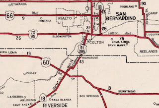
June 1936 California Highways & Public Works illustrated the realignment of US 99/US 70/LRN 26 east of Colton towards Redlands. A new project is cited which would see a realignment of US 99/US 70/LRN 70 east of downtown Colton on a new bridge over the Santa Ana River. The existing alignment of US 99/US 70/LRN 26 is stated to follow I Street (now Valley Boulevard), Mount Vernon Avenue, Colton Avenue and E Street. Note: the original alignment of US 99/US 70/LRN 26 in Colton was multiplexed by US 395/CA 18 on I Street from 8th Street (now La Cadena Drive) in downtown Colton and north on Mount Vernon Avenue. US 395/CA 18 continued north of Mount Avenue whereas US 99/US 70/LRN 26 split east on Colton Avenue. US 395 had been approved to be extended into California by the AASHO during August 1934.


An opening ceremony for the fourth Figueroa Street Tunnel was held on August 4th of 1936 which was featured in the Los Angeles Times. The completion of the fourth Figueroa Street Tunnel connected US 99/US 66/CA 11/LRN 165 directly to US 101/LRN 2 at Sunset Boulevard which provided a smoother transition for US 99 onto US 60/US 70/LRN 26 via Macy Street towards Ramona Boulevard. The
August 1936 California Highways & Public Works announced plans for the North Figueroa Street Viaduct and details the planned Arroyo Seco Parkway (LRN 205). The North Figueroa Street Viaduct would eliminate the jog in US 99/US 66/CA 11/LRN 165 on Arroyo Seco Boulevard and Riverside Drive. Note:
LRN 205 and the Arroyo Seco Parkway were defined by 1935 Legislative Chapter 426 as a State Highway.


A letter dated February 8th, 1937, by the AASHO Executive Secretary to the State Highway Engineers of; Colorado, Nevada and California announced the approved extension of US 6 from Greeley, Colorado to Long Beach, California. The extension of US 6 to Long Beach was carried via multiplex of US 99/LRN 4 from San Fernando Pass south onto San Fernando Road and US 99/US 66/CA 11/LRN 165 via the Figueroa Street Tunnels to downtown Los Angeles.
The April 1937 California Highways & Public Works features the last divided highway link to open on the Los Angeles-Pomona Arterial alignment of US 99/US 60/US 70/LRN 26. The Los Angeles-Pomona Arterial is stated to having an anticipated completion during May 1937 and would provide 27 miles of continuously divided highway. The Los Angeles-Pomona Arterial is stated to have only two traffic signals.
The April
1937 California Highways & Public Works features construction of the North Figueroa Street Viaduct over the Los Angeles River. The North Figueroa Street Viaduct is stated in the article stub to be nearing completion.


The
August 1937 California Highways & Public Works featured the realignment of US 99/US 70/LRN 26 from Colton to Redlands. The new alignment of US 99/US 70/LRN 26 is shown shifted onto an extension of I Street east of downtown Colton (referred to as the Valley Boulevard) towards a new bridge over the Santa Ana River. The new alignment of US 99/US 70/LRN 26 tied in with the recently completed Central Boulevard extension in Redlands. The realignment of US 99/US 70/LRN 26 in Colton was dedicated on July 28th, 1937.
US 99/US 66/US 6/CA 11/LRN 165 can be seen realigned over the North Figueroa Street Viaduct on the
1938 Division of Highways Map. US 99/US 6 are shown being realigned onto Avenue 26 approaching the North Figueroa Street Viaduct.
The new alignment of US 99/US 70/LRN 26 in Colton and Redlands both appear on the 1938 Division of Highways Map. US 99/US 70/LRN 26 is shown to be redesignated as Roosevelt Road in Redlands.
A partially completed segment of the Arroyo Seco Parkway appears in the
October 1939 California Highways & Public Works.
The
October 1939 California Highways & Public Works details the upcoming Pomona Grade Separation which would serve as an extension of LRN 77 and the new split of US 60 from US 99/US 70/LRN 26. US 60 originally had split from US 99/US 70/LRN 26 via Garey Avenue south to 5th Street in downtown Pomona. Once completed the Pomona Grade separation would have US 60 follow LRN 77 to 5th Street via two railroad overpass structures. Construction on the Pomona Grade Separation is noted to have already begun and was partially Federally funded.
The
May 1940 California Highways & Public Works detailed the newly opened Pomona Grade Separation which served as the new branch for US 60 from US 99/US 70/LRN 26 in Pomona. The Pomona Grade Separation is noted to have opened on March 19th, 1940.
The
August 1940 California Highways & Public Works announced the opening of a 3.7-mile unit of the Arroyo Seco Parkway from Orange Grove Avenue in south Pasadena to Avenue 40 in Los Angeles. The initial segment of the Arroyo Seco Parkway served as a new alignment of US 66.
The
November 1940 California Highways & Public Works featured the completed extension of the Arroyo Seco Parkway south to Avenue 22 near the Los Angeles River. The extension of the Arroyo Seco Parkway to Avenue 22 was completed by November 1st, 1940 and include the new interchanges with US 99/US 6 and CA 11.


The completed Arroyo Seco Parkway between Los Angeles and Pasadena is featured in the
January 1941 California Highways & Public Works. The Arroyo Seco Parkway is stated to have been dedicated on December 30th, 1940, Governor Culbert L. Olson. The Arroyo Seco Parkway is stated to be the first freeway in the western United States serving as a direct limited access link between Los Angeles and Pasadena. The Arroyo Seco Parkway terminated at Avenue 22 where US 99/US 6/US 66/CA 11 continued south into Los Angeles via the North Figueroa Street Viaduct and Figueroa Street Tunnels. US 99 was carried via multiplex of US 66/US 6/CA 11/LRN 165 between Avenue 22 south on the Arroyo Seco Parkway to US 101/LRN 2 at Sunset Boulevard/Macy Boulevard.


The
February 1941 California Highways & Public Works details the ongoing construction of the Eastern Gateway which would serve as a freeway structure originating at Aliso Street in Los Angeles. the Eastern Gateway is noted to be planned to tie directly in with existing US 99/US 60/US 70/LRN 26 via Ramona Boulevard along with the planned Santa Ana Parkway of US 101/LRN 2. The Eastern Gateway included construction of the new Aliso Street Bridge.
The
April 1941 California Highways & Public Works detailed the planned extension of the Arroyo Seco Parkway south from Avenue 22 to Adobe Street in Los Angeles. The extension of the Arroyo Seco Parkway included incorporating the existing Figueroa Street Tunnels as northbound travel lanes whereas new excavated southbound lanes were in the process of being constructed. The extension of the Arroyo Seco Parkway is stated to be a cooperative project between the State of California and the Federal Government.
The
September 1941 California Highways & Public Works notes the Arroyo Seco Parkway extension had been designated a Defense Highway Project. The designation as a Defense Highway Project would ensure the Arroyo Seco Parkway extension was kept as a priority highway project in the event the United States would be pulled into World War II (spoiled, see what transpired on December 7th, 1941).
The
July 1942 California Highways & Public Works features new ramp divider structures recently installed on the Arroyo Seco Parkway. The dividers are stated to be intended to prevent wrong-way entrances to the Arroyo Seco Parkway.
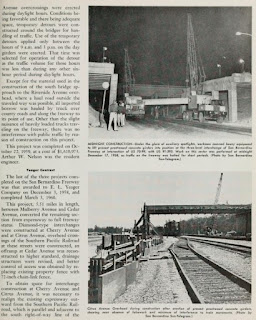
The November/December 1943 California Highways & Public Works features ongoing construction of the Los Angeles River Bridge along the southbound lanes of the Arroyo Seco Parkway extension to downtown Los Angeles.
The
January/February 1944 California Highways & Public Works features the extension of the Arroyo Seco Parkway south to downtown Los Angeles to Adobe Street. The extension of the Arroyo Seco Parkway moved US 99/US 66/US 6/CA 11/LRN 165 to a new freeway structure between Avenue 22 and Adobe Street. The existing Figueroa Street Tunnels were converted to northbound freeway usage whereas new southbound lanes were routed via the new Los Angeles River Bridge and an excavated cut. The extension of the Arroyo Seco Parkway opened to traffic on December 30th, 1943.
The
May/June 1944 California Highways & Public Works features the conceptual Four Level Interchange. The Four Level Interchange as planned would permit direct limited access travel between the Arroyo Seco Parkway, Hollywood Parkway, Santa Ana Parkway and Harbor Parkway. in downtown Los Angeles.
The
July/August 1944 California Highways & Public Works features the proposed Ramona Parkway and Santa Ana Parkway. The Aliso Street Bridge is noted to have an upcoming opening to traffic on August 15th, 1944, along with a temporary connection to Mission Street and US 99/US 60/US 70/LRN 26 on existing Ramona Parkway. Part of the upcoming project is stated to consist of upgrading Ramona Boulevard to full freeway standards to the eastern Los Angeles city limit.
The
July/August 1946 California Highways & Public Works notes US 99/US 70/LRN 26 in Redlands east of State Street was in the process of being expanded to four lanes. The same volume references US 99/US 70/LRN 26 was in the process of being converted to freeway standards between Ontario-Colton. The Ontario-Colton freeway is stated as being in the process of construction next to existing US 99/US 70/LRN 26 on Colton Avenue.
The reconstructed and widened US 99/US 70/LRN 26 in eastern Redlands is featured in the
March/April 1947 California Highways & Public Works. The expansion of US 99/US 70/LRN 26 to four lanes originated at State Street in downtown Redlands and extended 2.8 miles to the eastern city limit.
On July 1st, 1947, the AASHO Executive Secretary notified the California State Highway Engineer that California's request to extend US 91 from Barstow to Long Beach had been approved. US 91 was carried concurrently with US 395/CA 18 onto a brief multiplex of US 99/US 70/LRN 26 on I Street in Colton. The multiplex of US 99/US 70/US 395/US 91/CA 18 in Colton can be seen on the
1948 Division of Highways Map.
1947 Legislative Chapter 11 added a third segment to LRN 161 which formed part of the basis what would become the future Golden State Freeway corridor of US 99/US 6. The third segment of LRN 161 was defined as spur with a definition of "LRN 205 near Elysian Park in Los Angeles to a connection with LRN 4 near Glendale." The spur of LRN 161 appears on the
1948 Division of Highways Map.
The
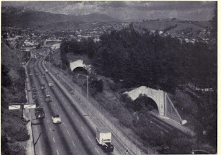
July/August 1948 California Highways & Public Works features the opening of the Santa Ana Freeway (US 101/LRN 2) between the Aliso Street Grade Separation to Soto Street. The completed segment of the Santa Ana Freeway would later incorporate part of what would become US 99 in later years. The junction of the Santa Ana Freeway with the Ramona Freeway appears in one of the project photos.
The
July/August 1948 California Highways & Public Works features the recently complete Ontario-Colton freeway alignment of US 99/US 70/LRN 26. The Ontario-Colton freeway fully opened to traffic by March 2nd, 1948, spanning from Vineyard Avenue in Ontario and trying into I Street in Colton.
The
January/February 1949 California Highways & Public Works features an update on the construction of the Four Level Interchange. The Four Level Interchange is stated to be nearing completion. The article stub notes the Four Level Interchange would link the Arroyo Seco Parkway via a limited access grade to the Hollywood Parkway and Harbor Parkway. Construction of the Four Level Interchange once complete would eventually link the Arroyo Seco Parkway south from Adobe Street.
The completed Four Level Interchange appears on the cover of the
September/October 1949 California Highways & Public Works.

The
September/October 1951 California Highways & Public Works features an update on the Ramona Freeway corridor between Los Angeles and Colton. Conversion of US 99/US 60/US 70/LRN 26 to full freeway standards east from Los Angeles city limit 1.8 miles to Helen Drive is stated to have been completed by April 1951. Freeway agreements with the cities of Pomona and El Monte are cited as being signed. Conversion of US 99/US 60/US 70/LRN 26 to Hellman Avenue in Alhambra is stated to be anticipated to be complete by November 1952. Construction of an underpass of the Pacific Electric Railway along with an interchange at Eastern Avenue is stated as having an anticipated completion by July 1952.


The
January/February 1952 California Highways & Public Works notes US 101/US 99/LRN 2 on the Santa Ana Freeway was expected to be completed between Alameda Street to Lyon Street by mid-year 1953. The article stubs also notes the connecting Hollywood Freeway segment from Lyon Street to the Aliso Street Bridge was expected to be completed during 1954.
Upgrades to US 99/US 60/US 70/LRN 26 on the Ramona Freeway are noted in the J
anuary/February 1952 California Highways & Public Works. The article stub notes the Ramona Freeway between Helen Drive and Hellman Avenue was expected to be completed to modern freeway standards by November 1952. The segment of the Ramona Freeway from Hellman Avenue to 8th Street is stated to have an anticipated completion to full freeway standards by March 1953.
The
March/April 1952 California Highways & Public Works provides an update to the progress of construction pertaining to US 99/US 60/US 70/LRN 26 on the Ramona Freeway. The Ramona Freeway grade separation with CA 19/LRN 168 at Rosemead Boulevard is stated to have been completed by September 1951. The articles states that the Ramona Freeway would be upgraded to full freeway standards between the Aliso Street Bridge and CA 19/Rosemead Boulevard by Fall 1953.
The
March/April 1953 California Highways & Public Works notes US 99/US 60/US 70/LRN 26 had been completed to freeway standards to Fremont Street in Alhambra. The article states Ramona Freeway was schedule to be completed to full freeway standards between the Aliso Street Bridge and CA 19/LRN 168 at Rosemead Boulevard by December 1953.
The
March/April 1953 California Highways & Public Works notes US 101/US 99/LRN 2 was expected to be complete between Lyon Street and the Aliso Street Bridge during the year. The Vignes Street Grade separation and widening of the Aliso Street Bridge over the Los Angeles River are cited as barriers to completing the Santa Ana Freeway in downtown Los Angeles.
The
March/April 1953 California Highways & Public Works notes the Arroyo Seco Parkway was expected to be completed to the Four Level Interchange by summer 1953. The completion of the Arroyo Seco Parkway to the Four Level Interchange would provide full freeway access through the structure for the first time.
The
March/April 1953 California Highways & Public Works features progress on construction of the Ramona Freeway in the Pomona-Claremont-Ontario-Upland corridor. The article notes the Pomona-Claremont-Ontario-Upland corridor of the Ramona Freeway was expected to be completed by 1955. In total 13.4 miles of freeway in the Pomona-Claremont-Ontario-Upland corridor had been budgeted for construction.
The
July/August 1953 California Highways & Public Works notes US 99/US 60/US 70/LRN 26 on the Ramona Freeway from Aliso Street 6.2 miles to Alhambra had been completed to freeway standards by May 26th, 1953. The article notes development on a segment of the Ramona Freeway from the Los Angeles County Line east through Ontario to the existing freeway segment carrying US 99/US 70/LRN 26 near Archibald Avenue was in progress.
The
1954 Division of Highways Map displays the completed segment of US 99/US 66/US 6/CA 11/LRN 165 on the Arroyo Seco Parkway to the Four Level Interchange. US 99/US 101/LRN 2 are shown moved to the completed Santa Ana Freeway and Aliso Street Bridge over the Los Angeles River. The completed Ramona Freeway alignment of US 99/US 60/US 70/LRN 26 from the Aliso Street Bridge to Alhambra is displayed. The planned Ramona Freeway extension of US 99/US 60/US 70/LRN 26 can also be seen.
The planned Ramona Freeway extension through Pomona-Claremont-Ontario-Upland can be seen on the 1954 Division of Highways Map.

The
January/February 1954 California Highways & Public Works illustrates the planned realignment of US 99/US 6 north of Los Angeles onto the Golden State Freeway. Below the Golden State Freeway (part of LRN 4) can be seen in the vicinity of San Fernando Pass and Weldon Canyon at what is now near the Los Angeles city limit. Existing US 99/LRN 4 on San Fernando Road can be seen right of the construction zone.
The planned scale of the Golden State Freeway between Weldon Canyon to existing US 99/US 6/LRN 4 at San Fernando Road can be seen in the
January/February 1954 California Highways & Public Works. The portion of the Golden State Freeway in the process of construction included a new junction between US 99/LRN 4 and US 6/LRN 23 at Sierra Highway.
US 99/US 60/US 70/LRN 26 on the Ramona Freeway is stated to be completed from the Santa Ana Freeway east 8.5 miles to San Gabriel Boulevard in Alhambra in the
January/February 1954 California Highways & Public Works. The article notes US 99/US 60/US 70/LRN 26 on the Ramona Freeway was expected to be extended to CA 19/LRN 168 at Rosemead Boulevard by February. The Ramona Freeway segments under construction in Pomona and Claremont are cited to have anticipated completion dates during January 1955.
The
September/October 1954 California Highways & Public Works announced the groundbreaking of construction on the Ramona Freeway (US 99/US 60/US 70/LRN 26) in El Monte from CA 19/LRN 168 at Rosemead Boulevard east to the San Gabriel River. The article stub notes the Ramona Freeway was nearing completion in the Ontario-Upland corridor and Pomona-Claremont corridor.
The
November/December 1954 California Highways & Public Works announced the Ramona Freeway was opened to traffic through the cities of Pomona, Claremont, Upland and Ontario on November 16th, 1954, over a span of 13.5 miles. The new segment of the Ramona Freeway included the split between US 99/US 70 and US 60 in Pomona.
The
January/February 1955 California Highways & Public Works announced the San Bernardino Freeway (former Ramona Freeway) was fully complete from the Santa Ana Freeway east to CA 19/LRN 168 at Rosemead Boulevard. US 99/US 70/LRN 26 was shifted to the San Bernardino Freeway originating at San Dimas Avenue in Pomona east through Claremont to the San Bernardino County Line upon its opening on December 3rd, 1954.
US 99/US 101/LRN 2 as it appears on the Santa Ana Freeway west of the Aliso Street Bridge can be seen below in the
May/June 1955 California Highways & Public Works. An attached article stub notes the Aliso Street Bridge widening as 70% complete.
The
September/October 1955 California Highways & Public Works cites the Golden State Freeway corridor between the Santa Ana Freeway and Hollywood Freeway as being a recommended for construction and rerouting of US 99 by the Los Angeles Chamber of Commerce. The corridor of the Golden State Freeway between the Santa Ana Freeway north to the Hollywood Freeway would take it through the cities of Glendale and Burbank.
The
January/February 1956 California Highways & Public Works notes construction of the Golden State Freeway was underway at Los Feliz Boulevard in Los Angeles and was expected to be completed during summer of 1956. A second project to grade the Golden State Freeway 4.2 miles through Los Angeles, Glendale and Burbank from 0.9 miles south of the Los Angeles River north to Ash Avenue in Burbank was under way.
On June 29th, 1956, the Federal Highway Aid Act of 1956 was signed into law on the Federal Level. The Federal Highway Aid Act of 1956 was the genesis point of the Interstate Highway System which would in the coming decade sew the demise via of US 99 in California. US 99 on the Golden State Freeway was destined become part of Interstate 5 (I-5) whereas US 99 on the San Bernardino Freeway was destined to become part of Interstate 10 (I-10).


The
March/April 1957 California Highways & Public Works features the opening of the San Bernardino Freeway through Colton as a realignment of US 99/US 70/LRN 26. The San Bernardino Freeway in Colton is cited as opening on October 18th, 1956. US 395/US 91/CA 18 were all multiplexed on the San Bernardino Freeway between 8th Street east to Moun Vernon Avenue.
The
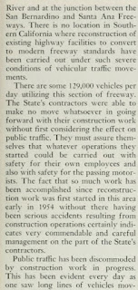
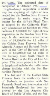
September/October 1957 California Highways & Public Works features the opening of the Golden State Freeway between the Los Angeles River near Griffith Park north to Ash Avenue. The Los Angeles River-Ash Avenue corridor of the Golden State Freeway opened as realignment of US 99/US 6/LRN 4 on September 6th, 1957.
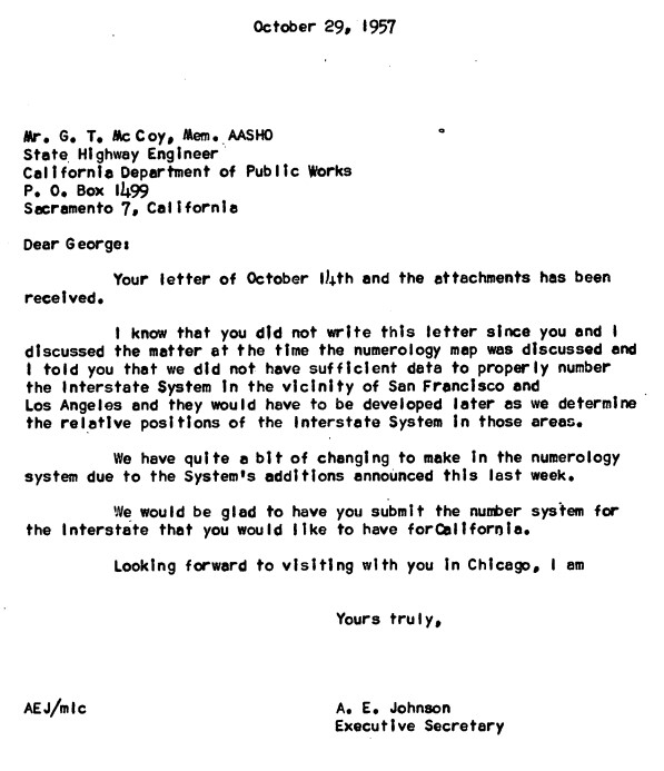
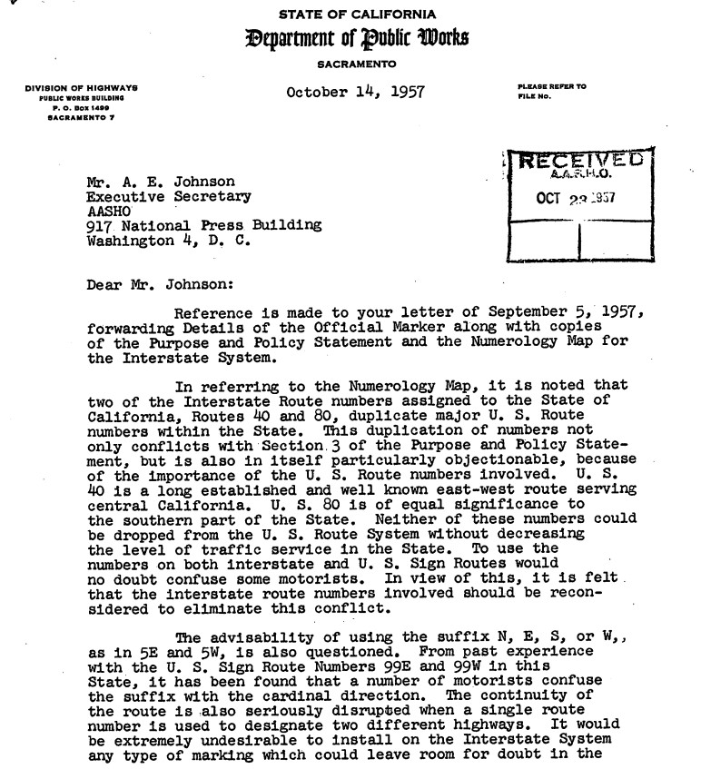
A series of October 1957 communications between the AASHO Executive Secretary and California State Highway Engineer reveal the entirety of California's initial run of chargeable Interstates. The major Interstate corridors described above are shown to have had route numbers been approved by the Commissioner of Public Roads during May 1957.
The California State Highway Engineer asked for numerous numbering changes and additions. Notably there was not a request to assign a number to corridor H which included a segment of the San Bernardino Freeway and Santa Ana Freeway in downtown Los Angeles.
The Los Feliz Boulevard Interchange and Colorado Street Freeway Extension Interchange of the Golden State Freeway appear in the
January/February 1958 California Highways & Public Works. The Colorado Boulevard Interchange would serve to connect CA 134 via LRN 4 to US 99/US 6 on the Golden State Freeway over the Los Angeles River extending it from San Fernando Road in Glendale. The Los Feliz Boulevard Interchange is stated to still be under construction.


A letter dated April 1, 1958, from the California State Highway Engineer to the AASHO Executive Secretary contained new proposal for short three-digit Interstates along with two three-digit Interstate shield designs. The three-digit Interstate shield designs contained one variation with the State name and another lacking it. The proposed Interstate numbers in California changed drastically from the December 1957 plan. Interstate 106 was proposed for the downtown corridors of the Santa Ana Freeway and San Bernardino Freeway.


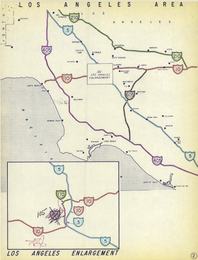
A letter dated August 7, 1958, from the California State Highway Engineer to the AASHO Executive Secretary contained a new draft for the Interstate numberings in California subsequent to the urban route numbering conventions being established during July 1958. The August 1958 proposal was close to the finalized numbering conventions in California but had some differences in the San Francisco Bay Area. The Interstate corridors of downtown Los Angeles matched what they ultimately would become with Interstate 110 being assigned to the San Bernardino Freeway east from the Santa Ana Freeway to the Golden State Freeway.
The Golden State Freeway appears complete Alameda Avenue in Burbank south to Glendale Boulevard in Los Angeles on the
1959 Division of Highways Map. US 99/US 6 is shown following an interim alignment on LRN 4 originating at San Fernando Road in Burbank, west on Alameda Avenue, south on the Golden State Freeway and east on the Colorado Street Freeway Extension to San Fernando Road in Glendale. CA 134 is shown following an interim multiplex of US 99/US 6/LRN 4 on the Golden State Freeway between Colorado Boulevard north to Alameda Avenue. South of Colorado Boulevard to Glendale Boulevard the Golden State Freeway is shown to be part of LRN 161.
The
January/February 1959 California Highways & Public Work discusses updates to US 99/US 6/LRN 4 on the Golden State Freeway. The Golden State Freeway is stated to have a planned opening north from Ash Street to Burbank Boulevard in Burbank by the upcoming October. 8.3 miles of the Golden State Freeway from Lankershim Boulevard/LRN 159 and San Fernando Road are stated to have an anticipated completion during 1959.
The
September/October 1959 California Highways & Public Works provides numerous an update on construction of the Golden State Freeway north from the San Bernardino Freeway. A segment of the Golden State Freeway from Mission Road north to Pasadena Avenue is stated to be the process of construction.
The
May/June 1960 California Highways & Public Works featured the newly continuous 60.2 miles of the San Bernardino Freeway between the Santa Ana Freeway in Los Angeles and Riverside Freeway (US 395/US 91/LRN 43) in Colton. Interchanges Cherry Avenue and Cedar Avenue were opened to traffic on US 99/US 70/LRN 26 on March 3rd, 1960, which saw the last expressway segments of the San Bernardino Freeway closed between Los Angeles and Colton. The article stub is one of the first to note the San Bernardino Freeway as part of I-10.
The Golden State Freeway segment of I-5/US 99/US 6/LRN 4 in Burbank appears in the
November/December 1961 California Highways & Public Works.

The
1962 Division of Highways Map shows the Golden State Freeway (LRN 4) complete from US 101/LRN 2 at the Santa Ana Freeway north to Arnold Street near the Pasadena Freeway. The Golden State Freeway is shown completed to Lankershim Boulevard/LRN 158 north of Burbank. US 99/US 6 are shown jogging north on Lakershim Boulevard to reach San Fernando Road north of Burbank.


The
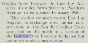
September/October 1962 California Highways & Public Works announced the Golden State Freeway was fully complete from Lankershim Boulevard south to the Santa Ana Freeway. The Golden State Freeway from Glendale Boulevard south to Arnold Street is stated to have opened during January 1962 whereas the segment south to Pasadena Avenue opened during March 1962. The completion of the Golden State Freeway from Lankershim Boulevard to the Santa Freeway would see US 99 realigned. US 99 now followed I-5/LRN 4 on the Golden State Freeway directly to the San Bernardino Freeway bypassing the Pasadena Freeway and Santa Ana Freeway through downtown Los Angeles.
The
March/April 1963 California Highways & Public Works announced I-5/US 99/US 6/LRN 4 on the Golden State Freeway was opened from Lankershim Boulevard north to Osborne Street in Sun Valley (the Los Angeles neighborhood) on January 15th, 1963.

The truncation of US 99 from Calexico to the junction of the Golden State Freeway and San Bernardino Freeway in Los Angeles was approved by the AASHO Executive Committee on June 19th, 1963. The justification by the California Division of Highways to truncate US 99 was to avoid what the agency viewed as confusing multiplexes on the new Interstate corridors of Southern California. The truncation of US 99 to Los Angeles left US 70, I-10 and part of US 60 aligned on the San Bernardino Freeway.
The truncation of US 99 was part of the wider 1964 California State Highway Renumbering. The 1964 California State Highway Renumbering eliminated Legislative Route Numbers in favor of field signage, minimized multiplexes, eliminated US Routes which didn't cross the State Line and assigned field signage to former Legislative Route Numbers which lacked it.
The truncation of US 66 from Long Beach to Bishop was approved by the AASHO Executive Committee on June 19th, 1963. The truncation of US 6 to Bishop removed it from the Pasadena Freeway and Golden State Freeway. This measure only left I-5 and US 99 assigned to the Golden State Freeway in Los Angeles, Burbank, Glendale and San Fernando.
US 70 was approved to be truncated from Los Angeles to US 95 in Blythe by the AASHO on August 26th, 1963. The truncation of US 70 removed it entirely from the San Bernardino Freeway leaving I-10 as the only highway fully aligned over it.
US 66 was approved to be truncated from Los Angeles to US 95 in Needles by the AASHO on November 14th, 1963. US 66 was effectively immediately removed from the Pasadena Freeway with signage being truncated to Pasadena. This measure left only CA 11 as the only signed highway on the Pasadena Freeway. Signage of US 66 would not be truncated from Pasadena to US 95 until I-40 was completed through the Bristol Mountains in 1972.
The changes to the US Route System around Los Angeles illustrated above can be seen in effect on the
1964 Division of Highways Map. US 99 is seen terminating via I-5 and the Golden State Freeway at I-10/US 60 at the San Bernardino Freeway. What had been US 99/US 70/US 60 on the San Bernardino Freeway between the Santa Ana Freeway and Golden State Freeway is shown assigned as the original I-110.


The AASHO Renumbering database shows that US 99 was approved to be truncated out of California to Ashland, Oregon by the AASHO Executive Committee on June 29th, 1965. This measure would have become effective on New Year's Day 1966. This measure left only I-5 signed on much of the Golden State Freeway.
The AASHO Executive Committee approved US 60 to be truncated from downtown Los Angeles to US 95 in Blythe on October 2nd, 1965. The truncation of US 60 to Blythe left only I-10 signed on the San Bernardino Freeway between Los Angeles and Pomona.
1981 Legislative Chapter 292 defined all of CA 11 on the Pasadena Freeway and Harbor Freeway as "Route 110." CA 110 was applied to the entirety of the Pasadena Freeway and the Harbor Freeway south through downtown Los Angeles to I-10. The Harbor Freeway south of I-10 was assigned as the second iteration of I-110. The Harbor Freeway south of I-10 had been designated an Interstate corridor as part of the Surface Transportation Assistance Act of 1978. The entire Pasadena Freeway can be seen legislatively assigned as CA 110 on the
1982 Caltrans Map.
During 2010 the Pasadena Freeway was redesignated as the Arroyo Seco Parkway. The Arroyo Seco Parkway was added to the National Register of Historic Places during 2011. The Arroyo Seco Parkway is one of the few segments of US 99 to be added to the National Register of Historic Places.
Part 2; a drive on former US Route 99 through the Figueroa Street Tunnels and Arroyo Seco Parkway
CA 110/Harbor Freeway northbound approaches the Four Level Interchange. Access to the Santa Ana Freeway is presently signed as US 101 south to I-5/I-10/CA 60 whereas it once was US 99/US 101 south. Access to the Hollywood Freeway is signed as US 101 north whereas it would have once been US 101 north/US 66 west. CA 110 continues northward onto the Arroyo Seco Parkway and would have once carried; US 66 east/US 6 east/US 99 north/CA 11 north. Truck traffic is advised of they are prohibited on the Arroyo Seco Parkway. The truck prohibition on the Arroyo Seco Parkway dates back to 1943.
The Arroyo Seco Parkway begins north of the Four Level Interchange. The older character of the Arroyo Seco Parkway is evident immediately due to the button-copy signage and older Arc Deco bridge structures. CA 110 north on the Arroyo Seco Parkway accesses Stadium Way via Exit 24.
CA 110 north on the Arroyo Seco Parkway proceeds into the 1936 Figueroa Street Tunnel. The 1936 Figueroa Street Tunnel is the longest of the four tunnels at 755 feet in length. Academy Road and Solano Avenue are signed as being accessible from Exit 25. Before the completion of the fourth Figueroa Street Tunnel the alignment of US 66/US 99/CA 11 made a right-hand turn towards Broadway via Solano Avenue.
The next three Figueroa Street Tunnels were completed in 1931. The next northward tunnel is 461 feet in length.
The third Figueroa Street Tunnel northward is the shortest at 130 feet in length.
The fourth northernmost Figueroa Street Tunnel is 405 feet in length. I-5 north traffic is directed to use Exit 26A from the left.
CA 110 north on the Arroyo Seco Parkway crosses the Los Angeles River via the 1937 North Figueroa Street Viaduct. The junction for US 66 with US 6/US 99/CA 11 before the Arroyo Seco Parkway was built can be located via Exit 26B onto Figueroa Street which connects with San Fernando Road/Avenue 26.
Part 3; a drive on former US Route 99 on the Golden State Freeway from the San Bernardino Freeway to the northern Los Angeles city limit
Below the defined 1963 beginning of US 99 can be found as I-5 northbound on the Golden State Freeway splits I-10 eastbound at the San Bernardino Freeway Interchange.
I-5 north on the Golden State Freeway skirts the eastern side of downtown Los Angeles.
At Exit 136A I-5 north accesses Main Street.
I-5 north meets CA 110/Arroyo Seco Parkway at Exit 137B and Figuroa Street at Exit 137A. After US 99 was onto the Golden State Freeway between the San Bernardino Freeway and Arroyo Seco Parkway in 1962 this is where the multiplex of US 99/US 6 towards Glendale would begin.
I-5 north of CA 110 crosses the Los Angeles River and begins to follow it's western bank. At Exit 138 I-5 north meets CA 2 on the Glendale Freeway.
At Exit 140 I-5 north accesses Glendale Boulevard.
Suffice to say the underpass of Hyperion Avenue has the classic Los Angeles Area bridge look to it.
I-5 north has access to Griffith Park Drive at Exit 141B.
At Exit 142 I-5 north meets Colorado Boulevard. CA 134 would have begun a multiplex of US 99/US 6 on the Golden State Freeway to Alameda Avenue beginning at Colorado Boulevard. CA 134 would multiplex I-5 after US 99 was decommissioned until the Ventura Freeway was completed in Glendale during the early 1970s.
I-5 north meets CA 134 on the Ventura Freeway at Exits 144 A/B.
I-5 north crosses the Los Angeles River into Glendale. I-5 briefly crosses through Glendale and Burbank before entering the northern extent of Los Angeles. Near Sheldon Street I-5 north crosses under the north terminus of CA 170. I-5 north doesn't have access to CA 170 south.
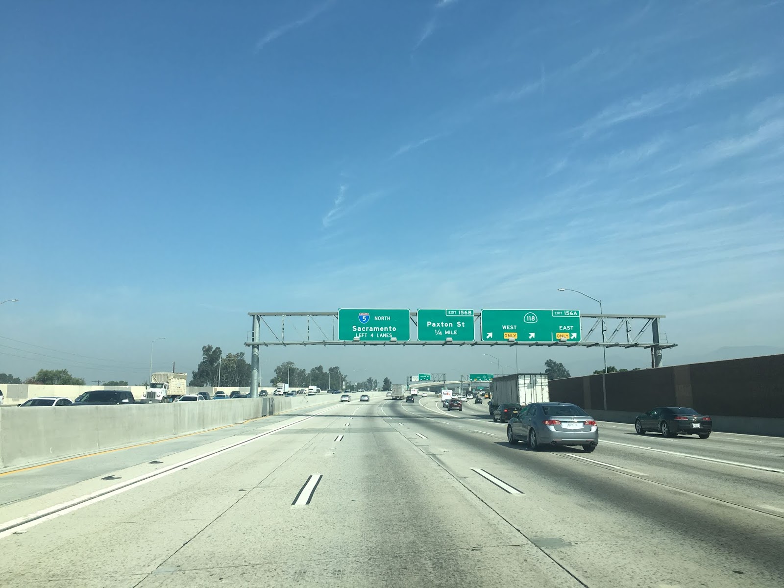
At Exit 156A I-5 north meets CA 118.
North of San Fernando Mission Boulevard I-5 north merges in with traffic from I-405. I-5 north doesn't have access to I-405 south.
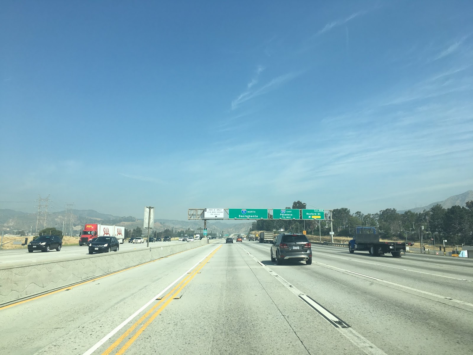
At Exit 161 I-5 meets I-210.
I-5 north crosses over former the surface alignment of US 99/US 66 on San Fernando Road and reaches the northern limit of Los Angeles at the junction for CA 14/Antelope Valley Freeway. US 99 would have split left following the Golden State Freeway whereas US 6 would have split right following the Antelope Valley Freeway.
Part 4; the former surface alignments of US Route 99 in Redlands
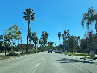
As noted in Part 1 prior to 1936 US 99/US 70 entered Redlands via Colton Avenue and Orange Street. Below the intersection of Orange Street and Colton Avenue can be seen as the terminus of CA 38.
Prior to 1936 US 99/US 70 entered downtown Redlands and turned left at State Street towards Calimesa. State Street can be seen behind Redlands Boulevard in the photo below. After being realigned in 1936 US 99/US 70 would have been aligned through Redlands via what now Redlands Boulevard originating at E Street near the Santa Ana River.
Below the 1936-1962 alignment of US 99/US 70 in Redlands can be observed from Orange Street east to I-10.
Further Reading
Interested in exploring the 1926-1934 corridor of US Route 99 between Los Angeles and Redlands?
Continuing north on US Route 99 to the Ridge Route?
Continuing south on US Route 99 to Calimesa?


Comments