
This blog is Part 3 of a three part series on of the Shoreline Highway segment of California State Route 1 and features a drive through Mendocino County. Part 2 found below features a drive through Marin County.
California State Route 1 the Shoreline Highway Part 2; a drive through Sonoma County
Chapter 4; California State Route 1/Shoreline Highway through Mendocino County
Upon crossing the Gualala River and entering Mendocino County CA 1 northbound traverses into Gualala at Postmile MEN 1.2.


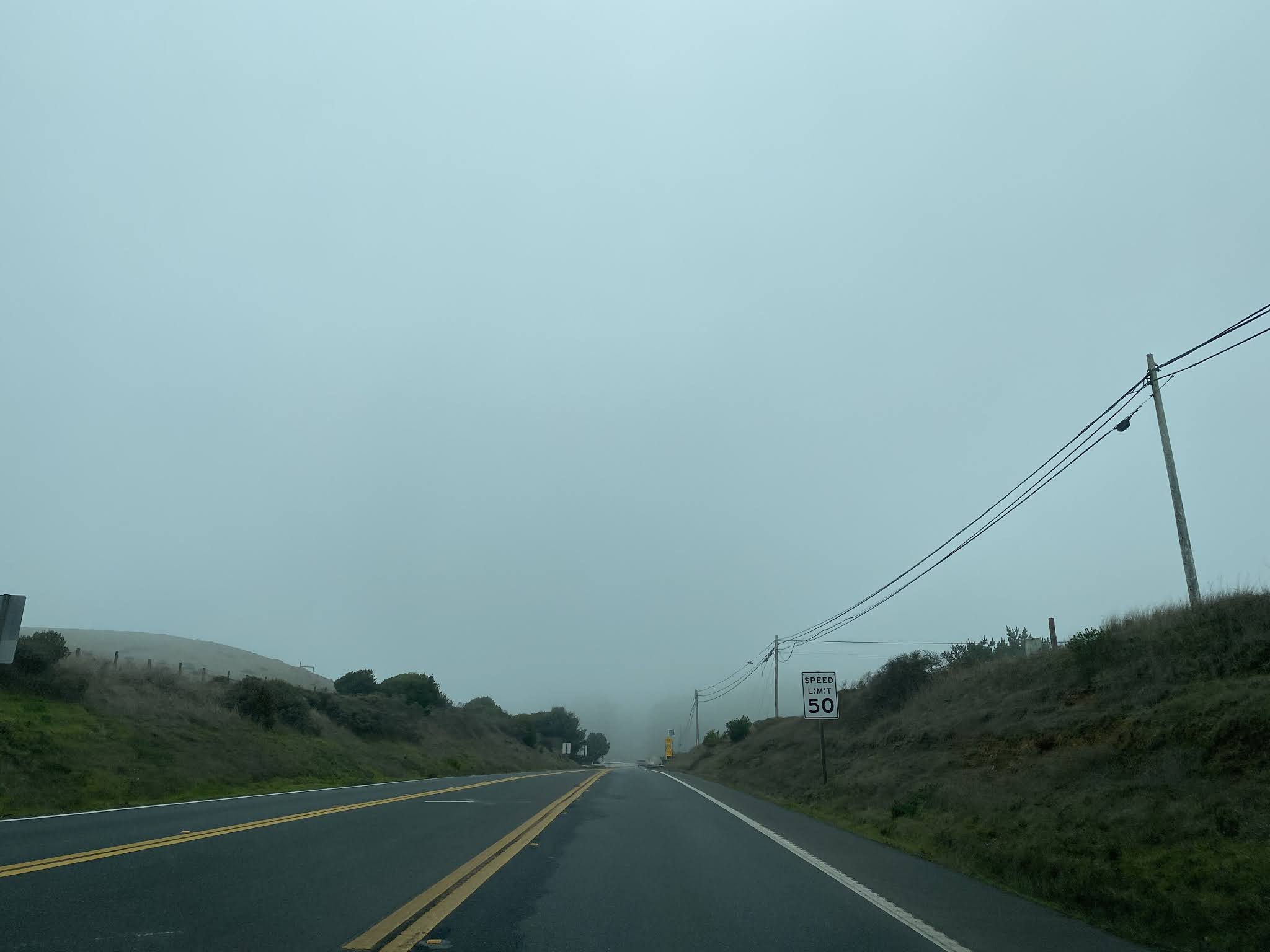
CA 1 northbound passes through Gualala. Traffic is notified departing Gualala of 15 miles of curvy roads. Point Arena is signed as 13 miles away, CA 128 at 38 miles away and Fort Bragg at 57 miles away.


For good measure CA 1 northbound traffic is reminded they are in fact on the Shoreline Highway departing Gualala.

At Postmile MEN 4.44 CA 1 northbound enters Anchor Bay.


CA 1 north of Anchor Bay follows the coastline and crosses the 1941 Schooner Gulch Bridge at Postmile MEN 11.28.


The first documented European siting of Point Arena was made in 1542 Spaniard Bartolome Ferrer who named it "Cabo de Fortunes." In 1775 Juan Francisco de la Bodega renamed the cape as Putna Delgado. The first wharf in Point Arena was constructed in 1866 and the Federal Government ordered the construction of the first Point Arena Light. The first Point Arena Light and first lumber mill both opened in 1870. The Point Arena Lumber Mill was located five miles east of the town upstream on the Garcia River. Point Arena and the Point Arena Town Site can be seen on the 1884 California Office of the State Engineer Map.


Much of Point Arena along with the first Point Arena Light were destroyed by the 1906 San Francisco Earthquake. The current Point Arena Light was constructed and became operational in 1908. Point Arena would incorporate as a City on July 11th, 1908. Below the current Point Arena Light can be seen in this stock Wikipedia photo.

Access to the Point Arena Cove Historical District can be found as CA 1/Main Street intersects Iverson Avenue.

CA 1 northbound crosses through downtown Point Arena on Main Street and takes a left hand turn onto School Road at Postmile MEN 15.23. Much of Point Arena burned in a massive fire which occurred in 1927. Subsequently the majority of the current structures in downtown Point Arena were constructed in 1927 or 1928.


Departing Point Arena CA 1 northbound is signed as 42 miles from Fort Bragg.


Access to the Point Arena Light from CA 1 northbound can be found at Postmile MEN 16.16.


CA 1 northbound traffic upon crossing the Garcia River Bridge is advised of 21 miles of curvy roads ahead.


CA 1 northbound enters Manchester at Postmile MEN 20.66.


CA 1 northbound intersects Kinney Road at Postmile MEN 21.39 which is signed as access to Manchester State Beach.

CA 1 northbound passes by Irish Beach at Postmiile MEN 24.63.


A vista can be found on CA 1 north of Irish Creek approaching Mal Paso Creek.


CA 1 northbound follows the coastline before descending a bluff to Elk Creek at Postmile MEN 31.35.


CA 1 northbound enters Elk at Postmile MEN 34.12.


The area which is now Elk was settled by the Greenwood Brothers. The community that would later develop would take the Greenwood name after they sold their ranching interests. Development in Greenwood was spurred out of growth from nearby Cuffy's Cove. Upon receiving Post Office Service in 1887 the community was assigned the postal name of Elk due to Greenwood being in use elsewhere in California. A large sawmill and narrow gauge railroad were constructed in Elk which spurred the decline of Cuffy's Cove. Logging of the Redwoods around Elk saw a end in 1930 when the Goodyear Redwood Company mill shuttered. Greenwood and Cuffy's Cove can be both be seen on the primary coastal stage route on the 1898 San Francisco & North Pacific Railroad Map.


Departing Elk CA 1 northbound is signed as 24 miles from Fort Bragg and 69 miles from US 101.

CA 1 follows the coastline northward and jogs inland to the Navarro River Bridge at Postmile MEN 40.18. Upon crossing the Navarro River Bridge CA 1 northbound intersects CA 128 and is signed as 19 miles from Fort Bragg. The current Navarro River Bridge was constructed in 1949 and features a 478 foot long deck girder design.


CA 1 northbound climbs above the Navarro River and crosses Big Salmon Creek at Postmile MEN 43.00.


The name "Albion" is a refence to a name given to California by Sir Francis Drake upon his landing at Point Reyes. This name was applied to the Albion River in 1844 which soon became the site of a sawmill built by Captain William A. Richardson in 1853. The logging operation at Albion incorporated as the Albion River Railroad Company in 1885. By 1891 the Albion River Railroad reached 11.6 miles eastward to Keene's Summit the same year it was also reorganized as part of the Albion Lumber Company. The Albion Lumber Company and Albion River Railroad eventually consolidated into the Fort Bragg & Southeastern Railroad. The line was intended to eventually reach inland California but never went further east than Christine which was on modern CA 128 between Navarro and Booneville. The sawmill in Albion ceased operations in 1928 which was followed by the railroad in 1930.
A map of the Albion River Railroad can be seen in the Northwestern Pacific book on the Albion Branch.


Some assorted photos of the Albion logging operation and the Albion River Railroad as seen in the Albion Branch.


CA 1 northbound crosses the Albion River Bridge at Postmile MEN 43.74.


The Albion River Bridge was constructed in 1944 and features a 969.2 foot long deck truss design. The Albion River Bridge can be seen under construction in this photo hosted on bridgehunter.com.

The Albion River Bridge can be seen in this 1930s era postcard hosted on bridgehunter.com. Note; the postcard refers to the Albion River Bridge as being on the "Shoreline Highway."

CA 1 northbound enters the community of Little River at Postmile MEN 47.82.


The community of Little River dates to the 1850s when the Beall family settled along the Little River watershed. The Beall family was bought out by W.H. Kent in 1864 who in turn opened the lands on the Little River it to the lumber industry. The Little River Post Office first opened in 1865 and the community remained active in logging until it's mill closed in 1893. Little River and Little River Harbor can be seen on the 1898 San Francisco & North Pacific Railway Map.

CA 1 northbound passes through Little River and intersects Park Road at Postmile MEN 48.00. Park Road is signed as access to Van Damme State Park.


At Postmile MEN 48.05 CA 1 northbound crosses the 1955 Little River Bridge. The Little River Bridge features a 68.9 foot slab design.

Upon crossing the Little River Bridge CA 1 northbound is signed as 10 miles from Fort Bragg and 57 miles from US 101.

At Postmile MEN 50.04 CA 1 northbound intersects Comptche-Ukiah Road.


CA 1 northbound crosses the Big River Bridge at Postmile MEN 50.57. Access to Mendocino Headlands State Park is signed north of the Big River Bridge.


At Postmile MEN R50.57 CA 1 northbound intersects Main Street in Mendocino which is signed as access to the Mendocino Presbyterian Church. CA 1 was originally aligned on Main Street and Lansing Street through downtown Mendocino.


Mendocino is located on the namesake Cape Mendocino (which is also the source of Mendocino County's name). Mendocino was originally the site of a Pomo settlement which was known as Buldam. Mendocino was founded as Meiggsville in 1852 as a logging company town. The name "Meiggsville" was given in honor of Henry Meiggs who operated a large sawmill near Bodega and investigated the lumber prospects around Cape Mendocino. The Redwood Lumber Manufacturing Company (later the "Mendocinto Lumber Company") set up their sawmill by the spring of 1853 on the Big River which saw an economic boom in the community.
Post Office Service in Mendocino opened in 1858 which saw the community take it's current name. Logging continued in Mendocino until the Mendocino Lumber Company shuttered it's mill in 1931. The Mendocino Lumber Company logging railroad was dismantled in 1936-37 for scrap iron. Following the closure of the Mendocino Lumber Company the community of Mendocino began a decline until it became the site of the Mendocino Art Center in 1959. Mendocino further saw a revival in the 1980s when the Mendocino Music Festival began.
Mendocino City can be seen on the 1884 California Office of the State Engineer Map.

CA 1 north of Mendocino crosses the 1939 Jack Peters Creek Bridge at Postmile MEN 51.81.


At Postmile MEN 52.72 CA 1 northbound intersects Point Cabrillo Road which is signed as access to Russian Gulch State Park.


Access to Jughandle State Reserve is signed from CA 1 northbound at Postmile MEN R55.83.


CA 1 northbound enters a roundabout at the Old Coast Highway/Simpson Lane intersection.


CA 1 northbound crosses the 1947 Sgt. Emil H. Evensen Memorial Bridge over Hare Creek at Postmile MEN 59.67. Upon crossing Hare Creek CA 1 northbound intersects CA 20 and enters the City of Fort Bragg.


At Postmile MEN 60.23 CA 1 northbound crosses the Noyo River via the Lt. Charles L. Larson Memorial Bridge.


CA 1 northbound is signed on Main Street in downtown Fort Bragg. CA 1 northbound in downtown Fort Bragg intersects Elm Street at Postmile MEN 61.98. Elm Street is the direct access point to the Glass Beach.


The Mendocino Indian Reservation can be seen on the 1865 Colton Map of California, Nevada, Utah, Colorado, Arizona and New Mexico.

In 1885 C.R. Johnson, Calvin Stewart and James Hunter moved their logging mill operation from Ten Mile River south to Fort Bragg to take advantage of it's existing harbor. This new mill was incorporated in 1885 as the Fort Bragg Lumber Company. The Fort Bragg Lumber Company merged with the Noyo River Lumber Company in 1891 and was renamed as the Union Lumber Company. Fort Bragg would incorporate as a City on August 5th, 1891. Fort Bragg can be seen on the 1898 San Francisco & North Coast Railway map on the coastal stage route.

CA 1/Main Street looking south from the Laurel Street intersection.


The Fort Bragg Town Hall on CA 1/Main Street.

A look east on Laurel Street from the Main Street intersection.


A southward look on CA 1/Main Street from the Guest House Museum.

The Guest House Museum was built in 1892 as lodging for the owners of the Union Logging Company.


The Fort Bragg City Hall at the northeast corner of Franklin Street and Laurel Street.

Looking south on Franklin Street.


A look west on Laurel Street towards the Skunk Train Depot of the California Western Railroad.

The genesis of the California Western Railroad was in 1885 when the Fort Bragg Railroad opened between Fort Bragg eastward 6.6 miles to the Redwood mill at Glen Blair. The Fort Bragg Railroad was a operating division of the Union Lumber Company and was subsequently extended upstream eastward on the Noyo River to Alpine by 1904. The connection to Alpine was the beginning of passenger service on the Fort Bragg Railroad. The siding in Alpine was connected further east via stage route to the Town of Willits. In 1905 the line was renamed to the "California Western Railroad & Navigation Company."
By 1911 the California Western Railroad reached Willits and connected to the Northwestern Pacific Railroad. The inland rail connection to Fort Bragg proved to be popular with San Francisco Bay Area residents which led to a tourism boom in Fort Bragg. In 1916 a 17.6 mile spur line of the California Western Railroad was completed north Fort Bragg to Ten Mile River and eastward to Camp 6. A secondary spur was also constructed 4.4 miles up the North Fork Ten Mile River to Clark Fork Landing.
The beginning of the Skunk Train era came in 1925 when gasoline powered motorcars were introduced to the California Western Railroad. These single unit motor cars had crude oil burning stoves which coupled with the gasoline engine gave off a pungent smell. A Skunk Train (M-100 motorcar) can be seen in the 1960s in this photo hosted by skunktrain.com.

In 1947 the line name was officially shorted to California Western Railroad. The California Western Railroad retired all of it's steam locomotives in favor of diesel in 1952. In 1970 the Union Lumber Company and California Western Railroad were purchased by the Georgia-Pacific Corporation. Georgia-Pacific sold the California Western Railroad to Kyle Railways in 1987. Kyle Railways continued to operate the California Western Railroad as a subsidiary of the Mendocino Coast Railway. The California Western Railroad was later shuttered due to not being profitable and was sold to local Mendocino Coast investors in 1996 who turned it into a heritage railroad.
The full California Western mainline between Fort Bragg and Willits is displayed on the 1935 Division of Highways Map of Mendocino County.


California Western Railroad rolling stock at the Skunk Train Depot.


As noted above the Glass Beach can be found on Elm Street. The origin of the Glass Beach was from the Fort Bragg City dumping sites located behind the Union Lumber Company property on the Pacific Ocean. Site 1 was in use as a dumping ground from 1906 through 1943 when it was replaced by Site 2. Site 2 was replaced by Site 3 in 1949 which was subsequently in use until 1967 when it was closed by City Officials and the California State Water Resources Control Broad.
The glass and trash debris at Site 3 being churned by the ocean over decades led to be it being ground down to smooth sea glass. While sea glass can be found at Site 1 and Site 2 it was Site 3 that came be known as the Glass Beach.


Returning to CA 1; headed northbound out of downtown Fort Bragg the highway crosses the Pudding Creek Bridge at Postmile MEN 62.12.


Pudding Creek Beach and the Pudding Creek trestle are a excellent place to catch a sundown in Fort Bragg.

Departing Fort Bragg CA 1 northbound is signed as 15 miles from Westport and 43 from US 101. CA 1 traffic is notified of a upcoming 30 foot length advisory and 16 miles of curvy roads.


CA 1 northbound passes through Inglenook. Inglenook had an operating Post Office from 1880 to 1919.


The present Ten Mile River Bridge had been in place since 2009 and replaced a structure from 1954. The 1954 Ten Mile River Bridge was a tee beam design which was 1,351.1 feet in length. The bridgehunter.com website shows a truss bridge that was in place prior to the 1954 structure in this photo dated to 1930.

From the Ten Mile River CA 1 northbound is signed as 7 miles from Westport and 35 miles from Leggett.

CA 1 northbound follows the coastal terrain from the Ten Mile River and enters Westport at Postmile MEN 77.16.


Westport was founded originally as Beall's Landing. The community was renamed to Westport by James T. Rodgers in 1877 in honor of his hometown in Maine when he constructed a timber loading facility. Westport received a Post Office in 1879 and has never lost service despite declining to a near-ghost town in modern times. Westport can be seen on the 1884 California Office of the State Engineer Map.


Departing Westport CA 1 northbound is signed as 10 miles from Rockport and 27 miles from US 101.

CA 1 northbound passes Westport-Union Landing State Beach at Postmile MEN R80.53.


Upon crossing Howard Creek CA 1 northbound has a Vista Point at Westport-Union Landing State Beach which overlooks a natural bridge. The Vista Point parking lot is an older alignment of CA 1.


CA 1 northbound crosses Hardy Creek at Postmile MEN 83.79 and passes through the Hardy ghost town. Hardy was part of the Cottoneva Lumber Company operation which was mostly known for nearby Rockport. Hardy had a lumber mill on Hardy Creek along with a lumber railroad and wharf. Post Office service in Hardy operated from 1902 to 1915.


Hardy and Rockport can be seen on the 1935 Division of Highways Map of Mendocino County.

Departing Hardy CA 1 northbound is given a 22 mile curvy road advisory.

CA 1 northbound winds through the coastal mountains and enters the ghost town of Rockport upon crossing Cottoneva Creek at Postmile MEN 87.84. CA 1 in Rockport is signed as 18 miles from US 101 and Leggett.


Rockport Street was where the majority of the community once stood on the north bank of South Fork Cottoneva Creek.


Miller sold his mill to the Cottoneva Lumber Company in 1886. The mill at Rockport and the Rockport Bay suspension bridge burned in 1900. In 1907 the New York & Pennsylvania Lumber Company acquired the Cottoneva Lumber Company and reinvested in the Rockport mill. The new mill in Rockport subsequently burned again in 1912.
Rockport was modernized from 1924-1926 by the Finebike-Guild Lumber Company. The new construction included a electric lumber mill and new railroad. Rockport's operations were shuttered in 1927 and the assets were sold to the Great Southern Lumber Company. The mill in Rockport reopened in 1938 as the part of the rebranded Rockport Redwood Company. The railroad in Rockport was dismantled in 1939 which was followed by another fire in 1942. Rockport shuttered for the last time in 1957 when the town site had a population of approximately 500.
Rockport was acquired by the Georgia-Pacific Corporation in 1971 and was transferred via FTC mandate to the newly formed Louisiana-Pacific Corporation in 1972. The Mendocino Redwood Company acquired Rockport in 1998 and subsequently demolished most of the structures. Today the only structure of substance still standing in Rockport is the school.


CA 1 north of Rockport follows Cottoneva Creek and intersects Usal Road at Postmile MEN 90.86.


As noted in Part 1/Chapter 1 the alignment of CA 1 was planned to be constructed following the rough course of Usal Road north into the Lost Coast towards Ferndale. Usal Road is a reference to the Usal Redwood Company which set up a mill on Usal Creek and established a stage route through the Lost Coast in 1889. This stage route is seen on the 1898 San Francisco & North Coast Railway Map swinging inland from Thorn to Garberville.

A complete primitive road through the Lost Coast from Rockport to Ferndale is seen on 1917 California State Automobile Map.


As noted in Part 1 the State Senate definition of the Shoreline Highway continues to Ferndale and thusly it isn't clear if it also continues to Leggett. The Postmiles on CA 1 continue to ascend north from Usal Road. At Postmile MEN 92.77 CA 1 northbound crosses Dunn Creek.


CA 1 northbound continues to wind through mountain grades and crosses the 1944 South Fork Eel River Bridge at Postmile MEN 104.97. The 1944 South Fork Eel River Bridge is a 358 foot long Through Truss design.


CA 1 north climbs from the South Fork Eel River to CA 271 in Leggett at Postmile MEN 105.49. The Drive Thru Tree is accessible via CA 271.


The Drive-Thru Tree (also known as the Chandelier Tree) is a 276 foot tall Coastal Redwood which was carved by Charlie Underwood during the 1930s. The Drive-Thru Tree was a major attraction on US 101 before it was realigned and remains so given it near the CA 1/US 101 junction.


Comments