Pier Covered Bridge - New Hampshire


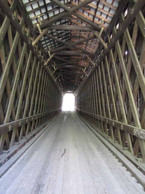
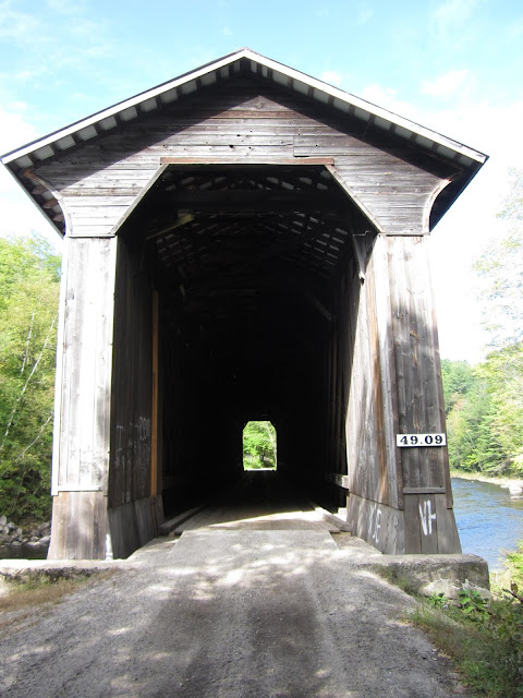
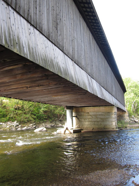
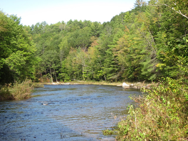
The Pier Covered Bridge in Newport, New Hampshire is a bit of a rarity, as not many covered bridges that were originally built for use by railroads are still in existence today. There are only a handful railroad covered bridges still around today, two which happen to be located in Newport (the Wright's Covered Bridge is the other). Also known as the Chandler Station Covered Bridge, the 216 foot long bridge over the Sugar River was originally built in 1907 as one of fifteen railroad covered bridges that once followed the Newport section of the Claremont and Concord Railroad, which was part of the Boston and Maine Railroad system. This makes it the longest covered railroad bridge in the world still in existence. The bridge was built in a double Town-Pratt lattice truss design and was constructed to replace an earlier covered bridge at the same location. The double Town-Pratt lattice trusses with laminated arches were long favored for construction on the branch lines of the Boston and Maine Railroad. In 1900, at least one hundred of this type were in use on the Boston and Maine Railroad system alone, with 15 of those railroad covered bridges being found in Newport. The Pier Covered Bridge is listed on the National Register of Historic Places.


Today, the Pier Covered Bridge lives a quiet existence as part of the Sugar River Trail, which is a recreational rail trail of about nine miles in length, following the Sugar River in Newport and neighboring Claremont, New Hampshire. During one of my many trips to New Hampshire, I checked out the Pier Covered Bridge, exploring its tall, narrow and sleek nooks and crannies. It looks like a swell place to take a bicycle or long walk, or just to passively recreate on a sunny day. You can find the Pier Covered Bridge by taking a drive down a scenic local road called the Chandlers Mill Road, less than a mile west of its junction with NH Routes 11 and 103 near scenic Newport, New Hampshire.


How to Get There:


Sources and Links:
Lake Sunapee Living - Lake Sunapee Covered Bridges
New Hampshire Bridges - Pier Bridge
Wright Construction Company - Pier & Wright Covered Bridge - NH
Bridgehunter.com - Sugar River Trail - Pier Railroad Covered Bridge 29-10-03#2

Comments

Popular posts from this blog

US Route 62 and US Route 180 in the Guadalupe Mountains

US Route 62/US Route 180 between El Paso, Texas and Carlsbad, New Mexico passes through the Guadalupe Mountains.  The Guadalupe Mountains comprise the highest peaks of Texas which are largely protected as part Guadalupe Mountains National Park.  The automotive highway through the Guadalupe Mountains was constructed in the late 1920s as part of Texas State Road 54.  US Route 62 was extended from Carlsbad through the Guadalupe Mountains to El Paso during 1932.  US Route 62 was joined in the Guadalupe Mountains by US Route 180 in 1943.  The Guadalupe Mountains comprise a portion of the 130 mile "No Services" zone on US Route 62/US Route 180 between El Paso-Carlsbad. Part 1; the history of US Route 62 and US Route 180 in the Guadalupe Mountains The Guadalupe Mountains lie within the states of Texas and New Mexico.  The Guadalupe Mountains essentially is a southern extension of the larger Rocky Mountains.  The Guadalupe Mountains is the highest range in Texas with the peak elevati

Former California State Route 215

  California State Route 215 was a short-lived state highway which existed in the Los Angeles Metropolitain area after the 1964 State Highway Renumbering.  California State Route 215 was aligned from US Route 60 at 5th Street in Pomona north to US Route 66 near Claremont via Garey Avenue.  California State Route 215 came to be after California State Route 71 was bisected in Pomona due to relinquishment of a portion of Garey Avenue due to the opening of a portion of the Corona Freeway (now Chino Valley Freeway) during 1958.  California State Route 215 was deleted by the Legislature during 1965. The history of California State Route 215 The initial segment of what was to become California State Route 215 was added to the State Highway System as part of the 1909 First State Highway Bond Act.  The First State Highway Bond Act defined what would become  Legislative Route Number 19  (LRN 19) as running from Claremont to Riverside.  The segment of LRN 19 between Claremont and Pomona would in

Paper Highways; unbuilt California State Route 100 in Santa Cruz

This edition of Paper Highways examines the unbuilt California State Route 100 in Santa Cruz. The History of Unbuilt California State Route 100 The route that became CA 100 was added to the State Inventory in 1959 as part of the Freeway & Expressway System as Legislative Route 287 .  According to CAhighways.org the initial definition of LRN 287 had it begin at LRN 5 (CA 17) and was defined over the below alignment to LRN 56 (CA 1) through downtown Santa Cruz. -  Ocean Street -  2nd Street -  Chestnut Street For context the above alignment would required tearing down a large part of the densely populated Santa Cruz.  A modern Google imagine immediately reveals how crazy an alignment following Ocean Street, 2nd Street, and Chestnut Street would have been. LRN 287 first appears on the 1960 Division of Highways State Map . In 1961 the definition of LRN 287 was generalized to; from LRN 5 via the beach area in Santa Cruz to LRN 56 west of the San Lorenzo River.