Thompson Covered Bridge - West Swanzey, New Hampshire


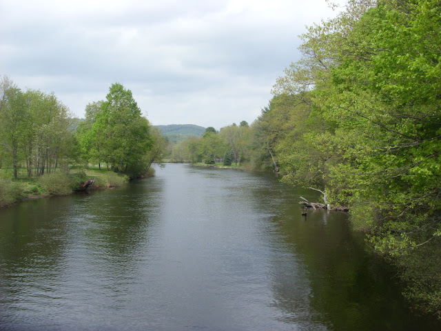
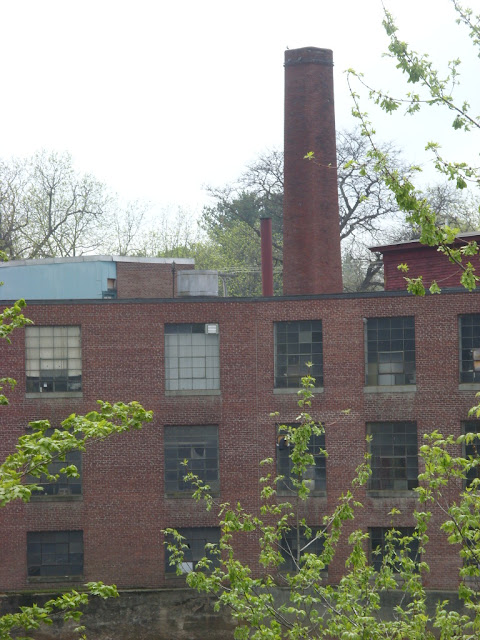
Also known as the West Swanzey Covered Bridge, the Thompson Covered Bridge connects the two halves of West Swanzey, New Hampshire over the Ashuelot River. The covered bridge was originally built in 1832 by Zadoc Taft for the grand sum of $523.27, which might seem like chump change by today's standards, but that was a nice payout in 1832. Utilizing a through truss design with lattice work, the bridge has two spans as it goes 151 feet across the river. The Thompson Covered Bridge is listed in the World Guide of Covered Bridges (WGCB) as number 29-03-04, is also listed as New Hampshire Covered Bridge # 5 and is on the National Register of Historic Places. The bridge has its home next to a mill of some sort, which is a monument to New England's industrial history. There is also a covered sidewalk on the north side of the bridge, which allows pedestrian traffic to enjoy the bridge without dodging cars.

By the time the 1970s rolled around, it was a whole new world of change and the covered bridge was showing its age after years of wear and tear. In 1973, when the bridge was posted for a six ton load limit, school buses were allowed to cross the bridge, but only if empty. I have come across similar factoids from other covered bridges I've researched, so maybe that was the solution at the time. When a bus full of students came to the bridge, the students would get off the bus, walk across the bridge, and board the bus again on the other side. In 1976, a new concrete and steel bridge was built nearby to carry heavy vehicles, just south of the covered bridge, at a cost of $376,914.61. The covered bridge was closed to vehicular traffic since the fall of 1990 after a report by state inspectors indicated the bridge was unsafe, and as a result, a committee was quickly formed in 1990 to develop proposals for the rehabilitation of the town's covered bridges. The Thompson Covered Bridge was ultimately reconstructed in 1993, so future generations can enjoy this local treasure.


How to Get There:


Sources and Links:
Bridgehunter.com - Thompson Covered Bridge 29-03-04
NHTourGuide.com - Thompson Covered Bridge West Swanzey
New Hampshire Bridges - West Swanzey Bridge
Life, on a Bridged - Thompson Covered Bridge, West Swanzey, NH 

Comments

Popular posts from this blog

Old US Route 60/70 through Hell (Chuckwall Valley Road and Ragsdale Road)

Back in 2016 I explored some of the derelict roadways of the Sonoran Desert of Riverside County which were part of US Route 60/70; Chuckwalla Valley Road and Ragsdale Road. US 60 and US 70 were not part of the original run of US Routes in California.  According to USends.com US 60 was extended into California by 1932.  US 60 doesn't appear on the California State Highway Map until the 1934 edition. USends.com on US 60 endpoints 1934 State Highway Map Conversely US 70 was extended into California by 1934, it first appears on the 1936 State Highway Map. USends.com on US 70 endpoints 1936 State Highway Map When US 60 and US 70 were extended into California they both utilized what was Legislative Route Number 64 from the Arizona State Line west to Coachella Valley.  LRN 64 was part of the 1919 Third State Highway Bond Act routes.  The original definition of LRN 64 routed between Mecca in Blythe and wasn't extended to the Arizona State Line until 1931 acc...

The last 1956-63 era California Sign State Route Spade?

Along southbound California State Route 170 (the Hollywood Freeway Extension) approaching the Hollywood Freeway/Ventura Freeway interchange a white California State Route 134 Sign State Route Spade can be observed on guide sign.  These white spades were specifically used during the 1956-63 era and have become increasingly rare.  This blog is intended to serve as a brief history of the Sign State Route Spade.  We also ask you as the reader, is this last 1956-63 era Sign State Route Spade or do you know of others?  Part 1; the history of the California Sign State Route Spade Prior to the Sign State Route System, the US Route System and the Auto Trails were the only highways in California signed with reassurance markers.  The creation of the US Route System by the American Association of State Highway Officials during November 1926 brought a system of standardized reassurance shields to major highways in California.  Early efforts to create a Sign State Route ...

Paper Highways; Interstate H-4 through downtown Honolulu

The Hawaiian Island of O'ahu is home to four Interstate Highways; H-1, H-2, H-3 and H-201.  Had history gone slightly differently during the 1960s a fifth Interstate corridor on O'ahu could have been constructed through downtown Honolulu and the neighborhood of Waikiki.  The proposed corridor of Interstate H-4 can be seen above as it was presented by the Hawaii Department of Transportation during October 1968 .   This page is part of the Gribblenation O'ahu Highways page.  All Gribblenation and Roadwaywiz media related to the highway system of O'ahu can be found at the link below: https://www.gribblenation.org/p/gribblenation-oahu-highways-page.html The history of proposed Interstate H-4 The corridor of Interstate H-4 was conceived as largely following what is now Hawaii Route 92 on Nimitz Highway and Ala Moana Boulevard.   Prior to the Statehood the first signed highways within Hawaii Territory came into existence during World War II.    Dur...