
Sanger Depot


Sanger Depot located in the namesake city in San Joaquin Valley of California.  The depot was constructed in 1887 as part of the Southern Pacific Railroad's East Side Line.  The depot building was relocated in 1977 to 1710 7th Street where it became a city museum.  The original location of Sanger Depot at 7th Street and L Street can be seen below on the 1947 United States Geological Survey map of Sanger.


Part 1; the history of Sanger Depot

The site of Sanger was plotted by the Southern Pacific Railroad in 1886 during construction of their East Side Line through San Joaquin Valley.  Sanger Depot was constructed in 1887 at what would become the site of 7th Street and L Street.  The Southern Pacific Railroad would begin to subdivide and plot the town site of Sanger in 1888.  

The East Side Line (alternatively Stockton-Tulare Railroad) branched east from main San Joaquin Valley line in Fresno towards Porterville.  The East Side Line consolidated with the main line at Famoso in Kern County.  

The East Side Line can be seen passing through Sanger on the 1923 United States Geological Survey map.  The site of Sanger Depot can be seen at the southeast corner of 7th Street and L Street.  A large siding facility can be seen branching east from L Street along Annadale Avenue.  


The siding facility in Sanger is no longer present on the 1947 United States Geological Survey map.


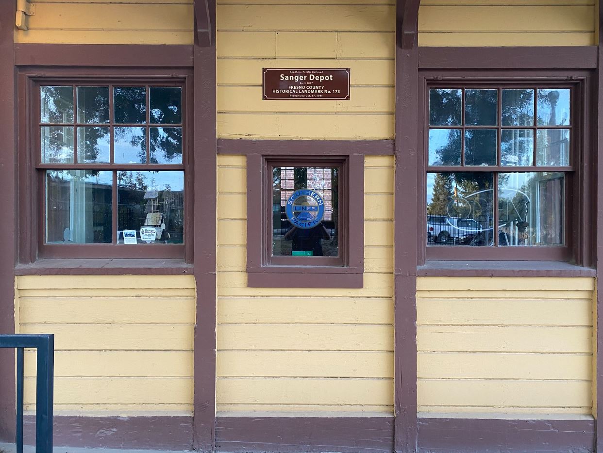
Sanger Depot was eventually closed and purchased by the Tanney brothers.  The depot was discovered to be the oldest building in Sanger and was denoted to the Sanger Historic Society.  The building was relocated to 7th Street and Hoag Avenue where it would reopen as a museum in December 1977.  


Part 2; the past and present sites of Sanger Depot

The below photos are from 7th Street and L Street where Sanger Depot was originally located on the Southern Pacific Railroad.  The street blade at the intersection still is an embossed porcelain design.  The Hotel Sanger Building still displays a vintage neon sign on the marque.  


Sanger Depot can be now found at 1710 7th Street approximately six blocks of where it was originally located.  The depot marque lists the distance from San Francisco and New Orleans. 


Comments

Popular posts from this blog

Abandoned Fowler Avenue in Clovis, California

Originally Fowler Avenue in the city of Clovis had a brief discontinuation approaching Herndon Avenue.  Fowler Avenue traffic heading northbound was required to detour briefly onto westbound Herndon Avenue.  During 2001 this discontinuation was removed when Fowler Avenue was reconfigured to access the Sierra Freeway (California State Route 168) via an interchange.  This led to a segment of the original alignment of Fowler Avenue just south of Herndon Avenue to be abandoned.  Despite a shopping center opening over part of the original Fowler Avenue alignment in 2016 much of the abandoned roadway remains.   The history of the abandoned original alignment of Fowler Avenue in Clovis The original alignment of California State Route 168 departed downtown Clovis eastbound along Tollhouse Road.  This original alignment did not interact with Fowler Avenue at the Herndon Avenue intersection.  Fowler Avenue north of Tollhouse Road ran north to Herndon Avenue...

May 2023 Ontario Trip (Part 3 of 3)

  Over the years, I have made plenty of trips to Ontario, crisscrossing the southern, central and eastern parts of the province. Living in Upstate New York, it's pretty easy to visit our neighbor to the north, or is that our neighbor to the west? Ottawa is one of my favorite cities to visit anywhere in the world, plus I've discovered the charm of Kingston, the waterfalls of Hamilton (which is on the same Niagara Escarpment that brings us Niagara Falls), the sheer beauty of the Bruce Peninsula, and more. But I hadn't explored much of Cottage Country. So I decided to change that, and what better time to go than over Memorial Day weekend, when the daylight is long and I have an extra day to explore. On the third and final day of my trip, I started in Huntsville and made my way through Muskoka District and Haliburton County, passing by many lakes along the way. I stopped in towns such as Dorset, Haliburton and Bancroft before making a beeline down to Belleville and then over th...

What's In a Name?: When the Roads Really Do Tell a Story

  Our tagline on the Gribblenation blog is "because every road tells a story". Some roads tell different stories than others. Along our travels, we may see historic markers that tell us a little story about the roads we travel or the places we pass by. Some historic markers are more general, as to telling us who lived where or what old trail traversed between two towns. During my travels across New York State and other states or provinces, I pass by many historic markers, some with interesting or amusing references to roads. I wanted to highlight a few of the markers I've seen along my travels around the Empire State and help tell their stories. Those stories may be as specific as explaining the tales of a tree that was used to help measure a distance of eight miles from Bath to Avoca in Steuben County, as referenced on the Eight Mile Tree historical marker above. They may also help point the way along historical roads first used centuries ago, or may help tell a local l...