OR 31 is a 120-mile-long state route stretching between Valley Falls and LaPine in Oregon's Outback, a region of high desert terrain east of the Cascades in the central, southern, and eastern regions of Oregon. Also known as the Fremont Highway, OR 31 connects US 395 north of Lakeview with US 97 south of Bend in a southeast-northwest direction, passing by the towns of Silver Lake, Summer Lake, and Paisley along the way. Oregon State Route 31 became part of the state route system in Oregon in 1932 and has remained on its original route ever since, serving as a key cog for travel around different parts of Oregon.
The Oregon Outback Scenic Byway follows OR 31 through the state route's entire length, as it passes by memorable terrain and landscapes. Along the way, you'll pass by Summer Lake, which is a long, shallow alkaline lake that has depths of 4 to 5 feet and is a rest stop for migrating birds migrating along the Pacific Flyway. Summer Lake sometimes dries up completely but tends to fill up more than the other basin along OR 31, Silver Lake, which tends to only fill up with water about once every thirty years. Near Paisley, you will find a local hot spring along with pastures for one of the largest cattle ranches in the country. Plus some of the traces of the earliest human history can be found along OR 31, including the earliest known footwear found in the world, sandals made from sagebrush bark that is at least 9,300 years old.
OR 31 is a fun drive and I found it to be both scenic and unique. Plenty of mountains along the road can be seen to keep the terrain interesting. There were a lot of surprises too. I saw some old buildings along the way that looked like they were from a bygone era. Trying to see the other side of Summer Lake kept me occupied as well. With that, I present to you a photographic journey along OR 31.
 |
| OR 31 splits off from US 395, as US 395 makes its long journey towards Burns, Oregon. |
 |
| The first few miles of OR 31 treats us to hay fields and pasture lands for cattle for the Z X Ranch, one of the largest cattle ranches in the United States with over one million acres of land. |
 |
| OR 31 is part of the Oregon Outback Scenic Byway. |
 |
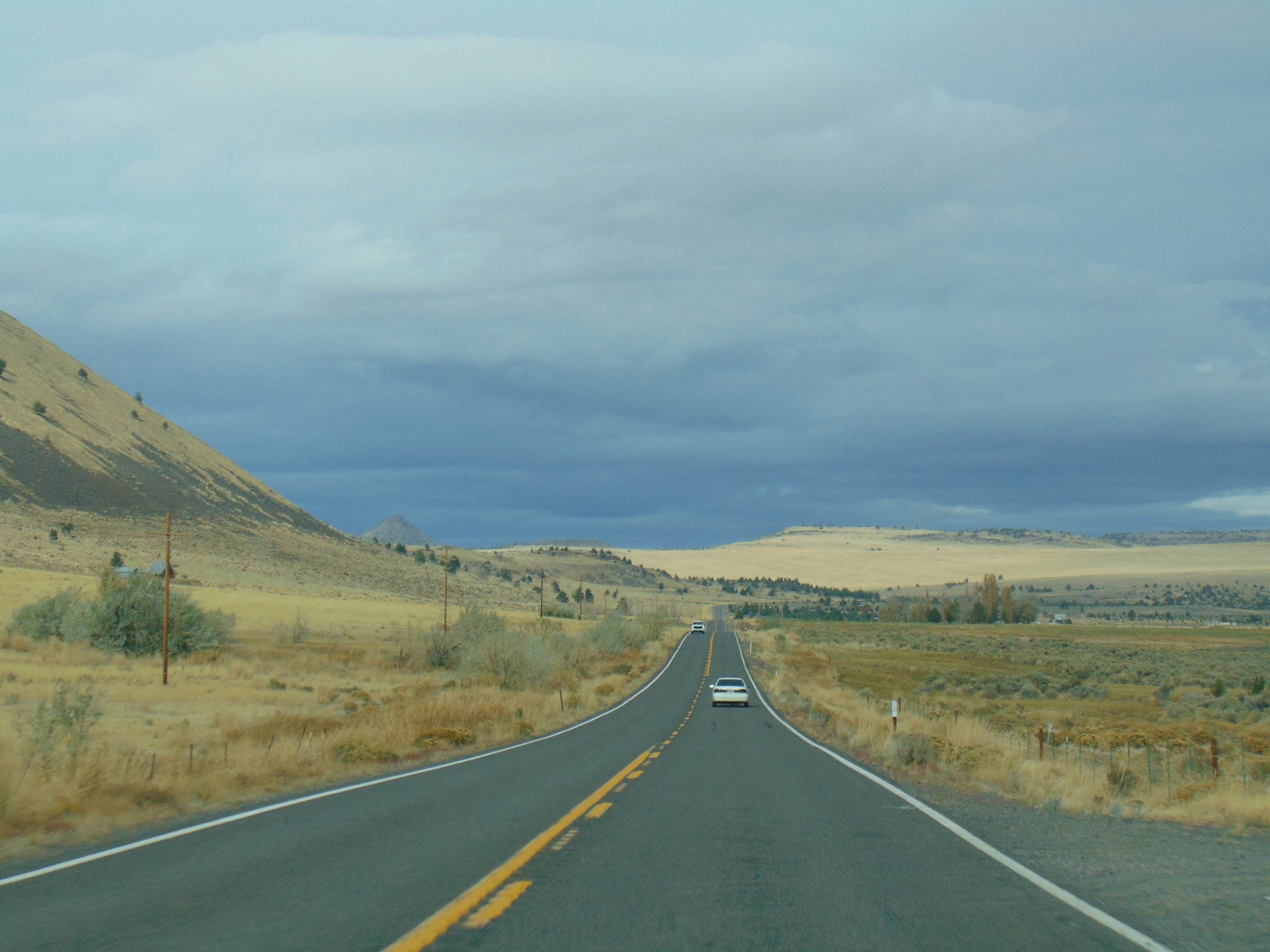
| Right now, OR 31 is heading in a generally east-west orientation. While the highway runs from southeast to northwest, the topography calls for the highway to go north-south or east-west at times. |
 |
| Hitting our first big curve, compliments of the upcoming hills. |
 |
| OR 31 has a number of farms and barns along the way, or really, ranches. |
 |
| Rolling through the small city of Paisley, Oregon. Established in 1870 and incorporated in 1911, Paisley is known for its Mosquito Festival the last weekend of July every year. |
 |
| Blink, and you'll miss Paisley, pretty quickly I may add. Back to the wide open expanses of the high desert already. |
 |
| I think there may be a little snow on top of that mountain. I took the photos on November 1, and sure enough, there was some snow left over from storms the week before. |
 |
| I really enjoyed the quiet nature of a cruise down OR 31. |
 |
| A few houses and barns dotting the landscape near Summer Lake. |
 |
| Summer Lake is pretty expansive itself. |
 |
| Some houses and barns, but OR 31 stretches as far as the eye can see. |
 |
| OR 31 hugs near the southern and western shore of Summer Lake. |
 |
| I seem to have encountered a car in front of me. The driver was going pretty fast, so I just followed along. |
 |
| One last glimpse of Summer Lake. |
 |
| But because there are enough water sources in the area around Summer Lake, irrigation is possible. |
 |
| There is also the Ana Reservoir nearby, which I am guessing retains water better than Summer Lake. |
 |
| The landscape becomes wide open again after passing the Summer Lake area. |
 |
| Maybe an old church or an old school along OR 31. |
 |
| I believe that is more ranch land out in the distance. |
 |
| Turnoff for some wildlife viewing coming up ahead. |
 |
| An old barn in the distance. It kind of looks dilapidated. |
 |
| Starting the climb to Picture Rock Pass, which is the highest point of OR 31 at 4,830 feet above sea level. There are also some ancient petroglyphs located within walking distance of OR 31, which is how the pass got its name. |
 |
| A view of the terrain below. |
 |
| Picture Rock Pass is actually located alongside the mountain ahead. |
 |
| At Picture Rock Pass, you can start to see some of the Cascades in the far distance. |
 |
| Around the top of Picture Rock Pass. |
 |
| Descending from Picture Rock Pass, OR looks like it goes on for miles and miles (and it does). |
 |
| A mesa that I was able to spot in the distance along OR 31. |
 |
| Silver Lake, Oregon. Silver Lake was founded during the 19th Century and is home to the Cowboy Dinner Tree, which is a restaurant that offers an interesting ranch-style dining experience. The restaurant started as a chuck wagon to feed hungry ranchers herding cattle. |
 |
| We're definitely still in the Oregon Outback, although I wish I could have stayed in Silver Lake for some cowboy dinner. |
 |
| Next stop is La Pine, still 49 miles away. |
 |
| Grazing lands as far as the eye can see, but starting to see thicker amounts of evergreen trees such as ponderosa pines in the distance. |
 |
| Some of the Cascades are also coming into better focus in the distance. On a clearer day, I bet you can see a lot more of the mountains. |
 |
| Soon, the fields of sagebrush will give way to forest. |
 |
| Upon reading about Fort Rock, I should have made a detour to see it. Fort Rock is an ancient volcanic crated that rises 325 feet out of the plain like a desert mirage. Fort Rock is a national natural landmark and state park that takes its name from the high rock walls that form an open circle, making it have a fort-like appearance. It’s actually the ring of an ancient volcanic crater that was set in a shallow sea. Humans have occupied Fort Rock for over 10,000 years and the first sandals ever made were discovered at Fort Rock. |
 |
| There's a snow zone sign lurking behind that OR 31 shield. During winter weather, the sign can reveal if chains are required for travel. |
 |
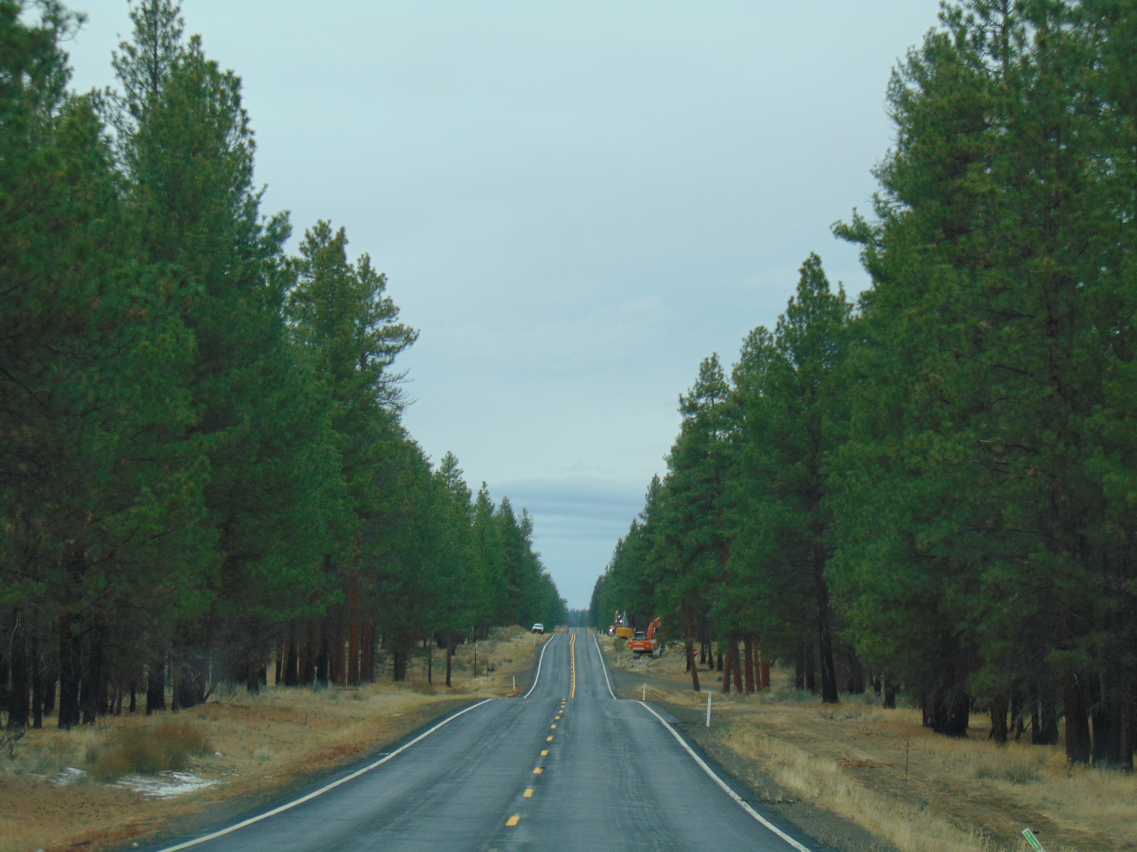
| But only pockets of snow can be found along the road as we have entered the towering ponderosa pine era of OR 31. |
 |
| While most of OR 31 travels through Lake County, the highway clips the northeast corner of Klamath County, before ending its journey with a brief jaunt into Deschutes County. |
 |
| Winding down with the last few miles of OR 31. |
 |
| OR 31 ENDS! at US 97. From here, you can go south towards Crater Lake and Klamath Falls. To the north, US 97 takes you to Bend and Central Oregon. Hopefully you enjoyed the virtual journey along OR 31 as much as I enjoyed driving the road. |
Sources and Links:
ORoads -
Oregon Route 31Travel Oregon -
Oregon Outback Scenic BywayTripCheck.com -
The Oregon Outback Scenic BywayReturn to:
Gribblenation /
Oregon? Absolutely!


Comments