
Angeles Forest Highway (Los Angeles County Route N3) is an approximately twenty-five-mile crossing of the San Gabriel Mountains. Angeles Forest Highway begins at California State Route 14 near Palmdale and Vincent siding. Angeles Forest Highway crosses the San Gabriel Mountains and Angeles National Forest to Angeles Crest Highway (California State Route 2). Angeles Forest Highway was completed during 1941 after the opening of the Mill Creek Tunnel and Armstrong Memorial Bridge. The general corridor Angeles Forest Highway added to the Freeway & Expressway System during 1959 as part of the once proposed Ells Tunnel project. During the 1960s Angeles Forest Highway would be assigned as Los Angeles County Route N3.

Part 1; the history of Angeles Forest Highway
During 1915 the corridor of what would in time become Angeles Forest Highway was defined as a new state highway which would cross the San Gabriel Mountains and Angeles National Forest. 1915 Legislative Chapter 704 defined the Pasadena State Highway with the following description:
"La Canada valley with the Antelope Valley...starting 2 mi NE of La Canada thence following the N and NW-ly the Arroyo Seco to a point E of Hoyt Ranch; thence NE-ly following Tujunga Cyn and Mill Creek to Tie Cyn; thence NW-ly by way of Kennedy Springs to Vincent."
1915 Legislative Chapter 704 only provided funding for a survey for through the San Gabriel Mountains but not actual construction. For unknown reasons the concept of this survey for where modern Angeles Forest Highway branches north from modern California State Route 2 (Angeles Crest Highway) is unknown. The 1912-1916 California Highway Bulleting and 1924-1967 California Highways & Public Works publication do not touch on the subject.
The survey routing would be clarified by the 1919 Third State Highway Bond Act as "La Canada to Mount Wilson Road via Arroyo Seco." The 1919 Third State Highway Bond Act provided construction funding and designated the corridor as Route Number 61 (later codified as Legislative Route Number 61 in 1935).
Route Number 61 appears for the first time formally on the 1920 California Highway Commission map. As noted above, the previous routing north through Tujunga Canyon, Mill Creek, Tie Canyon and Kennedy Springs to Vincent was abandoned by the state.

During the 1920s the Edison Pole Line Road was constructed north of LRN 61 to Vincent. Edison Pole Line Road was constructed by Southern California Edison to permit their vehicles access to power line infrastructure. Edison Pole Line Road can be seen in minimal detail on the 1931 Richfield Oil Company Map of California.

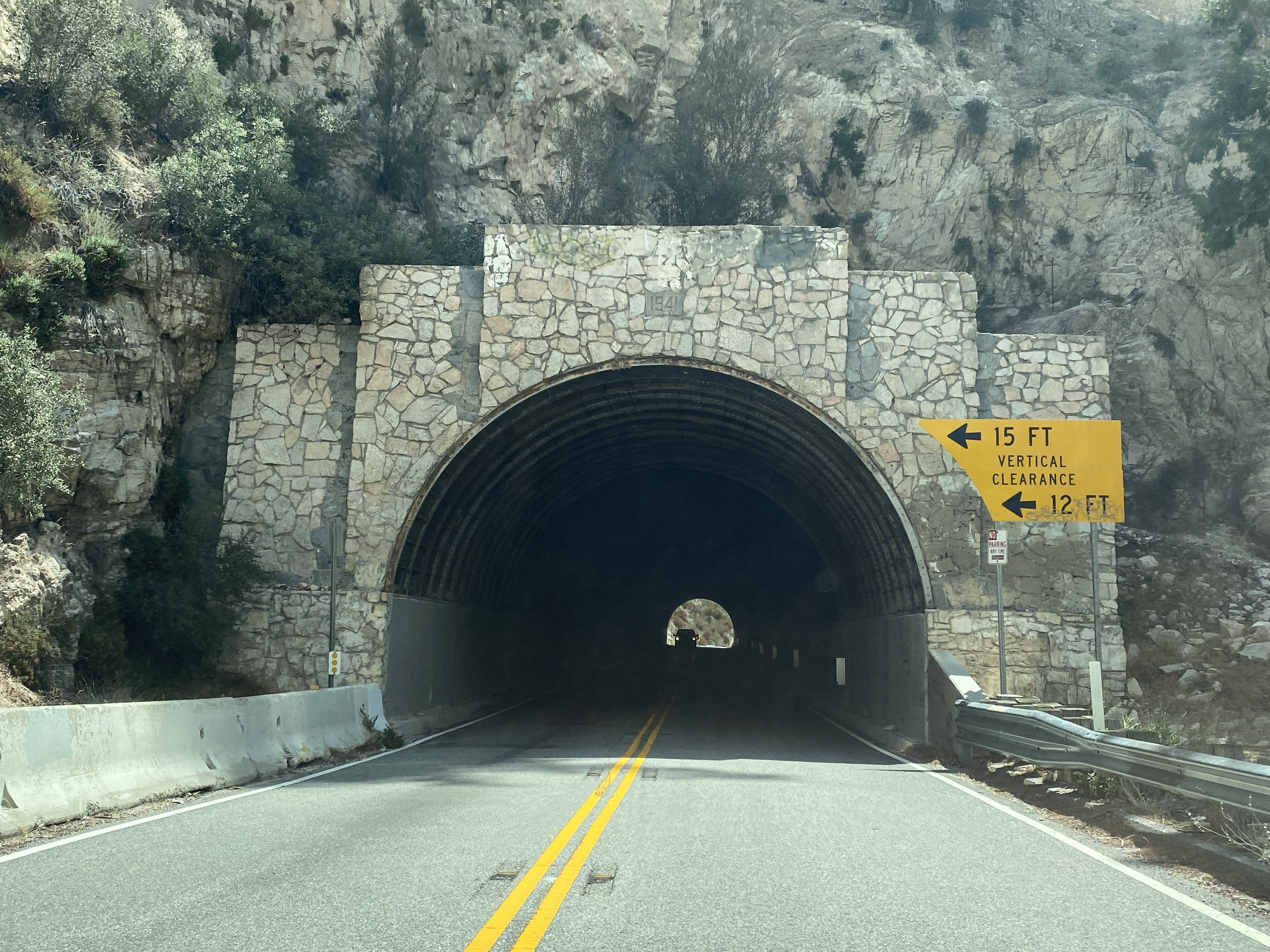
During 1928 the Los Angeles County Board of Supervisors would approve the commissioning of Angeles Forest Highway. The routing of Angeles Forest Highway would comprise much of the corridor defined by 1915 Legislative Chapter 706. Surveys for the construction of Angeles Forest Highway by Los Angeles County were conducted during 1931. The routing of Angeles Forest Highway would require construction of a bridge and tunnel at Mill Creek.
The Edison Pole Line Road can be seen in detail on the 1935 Division of Highways Map of Los Angeles County. Edison Pole Line Road can be seen branching north from California State Route 2 (designated during August 1934) and Legislative Route Number 61 towards Big Tunjunga Canyon. Edison Pole Line Road can be seen crossing Big Tujunga Creek, Fall Creek, Lucas Creek, Mill Creek and Fall Creek again via what is now Forest Road 3N27/North Fork Mill Creek Road.

Edison Pole Line Road continued north following North Fork Mill Creek near Mount Gleason to Aliso Canyon Road (modern Forest Road 3N27, Mount Gleason Road/Forest Road 3N17 and Bear Trap Canyon Road). North of Aliso Canyon Road the alignment of Edison Pole Line Road follows what often appears now on maps as Edison Road towards Vincent.


Angeles Forest Highway was completed on September 12, 1941, following the completion of the Armstong Memorial Bridge over Mill Creek and the Mill Creek Tunnel. Angeles Forest Highway was dedicated on September 15, 1941. Below various news articles and vintage photos of Angeles Forest Highway approaching opening day can be seen (courtesy Carol Stephens of the Freeways of Los Angeles Facebook group). Angeles Forest Highway is noted have a peak elevation of 4,903 feet at Mill Creek Summit in an article regarding the opening of the highway.


Angeles Forest Highway can be seen on the 1944 State Farm Road Map of California.

1959 Legislative Chapter 1062 defined the general corridor of Angeles Forest Highway as part of planned Legislative Route Number 266 and as part of the Freeway & Expressway System. Legislative Route Number 266 appears for the first time on the 1960 Division of Highways Map as a planned State Highway.

As part of the 1964 State Highway Renumbering Legislative Route Number 266 north of California State Route 2 was redesignated as California State Route 249. California State Route 249 can be seen for the first time on the 1964 Division of Highways Map. Existing Angeles Forest Road would be designated as Los Angeles County N3 during the mid-1960s.

The planned routing of California State Route 249 was largely contingent upon the Ells Tunnel being constructed through the San Gabriel Mountains. The proposed Ells Tunnel appeared in the April 4, 1968, Los Angeles Times (courtesy Carol Stephens of the Santa Clarita History Buffs Facebook page) as it was then being considered by the Legislature. The Ells Tunnel is noted to have been first proposed as a tollway tunnel during the 1940s. The Ells Tunnel is noted to have a planned length of 15.7 miles and would consist of three segments. Two of the tunnel segments would comprise a part of the greater Angeles Crest Freeway (which also consisted of a small segment of California State Route 2) and the third would host a high-speed railroad. The Ells Tunnel bill called for surveys to be conducted beginning in 1971 with construction breaking ground as early as 1985. The Ells Tunnel was named for Joe C. Ells a civil engineer from El Monte who proposed the structure during 1953.


Part 2; a drive on Angeles Forest Highway
Southbound Angeles Forest Highway begins at California State Route 14 at Soledad Pass near Vincent siding. Traffic departing California State Route 14 is advised that no trucks with three or more axles or weighing more than 9,000lbs are not permitted on Angeles Forest Highway. Despite being designated as Los Angeles County Route N3 there are no longer county route shields present on Angeles Forest Highway.


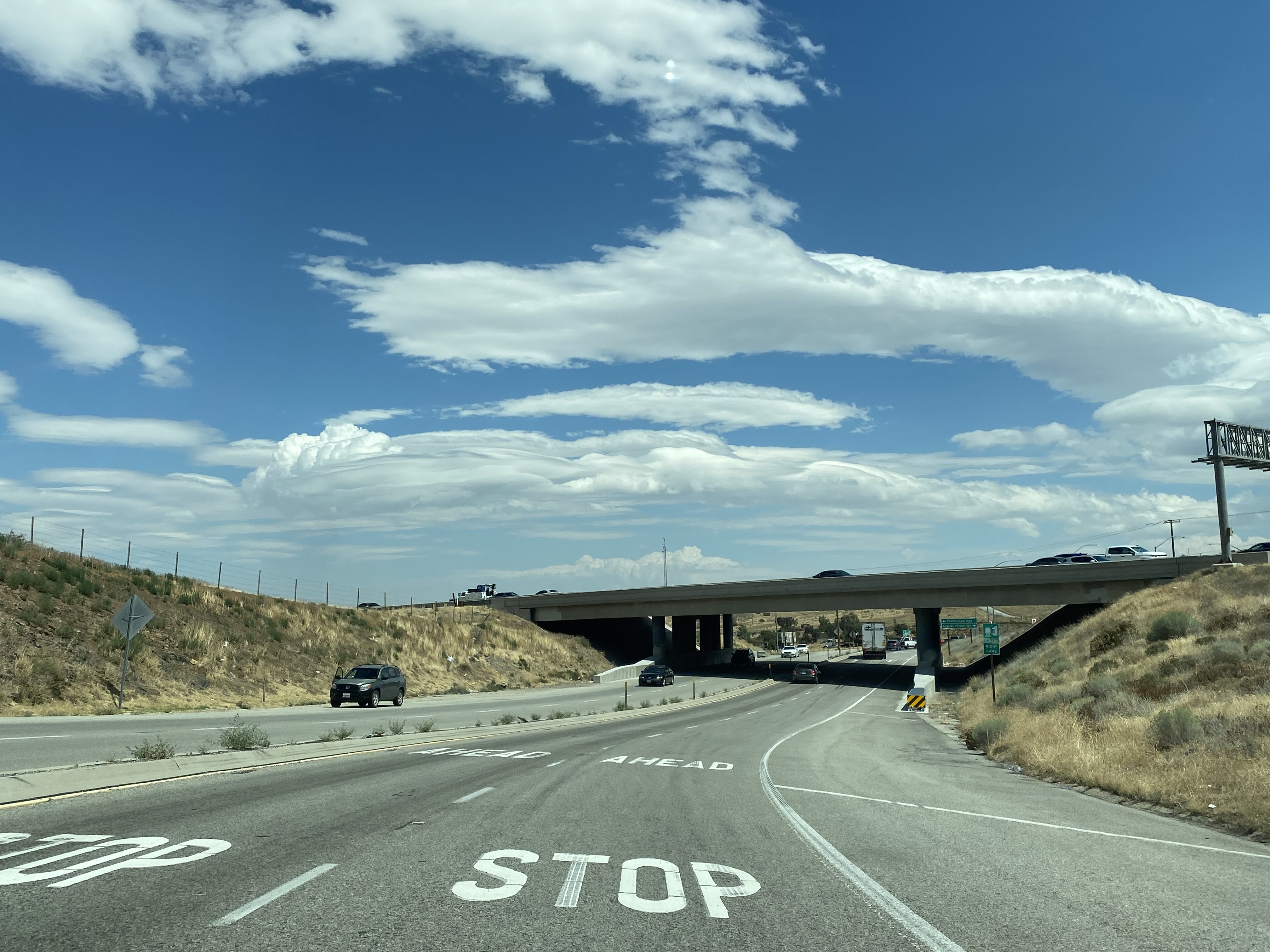

Southbound Angeles Forest Highway crosses over the Union Pacific Railroad departing Soledad Pass. A guide sign denotes which connecting roads are open to traffic.


Angeles Forest Highway is designated as "Los Angeles County Fire Department Captain Ted Hall and Engineer Arnie Quinones Memorial Highway."


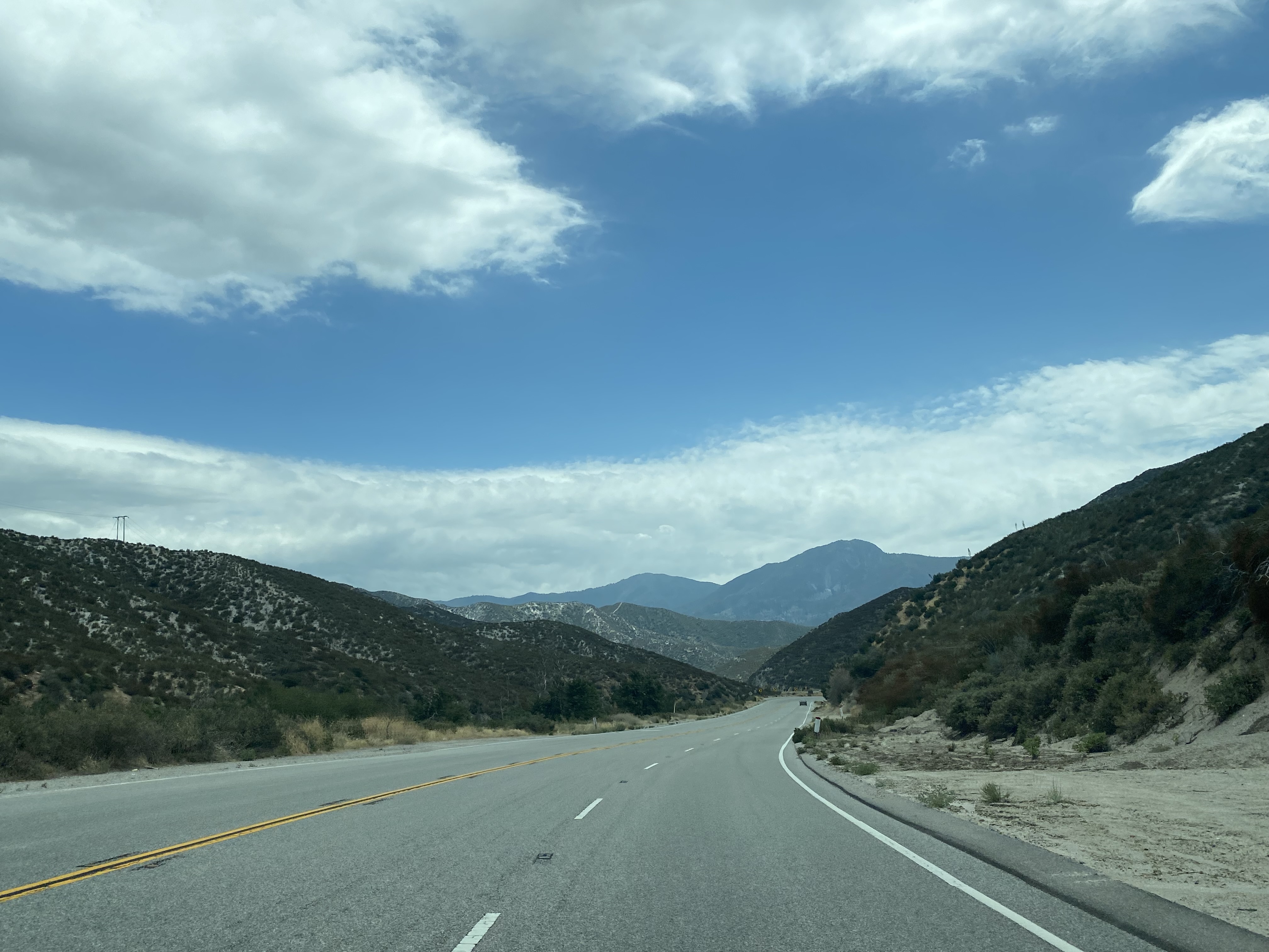
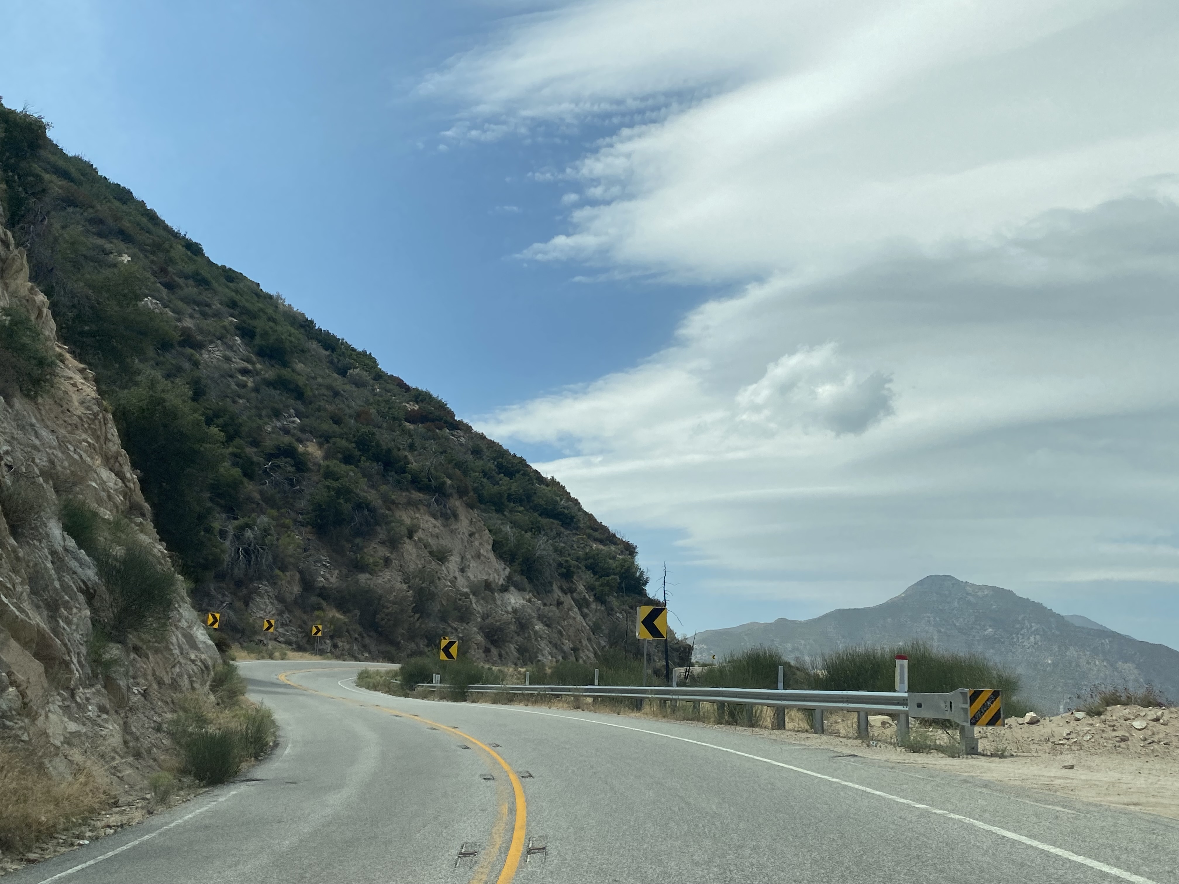
Southbound Angeles Forest Highway approaching Tie Canyon enters Angeles National Forest and intersects Aliso Canyon Road.


Southbound Angeles Forest Highway crosses through Tie Canyon to the 4,903-foot-high Mill Creek Summit.


Southbound Angeles Forest Highway follows the course of Mill Creek and intersects Upper Big Tujunga Canyon Road.


Southbound Angeles Forest Highway continues to follow Mill Creek to the Hidden Springs Picnic Grounds. The Mill Creek Tunnel can be observed from the Hidden Springs Picnic Grounds.


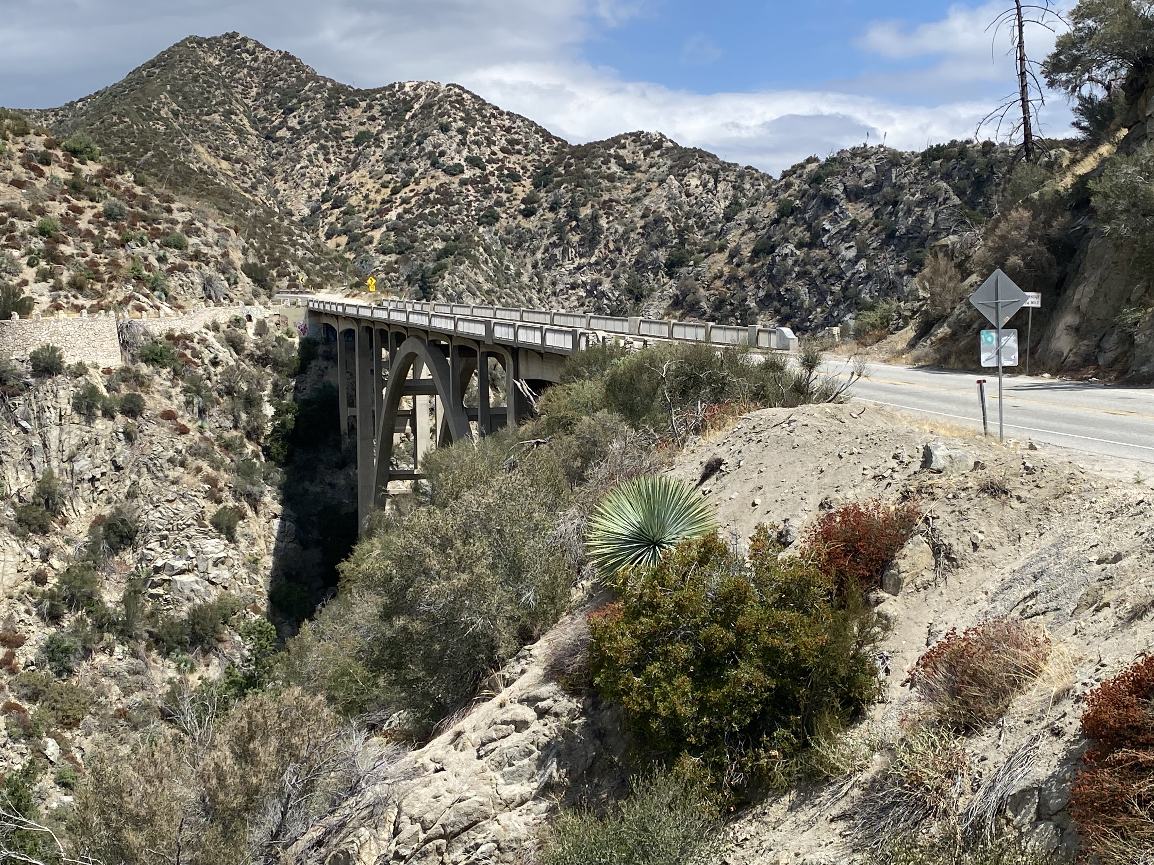
Southbound Angeles Forest Highway crosses the 450-foot long Armstong Memorial Bridge. The Armstrong Memorial Bridge is an arch concrete span which crosses 205 feet above Mill Creek.


Angeles Forest Highway south of the Armstrong Memorial Bridge climbs to Big Tujunga Canyon Road.


Angeles Forest Highway continues south Big Tujunga Canyon Road to a terminus at California State Route 2 (Angeles Crest Highway).


Comments