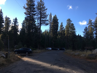
Former California State Route 188 was a 4.7-mile State Highway which located on Fallen Leaf Lake Road in the Lake Tahoe region of El Dorado County. California State Route 188 followed Fallen Leaf Lake Road along the eastern shore of the namesake lake from the vicinity of California State Route 89 near Camp Richardson. The original California State Route 188 was deleted during 1965 as one of the first State Highways removed after the 1964 California State Highway Renumbering.
Part 1; the history of California State Route 188 on Fallen Leaf Lake Road
Fallen Leaf Lake is an oval shaped lake which is approximately 2.9 miles long in a north/south direction and as wide as 0.9 miles east/west. Fallen Leaf Lake was formed by two glaciers which once extended north from Glen Alpine Valley. Given the glacial origin of Fallen Leaf Lake it has average depth of about 240 feet. Fallen Leaf Lake is part of the Lake Tahoe Basin Management Unit of the National Forest Service.
The development of Fallen Leaf Lake is heavily associated with William W. Price, a graduate of Stanford University. Price would settle near Fallen Leaf Lake in 1896 when he constructed a boy's camp near Glen Alpine Springs. When Price married his campground became accessible to the family members of the boys who stayed there. This change in business format began to draw visitors to Price's campground from the nearby Glen Alpine Springs Resort.
At the behest of the Glen Alpine Springs Resort, Price would relocate his camp to the shore of Fallen Leaf Lake. During 1905 Price began to construct permanent structures at his camp on Fallen Leaf Lake which led to a property line dispute. Upon the property dispute being resolved Price would begin construction of cabins which would form the basis of Fallen Leaf Lodge during 1907. Originally visitors to Fallen Leaf Lodge were brought to the site by way of barge from the north shore of Fallen Leaf Lake. The emergence of the South Lincoln Highway would bring regular summer automotive traffic to the Lake Tahoe region which led to the emergence of Fallen Leaf Lake Road. Fallen Leaf Lake Road, Fallen Leaf Lodge and Glen Alpine Springs can be seen below on the 1917 California State Automobile Association Map.
Fallen Leaf Lake Road entered the State Highway System during 1933 when it was adopted as Legislative Route Number 94 (LRN 94). The original definition of LRN 94 was as follows:
"LRN 38 near Camp Richardson to S end Fallen Leaf Lake."
Fallen Leaf Lake Road appears as LRN 94 on the 1934 Division of Highways Map. LRN 94/Fallen Leaf Lake Road would not receive a Sign State Route designation when the system was announced in the August 1934 California Highways & Public Works.
LRN 94 on Fallen Leaf Lake Road appears in detail on the 1935 Division of Highways Map of El Dorado County. Given Fallen Leaf Lake Lodge was popular for meetings by State Officials it is likely LRN 94 was added to provide easier access via maintenance by the Division of Highways. Popular Division of Highways lore alleges that Fallen Leaf Lodge was the site where State Officials would partake in off-grid poker and drinking games.
Fallen Leaf Lake from LRN 94/Fallen Leaf Lake Road appears as the back cover of the September/October 1955 California Highways & Public Works.
LRN 94 and Fallen Leaf Lake Road were rarely mentioned in the California Highways & Public Works publication. An exception came in the May/June 1962 California Highways & Public Works when LRN 94/Fallen Leaf Lake Road was referenced as opening on April 10th.
As part of the 1964 State Highway Renumbering all the Legislative Routes lacking a Sign State Route were assigned one. Subsequently LRN 94 was renumbered to California State Route 188 (CA 188). CA 188 on Fallen Leaf Lake Road first appears on the 1964 Division of Highways Map.
1965 Legislative Chapter 1372 deleted CA 188 and removed Fallen Leaf Lake Road from the State Highway System. The deletion of CA 188 is announced in the September/October 1965 California Highways & Public Works. CA 188 was described a 4.7-mile State Highway which was unimproved single lane highway which was lightly traveled.
The original CA 188 no longer appears on Fallen Leaf Lake Road starting with the 1966 Division of Highways Map.
Part 2; a drive on former California State Route 188 on Fallen Leaf Lake Road
From CA 89 traffic can access former CA 188 at Fallen Leaf Lake Road.
Former CA 188 on Fallen Leaf Lake Road is a single lane paved highway. Traffic southbound on Fallen Leaf Lake Road is advised it is not subject to winter snow removal.
Fallen Leaf Lake Road southbound passes by Fallen Leaf Campground.
Fallen Leaf Lake Road southbound narrows approaching Fallen Leaf Lake.
As Fallen Leaf Lake Road approaches the eastern shore of Fallen Leaf Lake traffic is notified trucks are not advised.
Fallen Leaf Lake Road southbound passes by the Fallen Leaf Lake Fire Department.
Fallen Leaf Lake Road southbound becomes narrows considerably on the east shore of Fallen Leaf Lake which has numerous seasonal residences access driveways.
Fallen Leaf Lake Road terminates at the south shore of Fallen Leaf Lake where CA 188 terminated at Fallen Leaf Lodge. Traffic can take Glen Alpine Road as a continuance to Glen Alpine Springs.


Comments