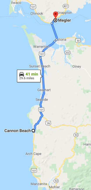
This past September I drove a segment of US Route 101 from Cannon Beach, Oregon northward over the Columbia River into Washington State via the Astoria-Megler Bridge.

US 101 from Cannon Beach, Oregon northward to Megler, Washington is a shade under 30 miles. Despite the short length this particular segment of US 101 has several notable locales in; Cannon Beach, Seaside, Astoria and the Astoria-Megler Bridge.

My trip on US 101 began in downtown Cannon Beach after taking US 26 on the Sunset Highway west out of Portland.

Cannon Beach is an incorporated City within Clatsop County with an approximate population of around 1,700. Cannon Beach is located on the Pacific Ocean off of Ecola Creek. Ecola Creek and what is now Cannon Beach was explored by William Clark of the Lewis & Clark Expedition in 1805. During the ensuing decades a small community known as Elk Creek was settled near Ecola Creek. In 1846 a cannon from the wrecked USS Shark landed south of Elk Creek near Arch Cape. In 1848 Oregon Territory was organized which eventually became the State of Oregon in 1859. In 1898 the lost cannon from the US Shark was rediscovered which led to Elk Creek being renamed to Cannon Beach in 1922. In 1956 Cannon Beach incorporated as a City.

Cannon Beach today is one of the most frequently visited coastal communities in Oregon. Ecola Creek is accessible west of 2nd Street near it's mouth at the Pacific Ocean.


The namesake Cannon Beach extends south from the mouth of Ecola Creek to Arch Cape. Cannon Beach has been featured in several movies but is mostly known as for being a backdrop in The Goonies (which is amusing considering it is significant distance south storyboard setting of Astoria). The most notable feature of Cannon Beach is the Haystack Rock. Haystack Rock 235 foot tall sea stack which consists of Basalt Rock. The Basalt Rock formations at Cannon Beach are thought to have come from volcanic eruptions in the Blue Mountains and Columbia Basin 15 to 16 million years ago.


No Auto Trails were apparently ever routed to Cannon Beach. The closest Auto Trail was was Grant Highway which was routed through nearby Seaside and Astoria. The Grant Highway can be seen east of Cannon Beach on the 1925 Rand McNally Highway Map of Washington and Oregon. The Grant Highway as a full route was signed between Chicago and Astoria.

When the US Route System was approved in late 1926 it was not aligned through Cannon Beach. US 101 originally was aligned to the east from Mohler north on modern OR 53/Nacanicum Highway and west on US 26/Sunset Highway to Seaside. The original alignment of US 101 east of Cannon Beach can be seen on the 1927 National Company Map of Oregon.

Early US 101 east of Cannon Beach can also been seen on the 1931 Clason's Road Map of Oregon.

The new alignment of US 101 through Cannon Beach can be seen under construction on the 1939 Rand McNally Map of Oregon.

The 1940 Rand McNally Map of Oregon also shows US 101 under construction through Cannon Beach. The 1944 Rand McNally Map of Oregon shows US 101 routed through Cannon Beach with the previous alignment becoming OR 53 and OR 2.

The original alignment of US 101 through Cannon Beach was as follows northbound:
- From modern US 101 Hemlock Street to 2nd Street.
- 2nd Street to Spruce Street.
- Spruce Street to 3rd Street.
- 3rd Street to Fir Street.
- Fir Street over the Ecola River to modern US 101.
According to JasonOfORoads of beaverstateroads.net US 101 was realigned onto a bypass of downtown Cannon Beach in 1952. The description of US 101 being rerouted onto a bypass of Cannon Beach can be seen on an ODOT document hosted on beaverstateroads.

In 1964 a tsunami from the Good Friday Earthquake wiped out the original alignment of US 101 in northern Cannon Beach along Ecola Creek. According to JasonOfORoads the original bridgework over Ecola Creek is shown as rebuilt on the National Bridge Inventory.
From Haystack Rock I walked/drove former US 101 through downtown Cannon Beach northward to the modern expressway.
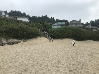


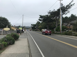


Modern US 101 northbound from Cannon Beach quickly intersects US 26/Sunset Highway. From 1952 to 2003 US 26 westbound multiplexed US 101 northbound to Astoria.


US 101 north of US 26 is signed as the Persian Gulf, Afghanistan, and Iraq Veterans Memorial Highway.


US 101 northbound crosses the Necanicum River and enters Seaside.


Access to downtown Seaside is signed from US 101 via Broadway.


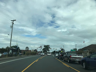

The original alignment of US 101 through Seaside was on Holladay Drive and appears to have been moved east to present route at some point in the 1950s. The modern grade of US 101 appears to have been largely built next to the grade of the Spokane, Portland and Seattle Railway branch line.
The first Europeans to really stake out any form of civilization in present day Seaside was during January of 1806 when the Lewis & Clark Expedition set up salt works. Seaside became the terminus of a railroad routed south from Astoria in 1889. The region slowly grew and the City of Seaside incorporated in 1899. Seaside oddly was involved in World War II when nearby Fort Stevens was shelled in July of 1942 by a Japanese submarine. Today Seaside is largely just known as a busy beach resort town and matches the feel of what one might expect to see on the much more built up East Coast.
I made a side trip from US 101 to the shore line via Broadway in downtown Seaside.


While not quite as scenic as Haystack Rock the shoreline of Seaside does have a nice view of Tillamook Head to the south.

The western terminus of Broadway has a small Lewis & Clark Expedition Monument.


Seaside has several interesting bridges over the Necanicum River. The Broadway Bridge pictured below is the only Luten Arch structure in Oregon. The Broadway Bridge opened to traffic in 1924.

The Necanicum River Bridge on Avenue G is stringer structure which was constructed in 1952

The First Avenue Bridge features a slab design and also known as the Pearl Harbor Memorial Bridge. The First Avenue Bridge is reported as being constructed in 2001 on Bridgehunter.com. If that is the actual case the First Avenue Bridge is one of the best emulations of Mid-20th Century Bridge designs I've seen.


Returning to modern US 101 northbound the highway crosses the Neawanna Creek Bridge near the northern City Limits of Seaside. The Neawanna Creek Bridge is a continuous concrete multi-span structure which completed in 1930.

US 101 north of Seaside enters the City of Gerhart. Gerhart has origins dating back to the same railroad line which was completed from Astoria south to Seaside in 1889. The name of "Gerhart" comes from a local homesteader who owned a large plot of land near the community in the late 19th Century.

US 101 passes through Gerhart and opens back up into a 55 MPH speed zone.


Access to Del Ray Beach State Recreation Area is signed off of US 101 via Highlands Lane.

Several Lewis & Clark National Historic Park locales are signed from US 101 north of Gearhart; namely Fort Stevens and Fort Clatsop both at 10 miles.

US 101 north of Gearhart passes by a weigh station.


Access to Cullaby Lake County Park is signed off of US 101 north from Cullaby Lake Lane.


The Fort to Sea Trail and Sunset Beach Trailhead are accessible from US 101 northbound via Pioneer Farm Lane.

US 101 north traffic is advised that Fort Stevens State Park is accessible via OR 104.


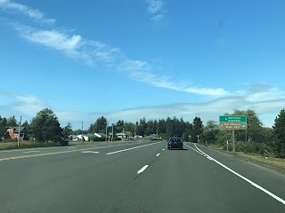
OR 104 is partially aligned on the original route of US 101 north towards Astoria. The original route of US 101 swung onto what is now OR 104/Fort Stevens Highway and Main Street to OR 104S/Fort Stevens Spur. US 101 followed OR 104S east over the modern highway to SE 12th Place. US 101 continued through what is now the runway at Astoria Regional Airport to the 1924 Lewis & Clark River Bridge. Upon crossing the Lewis & Clark River US 101 continued east on what is now the US 101 Business route to Miles Crossing. US 101 swung north at Miles Crossing on US 101 Business/Warrenton-Astoria Highway over Young Bay on the 1921 Young Bay Bridge. Upon entering Astoria US 101 followed current US 101 Business/OR 202 back to the modern highway via Marine Drive. The realignment of US 101 was straightened by the completion of the 1964 Young Bay Bridge. On the 1956 Shell Highway Map of Oregon US 101 along with US 26 are seen on the original iteration of the highway entering Astoria via the 1921 Young Bay Bridge.

The Lewis & Clark National Historic Park is signed from US 101 on Ensign Lane.


US 101 northbound meets OR 104S and US 101 Business at Fort Stevens Spur.


Access to Fort Stevens State Park is signed from US 101 north via Marlin Drive.

US 101 north crosses the 1964 Young Bay Bridge into Astoria. The 1964 Young Bay Bridge is a 4,203 foot structure which features a vertical lift span. The Astoria-Megler Bridge is easily observed off in the distance over the Columbia River.


At Smith Point US 101 enters a roundabout where it intersects US 101 Business/OR 202.


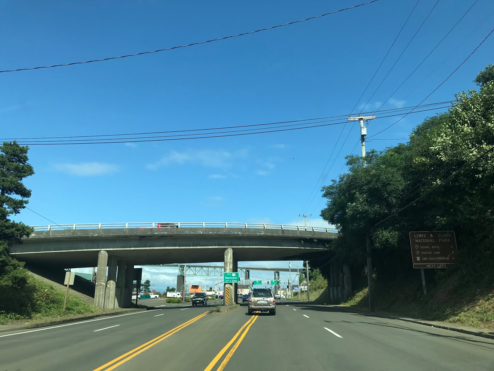
US 101 north follows Marine Drive to the foot of the Astoria-Megler Bridge. US 101 northbound turns towards Washington State via the Astoria-Megler Bridge whereas US 30 eastbound begins on Marine Drive. From 1966 to 2003 US 26 westbound ended at the foot of the Astoria-Megler Bridge.


The Astoria-Megler Bridge was built as a replacement to the Astoria-Megler Ferry. The Astoria-Megler Bridge is 4.1 mile continuous rigid-cantilever truss structure which carries US 101 over the Columbia River into Washington State. The Astoria-Megler Bridge began construction in November of 1962 and was opened to traffic in July of 1966. The Astoria-Megler Bridge was tolled until December 1993 and now is free to cross.
The Astoria-Megler Bridge takes a 360 degree loop up to the main truss span. On the ascent to the main span traffic on US 101 passes through the old toll facility.


The main truss span of the Astoria-Megler Bridge carries a 196 foot vertical clearance over the Columbia River at high tide.


As US 101 northbound descends the main span of the Astoria-Megler Bridge there is an open vista of the Columbia River and Pacific County, Washington.


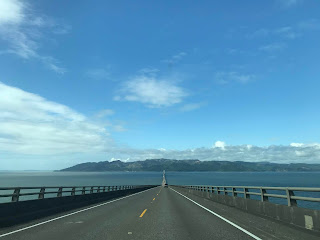


US 101 northbound crosses a shallow span of the Astoria-Megler Bridge before approaching a second truss at the Washington State Line.


US 101 northbound approaches land and meets WA 401.


Before turning back southbound to Astoria I stopped on the side of US 101 to get a vista photo of the Astoria-Megler Bridge.

US 101 originally accessed the Astoria-Melger Ferry on 14th Street. The Astoria-Megler Ferry operated from 1921 until July 28th 1966 (the day before the Astoria-Megler Bridge opened). The Astoria-Megler Ferry was sold the Oregon Department of Transportation in June of 1946. Bridgehunter.com has numerous vintage photos of the Astoria-Megler Ferry operation and a roster of ferry boats.
USends.com has a detailed history of the US Routes endpoints in Astoria. US 101 northbound originally followed Bond Drive, 7th Street and Commercial Street to 14th Street (which can be seen on the 1939 topographical map of Astoria on historiaerials.com). US 101 was straightened onto a direct alignment to 14th Street likely at sometime in the 1940s. At some point likely in the 1950s US 101/US 26 split onto a one-way coupling on Marine Drive and Commercial Street.
During my return trip to Portland I took US 30 through downtown Astoria. Astoria is the County Seat of Clatsop County and is the oldest American settlement west of the Rocky Mountains having been founded in 1811. Astoria was incorporated as a City in 1876 and grew to a peak population of about 14,000 residents by the 1920 due to it's fortunate location at the mouth of the Columbia River. Astoria is a common movie and TV backdrop but is mostly known for being the setting of The Goonies.
US 30 east from the Astoria-Megler Bridge follows what was US 101 north/US 26 west (yes a wrong-way direction) to 8th Street. At 8th Street US 30 east splits one-way onto what was US 101/US 26 west.


From 8th Street US 30 east follows the former path of US 101 north/US 26 west onto Commercial Street.

US 30 east follows former US 101 north/US 26 west to 14th Street on Commercial Street. US 101 north would have turned on 14th Street towards the Astoria-Megler Ferry whereas US 26 west ended at the intersection. Interestingly the original eastern beginning of US 30 was located at 14th Street and Commercial Street.



Cannon Beach is an incorporated City within Clatsop County with an approximate population of around 1,700. Cannon Beach is located on the Pacific Ocean off of Ecola Creek. Ecola Creek and what is now Cannon Beach was explored by William Clark of the Lewis & Clark Expedition in 1805. During the ensuing decades a small community known as Elk Creek was settled near Ecola Creek. In 1846 a cannon from the wrecked USS Shark landed south of Elk Creek near Arch Cape. In 1848 Oregon Territory was organized which eventually became the State of Oregon in 1859. In 1898 the lost cannon from the US Shark was rediscovered which led to Elk Creek being renamed to Cannon Beach in 1922. In 1956 Cannon Beach incorporated as a City.

Cannon Beach today is one of the most frequently visited coastal communities in Oregon. Ecola Creek is accessible west of 2nd Street near it's mouth at the Pacific Ocean.


The namesake Cannon Beach extends south from the mouth of Ecola Creek to Arch Cape. Cannon Beach has been featured in several movies but is mostly known as for being a backdrop in The Goonies (which is amusing considering it is significant distance south storyboard setting of Astoria). The most notable feature of Cannon Beach is the Haystack Rock. Haystack Rock 235 foot tall sea stack which consists of Basalt Rock. The Basalt Rock formations at Cannon Beach are thought to have come from volcanic eruptions in the Blue Mountains and Columbia Basin 15 to 16 million years ago.


No Auto Trails were apparently ever routed to Cannon Beach. The closest Auto Trail was was Grant Highway which was routed through nearby Seaside and Astoria. The Grant Highway can be seen east of Cannon Beach on the 1925 Rand McNally Highway Map of Washington and Oregon. The Grant Highway as a full route was signed between Chicago and Astoria.

When the US Route System was approved in late 1926 it was not aligned through Cannon Beach. US 101 originally was aligned to the east from Mohler north on modern OR 53/Nacanicum Highway and west on US 26/Sunset Highway to Seaside. The original alignment of US 101 east of Cannon Beach can be seen on the 1927 National Company Map of Oregon.

Early US 101 east of Cannon Beach can also been seen on the 1931 Clason's Road Map of Oregon.

The new alignment of US 101 through Cannon Beach can be seen under construction on the 1939 Rand McNally Map of Oregon.

The 1940 Rand McNally Map of Oregon also shows US 101 under construction through Cannon Beach. The 1944 Rand McNally Map of Oregon shows US 101 routed through Cannon Beach with the previous alignment becoming OR 53 and OR 2.

The original alignment of US 101 through Cannon Beach was as follows northbound:
- From modern US 101 Hemlock Street to 2nd Street.
- 2nd Street to Spruce Street.
- Spruce Street to 3rd Street.
- 3rd Street to Fir Street.
- Fir Street over the Ecola River to modern US 101.
According to JasonOfORoads of beaverstateroads.net US 101 was realigned onto a bypass of downtown Cannon Beach in 1952. The description of US 101 being rerouted onto a bypass of Cannon Beach can be seen on an ODOT document hosted on beaverstateroads.

In 1964 a tsunami from the Good Friday Earthquake wiped out the original alignment of US 101 in northern Cannon Beach along Ecola Creek. According to JasonOfORoads the original bridgework over Ecola Creek is shown as rebuilt on the National Bridge Inventory.
From Haystack Rock I walked/drove former US 101 through downtown Cannon Beach northward to the modern expressway.


Modern US 101 northbound from Cannon Beach quickly intersects US 26/Sunset Highway. From 1952 to 2003 US 26 westbound multiplexed US 101 northbound to Astoria.


US 101 north of US 26 is signed as the Persian Gulf, Afghanistan, and Iraq Veterans Memorial Highway.


US 101 northbound crosses the Necanicum River and enters Seaside.


Access to downtown Seaside is signed from US 101 via Broadway.


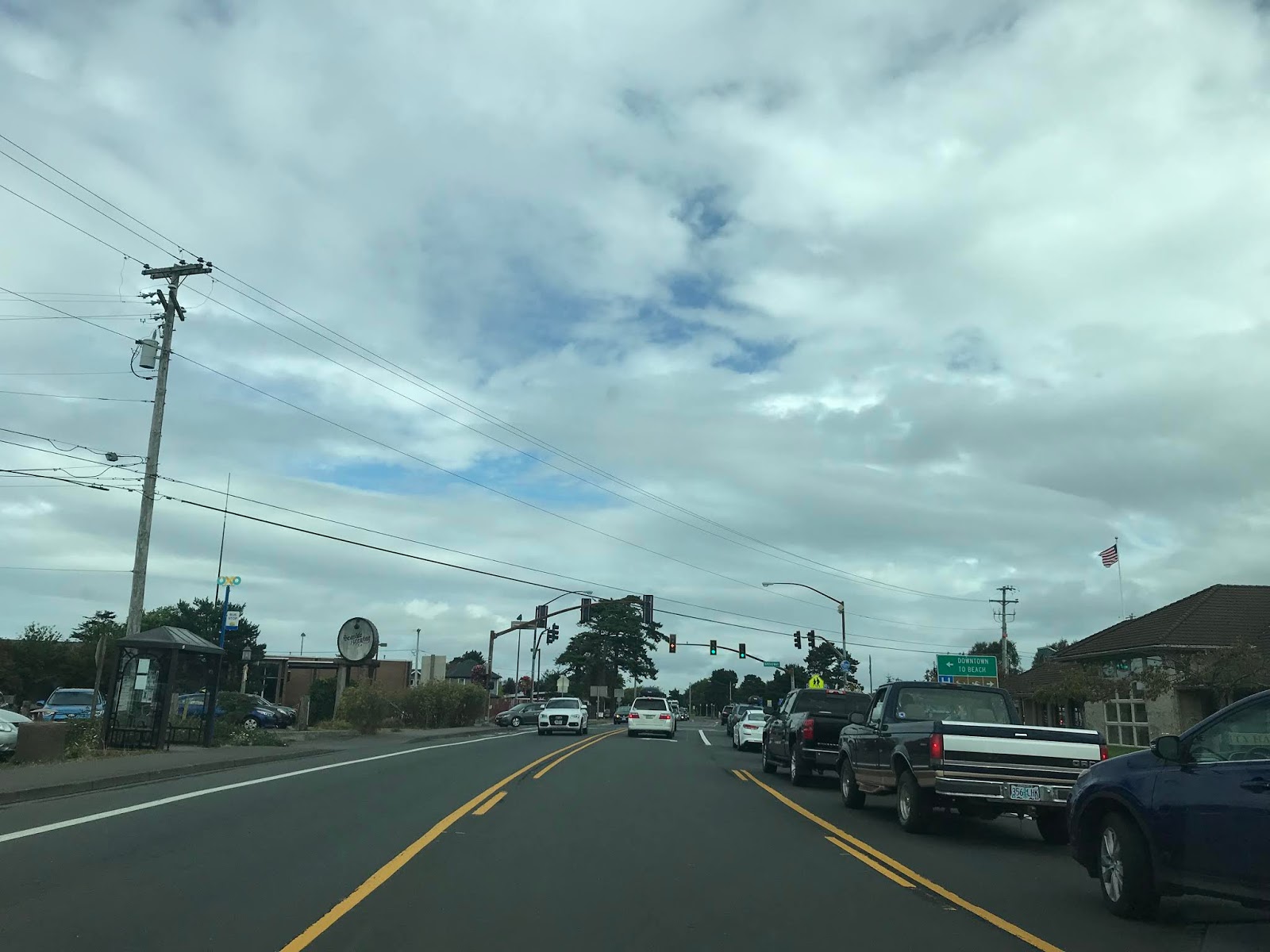

The original alignment of US 101 through Seaside was on Holladay Drive and appears to have been moved east to present route at some point in the 1950s. The modern grade of US 101 appears to have been largely built next to the grade of the Spokane, Portland and Seattle Railway branch line.
The first Europeans to really stake out any form of civilization in present day Seaside was during January of 1806 when the Lewis & Clark Expedition set up salt works. Seaside became the terminus of a railroad routed south from Astoria in 1889. The region slowly grew and the City of Seaside incorporated in 1899. Seaside oddly was involved in World War II when nearby Fort Stevens was shelled in July of 1942 by a Japanese submarine. Today Seaside is largely just known as a busy beach resort town and matches the feel of what one might expect to see on the much more built up East Coast.
I made a side trip from US 101 to the shore line via Broadway in downtown Seaside.


While not quite as scenic as Haystack Rock the shoreline of Seaside does have a nice view of Tillamook Head to the south.

The western terminus of Broadway has a small Lewis & Clark Expedition Monument.


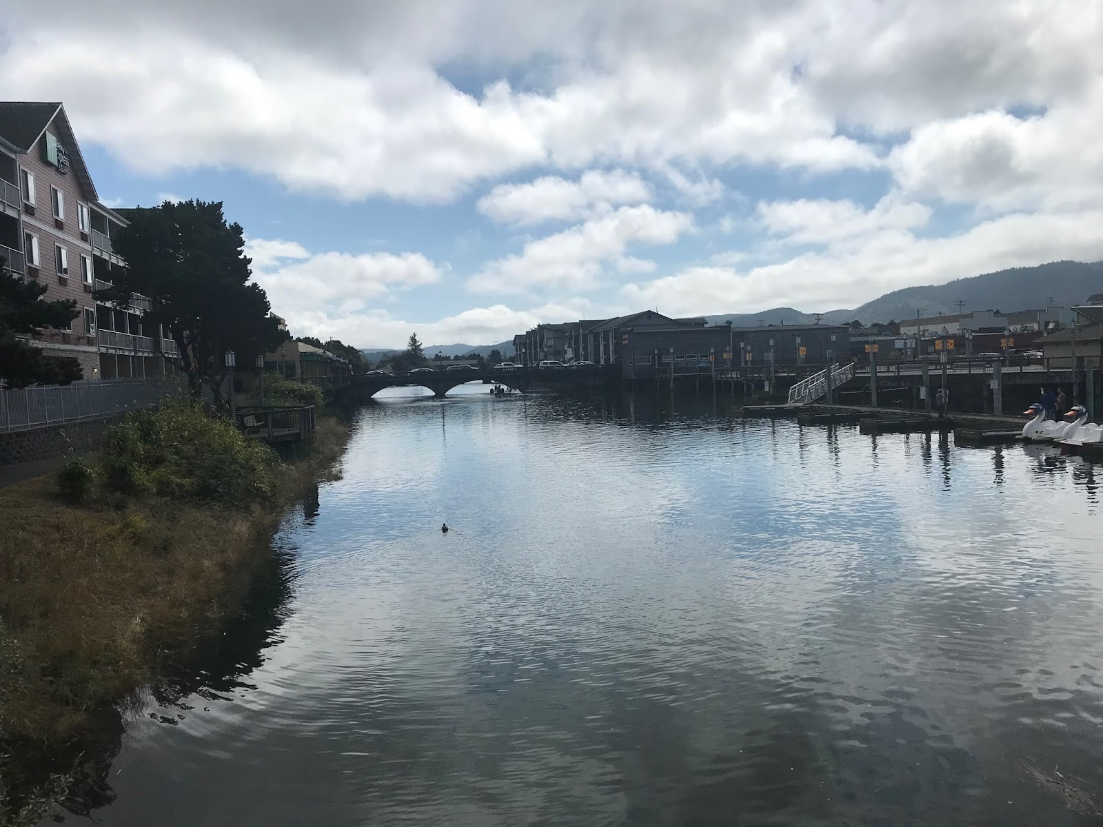
Seaside has several interesting bridges over the Necanicum River. The Broadway Bridge pictured below is the only Luten Arch structure in Oregon. The Broadway Bridge opened to traffic in 1924.
The Necanicum River Bridge on Avenue G is stringer structure which was constructed in 1952

The First Avenue Bridge features a slab design and also known as the Pearl Harbor Memorial Bridge. The First Avenue Bridge is reported as being constructed in 2001 on Bridgehunter.com. If that is the actual case the First Avenue Bridge is one of the best emulations of Mid-20th Century Bridge designs I've seen.


Returning to modern US 101 northbound the highway crosses the Neawanna Creek Bridge near the northern City Limits of Seaside. The Neawanna Creek Bridge is a continuous concrete multi-span structure which completed in 1930.

US 101 north of Seaside enters the City of Gerhart. Gerhart has origins dating back to the same railroad line which was completed from Astoria south to Seaside in 1889. The name of "Gerhart" comes from a local homesteader who owned a large plot of land near the community in the late 19th Century.

US 101 passes through Gerhart and opens back up into a 55 MPH speed zone.


Access to Del Ray Beach State Recreation Area is signed off of US 101 via Highlands Lane.

Several Lewis & Clark National Historic Park locales are signed from US 101 north of Gearhart; namely Fort Stevens and Fort Clatsop both at 10 miles.

US 101 north of Gearhart passes by a weigh station.


Access to Cullaby Lake County Park is signed off of US 101 north from Cullaby Lake Lane.


The Fort to Sea Trail and Sunset Beach Trailhead are accessible from US 101 northbound via Pioneer Farm Lane.

US 101 north traffic is advised that Fort Stevens State Park is accessible via OR 104.


OR 104 is partially aligned on the original route of US 101 north towards Astoria. The original route of US 101 swung onto what is now OR 104/Fort Stevens Highway and Main Street to OR 104S/Fort Stevens Spur. US 101 followed OR 104S east over the modern highway to SE 12th Place. US 101 continued through what is now the runway at Astoria Regional Airport to the 1924 Lewis & Clark River Bridge. Upon crossing the Lewis & Clark River US 101 continued east on what is now the US 101 Business route to Miles Crossing. US 101 swung north at Miles Crossing on US 101 Business/Warrenton-Astoria Highway over Young Bay on the 1921 Young Bay Bridge. Upon entering Astoria US 101 followed current US 101 Business/OR 202 back to the modern highway via Marine Drive. The realignment of US 101 was straightened by the completion of the 1964 Young Bay Bridge. On the 1956 Shell Highway Map of Oregon US 101 along with US 26 are seen on the original iteration of the highway entering Astoria via the 1921 Young Bay Bridge.

The Lewis & Clark National Historic Park is signed from US 101 on Ensign Lane.


US 101 northbound meets OR 104S and US 101 Business at Fort Stevens Spur.


Access to Fort Stevens State Park is signed from US 101 north via Marlin Drive.

US 101 north crosses the 1964 Young Bay Bridge into Astoria. The 1964 Young Bay Bridge is a 4,203 foot structure which features a vertical lift span. The Astoria-Megler Bridge is easily observed off in the distance over the Columbia River.


At Smith Point US 101 enters a roundabout where it intersects US 101 Business/OR 202.


US 101 north follows Marine Drive to the foot of the Astoria-Megler Bridge. US 101 northbound turns towards Washington State via the Astoria-Megler Bridge whereas US 30 eastbound begins on Marine Drive. From 1966 to 2003 US 26 westbound ended at the foot of the Astoria-Megler Bridge.




The Astoria-Megler Bridge was built as a replacement to the Astoria-Megler Ferry. The Astoria-Megler Bridge is 4.1 mile continuous rigid-cantilever truss structure which carries US 101 over the Columbia River into Washington State. The Astoria-Megler Bridge began construction in November of 1962 and was opened to traffic in July of 1966. The Astoria-Megler Bridge was tolled until December 1993 and now is free to cross.
The Astoria-Megler Bridge takes a 360 degree loop up to the main truss span. On the ascent to the main span traffic on US 101 passes through the old toll facility.


The main truss span of the Astoria-Megler Bridge carries a 196 foot vertical clearance over the Columbia River at high tide.


As US 101 northbound descends the main span of the Astoria-Megler Bridge there is an open vista of the Columbia River and Pacific County, Washington.


US 101 northbound crosses a shallow span of the Astoria-Megler Bridge before approaching a second truss at the Washington State Line.


US 101 northbound approaches land and meets WA 401.


Before turning back southbound to Astoria I stopped on the side of US 101 to get a vista photo of the Astoria-Megler Bridge.

US 101 originally accessed the Astoria-Melger Ferry on 14th Street. The Astoria-Megler Ferry operated from 1921 until July 28th 1966 (the day before the Astoria-Megler Bridge opened). The Astoria-Megler Ferry was sold the Oregon Department of Transportation in June of 1946. Bridgehunter.com has numerous vintage photos of the Astoria-Megler Ferry operation and a roster of ferry boats.
USends.com has a detailed history of the US Routes endpoints in Astoria. US 101 northbound originally followed Bond Drive, 7th Street and Commercial Street to 14th Street (which can be seen on the 1939 topographical map of Astoria on historiaerials.com). US 101 was straightened onto a direct alignment to 14th Street likely at sometime in the 1940s. At some point likely in the 1950s US 101/US 26 split onto a one-way coupling on Marine Drive and Commercial Street.
During my return trip to Portland I took US 30 through downtown Astoria. Astoria is the County Seat of Clatsop County and is the oldest American settlement west of the Rocky Mountains having been founded in 1811. Astoria was incorporated as a City in 1876 and grew to a peak population of about 14,000 residents by the 1920 due to it's fortunate location at the mouth of the Columbia River. Astoria is a common movie and TV backdrop but is mostly known for being the setting of The Goonies.
US 30 east from the Astoria-Megler Bridge follows what was US 101 north/US 26 west (yes a wrong-way direction) to 8th Street. At 8th Street US 30 east splits one-way onto what was US 101/US 26 west.


From 8th Street US 30 east follows the former path of US 101 north/US 26 west onto Commercial Street.

US 30 east follows former US 101 north/US 26 west to 14th Street on Commercial Street. US 101 north would have turned on 14th Street towards the Astoria-Megler Ferry whereas US 26 west ended at the intersection. Interestingly the original eastern beginning of US 30 was located at 14th Street and Commercial Street.


Comments