This past month I drove the entirety of Redinger Lake Road located in Madera County along the horseshoe bend region of the San Joaquin River.

Redinger Lake Road carries the designation of "Road 235" and is a 8.6 mile road which begins at Powerhouse Road (Road 222) at Kerckhoff Lake in Sierra National Forest and ends to the east at Italian Bar Road (Road 225) along Redinger Lake.

Redinger Lake Road was completed by 1950 and was used as a haul road during the construction of Redinger Dam. Redinger Dam was completed by 1951 and is part of the Big Creek Hydroelectric Project. Internally Redinger Dam is also known as Big Creek Dam #7. Redinger Dam is a 250 foot high concrete gravity dam which impounds the San Joaquin River. Redinger Dam has a maximum capacity of 35,000 acre feet of water.
My approach to Redinger Lake Road was from Powerhouse Road northbound on the shore of Kerckhoff Lake. From Powerhouse Road I turned east onto Redinger Lake Road.


Redinger Lake Road quickly enters the horseshoe bend of the San Joaquin River. Less than half a mile from Powerhouse Road there is a trailhead for Horseshoe Bend Trail.


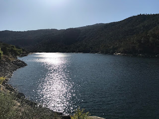
Redinger Lake Road quickly ascends to the top of the Horseshoe Bend where it has a view of Kerckhoff Lake.


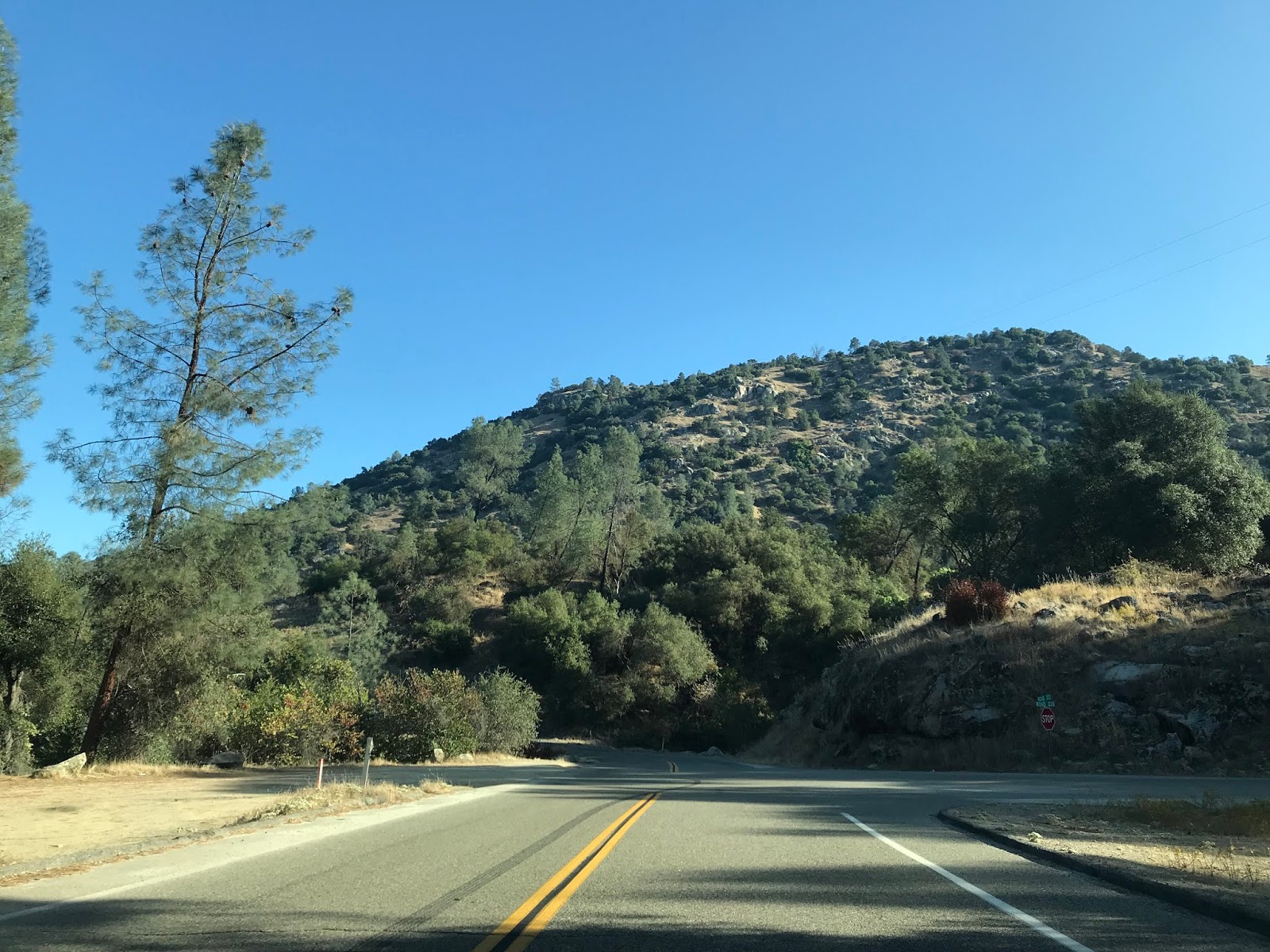
Redinger Lake ascends to a bluff above the Horseshoe Bend and continues eastward towards Willow Creek.


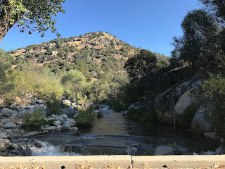
Redinger Lake Road makes a sharp descent through a series of hairpins to the 1950 Willow Creek Bridge in the Redinger Lake Recreation Area.


Redinger Lake Road makes a brief climb from Willow Creek to Redinger Dam.


Redinger Lake Road passes through the Redinger Campground and Marina before continuing several miles to an eastern terminus at Italian Bar Road.


From the eastern terminus of Redinger Lake Road the upstream waters of the San Joaquin River near the Italian Bar Bridge can be seen below.


Redinger Lake Road carries the designation of "Road 235" and is a 8.6 mile road which begins at Powerhouse Road (Road 222) at Kerckhoff Lake in Sierra National Forest and ends to the east at Italian Bar Road (Road 225) along Redinger Lake.

Redinger Lake Road was completed by 1950 and was used as a haul road during the construction of Redinger Dam. Redinger Dam was completed by 1951 and is part of the Big Creek Hydroelectric Project. Internally Redinger Dam is also known as Big Creek Dam #7. Redinger Dam is a 250 foot high concrete gravity dam which impounds the San Joaquin River. Redinger Dam has a maximum capacity of 35,000 acre feet of water.
My approach to Redinger Lake Road was from Powerhouse Road northbound on the shore of Kerckhoff Lake. From Powerhouse Road I turned east onto Redinger Lake Road.


Redinger Lake Road quickly enters the horseshoe bend of the San Joaquin River. Less than half a mile from Powerhouse Road there is a trailhead for Horseshoe Bend Trail.


Redinger Lake Road quickly ascends to the top of the Horseshoe Bend where it has a view of Kerckhoff Lake.


Redinger Lake ascends to a bluff above the Horseshoe Bend and continues eastward towards Willow Creek.


Redinger Lake Road makes a sharp descent through a series of hairpins to the 1950 Willow Creek Bridge in the Redinger Lake Recreation Area.


Redinger Lake Road makes a brief climb from Willow Creek to Redinger Dam.


Redinger Lake Road passes through the Redinger Campground and Marina before continuing several miles to an eastern terminus at Italian Bar Road.


From the eastern terminus of Redinger Lake Road the upstream waters of the San Joaquin River near the Italian Bar Bridge can be seen below.

Comments