
Have you ever wanted to travel on a single route number for as long as you can take it? To make as many stops as you can along that route?
Well for a long time Vermont 100 has been one of those routes that I wanted to complete in one day. Nearly 216 miles on one two lane highway through the heart of Vermont. The idea of driving VT 100 in one setting was inspired by an entry in The Most Scenic Drives in America: 120 Spectacular Road Trips . I often refer to this book and other scenic drive books as ideas for various roadtrips.
How did we drive it: We left Doug's place at 6:30 am and arrived in North Conway, NH at around 8 pm.
Our Route: I-890, I-90, US 9/20, NY 150, NY 43, NY 351, NY/MA 2, MA/VT 8, VT 9 , VT 100, VT 105, US 5, I-91, VT 105, VT 114, VT 122, I-91, I-93, US 302.
(Full Disclosure: we did skip one small segment of VT 100 south of Wilmington - I had already driven that section of VT 100 numerous times so we stated on VT 8 and rejoined VT 100 in Wilmington.)
For the full photo set from the Vermont leg of this journey head here.
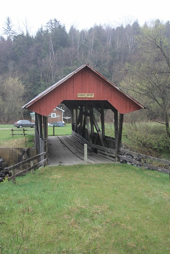
Of course a roadtrip into Vermont isn't complete without a stomp at the Medburyville Truss Bridge.
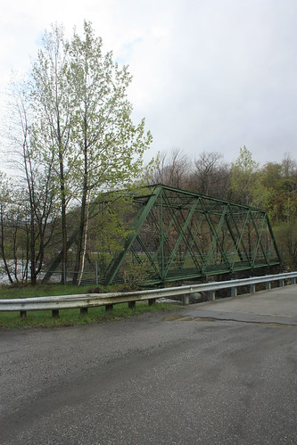
Doug and I now jokingly call this the "Bridge for all Seasons" or the "Bridge for all Roadtrips" because it has always been a stop. And since this was Joe's first time in New England so it was a must stop.
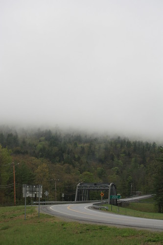
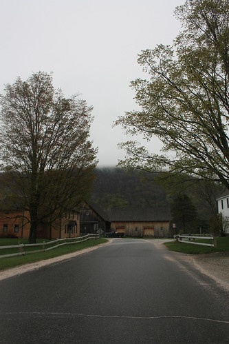
As I said earlier, the day was damp and overcast. There were some breaks of sun at times, but many times it was misty and foggy. But it allowed for some great views like this one at where VT 100 meets VT 30.
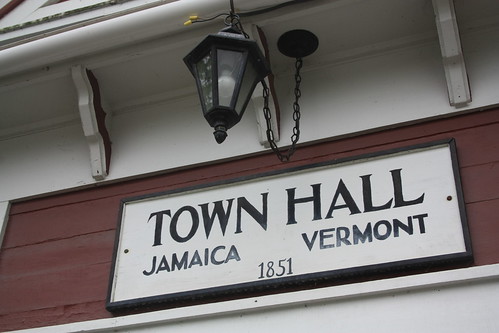
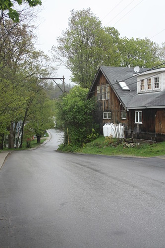
Just north of here is the Town of Jamaica. This was the first town that we stopped and walked around in.
North of Jamaica, we took a brief detour onto to VT 100A and the town of Plymouth Notch and the birthplace of President Calvin Coolidge.
The birthplace and homestead is a State Historic Site. However, when we visited, it was closed for the season. As a result, the visitor's center and a number of buildings were not open, but we were still able to walk around.
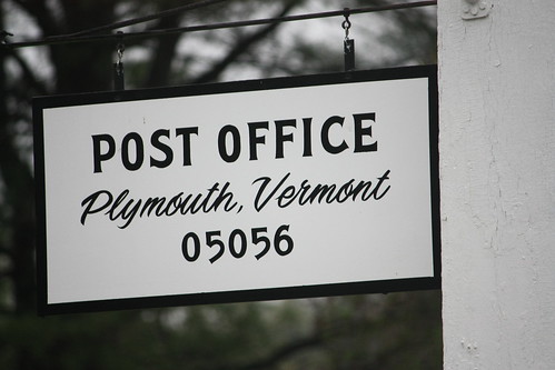
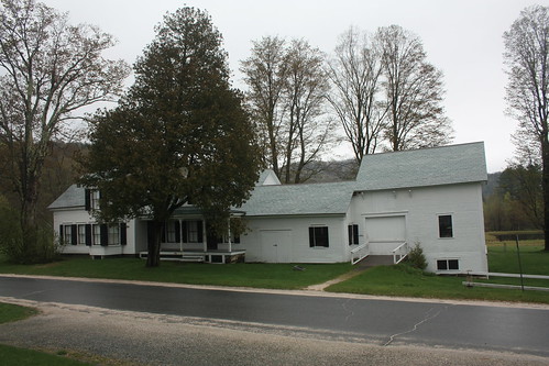
What amazed me the most about Plymouth Notch was how the Coolidge site was still part of everyday life in this part of rural Vermont.
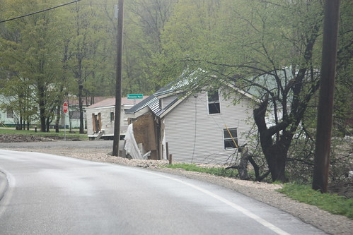
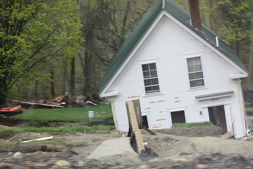
Throughout much of our time on Vermont 100, damage from the flooding that occurred from the remnants of Hurricane Irene was painfully visible. Temporary bridges, washed out homes, and downed trees were common place. Here is some of the damage from just north of Killington.
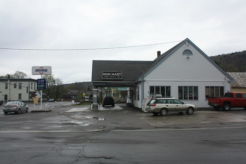
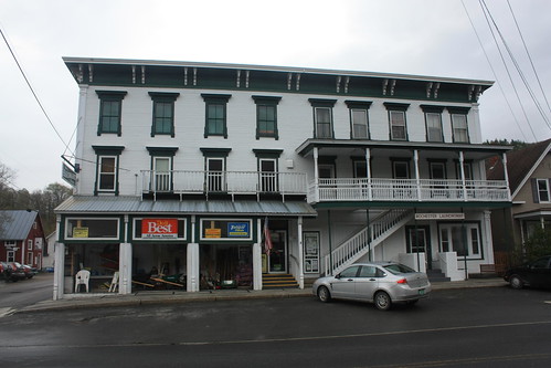
We stopped in Rochester for gas and also walked around a bit.
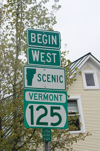
We then took a detour on Scenic VT 125 to check out Texas Falls. Route 125 is interesting as it contains a special 'Scenic' banner. And the signs we saw just off of VT 100 has a slowly disappearing white on green banners.
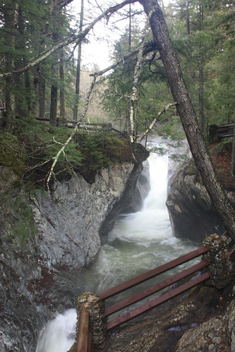
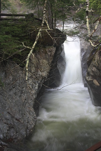
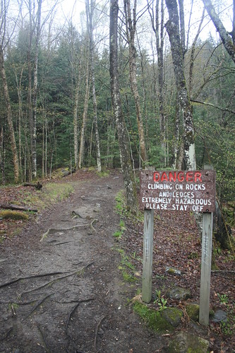
Texas Falls is worth the 10 or so minute drive off of VT 100 in Hancock. It is located within Green Mountain National Forest and is a very popular attraction. See the entire set of Texas Falls photos here.
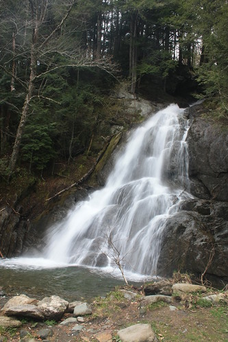
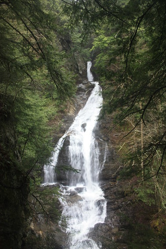
Back on VT 100, we come to another spectacular set of falls, and this is located right off the highway. Moss Glen Falls (Big and Little) are a pair of spectacular falls located near Granville.
It wouldn't be a roadtrip with Doug without finding something absurd.
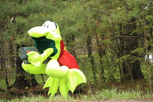
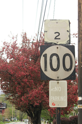
Old sign fun in Waterbury.
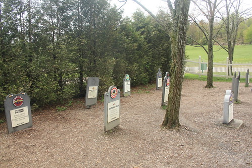
And what trip through Waterbury, Vermont wouldn't be complete without a stop at Ben & Jerry's! Or even better, the Flavor Graveyard.

We stopped and walked around the resort town of Stowe. It was very busy for a Friday afternoon in early May.

Just outside Stowe is another Moss Glen Falls. This one requires a little bit of a hike but is well worth the effort!
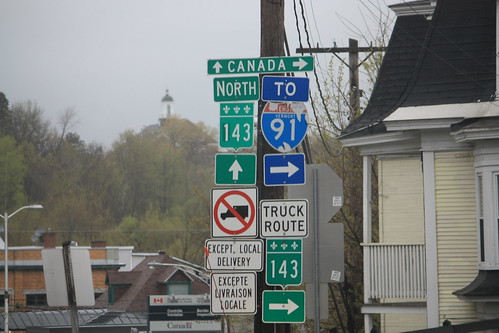
As you get closer to Canada, VT 100 takes on more of a highlands feel. And of course to prove that we did get to the North End of VT 100. Here's the end sign!
Next was a trip to Derby Line and the furthest north we could get without getting into Canada.
In Newport, there's a nice old button copy sign left over.
And you can't get any further north in Vermont than here.
We wanted to visit the Haskell Free Library and Opera House to technically be in Quebec. It is built on the boundaries of the two countries; however, we were about a half hour or so late. It closed at 5 pm.
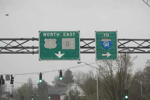
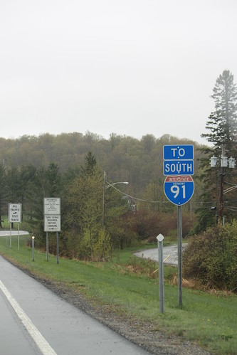
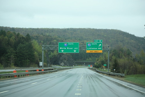
So it was onto I-91 and pretty much the beginning of Interstate 91 South - unless you were entering from Quebec.
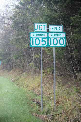
After exiting off of I-91 and taking VT 105 and VT 114 south towards Lyndonville, we did find two covered bridges in the Lyndonville Area. The Randall Bridge is off of VT 114.
Closer to Lyndonville and just off of VT 122 is the Miller's Run Covered Bridge.

From there it was back on I-91 South and then I-93 South into New Hampshire.
We'll pick up with our twilight journey into New Hampshire on the next blog post.
Well for a long time Vermont 100 has been one of those routes that I wanted to complete in one day. Nearly 216 miles on one two lane highway through the heart of Vermont. The idea of driving VT 100 in one setting was inspired by an entry in The Most Scenic Drives in America: 120 Spectacular Road Trips
How did we drive it: We left Doug's place at 6:30 am and arrived in North Conway, NH at around 8 pm.
Our Route: I-890, I-90, US 9/20, NY 150, NY 43, NY 351, NY/MA 2, MA/VT 8, VT 9 , VT 100, VT 105, US 5, I-91, VT 105, VT 114, VT 122, I-91, I-93, US 302.
(Full Disclosure: we did skip one small segment of VT 100 south of Wilmington - I had already driven that section of VT 100 numerous times so we stated on VT 8 and rejoined VT 100 in Wilmington.)
For the full photo set from the Vermont leg of this journey head here.
Of course a roadtrip into Vermont isn't complete without a stomp at the Medburyville Truss Bridge.
Doug and I now jokingly call this the "Bridge for all Seasons" or the "Bridge for all Roadtrips" because it has always been a stop. And since this was Joe's first time in New England so it was a must stop.
As I said earlier, the day was damp and overcast. There were some breaks of sun at times, but many times it was misty and foggy. But it allowed for some great views like this one at where VT 100 meets VT 30.
Just north of here is the Town of Jamaica. This was the first town that we stopped and walked around in.
North of Jamaica, we took a brief detour onto to VT 100A and the town of Plymouth Notch and the birthplace of President Calvin Coolidge.
The birthplace and homestead is a State Historic Site. However, when we visited, it was closed for the season. As a result, the visitor's center and a number of buildings were not open, but we were still able to walk around.
What amazed me the most about Plymouth Notch was how the Coolidge site was still part of everyday life in this part of rural Vermont.
Throughout much of our time on Vermont 100, damage from the flooding that occurred from the remnants of Hurricane Irene was painfully visible. Temporary bridges, washed out homes, and downed trees were common place. Here is some of the damage from just north of Killington.
We stopped in Rochester for gas and also walked around a bit.
We then took a detour on Scenic VT 125 to check out Texas Falls. Route 125 is interesting as it contains a special 'Scenic' banner. And the signs we saw just off of VT 100 has a slowly disappearing white on green banners.
Texas Falls is worth the 10 or so minute drive off of VT 100 in Hancock. It is located within Green Mountain National Forest and is a very popular attraction. See the entire set of Texas Falls photos here.
Back on VT 100, we come to another spectacular set of falls, and this is located right off the highway. Moss Glen Falls (Big and Little) are a pair of spectacular falls located near Granville.
It wouldn't be a roadtrip with Doug without finding something absurd.
Old sign fun in Waterbury.
And what trip through Waterbury, Vermont wouldn't be complete without a stop at Ben & Jerry's! Or even better, the Flavor Graveyard.
We stopped and walked around the resort town of Stowe. It was very busy for a Friday afternoon in early May.
Just outside Stowe is another Moss Glen Falls. This one requires a little bit of a hike but is well worth the effort!
As you get closer to Canada, VT 100 takes on more of a highlands feel. And of course to prove that we did get to the North End of VT 100. Here's the end sign!
Next was a trip to Derby Line and the furthest north we could get without getting into Canada.
In Newport, there's a nice old button copy sign left over.
And you can't get any further north in Vermont than here.
We wanted to visit the Haskell Free Library and Opera House to technically be in Quebec. It is built on the boundaries of the two countries; however, we were about a half hour or so late. It closed at 5 pm.
So it was onto I-91 and pretty much the beginning of Interstate 91 South - unless you were entering from Quebec.
After exiting off of I-91 and taking VT 105 and VT 114 south towards Lyndonville, we did find two covered bridges in the Lyndonville Area. The Randall Bridge is off of VT 114.
Closer to Lyndonville and just off of VT 122 is the Miller's Run Covered Bridge.
From there it was back on I-91 South and then I-93 South into New Hampshire.
We'll pick up with our twilight journey into New Hampshire on the next blog post.

Comments