
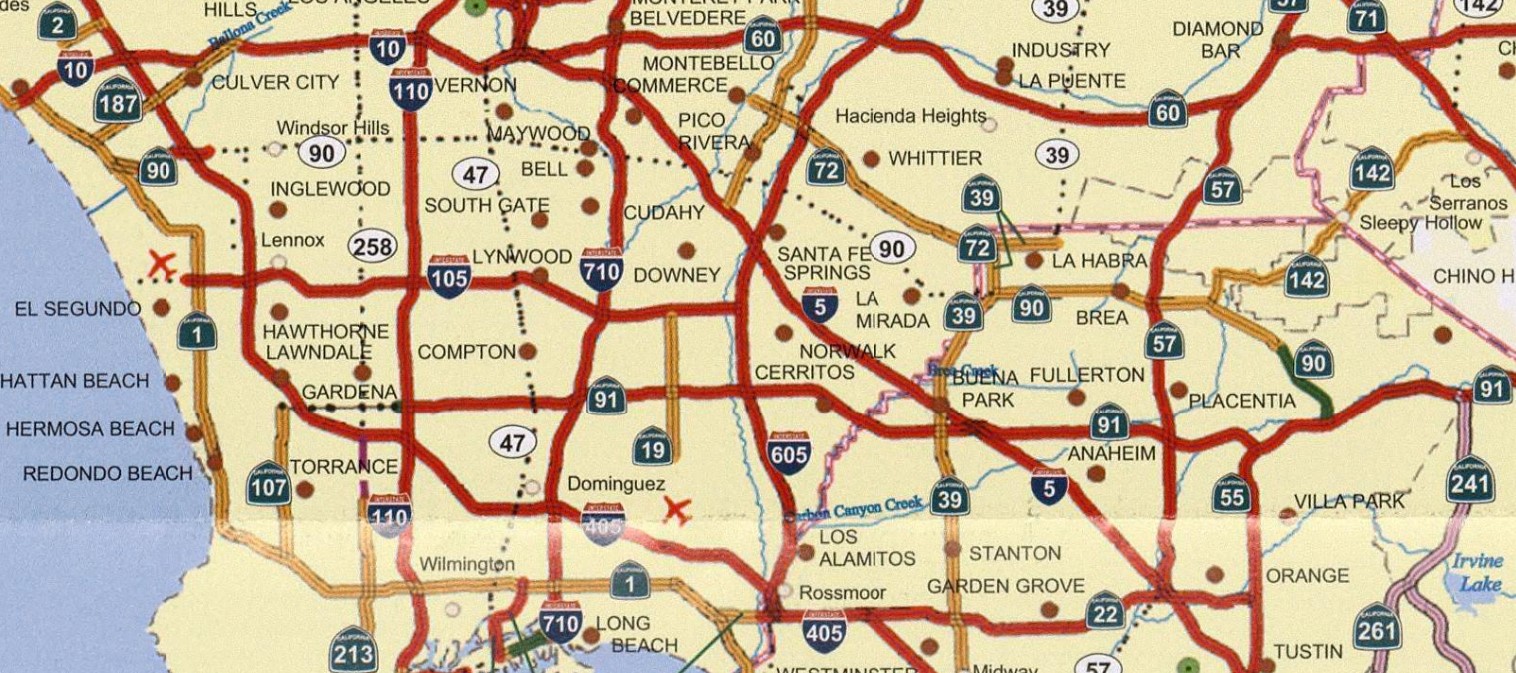
California State Route 90 is a discontinuous State Highway in the Los Angeles metro area which has a planned length of 41 miles. The western segment of California State Route 90 begins at California State Route 1 near Marina Del Rey and ends at Interstate 405 in Culver City. The western segment of California State Route 90 is 2.36 miles in length and is partially aligned on the Marina Freeway. The eastern segment of California State Route 90 consists of 12.33 miles of State Maintained roadway. Within the city of Yorba Linda California State Route 90 is locally maintained as the now relinquished Richard Nixon Parkway.
What was to become California State Route 90 (CA 90) was first added to the State Highway System as Legislative Route Number 176 (LRN 176) during 1933. The initial definition of LRN 176 was as follows:
"Buena Park-Azuza Road near La Habra to LRN 43 in Santa Ana Canyon via Brea."
LRN 176 first appears on the 1934 Division of Highways Map aligned between LRN 62 in La Habra eastward to LRN 43 via Cedar Street. For unknown reasons the planned routing of LRN 176 is displayed as completed rather than the interim alignment that actually existed at the time. LRN 176 was not assigned one of the original Sign State Routes during August 1934.


LRN 176 can be seen in detail on the 1935 Division of Highways Map of Orange County. LRN 176 can be seen originating at CA 39/LRN 62 in La Habra. LRN 176 is displayed following Cedar Street (now Imperial Highway) to Loftus. LRN 176 is seen following an interim alignment via Carolina Street (now Kramer Boulevard), Golden Avenue, Rose Drive, Citrus Avenue (now Bastanchury Road) and Plumosa Avenue to Yorba Linda. From Yorba Linda LRN 176 can be seen following Imperial Highway, Yorba Linda Boulevard, Ohio Street, Mountain View Avenue and Kellogg Drive to CA 14/LRN 175 at Placentia-Yorba Linda Boulevard. LRN 176 is displayed not yet connecting to CA 18/LRN 43.

The November 1935 California Highways & Public Works announced a new alignment of LRN 176 between Cedar Street to Luitweiler Avenue was advertised as a Federal Emergency Relief Project.


The July 1936 California Highways & Public Works features an article regarding mastodon bones being found during the excavation of the new alignment of LRN 176 on Imperial Highway.

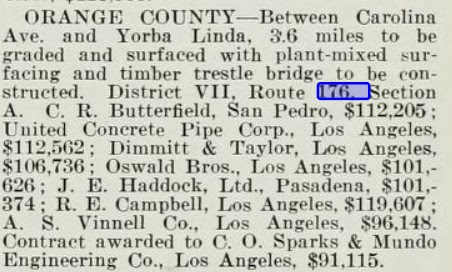
A contract to grade and surface the new alignment of LRN 176 between Carolina Street to Yorba Linda is listed as being awarded in the January 1937 California Highways & Public Works.
The August 1937 California Highways & Public Works announced the completion of the new alignment of LRN 176 on Imperial Highway. The Brea-Yorba Linda segment of LRN 176/Imperial Highway is stated to have opened on July 31st, 1937. Imperial Highway is stated to have an eventual planned western terminus in El Segundo.


The new alignment of LRN 176 on Imperial Highway between Brea-Yorba Linda appears on the 1938 Division of Highways Map.

The September 1939 California Highways & Public Works announced contracts to build new segments of CA 18/LRN 43, CA 14/LRN 175 and LRN 176 had been awarded.

The planned extension of LRN 176 from Yorba Linda to CA 18/LRN 43 appears on the 1940 Division of Highways Map.

The next segment of highway which would become part of modern CA 90 was defined via 1947 Legislative Chapter 11 as LRN 221. LRN 221 was originally carried the following definition:
"A point on LRN 60 (US Route 101A) near Los Angeles Airport to a point on LRN 165 (US Route 6/CA 11) between Santa Barbara and Slauson Avenues.
LRN 221 appears for the first time on the 1948 Division of Highways Map.

The November/December 1952 California Highways & Public Works a new bridge structure over the Santa Ana River was contracted to be constructed on CA 14/LRN 175 over the Santa Ana River to Route 91/CA 18/LRN 43.

The 1953 Division of Highways Map displays a new planned realignment of LRN 176 south of Yorba Linda. The planned realignment of CA 14/LRN 175 appears to have been the cause of the shifting of the planned corridor of LRN 176 to US Route 91/CA 18/LRN 43.

1953 Legislative Chapter 1836 changed the definition of LRN 221 to the following:
"Los Angeles International Airport to a point on LRN 165 the Harbor Freeway, between Santa Barbara Avenue and Florence Avenue."
The new definition of LRN 221 along with proposed routing appears on the 1954 Division of Highways Map.

The November/December 1954 California Highways & Public Works announced LRN 176/Imperial Highway between CA 39/LRN 62 and LRN 2 was budgeted to be widened during the 1955-56 Fiscal Year.
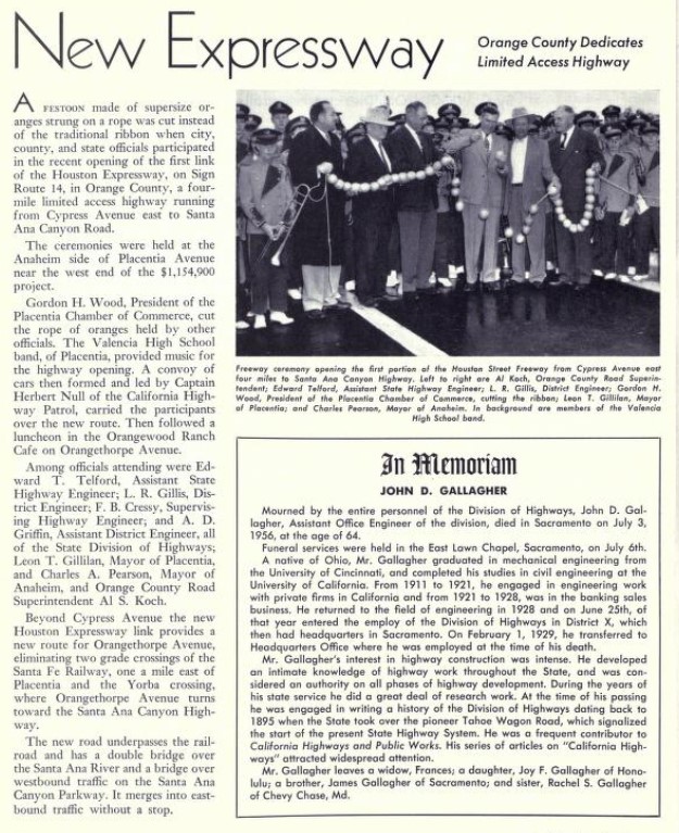
The July/August 1956 California Highways & Public Works announced CA 14/LRN 175 had been shifted to the first unit of the Houston Expressway between from Cypress Avenue to Santa Ana Canyon Road. The realignment of CA 14/LRN 175 onto the Houston Expressway extended LRN 176 to finally reach US Route 91/CA 18/LRN 43.
LRN 176 can be observed reaching US Route 91/CA 18/LRN 43 on the 1957 Division of Highways Map.

The January/February 1959 California Highways & Public Works announced LRN 176 had been adopted as a freeway corridor by the California Highway Commission on January 15th, 1952. The "Route 176 Freeway" is stated to planned to connect Yorba Linda Boulevard to the Newport Freeway. LRN 176 had been added to the Freeway & Expressway System when it was created during 1959.

LRN 221 was also added to the Freeway & Expressway System during 1959. 1959 Legislative Chapter 1062 changed the definition of LRN 221 to the following:
"LRN 60 northwest of the Los Angeles International Airport to LRN 170."
The planned Route 176 Freeway corridor, the definition of LRN 221 and newly planned alignment of LRN 221 all appear on the 1960 Division of Highways Map.


The January/February 1960 California Highways & Public Works announced LRN 221 as Marina Freeway. LRN 221 and the Marina Freeway corridor between US Route 101A/LRN 60 at Lincoln Boulevard east to CA 7/Sepulveda Boulevard had been adopted by the California Highway Commission on December 16th, 1959.

The January/February 1960 California Highways & Public Works referenced the Route 176 Freeway as the "Imperial Freeway."

The November/December 1960 California Highways & Public Works announced 2.3 miles of the Route 176 freeway had been budgeted initial two-lane construction during the 1961-62 Fiscal Year.
The March/April 1961 California Highways & Public Works referenced the Route 176 Freeway being renamed the "Imperial-Yorba Linda Freeway." The planned imperial-Yorba Linda Freeway is stated to have been extended to US Route 101/Interstate 5 at the Santa Ana Freeway. Construction of the Yorba Linda Freeway from US Route 91/LRN 43 at the Riverside Freeway 2.3 miles towards Yorba Linda is stated to be under way.


The March/April 1963 California Highways & Public Works referenced the planned Marina Freeway as being 2.6 miles between Lincoln Boulevard to Interstate 405/San Diego Freeway. Planned LRN 221 east of Interstate 405 is stated to have been named the "Slauson Freeway."

The initial 2.3 miles of the Yorba Linda Freeway were between US Route 91/Riverside Freeway-Yorba Linda were announced as having opened on February 8th, 1963 (the 1962 date shown is a typo) according to the March/April 1963 California Highways & Public Works.

The 1964 State Highway Renumbering deleted the Legislative Route Numbers in favor of actual Sign State Route signage. LRN 221 was redefined as CA 90 which carried an initial definition of:
"Route 1 northwest of the Los Angeles International Airport to Route 605."
LRN 176 was redefined as a segment of CA 42 which included the newly opened Yorba Linda Freeway:
"Route 1 west of Inglewood to Route 91 in Santa Ana Canyon via the vicinity of Norwalk."
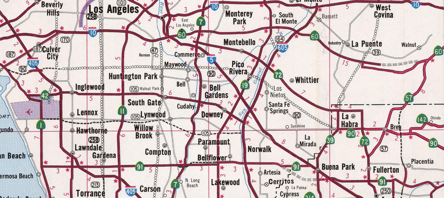
CA 90 and the extended CA 42 both appear on the 1964 Division of Highways Map. The Yobra Linda Freeway segment of CA 42 is shown having a connection in Downey near Firestone Avenue and CA 19. The Slauson Freeway segment of CA 90 is shown ending at Norwalk Boulevard near planned Interstate 605.

The March/April 1964 California Highways & Public Works details the planned scale CA 90. CA 90 is cited to be planned as 22.2 miles consisting of both the Mariana Freeway and Slauson Freeway corridors. The corridor of CA 90 is cited to planned to connect CA 1/Pacific Coast Highway at Lincoln Boulevard east to Interstate 605/San Gabriel River Freeway.


The March/April 1964 California Highway & Public Works features a photo of the completed segment of the Yorba Linda Freeway on CA 42. Notably the two-lane segments described in earlier volumes of the California Highways & Public Works can be seen immediately south of Orangethorpe Avenue.

1965 Legislative Chapter 1330 transferred the portion of CA 42 from Route 605 to the junction of Route and CA 42 east of La Habra to CA 90. Thusly The definition of CA 90 thusly changed to "Route 90 is from Route 1 northwest of the Los Angeles International Airport to the junction of Routes 39 and 42 near La Habra."
The March/April 1965 California Highways & Public Works announced numerous upcoming contracts to build the Marina Freeway. The first contract on the Marina Freeway is cited to be upcoming up for bid and would consist of the CA 90/Interstate 405 interchange which would include construction of the Slauson Avenue-Centinela Boulevard corridor. CA 90 and the Marina Freeway west of Centinela Boulevard are cited to be dependent upon adoption of the freeway segment.


The rerouting of the planned corridor of CA 90 to CA 39/CA 42 in La Habra first appears on the 1966 Division of Highways Map.

The November/December 1966 California Highways & Public Works features a construction photo of the CA 90 Marina-Slauson Freeway and Interstate 405 San Diego Freeway Interchange.

The California Highways & Public Works publication ended during 1967 when initial segment of the Marina was not yet completed. During 1968 the initial segment of CA 90 on the Marina Freeway opened to traffic which included the Interstate 405/San Diego Freeway Interchange. 1968 Legislative Chapter 282 transferred CA 42 east of La Habra to Route 91 to CA 90 which included the existing Yorba Linda Freeway. The first segment of the Marina Freeway and CA 90 east of La Habra to CA 91 appears on the 1969 Division of Highways Map. The new definition of CA 90 is displayed as "Route 1 northwest of the Los Angeles International Airport to Route 91 in Santa Ana Canyon passing near La Habra.
Between 1971 to 1976 entirety of CA 90 (constructed and planned) was renamed to Richard M. Nixon Freeway. The CA 90 freeway corridors reverted to their previous names after the resignation of Richard Nixon as President of the United States during the Watergate Scandal. CA 90 is shown following a completed expressway grade west of Centinela Avenue to CA 1 at Pacific Coast Highway on the 1975 Caltrans Map. The 1975 Caltrans Map displays the Slauson Freeway corridor of CA 90 as having a determined routing east to La Brea Avenue and undetermined to CA 39 in La Habra.

The 1981 Caltrans Map displays the adopted CA 90 freeway corridor east of Interstate 405 to La Brea Avenue as reverting to a undetermined routing. It is unclear when the California Highway Commission or California Transportation Commission dropped the adopted freeway routing of CA 90 between Interstate 405 and La Brea Avenue.

A. CA 90 ceases to be a State Highway.
B. May not considered for future adoption as a State Highway.
C. The City of Yorba Linda is required to ensure the continuity of traffic flow on the relinquished portion of Route 90 including traffic signal progressions) and must maintain signs directing motorists to the continuation of Route 90.
2003 Assembly Bill, Chapter 525 changed the legislative definition of CA 90 to reflect the relinquishment of CA 90 in Yorba Linda. The locally maintained segment of CA 90 on what was Yorba Linda Freeway was renamed to Richard Nixon Parkway. The new definition of CA 90 reflecting the relinquishment of the highway in Yorba Linda appears on the 2005 Caltrans Map.

Between 2005 and 2007 the Marina Freeway segment of CA 90 was extended west of Culver Boulevard which included a new interchange. The March 2006 Daily Breeze featured a plan by the Los Angeles County Public Works department to extend the Marina Freeway west of CA 1/Lincoln Boulevard to Admiralty Way as a non-State Highway facility. Construction is stated to have an anticipated target start date during 2011 but nothing ultimately materialized with the planned project.
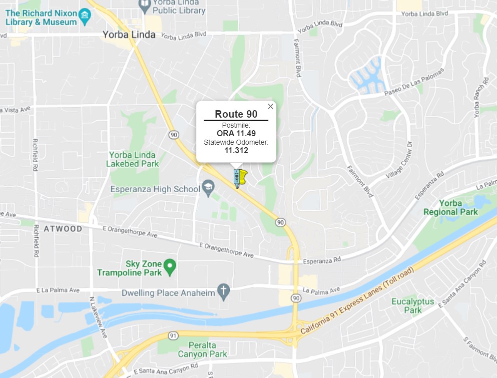
The eastern segment of CA 90 between CA 39 in La Habra to CA 91 is shown currently State Maintained from Postmiles ORA 0.5-8.14 and ORA 11.49-12.82 factoring the relinquishment in Yorba Linda.


Part 2; a drive on the Marina Freeway segment of California State Route 90
From CA 1/Lincoln Boulevard southbound near Marina del Rey traffic can access CA 90 towards the Marina Freeway.

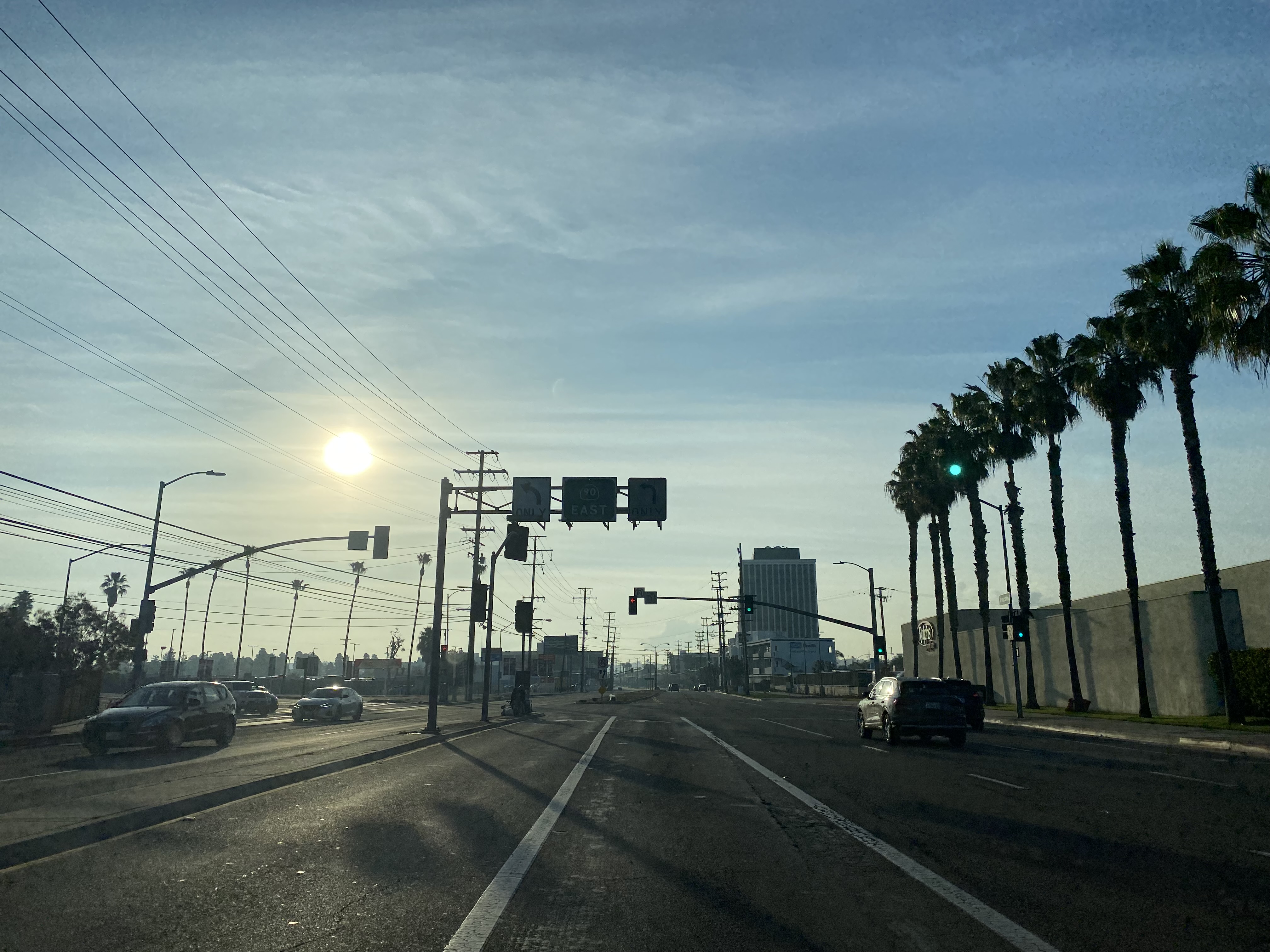
CA 90 eastbound follows the Marina Expressway to Culver Boulevard where the Marina Freeway begins. CA 90 accesses Culver Boulevard via an unnumbered Exit.

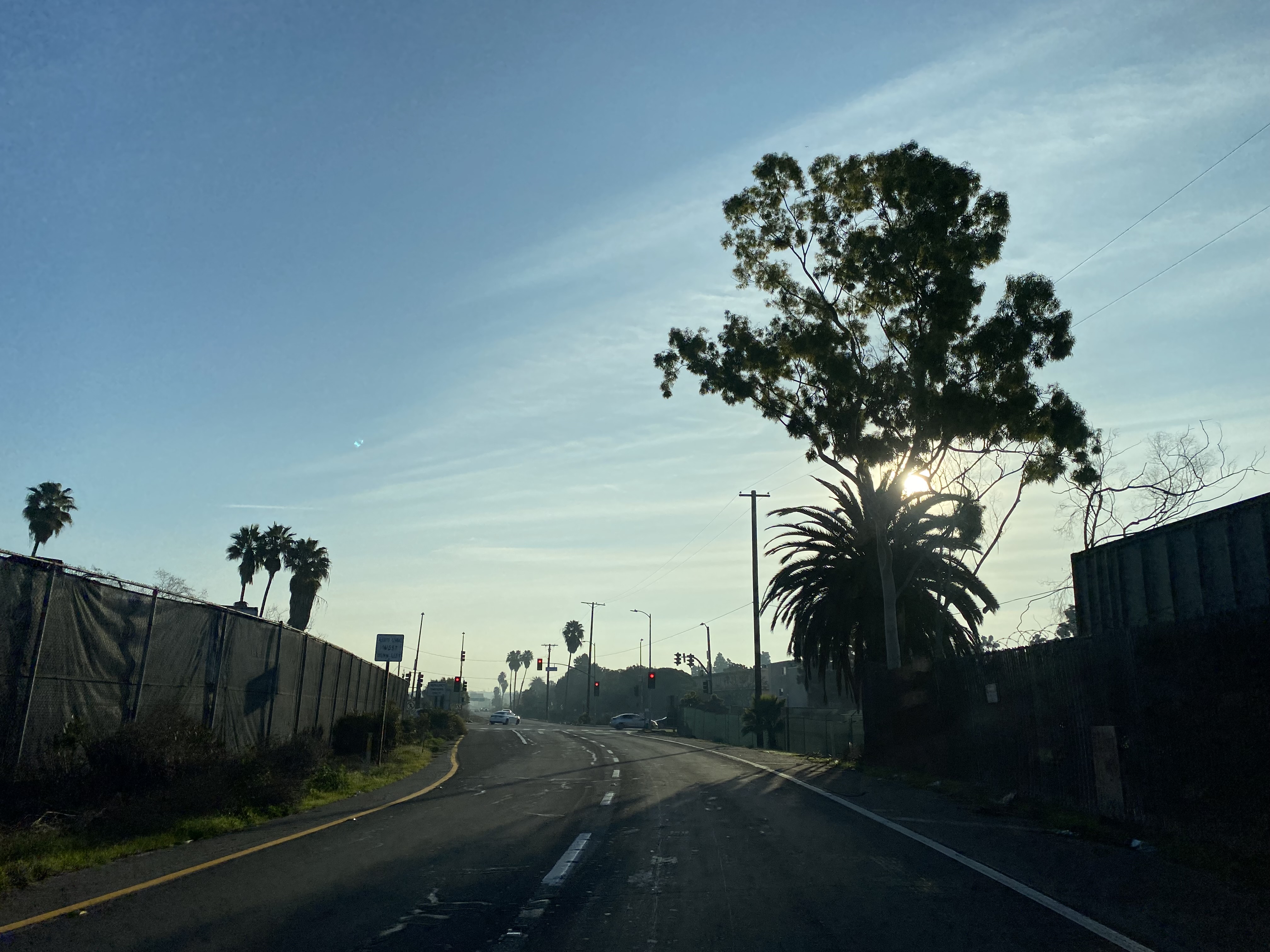


Upon joining the Marina Freeway CA 90 eastbound accesses Centinela Avenue at Exit 1

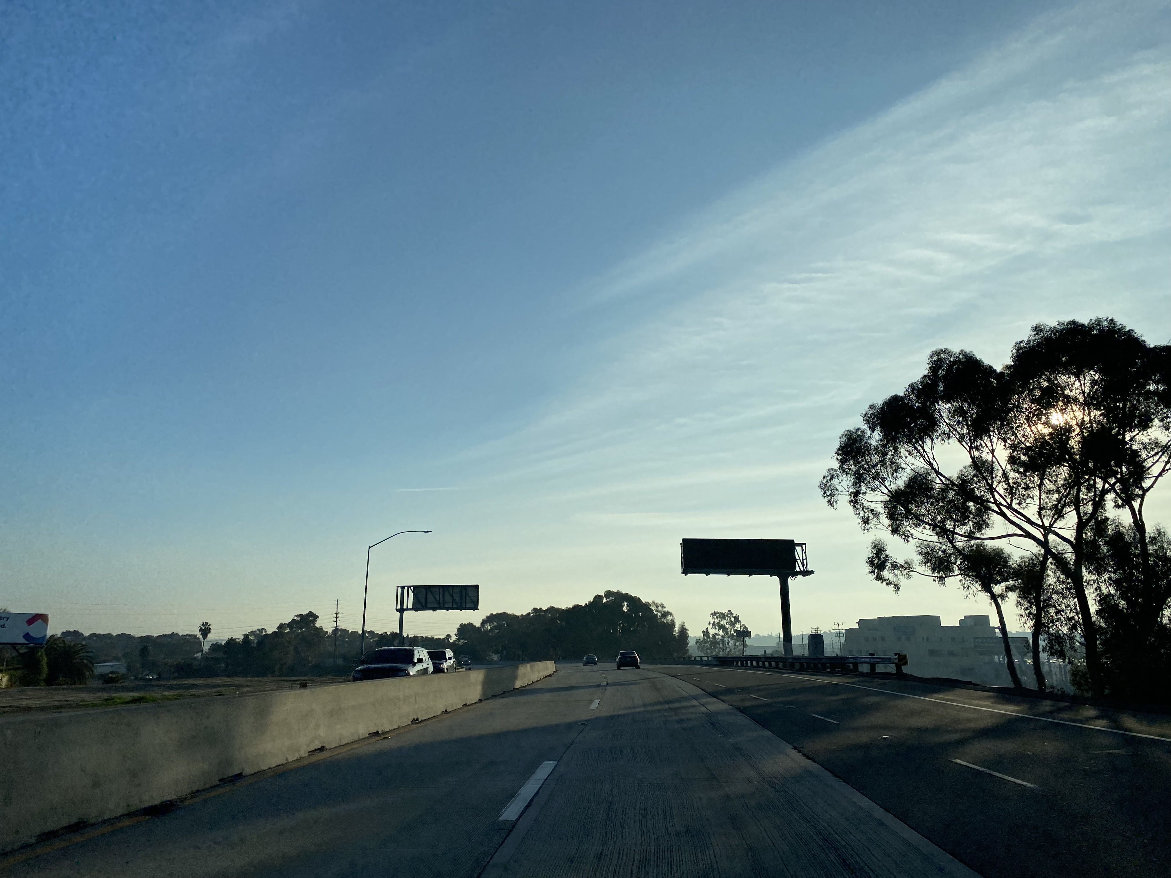


CA 90 eastbound on the Marina Freeway intersects Interstate 405/San Diego Freeway at Exit 2.


East of Interstate 405 the Marina Freeway and western segment of CA 90 terminates Postmile LA T3.278 at Slauson Avenue in Culver City.

Comments