
A near table setting in Franklin, Kentucky

When you come to a fork in the road, take it ---Yogi Berra
The fork in the road - where road trip adventures sometimes begin...or end. A decision point, a local landmark, and in Simpson County, Kentucky - a 21-foot piece of art.

Designed, built, and installed by welding students at Franklin-Simpson High School in 2018 - the literal "fork in the road" stands at the intersection of Uhls and Bunch Road outside of Franklin in South Central Kentucky.   The piece of art instantly became a hit - attracting visitors from Kentucky, nearby Tennessee, and all over the country.

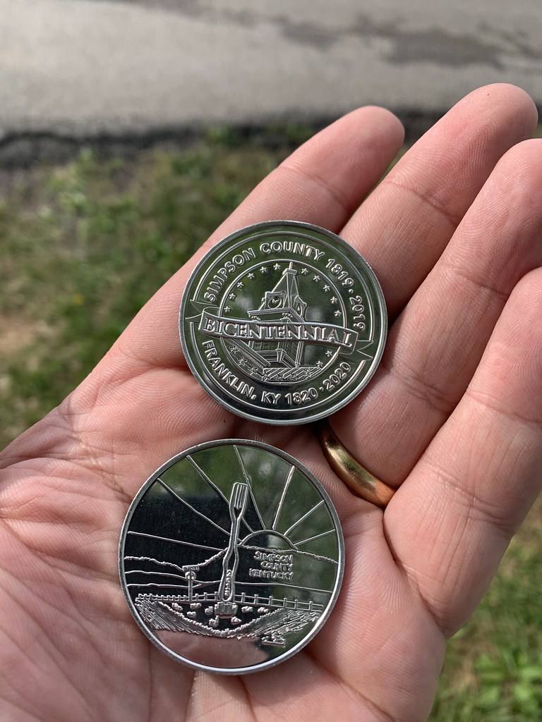
Simpson County Bicentennial Commemorative Coins that feature the Fork in the Road.

The Fork in the Road is celebrated throughout Simpson County.  During the county's bicentennial in 2019, commemorative coins featured the fork.  When I was visiting here in May 2022, I was fortunate to receive two of the Simpson County Bicentennial Coins from a passerby.


Three years later - the students at Franklin-Simpson High School were at it again.  This time, the welding students created a 24-foot butter knife sculpture.  Called "The Cutting Edge of Simpson County," it is located at the Blackjack Sculpture Park along Blackjack Road - only a few miles from the "fork."  The sculpture is considered the world's largest butter knife.

The latest addition to FSHS' public art portfolio is a working weathervane that features a glider airplane with a 48' wingspan.

The sculpture park is home to other FSHS welding class creations, including a glider weathervane and the Captain Wildcat Space Shutter.  Franklin-Simpson's welding classes have also created additional public art within Franklin.  

There's no word yet on when FSHS students will complete the table setting with a giant spoon.  

All photos taken by post author - May 3, 2022.

Further Reading:

How To Get There:

Comments

Popular posts from this blog

Did Caltrans just kill the G26 cutout US Route shields?

The US Route System was formally created by the American Association of State Highway Officials during November 1926.  Through the history of the system the only state to which has elected to maintain cutout US Route shields has been California.  The G26 series cutout US Route shields have become a favorite in the road enthusiast hobby and are generally considered to be much more visually pleasing than the standard Federal Highway Administration variant.  However, the G26 shield series appears to have been killed off on January 18, 2026, when Caltrans updated their Manual of Uniform Traffic Control Devices.  This blog will examine the history of the US Route shield specifications in California and what is happening with the 2026 changes.  The blog cover photo is facing towards the terminus of California State Route 136 and at a G26-2 specification US Route 395 shield.  In the background Mount Whitney can be seen in the Sierra Nevada range.   ...

Hawaii Route 50

Hawaii Route 50 is the longest Sign Route on the island of Kauai at 32.6 miles.  The entirety of Hawaii Route 50 is overlaid atop Kaumualii Highway from Lihue west to the Pacific Missile Range Facility at Barking Sands. Hawaii Route 50 is one of the original 1955-era State Highway designations on Kauai.  Much of the Kaumualii Highway corridor was constructed during the sugar plantation boom of the late Hawaiian Kingdom.  The first tee beam bridge in Hawaii would be constructed along the Kaumualii Highway in 1911 at the Hanapepe.  Much of this highway would be modernized to two-lane standards through the 1930s and 1940s. This page is part of the Gribblenation Hawaii Roads series.  A compellation of all Hawaii-related media from both Gribblenation and RoadwayWiz can be found by clicking  here .  Part 1; the history of Hawaii Route 50 and Kaumualii Highway Hawaii Route 50 is the longest highway on Kauai at 32.6 miles.  The highway begins at Rice Str...

Ghost Town Tuesday; Nichols, FL

A couple years ago I spent a lot of spare time exploring phosphate mining ghost towns in the Bone Valley of Polk County, Florida.  One ghost town in particular called Nichols on Polk County Route 676 west of Mulberry caught my eye due to a relative lack of documentation on ghosttowns.com. Nichols was created in 1905 during the early phosphate mining boom in the Bone Valley region.  For the time Nichols was unusual since it had company housing in the Nichols Mine site and private residences outside the gate.  Nichols is only about two miles west of Mulberry which probably made it a somewhat reasonable commute even by the wonky standards of the early 20th Century.  Most of the Bone Valley region was relatively remote which made commuting or homesteading impractical which is why there are so many ghost towns in the area.  The company housing section of Nichols was phased out and abandoned by 1950. The Nichols town site is largely abandoned and could "possibl...