Throwback Thursday; Chiricahua National Monument, Arizona State Route 186 and Arizona State Route 181
Back in 2012 I was trying to clinch as many of the Arizona State Routes as I could and visit all the National Monuments located in the State. When I had some free time during the winter months I made my way towards Willcox to visit Chiricahua National Monument. During my trip towards the National Monument I took AZ 186 from I-10/US 191 in Willcox and AZ 181 to US 191 as I was leaving.

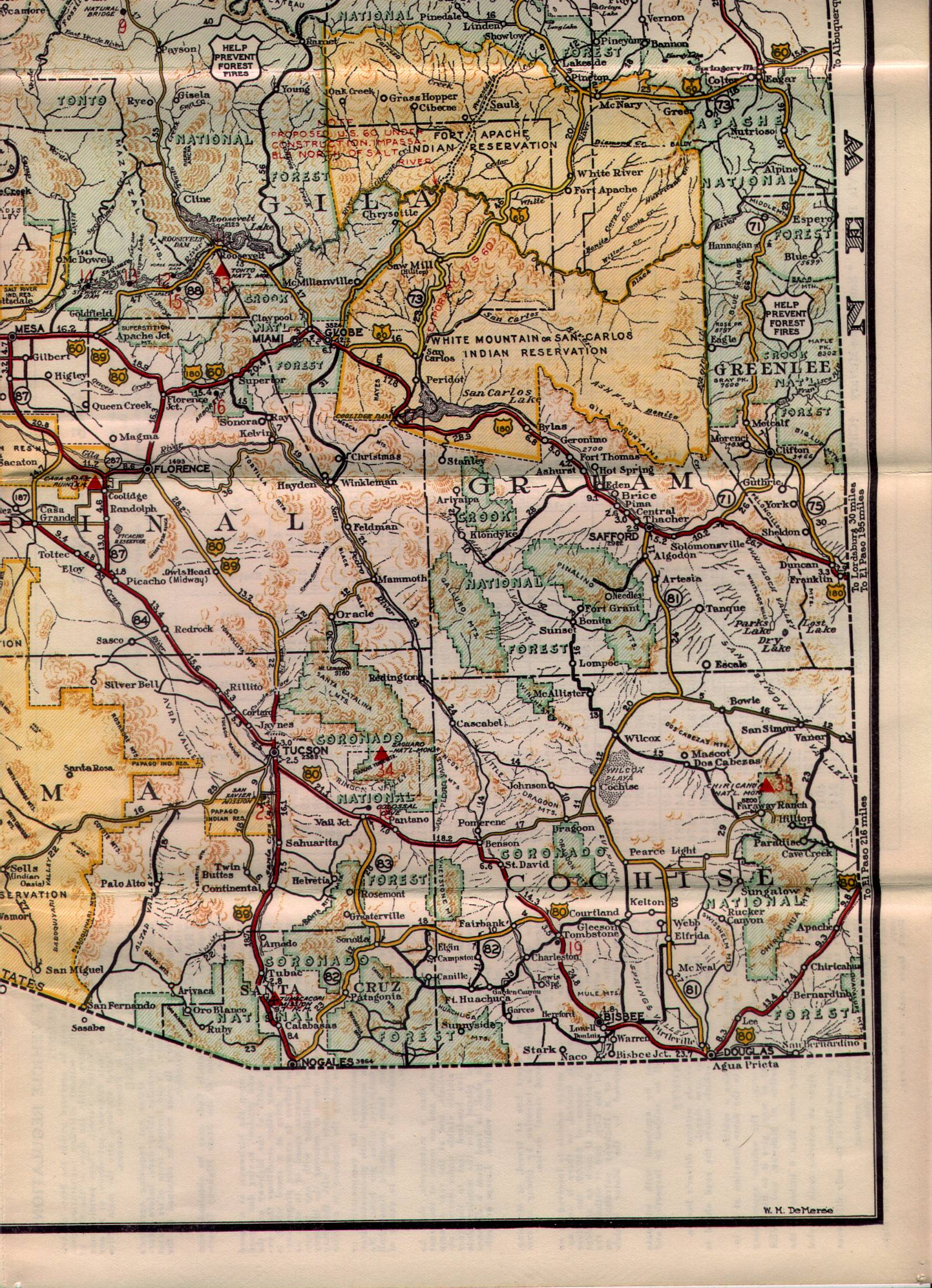
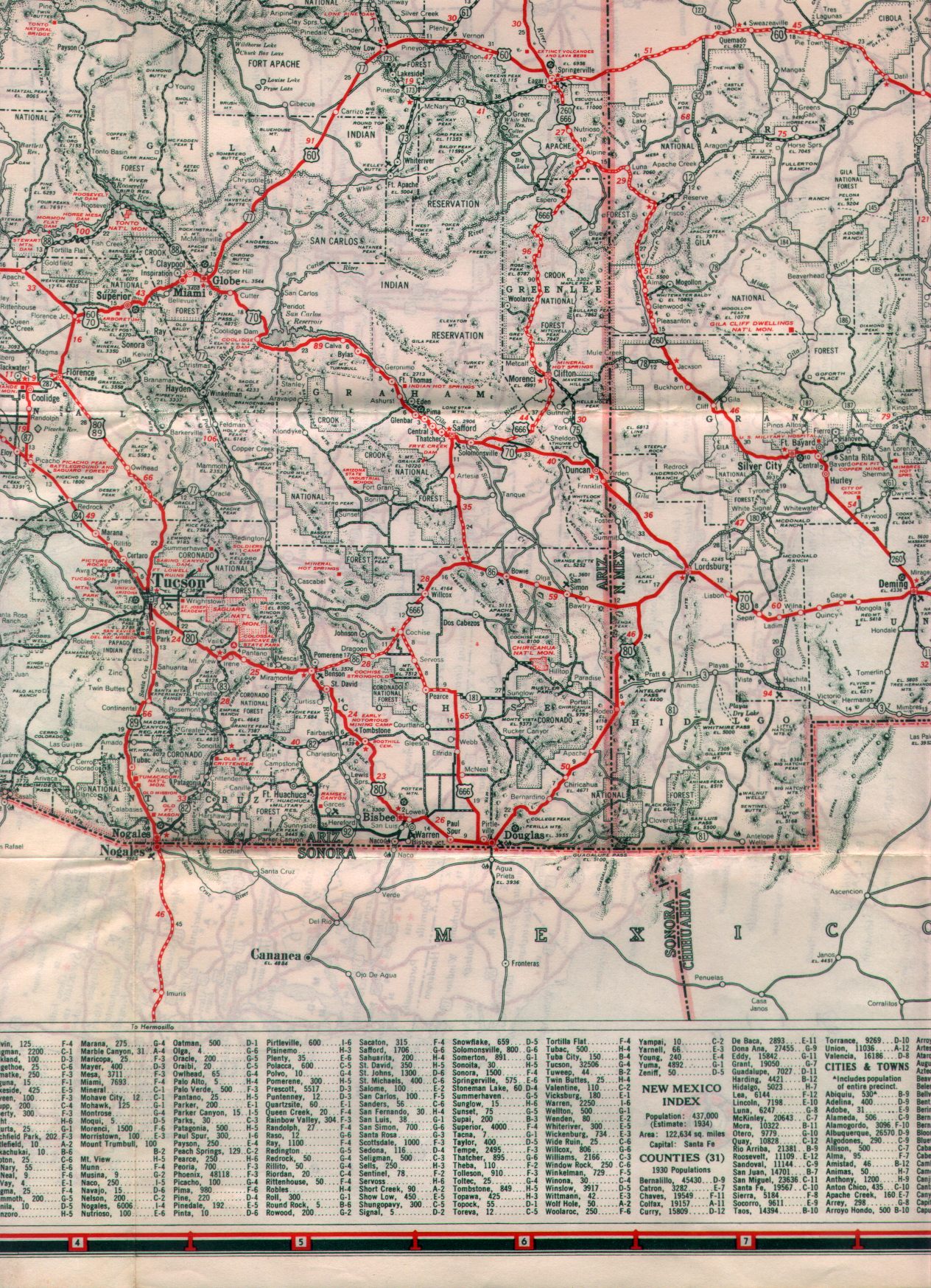
AZ 186 is an approximately 33.4 mile state route. AZ 186 begins at a junction with I-10/US 191 in Willcox on Rex Allen Drive and continues to Haskell Avenue. AZ 186 uses a former alignment of AZ 86 on Haskell Avenue to reach Marley Street. AZ 186 exits Willcox on Marley Street heading eastward towards Chiricahua National Monument. East of Willcox the alignment of AZ 186 enters the Dos Cabezas Range and passes by a small community of the same name before meeting AZ 181 at an eastern terminus near Chiricahua National Monument.
AZ 186 was supposedly created in 1955. The route is not present on the 1951 State Highway Map but is displayed on the 1956 edition.
1951 State Highway Map
1956 State Highway Map
After completing my route clinch of AZ 186 I took AZ 181 eastward into the Chiricahua Mountains and Chiricahua National Monument.

The Chiricahua Mountains is a 35x21 mile range central to Cochise County. The Chiricahua Range generally is above 6,000 feet but has a high point of Chiricahua Peak at 9,759 feet above sea level. The Chiricahua Range and by extension National Monument features volcanic rock hoodoos which were formed from a volcanic eruption in the Turkey Creek Caldera approximately 27 million years ago.
When I visited Chiricahua National Monument the weather was supposed to be good in Cochise County. However, when I approached the Chiricahua Range I encountered heavy fog and light snow attempting to drive above the clouds to Massai Point. I eventually settled for some lower elevation hiking to view the hoodoos.


Near the entrance to Chiricahua National Monument is the Faraway Ranch Historic District. The Faraway Ranch District was apparently first settled Ja Hu Stafford in 1879. The Faraway district is generally more well known for an 1885 Cavalry Camp which was part of the last military campaign to capture Apache leader Geronimo. Erickson Ranch was plotted in 1887 and eventually became part of Chiricahua National Monument when it was created in 1924.


Leaving Chiricahua National Monument I took AZ 181 westward to US 191. AZ 181 has a strange alignment with various 90 degree turns as it approaches US 191. AZ 181 is approximately 26.8 miles long and has only one community known as Sunizona along it's alignment. AZ 181 was created at some point between between 1935 and 1938 when it would have had a western terminus at AZ 81. AZ 181 is not seen on the 1935 Arizona State Highway Map but appears on the 1938 Edition when AZ 81 had been renumbered to US 666.
1935 State Highway Map Sectional
1938 State Highway Map Sectional
Comments