
On a sunny Saturday afternoon, Joe and I took a brief six hour trip into Southside Virginia.
The Route: US 64, I-95, NC/VA 46, US 1, VA 40, US 301, NC 48, I-95, US 64.
Photo set on flickr - right here.
You know it's going to be a good trip when the first photo of the day is of an increasingly rare Interstate 95 North Carolina shield.
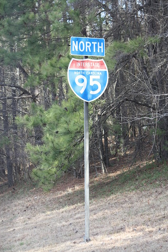
Funny thing is, this was the only photo I took in North Carolina on this trip.
About an hour later, we found ourselves in Lawrenceville, Virginia and decided to take a walk around.
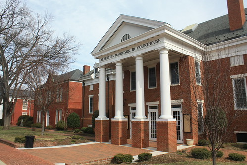
Lawrenceville is the Brunswick County Seat, and the courthouse - named after Albertis S. Harrison, Jr. - is rather impressive.
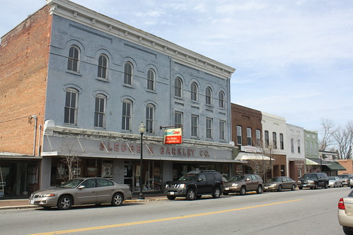
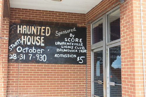
Like many small rural towns, there were more abandoned storefronts than open. An old Star Value Grocery Store only sees use as a Haunted House in the fall, with the exception of the two newspaper boxes in front of the store.
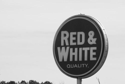
The open grocery store in town is something you don't see every day, Red & White.
We stayed north on VA 46 to Alberta, where we turned onto US 1 North.
In March of 2010, Virginia designated all of US 1 as "Historic Route 1". This was done to promote travel tourism - similar to Route 66 or some of the designated scenic or historical byways in other states. New stand alone US 1 trailblazers have recently been erected throughout the state like the one we found in rural Brunswick County.
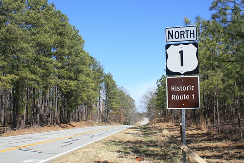
Personally, I like this idea. Though I don't think it will lead to the economic development that legislators desire, there are certainly people, like myself, who do enjoy driving - and plan day trips around - designated historic or scenic byways.
Unfortunately, the idea of US 1 travel tourism wasn't done in time to save the old Wimurt's Motel and Restaurant near McKenney.
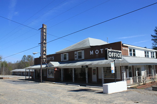
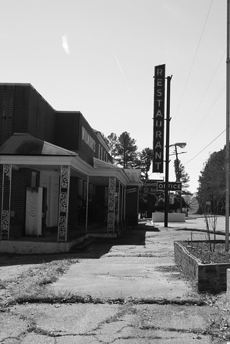
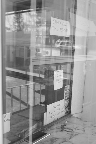
If you have a chance, stop by this old motel and restaurant. It's a true roadside museum with relics such as old merchant stickers with names long gone like "Master Charge".
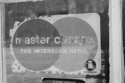
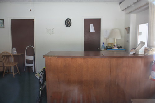
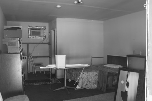
Other stickers date as recent as 2004-05. So it wasn't that long ago, that this old place was open. The motel lobby doesn't appear that dilapidated. Nor do the old motel rooms that you can pretty much walk right in.
From McKenney, we took VA 40 east to Stony Point where we hit US 301 and headed south. It was along US 301 where we came across two great finds.
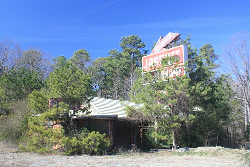
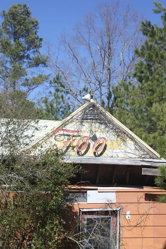
The first - the long abandoned Jarratt Restaurant. Which I believe also had a motor lodge.
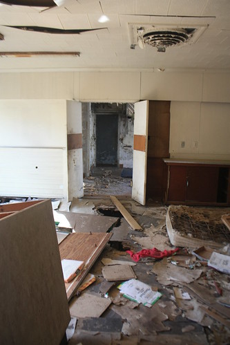
The interior of the building is pretty much beyond repair - and has been home to numerous squatters seeking some sort of refuge.
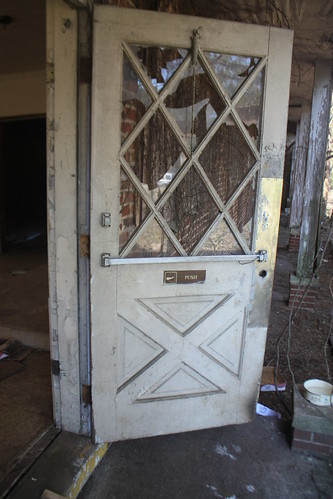
The old exit or entrance door is still operating and its creaking back and the forth broke an uneasy silence.
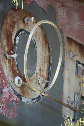
The neon tubing for the motor court office sign is pretty much all gone - with the exception of a still intact 'O' - which I found pretty interesting.
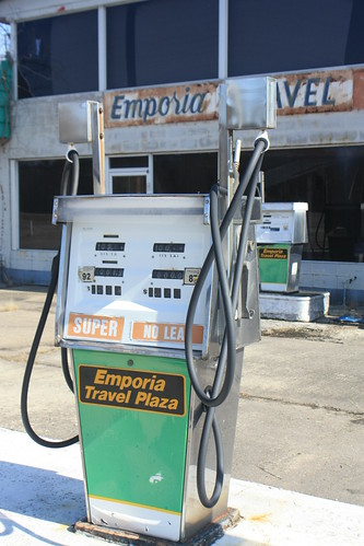
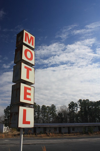
Further south on US 301 near Emporia, there was a triple abandoned treat. A closed motel (Dixie Motel), restaurant (Carol's Diner), and gas station (Emporia Travel Plaza).
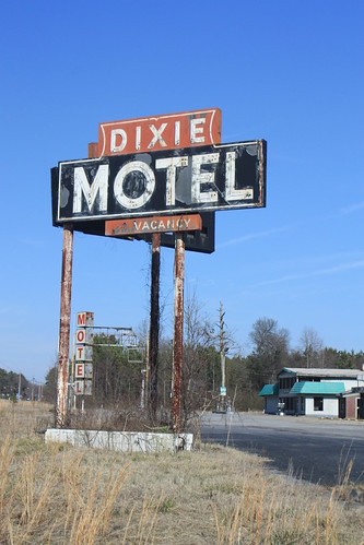
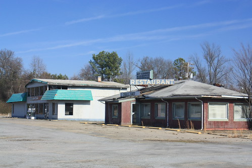
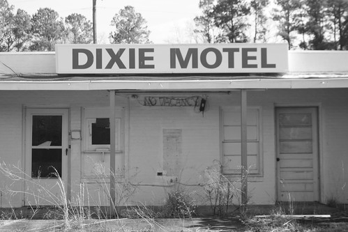
The Dixie Motel has been recently been condemned. Or at least the most recent (January 2011) posting says so.
Over at the Emporia Travel Plaza. There were old analog gas pumps.
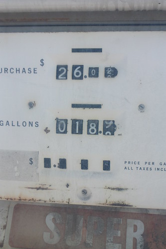
Including one that seemed to register its last sale. $26.02 for 18.9 gallons of Super Unleaded.
Inside the old travel plaza, there may have been one hint to when it closed. An old "We Card" sticker for cigarettes was on the checkout counter. It read, "1978".
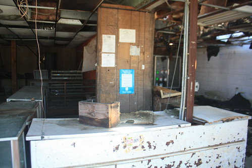
Which could mean this old gas station has been closed since 1996.
Finally, I came across this interesting blog entry on the old Dixie Motel - it's worth the read, and the photos are great too.
Well that's it until the next trip.
The Route: US 64, I-95, NC/VA 46, US 1, VA 40, US 301, NC 48, I-95, US 64.
Photo set on flickr - right here.
You know it's going to be a good trip when the first photo of the day is of an increasingly rare Interstate 95 North Carolina shield.
Funny thing is, this was the only photo I took in North Carolina on this trip.
About an hour later, we found ourselves in Lawrenceville, Virginia and decided to take a walk around.
Lawrenceville is the Brunswick County Seat, and the courthouse - named after Albertis S. Harrison, Jr. - is rather impressive.
Like many small rural towns, there were more abandoned storefronts than open. An old Star Value Grocery Store only sees use as a Haunted House in the fall, with the exception of the two newspaper boxes in front of the store.
The open grocery store in town is something you don't see every day, Red & White.
We stayed north on VA 46 to Alberta, where we turned onto US 1 North.
In March of 2010, Virginia designated all of US 1 as "Historic Route 1". This was done to promote travel tourism - similar to Route 66 or some of the designated scenic or historical byways in other states. New stand alone US 1 trailblazers have recently been erected throughout the state like the one we found in rural Brunswick County.
Personally, I like this idea. Though I don't think it will lead to the economic development that legislators desire, there are certainly people, like myself, who do enjoy driving - and plan day trips around - designated historic or scenic byways.
Unfortunately, the idea of US 1 travel tourism wasn't done in time to save the old Wimurt's Motel and Restaurant near McKenney.
If you have a chance, stop by this old motel and restaurant. It's a true roadside museum with relics such as old merchant stickers with names long gone like "Master Charge".
Other stickers date as recent as 2004-05. So it wasn't that long ago, that this old place was open. The motel lobby doesn't appear that dilapidated. Nor do the old motel rooms that you can pretty much walk right in.
From McKenney, we took VA 40 east to Stony Point where we hit US 301 and headed south. It was along US 301 where we came across two great finds.
The first - the long abandoned Jarratt Restaurant. Which I believe also had a motor lodge.
The interior of the building is pretty much beyond repair - and has been home to numerous squatters seeking some sort of refuge.
The old exit or entrance door is still operating and its creaking back and the forth broke an uneasy silence.
The neon tubing for the motor court office sign is pretty much all gone - with the exception of a still intact 'O' - which I found pretty interesting.
Further south on US 301 near Emporia, there was a triple abandoned treat. A closed motel (Dixie Motel), restaurant (Carol's Diner), and gas station (Emporia Travel Plaza).
The Dixie Motel has been recently been condemned. Or at least the most recent (January 2011) posting says so.
Over at the Emporia Travel Plaza. There were old analog gas pumps.
Including one that seemed to register its last sale. $26.02 for 18.9 gallons of Super Unleaded.
Inside the old travel plaza, there may have been one hint to when it closed. An old "We Card" sticker for cigarettes was on the checkout counter. It read, "1978".
Which could mean this old gas station has been closed since 1996.
Finally, I came across this interesting blog entry on the old Dixie Motel - it's worth the read, and the photos are great too.
Well that's it until the next trip.
Comments