
On Thursday, February 3rd, I had the day off and decided to take a drive east of Raleigh to do some roadgeeking. I picked up a number of crossroads, walked around a few Eastern NC smalltowns, and gained plenty of new mileage.
As always, you can view the entire set on flickr.
The route was. US 64, BUS US 64, NC 97, NC 122, NC 125, NC 11, US 70, US 258, NC 222, US 264, US 64.
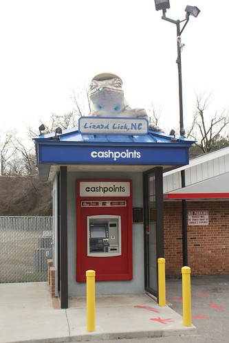
Of course if you're driving on NC 97 in Wake County, you have to go through Lizard Lick.
I had to divert off of NC 97 in Zebulon to get gas - and I came across this signal where NC 96 meets US 64/264.
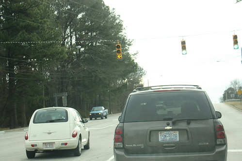
This is a three lens signal with flashing yellow. Most of the flashing yellow signals in North Carolina have four lens, with the bottom lens being a green arrow. Not seeing this before, I asked NCDOT what the deal was. Well, in select instances the state uses this type of signal. The signal is also allowed per the MUTCD Section 4D.18, para. 3 which allows such when there isn't a protected left phase. (H/T Brian Rawson-Ketchum)
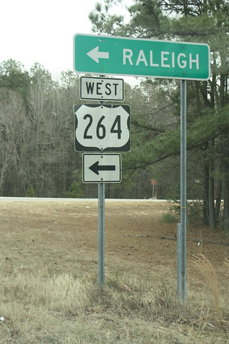
Back on NC 97 now, and an older US 264 shield.
Throughout my journey on NC 97 in Nash County, I keep coming across these "No Slaughterhouse" signs.
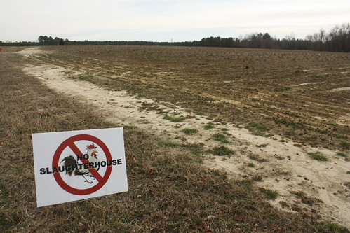
Residents are protesting a proposed poultry plant at I-95 and NC 97.
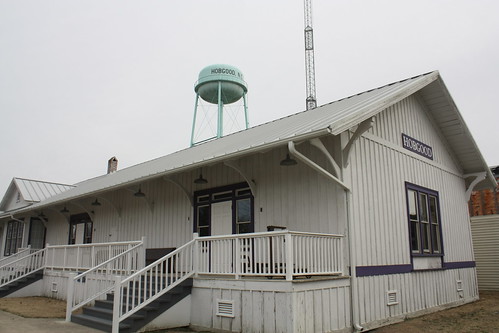
The first of three towns I stopped and walked at was Hobgood.
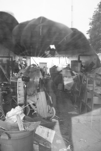
There were a number of abandoned stores in Hobgood with scenes like this inside.
After taking NC 11 all the way down to Kinston. I headed north on US 258 to Snow Hill.
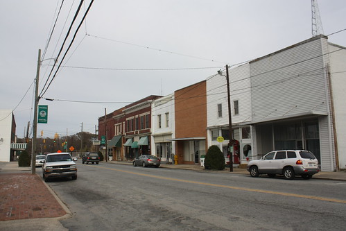
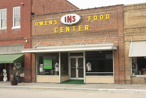
Snow Hill is the county seat of Greene County and there was a lot more activity here than there was in Hobgood. Legend has it that the town's name comes from "hills of white sand that looked like snow."
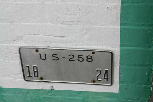
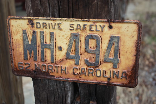
At the bottom of a painted billboard for Greene County's 1999 bicentennial, I saw this odd license plate like item attached to it. Does anyone know what it is?
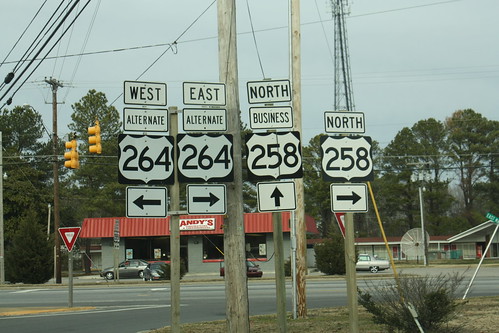
In 2009, NCDOT received permission to route US 258 to the east of Farmville. This was quickly signed.
Yet the US 311 extension to Eden still is not signed and its been nearly a decade since that was ok'd.
One of my favorite crossroads of the trip is located on US 258 north of the US 264 freeway. The community of Toddy.
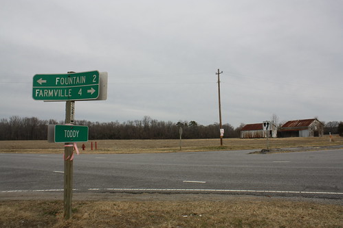
Toddy got it's name because you were able to get a shot of whiskey at a long abandoned general store.
The last town I stopped at is Fountain - where US 258 and NC 222 meet just north of Toddy.
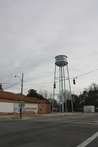
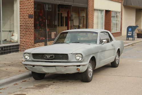
Like Hobgood, Fountain was very quiet this overcast winter day. However, there were a few more signs of life here - at least photo wise.
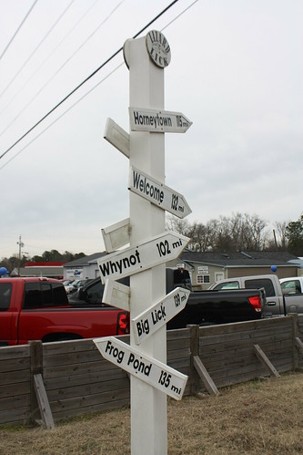
I had one last stop. On the way out on NC 97, I stopped again at Lizard Lick. The first pass through I didn't get a photo of this sign post.
Any suggestions on where I should head next?
As always, you can view the entire set on flickr.
The route was. US 64, BUS US 64, NC 97, NC 122, NC 125, NC 11, US 70, US 258, NC 222, US 264, US 64.
Of course if you're driving on NC 97 in Wake County, you have to go through Lizard Lick.
I had to divert off of NC 97 in Zebulon to get gas - and I came across this signal where NC 96 meets US 64/264.
This is a three lens signal with flashing yellow. Most of the flashing yellow signals in North Carolina have four lens, with the bottom lens being a green arrow. Not seeing this before, I asked NCDOT what the deal was. Well, in select instances the state uses this type of signal. The signal is also allowed per the MUTCD Section 4D.18, para. 3 which allows such when there isn't a protected left phase. (H/T Brian Rawson-Ketchum)
Back on NC 97 now, and an older US 264 shield.
Throughout my journey on NC 97 in Nash County, I keep coming across these "No Slaughterhouse" signs.
Residents are protesting a proposed poultry plant at I-95 and NC 97.
The first of three towns I stopped and walked at was Hobgood.
There were a number of abandoned stores in Hobgood with scenes like this inside.
After taking NC 11 all the way down to Kinston. I headed north on US 258 to Snow Hill.
Snow Hill is the county seat of Greene County and there was a lot more activity here than there was in Hobgood. Legend has it that the town's name comes from "hills of white sand that looked like snow."
At the bottom of a painted billboard for Greene County's 1999 bicentennial, I saw this odd license plate like item attached to it. Does anyone know what it is?
In 2009, NCDOT received permission to route US 258 to the east of Farmville. This was quickly signed.
Yet the US 311 extension to Eden still is not signed and its been nearly a decade since that was ok'd.
One of my favorite crossroads of the trip is located on US 258 north of the US 264 freeway. The community of Toddy.
Toddy got it's name because you were able to get a shot of whiskey at a long abandoned general store.
The last town I stopped at is Fountain - where US 258 and NC 222 meet just north of Toddy.
Like Hobgood, Fountain was very quiet this overcast winter day. However, there were a few more signs of life here - at least photo wise.
I had one last stop. On the way out on NC 97, I stopped again at Lizard Lick. The first pass through I didn't get a photo of this sign post.
Any suggestions on where I should head next?
Comments