
Carnesville, Georgia


Carnesville is a small town of just over 700 residents in Northeast Georgia.  Founded in 1805 as the county seat for Franklin County, Carnesville was incorporated as a town in 1819.  

Carnesville is named after Judge Thomas P. Carnes - a lawyer and later congressman.  Former in 1784, Franklin County is named after Ben Franklin and was Georgia's ninth county.

Franklin County Courthouse.

The center of this small city is the Franklin County Courthouse.  The neoclassical design structure has been standing since 1906 and was added to the National Register of Historic Places in 1980.  The courthouse is one of 12 locations listed within the register in the Carnesville Area.

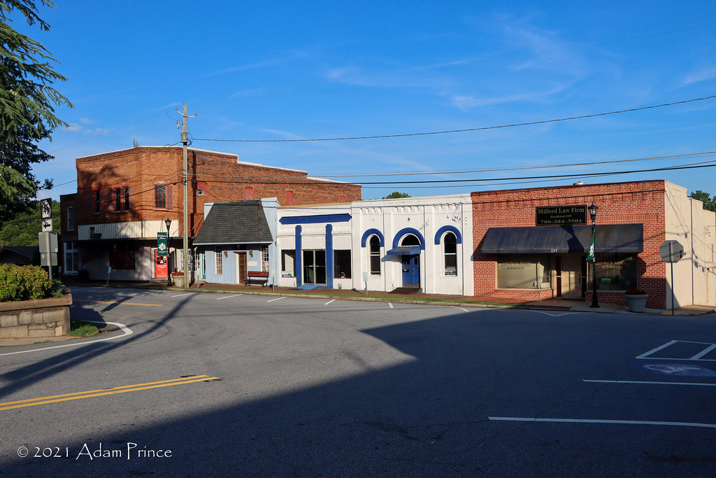
Downtown Carnesville might be small but it is still charming.

Carnesville is home to the Franklin County Livestock Market - which is the largest in the state.

All photos taken by post author - June 23, 2021.

Sources & Links:

How To Get There:

Comments

Popular posts from this blog

Dillon Road

Dillon Road is a 34.2-mile highway located in northern Coachella Valley of Riverside County, California.  Dillon Road begins at Avenue 48 on the outskirts of Indio and ends to the west at California State Route 62 near San Gorgonio Pass.  Dillon Road was developed the 1930s as a construction road for the Colorado River Aqueduct.  Dillon Road serves as a northern bypass to much of the development of Coachella Valley.  Dillon Road is known for it's frequent dips and spectacular views of San Gorgonio Pass.   Part 1; the history of Dillon Road Dillon Road was constructed as a haul road for the Colorado River Aqueduct through Coachella Valley.  The Colorado River Aqueduct spans 242 miles from Parker Dam on the Colorado River west to Lake Mathews near Corona.  Construction of the Colorado River Aqueduct began during January 1933 near Thousand Palms and was made functional on January 7, 1939.  West of Berdoo Canyon Road the alignment of Dillon Road is largely concurrent with the Colorado

Oldtown Toll Bridge - Maryland and West Virginia

  The Oldtown Toll Bridge linking Oldtown, Maryland over the Potomac River with neighboring Green Spring, West Virginia is only one of a few truly privately owned toll bridges located in the United States. It's a simple bridge by design, as the 318 foot long Oldtown Toll Bridge is a low water bridge. Low water bridges are designed to allow water to safely and efficiently flow over the bridge deck. Additionally, a dozen concrete pedestals have been secured in the Potomac River in order to support the bridge and wooden deck. The bridge was constructed in 1937 when a gentleman by the name of Mr. Carpenter obtained the proper permits to build the Bridge through an Act of Congress. This was a blessing for residents, especially on the West Virginia side of the Potomac River, as it saved motorists commuting to Cumberland an hour in travel time. Using Mr. Carpenter's blueprints, the Army Corp of Engineers and a number of local laborers constructed the bridge and it remained under the

Tehachapi-Willow Springs Road

Tehachapi-Willow Springs Road is an approximately 21-mile highway located in southeast Kern County.  Tehachapi-Willow Springs Road begins at Tehachapi Boulevard (former US Route 466) in Tehachapi and crosses the Tehachapi Mountains via the 4,820-foot-high Oak Creek Pass.  Tehachapi-Willow Springs Road enters Antelope Valley of the wider Mojave Desert and passes by the historic stage station of Willow Springs to a southern terminus at Rosamond Boulevard.  Tehachapi-Willow Springs Road has historic ties to the Havilah-Los Angeles Road and Stockton-Los Angeles Road due to the once reliable presence of water at Willow Springs. Part 1; the history of Tehachapi-Willow Springs Road Oak Creek Pass and Willow Springs were known to the local tribes of the Tehachapi Mountains for generations.  The first documented European crossing of Oak Creek Pass was during 1776 as part of an expedition by Francisco Garces.  Oak Creek Pass is as used again by John C. Fremont during an 1844-1845 expedition to e