From 2017 through to early 2019 I drove the majority of the California State Route 70; the Feather River Highway from CA 89 southwest to CA 99.

CA 70 is an approximately 178.5 mile state highway which starts at US 395 near the Nevada State Line and travels west through the Feather River Canyon to CA 99. CA 70 is often referred to as the Feather River Highway" given it's close association with the river. Historically CA 70 was previously signed as US 40A and CA 24. The Legislative Routes prior to the 1964 California Highway Renumbering that made up the current route of CA 70 are as follows:
- Legislative Route Number 21 from US 395 westward to Oroville.
- LRN 87 from Oroville south to Marysville.
- LRN 232 from Marysville to the current junction with CA 99. CA 70 was even dual signed with CA 99 into Sacramento on what was LRN 232 for a time.
The change from US 40A/LRN 21/LRN 87/LRN 232 can be seen by comparing the 1963 State Highway Map to the 1964 Edition.
1963 State Highway Map
1964 State Highway Map
The alignment history of CA 70 as a whole is very complicated. That being the case, I'll be covering the history of applicable sections grouped in with the actual road photos.
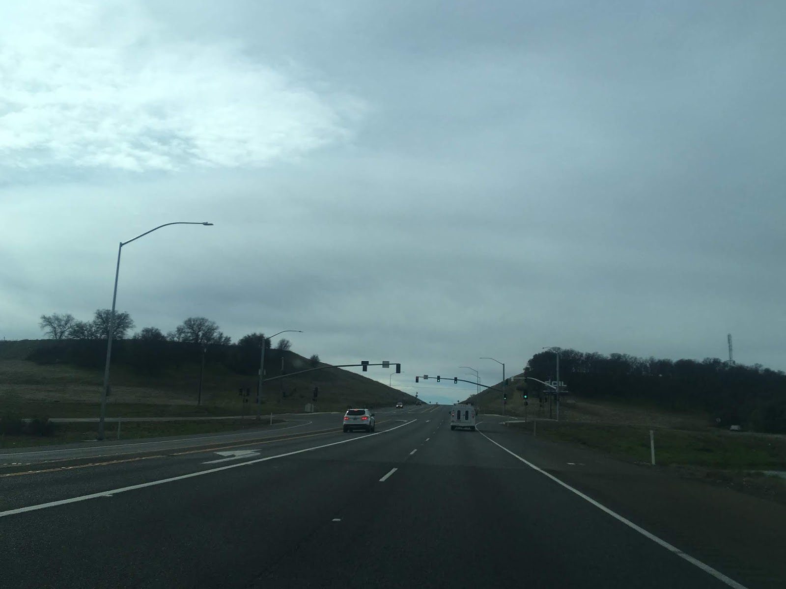
Back 2017 I took the route of CA 70 west from CA 89 north in Plumas County towards Oroville starting from the junction in the photo above. From the junction of CA 70 west/CA 89 north the two routes multiplex west through Quincy to the North Feather River.
From the junction at CA 89 the route of CA 70west/CA 89 north follows the Middle Fork River until it cuts northwest towards Quincy.


Quincy is only 11 miles west of Spring Garden.

CA 70 west/CA 89 north crosses this WWII era highway bridge over Estray Creek, this is just the first of many historic bridges on the Feather River Highway.

CA 70 west/CA 89 north crosses through East Quincy on Main Street before entering Quincy proper. CA 70 west/CA 89 north splits onto Lawrence Street while CA 70 east/CA 89 south is aligned on Main Street. Quincy is the County Seat of Plumas County and dates back to the Gold Rush Era having been founded in 1858.


The one-way split in CA 70 west/CA 89 north rejoins CA 70 east/CA 89 south at Crescent Street and exits the City of Quincy.


Trucks are advised of the length limits on CA 70 west through the Feather River Canyon which is only 10 miles from Quincy.

CA 70 west/CA 89 north meets the North Fork Feather River and the Western Pacific Railroad Feather River Route. CA 89 north splits away towards Lassen Volcanic National Park.


CA 70 west follows the North Fork Feather River through the Feather River Canyon. Following the discovery of the 5,221 foot Beckwourth Pass in 1850 there was considerable interest having a Trans-Continental Railroad line routed through the shallow grades of the Feather River Canyon. A route through the Feather River Canyon was surveyed in the 1860s which led to the founding of the Oroville and Virginia Railroad Company. Political pressure by the Central Pacific Railroad which had the first Trans-Continental Railroad routed over Donner Pass largely contributed to all rail construction in the Feather River Canyon shuttering by 1869.
Work on the Feather River Route didn't continue until 1906 when the concept was picked up by the Western Pacific Railroad. The Feather River Route was completed by 1909 and had an average grade of only 1% which was far more shallow the Central Pacific Donner Pass route. The Feather River Canyon was later found to be suitable for highway traffic, but I'll get to the history of Feather River Highway below.
CA 70 west is a visual feast that features the Feather River Route traversing the Feather River Canyon next to the highway. The amount of engineering that went into the design of both CA 70 west and the Feather River Route is on full display which makes the drive incredibly unique. Westbound there are several long draw looks at both the Feather River Route and CA 70.


At this ledge there is a historic marker for the community called Rich Bar.


Rich Bar was an a mining camp from 1850 which was founded off a gold claim in the North Fork Feather River. There aren't any ruins to be seen but there is a wide vista of the Feather River Canyon.


Oroville is listed as 53 miles to the west of Rich Bar on CA 70.

The Howell's Bridge is one of many original bridges to the Feather River Highway. The route was largely constructed in the 1930s.


The next historic bridge on CA 70 west is the Belden Town Bridge which dates from 1912. Belden is on the opposite side of the North Fork Feather River and dates back likely 1909.


West of the Belden Town Bridge CA 70 runs alongside the Rock Creek Reservoir.

The next significant bridge crossing is the Tobin Bridges. The Feather River Route crosses over CA 70 as both routes jump banks of the North Fork Feather River. The highway Tobin Bridge dates back to 1936.


The wooden Rock Crest Camp Bride is directly west of the Tobin Bridges.

The Storrie Bridge is next on CA 70 west and displays another 1936 date of construction.


From the Storrie Bridge the guide sign lists Oroville as 40 miles away.

CA 70 west next crosses under the Pacific Gas & Electricity Rock Creek Powerhouse.


The Rock Creek Bridge is crossed next on CA 70 west and displays another 1936 construction date.


CA 70 west crosses through two tunnels above a small reservoir. The first tunnel didn't display a name but the second one is called the Grizzly Dome Tunnel and has a 1936 construction date placard.


CA 70 west crosses the Butte County Line.

CA 70 west crosses through a third tunnel on the Butte County side of the highway.

At the Pulga maintenance yard Oroville is listed 28 miles away.

The Pulga Highway Bridge is the last major crossing over the North Fork Feather River. The Feather River Route is below the highway bridge on a rail bridge of the same name. The Pulga Bridge is a great place to watch trains come and go through the Feather River Canyon. I saw this particular train up river in Plumas County and waited for it to cross at the Pulga Bridge.


I should note that the Pulga Bridge was affected by Camp Fire of November 2018. The Camp Fire originated nearby at Poe Dam and proceeded west destroying the Town of Paradise in addition to several other communities.
West of the Pulga Bridge CA 70 begins to climb out of the Feather River Canyon. The Feather River Route can be seen far below.


The Feather River Highway originally would have used what is now Dark Canyon Road. Lake Oroville necessitated a shift to a new alignment to the west which has a four-lane section descending to the Central Valley. There is a wide vista overlooking the Central Valley as CA 70 descends out of the Sierras.


CA 70 west crosses over Lake Oroville before dropping back to two lanes. Lake Oroville was heavily damaged the winter of 2017 and was lowered due to a heavily eroded spillway.

CA 70 west has a junction with CA 191 at Clark Road. CA 191 continues north to Paradise and actually has a hanging end with no other state route connections.

CA 70 west continues to a junction with CA 149.


From CA 149 the orientation of CA 70 becomes much more of a north/south highway rather than east/west. Back in 2017 I took CA 70 south to Exit 46 for CA 162 in Oroville to view some of the original segments of the Feather River Highway from when it when it was US 40A/CA 24.


The 1936 highway bridge dates above are probably as good of an indication as any that the Feather River Highway was completed during said year. The completed route can be seen on the 1936 state highway map and CA 24 can be seen on the 1938 state highway map on the new alignment.
1936 State Highway Map
1938 State Highway Map
The Feather River Highway was originally an extension of LRN 21 which was extended from Oroville to Quincy in 1919. The Feather River Highway was meant to replace the Oroville-Quincy Highway which was the temporary routing of LRN 21. The Oroville-Quincy Highway was part of the 1909 definition of LRN 30 which was deleted when LRN 21 was extended.
CAhighways.org on LRN 21
On the 1935 California Division of Highway Maps of Butte and Plumas Counties the incomplete Feather River Highway can be seen along with the former LRN 30 on Oroville-Quincy Highway. The 1935 Butte County Map also displays the original alignment of the Feather River Highway. The original alignment of the Feather River Highway used Oroville Dam Boulevard/Signed County Route B2 approximately the site of Oroville Dam. From Oroville Dam the Feather River Highway crossed the North Fork Feather River and used Dark Canyon Road to the current alignment of CA 70.
1935 Butte County Map
1935 Plumas County Map
In 1955 the entirety of CA 24 north of Marysville was renumbered as US 40A. The change from CA 24 to US 40A can been on the following two maps.
1954 State Highway Map
1955 State Highway Map
By 1958 the newly adopted planned alignment of US 40A out of Oroville appears to the west of the highway to make way for the Oroville Dam project.
1958 State Highway Map
By 1963 US 40A is shifted onto the new aligment modern of the Feather River Highway.
1963 State Highway Map
During the 1964 State Highway Renumbering the Feather River Highway was assigned to CA 70. The Feather River Highway remained signed as US 40A until 1965 when CA 70 signage appeared.
1965 State Highway Map
On the 1967 state highway map Oroville Lake appears as the project was nearing completion, the reservoir was completed in 1968.
1967 State Highway Map
After reaching Oroville I actually checked Oroville Dam Boulevard but access to the dam was cut off due to the spillway repair project.

The Oroville Dam Visitor Center tower high above Lake Oroville was still open which offered a long view at the low levels of the reservoir. The Feather River Highway would have been at the bottom of what is now Lake Oroville.

During the winter of 2017 the water level in Lake Oroville was lapping over the main spillway and was threatening to take out the emergency spillway. Had the emergency spillway failed the Lake Oroville reservoir would have partially breached which would have flooded Oroville and the communities down the Feather River.


Ironically the Oroville-Quincy Highway would partially become a state highway again as CA 162. The new Bidwell Bar Bridge was constructed in 1965 to replace an earlier span which was due to be flooded over by the rising waters of Lake Oroville. By 1970 CA 162 was extended over Bidwell Bar Bridge on the Oroville-Quincy Highway. The change can be seen on the 1975 State Highway Map and more details about CA 162 can be found on CAhighways.org.
1975 State Highway Map
CAhighways.org on CA 162
When the 1965 Bidwell Bar Bridge was completed it had a 627 foot clearance over the waters below which was the highest in the world at the time for a suspension bridge. Even with the waters low in Lake Oroville the clearance above the water is nowhere near the 627 feet now.

South of Oroville CA 70 still follows the Feather River towards it's terminus at CA 99. As stated above the segment of CA 70 south of Oroville to Marysville was once part of LRN 87. The Oroville to Marysville segment of LRN 87 was an original part of the route adopted by the State Legislature in 1933.
South of Oroville CA 70 drops to an expressway before narrowing to two-lanes facing towards Sutter Buttes. There isn't much deviation in the current route of CA 70 in Butte County compared to the original alignment of LRN 87. That said Power House Hill Road and Palermo Road are original alignments of LRN 87 in addition to CA 24.


CA 70 south continues to alternate between two-lanes and passing zone areas. At North/South Honcut Creek the route of CA 70 south enters Yuba County.


CA 70 south continues into Marysville which is fairly apparent from the rail underpass at Binney Junction. Binney Junction is where the Feather River Route and Union Pacific lines meet.


CA 70 south enters Marysville on B Street and crosses below another rail underpass.

CA 70 south picks up CA 20 west at 12th Street on the shores of Ellis Lake.

CA 70 south/CA 20 west makes right hand turn onto 9th Street in downtown Marysville. Maryville is the County Seat of Yuba County and dates back to the 1843 trade post known as New Mecklenburg.


CA 70 south/CA 20 west multiplex on 9th Street before splitting at E Street. CA 70 south splits towards E Street whereas CA 20 west follows Colusa Avenue over the Feather River into Sutter County.


CA 24 originally followed CA 20 and US 99E over the Feather River into Sutter County where it continued a southward trek towards Sacramento on LRN 87. The original route of CA 24 over Feather River from Marysville can be seen on the 1938 State Highway Map.
1938 State Highway Map
The alignment of CA 24 was different than CA 70 in Marysville and appears to have followed B Street to 5th Street. CA 24 along with CA 20 would have picked up US 99E at E Street and all three routes would have crossed the Feather River together. Said alignment can be seen on the 1935 California Division of Highways Map of Yuba County.
1935 Yuba County Highway Map
The present route of CA 70 south follows what was LRN 232 south out of Marysville to Sacramento. LRN 232 was added to the State Highway system as a proposed route known by the duplicate designation of LRN 207 by the State Legislature in 1949. LRN 207 appears to have been originally proposed to meet US 40 in North Sacramento which can be seen on the 1950 State Highway Map.
1950 State Highway Map
By 1951 LRN 207 was designated as LRN 232. By 1958 LRN 232 was completed as a State Highway between Marysville and Sacramento.
1958 State Highway Map
By 1960 CA 24 was extended directly north out of Sacramento to Marysville via LRN 232.
1960 State Highway Map
CA 70 south follows E Street out of Marysville over the Yuba River where the highway expands to a freeway.


When CA 24 was realigned onto LRN 232 it followed Feather River Boulevard south of Marysville to Rio Oso and the Sutter County Line. CA 70 inherited the Feather River Boulevard alignment when it was first signed in 1965. The current limited access alignment of CA 70 first appears as a proposed route south of Marysville on the 1966 State Highway Map.
1966 State Highway Map
The current alignment of CA 70 south of Marysville to CA 99 appears on the 1969 State Highway Map.
1969 State Highway Map
At Exit 17 CA 70 south meets the northern segment of CA 65.


South of CA 65 the route of CA 70 is signed as being 34 miles from Sacramento.

CA 70 south enters Sutter County upon crossing the Bear River.

CA 70 south in Sutter County has some at-grade intersections starting at Berry Road.


CA 70 south crosses through Nicolaus where it is signed as being 19 miles from I-5 and 26 miles from Sacramento.

CA 70 south has another at-grade intersection at Striplin Road which is signed as access to CA 99 north.


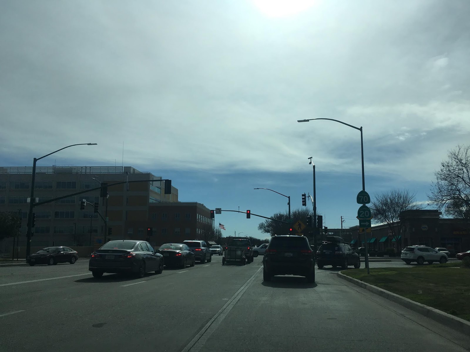
CA 70 south meets CA 99 and crosses over it. Today CA 70 terminates at CA 99 but it originally went all the way to Sacramento.


When CA 70 and CA 99 were first signed they both originated in Sacramento and used the Jibboom Street Bridge to cross the American River northbound. It isn't clear from the 1965 State Highway Map City insert if CA 70/CA 99 began at CA 16 at I Street or US 40/US 99W/CA 16 on Capitol Mall. Interestingly at least during 1965 CA 99 existed alongside US 99/US 99E/US 99W in Sacramento. CA 99, CA 70, CA 149 and CA 99 near Chico were intended to be part of the "East Valley Corridor" which meant to be a limited access alternate to I-5.

The Jibboom Street Bridge was completed in 1931 and is a swing span. The Jibboom Street Bridge was annexed into LRN 232 which became part of CA 24 and later CA 70/CA 99.


It is highly likely CA 70/CA 99 began at US 40/US 99E/CA 16 at Capitol Mall. CA 70/CA 99 is still signed as a northbound route to Marysville at intersection for 5th Street.

On the 1969 State Highway Map City Insert CA 70/CA 99 are co-signed with the incomplete I-5 which was built over the American River.

At some point between 1970 and 1975 CA 70 was cut back to where CA 99 now meets I-5 north of Sacramento.


According to CAhighways.org and Joel Windmiller there is a likelihood that CA 70 multiplexed I-5/CA 99 into downtown Sacramento briefly in the early 1970s. If that was the case it was likely to the intersection of I-5/CA 99 at what was I-80 (now US 50).
CAhighways.org on CA 70
CA 70 was cut back to it's current south terminus at CA 99 according to CAhighways.org. CA 70/CA 99 can be seen meeting I-5 together north of Sacramento as late as the 1990 State Highway Map.
1990 State Highway Map
Since CA 99 north of Sacramento has nothing to do with any historic alignment of US 99 I tend to associate it more with CA 24 and CA 70. From the modern south terminus of CA 70 the route of CA 99 is signed 11 miles from I-5 and 18 miles from Sacramento.

CA 99 south of CA 70 is signed as the Bernie Richter Memorial Highway.

Near Riego Road CA 99 south becomes a freeway.


Just south of Riego Road CA 99 south enters Sacramento County.

At Elkhorn Boulevard CA 99 south meets a junction with Signed County Route E14.

At Exit 306 CA 99 south meets I-5 at the Sacramento City Limit. This is where CA 70 would have terminated until the 1990s.


CA 99 south multiplexes I-5 south into Sacramento. CA 99 south/I-5 south soon meet I-80 which originally was I-880.


CA 99 south/I-5 south cross the American River into downtown Sacramento. CA 99 south traffic is directed to use Exit 518 for US 50 east.


Richards Boulevard at Exit 520 is signed as access to Discovery Park. Discovery Park is accessed via former CA 24/CA70/CA 99 on the Jibboom Street Bridge.


CA 99 south exits I-5 onto US 50 east via Exit 518. It is likely this was also the terminus of CA 70 at one point during the early 1970s.


CA 70 is an approximately 178.5 mile state highway which starts at US 395 near the Nevada State Line and travels west through the Feather River Canyon to CA 99. CA 70 is often referred to as the Feather River Highway" given it's close association with the river. Historically CA 70 was previously signed as US 40A and CA 24. The Legislative Routes prior to the 1964 California Highway Renumbering that made up the current route of CA 70 are as follows:
- Legislative Route Number 21 from US 395 westward to Oroville.
- LRN 87 from Oroville south to Marysville.
- LRN 232 from Marysville to the current junction with CA 99. CA 70 was even dual signed with CA 99 into Sacramento on what was LRN 232 for a time.
The change from US 40A/LRN 21/LRN 87/LRN 232 can be seen by comparing the 1963 State Highway Map to the 1964 Edition.
1963 State Highway Map
1964 State Highway Map
The alignment history of CA 70 as a whole is very complicated. That being the case, I'll be covering the history of applicable sections grouped in with the actual road photos.
Back 2017 I took the route of CA 70 west from CA 89 north in Plumas County towards Oroville starting from the junction in the photo above. From the junction of CA 70 west/CA 89 north the two routes multiplex west through Quincy to the North Feather River.
From the junction at CA 89 the route of CA 70west/CA 89 north follows the Middle Fork River until it cuts northwest towards Quincy.


Quincy is only 11 miles west of Spring Garden.

CA 70 west/CA 89 north crosses this WWII era highway bridge over Estray Creek, this is just the first of many historic bridges on the Feather River Highway.

CA 70 west/CA 89 north crosses through East Quincy on Main Street before entering Quincy proper. CA 70 west/CA 89 north splits onto Lawrence Street while CA 70 east/CA 89 south is aligned on Main Street. Quincy is the County Seat of Plumas County and dates back to the Gold Rush Era having been founded in 1858.


The one-way split in CA 70 west/CA 89 north rejoins CA 70 east/CA 89 south at Crescent Street and exits the City of Quincy.


Trucks are advised of the length limits on CA 70 west through the Feather River Canyon which is only 10 miles from Quincy.

CA 70 west/CA 89 north meets the North Fork Feather River and the Western Pacific Railroad Feather River Route. CA 89 north splits away towards Lassen Volcanic National Park.


CA 70 west follows the North Fork Feather River through the Feather River Canyon. Following the discovery of the 5,221 foot Beckwourth Pass in 1850 there was considerable interest having a Trans-Continental Railroad line routed through the shallow grades of the Feather River Canyon. A route through the Feather River Canyon was surveyed in the 1860s which led to the founding of the Oroville and Virginia Railroad Company. Political pressure by the Central Pacific Railroad which had the first Trans-Continental Railroad routed over Donner Pass largely contributed to all rail construction in the Feather River Canyon shuttering by 1869.
Work on the Feather River Route didn't continue until 1906 when the concept was picked up by the Western Pacific Railroad. The Feather River Route was completed by 1909 and had an average grade of only 1% which was far more shallow the Central Pacific Donner Pass route. The Feather River Canyon was later found to be suitable for highway traffic, but I'll get to the history of Feather River Highway below.
CA 70 west is a visual feast that features the Feather River Route traversing the Feather River Canyon next to the highway. The amount of engineering that went into the design of both CA 70 west and the Feather River Route is on full display which makes the drive incredibly unique. Westbound there are several long draw looks at both the Feather River Route and CA 70.


At this ledge there is a historic marker for the community called Rich Bar.


Rich Bar was an a mining camp from 1850 which was founded off a gold claim in the North Fork Feather River. There aren't any ruins to be seen but there is a wide vista of the Feather River Canyon.


Oroville is listed as 53 miles to the west of Rich Bar on CA 70.

The Howell's Bridge is one of many original bridges to the Feather River Highway. The route was largely constructed in the 1930s.


The next historic bridge on CA 70 west is the Belden Town Bridge which dates from 1912. Belden is on the opposite side of the North Fork Feather River and dates back likely 1909.


West of the Belden Town Bridge CA 70 runs alongside the Rock Creek Reservoir.

The next significant bridge crossing is the Tobin Bridges. The Feather River Route crosses over CA 70 as both routes jump banks of the North Fork Feather River. The highway Tobin Bridge dates back to 1936.


The wooden Rock Crest Camp Bride is directly west of the Tobin Bridges.

The Storrie Bridge is next on CA 70 west and displays another 1936 date of construction.


From the Storrie Bridge the guide sign lists Oroville as 40 miles away.

CA 70 west next crosses under the Pacific Gas & Electricity Rock Creek Powerhouse.


The Rock Creek Bridge is crossed next on CA 70 west and displays another 1936 construction date.


CA 70 west crosses through two tunnels above a small reservoir. The first tunnel didn't display a name but the second one is called the Grizzly Dome Tunnel and has a 1936 construction date placard.


CA 70 west crosses the Butte County Line.

CA 70 west crosses through a third tunnel on the Butte County side of the highway.

At the Pulga maintenance yard Oroville is listed 28 miles away.

The Pulga Highway Bridge is the last major crossing over the North Fork Feather River. The Feather River Route is below the highway bridge on a rail bridge of the same name. The Pulga Bridge is a great place to watch trains come and go through the Feather River Canyon. I saw this particular train up river in Plumas County and waited for it to cross at the Pulga Bridge.


I should note that the Pulga Bridge was affected by Camp Fire of November 2018. The Camp Fire originated nearby at Poe Dam and proceeded west destroying the Town of Paradise in addition to several other communities.
West of the Pulga Bridge CA 70 begins to climb out of the Feather River Canyon. The Feather River Route can be seen far below.


The Feather River Highway originally would have used what is now Dark Canyon Road. Lake Oroville necessitated a shift to a new alignment to the west which has a four-lane section descending to the Central Valley. There is a wide vista overlooking the Central Valley as CA 70 descends out of the Sierras.


CA 70 west crosses over Lake Oroville before dropping back to two lanes. Lake Oroville was heavily damaged the winter of 2017 and was lowered due to a heavily eroded spillway.

CA 70 west has a junction with CA 191 at Clark Road. CA 191 continues north to Paradise and actually has a hanging end with no other state route connections.

CA 70 west continues to a junction with CA 149.


From CA 149 the orientation of CA 70 becomes much more of a north/south highway rather than east/west. Back in 2017 I took CA 70 south to Exit 46 for CA 162 in Oroville to view some of the original segments of the Feather River Highway from when it when it was US 40A/CA 24.


The 1936 highway bridge dates above are probably as good of an indication as any that the Feather River Highway was completed during said year. The completed route can be seen on the 1936 state highway map and CA 24 can be seen on the 1938 state highway map on the new alignment.
1936 State Highway Map
1938 State Highway Map
The Feather River Highway was originally an extension of LRN 21 which was extended from Oroville to Quincy in 1919. The Feather River Highway was meant to replace the Oroville-Quincy Highway which was the temporary routing of LRN 21. The Oroville-Quincy Highway was part of the 1909 definition of LRN 30 which was deleted when LRN 21 was extended.
CAhighways.org on LRN 21
On the 1935 California Division of Highway Maps of Butte and Plumas Counties the incomplete Feather River Highway can be seen along with the former LRN 30 on Oroville-Quincy Highway. The 1935 Butte County Map also displays the original alignment of the Feather River Highway. The original alignment of the Feather River Highway used Oroville Dam Boulevard/Signed County Route B2 approximately the site of Oroville Dam. From Oroville Dam the Feather River Highway crossed the North Fork Feather River and used Dark Canyon Road to the current alignment of CA 70.
1935 Butte County Map
1935 Plumas County Map
In 1955 the entirety of CA 24 north of Marysville was renumbered as US 40A. The change from CA 24 to US 40A can been on the following two maps.
1954 State Highway Map
1955 State Highway Map
By 1958 the newly adopted planned alignment of US 40A out of Oroville appears to the west of the highway to make way for the Oroville Dam project.
1958 State Highway Map
By 1963 US 40A is shifted onto the new aligment modern of the Feather River Highway.
1963 State Highway Map
During the 1964 State Highway Renumbering the Feather River Highway was assigned to CA 70. The Feather River Highway remained signed as US 40A until 1965 when CA 70 signage appeared.
1965 State Highway Map
On the 1967 state highway map Oroville Lake appears as the project was nearing completion, the reservoir was completed in 1968.
1967 State Highway Map
After reaching Oroville I actually checked Oroville Dam Boulevard but access to the dam was cut off due to the spillway repair project.

The Oroville Dam Visitor Center tower high above Lake Oroville was still open which offered a long view at the low levels of the reservoir. The Feather River Highway would have been at the bottom of what is now Lake Oroville.

During the winter of 2017 the water level in Lake Oroville was lapping over the main spillway and was threatening to take out the emergency spillway. Had the emergency spillway failed the Lake Oroville reservoir would have partially breached which would have flooded Oroville and the communities down the Feather River.


Ironically the Oroville-Quincy Highway would partially become a state highway again as CA 162. The new Bidwell Bar Bridge was constructed in 1965 to replace an earlier span which was due to be flooded over by the rising waters of Lake Oroville. By 1970 CA 162 was extended over Bidwell Bar Bridge on the Oroville-Quincy Highway. The change can be seen on the 1975 State Highway Map and more details about CA 162 can be found on CAhighways.org.
1975 State Highway Map
CAhighways.org on CA 162
When the 1965 Bidwell Bar Bridge was completed it had a 627 foot clearance over the waters below which was the highest in the world at the time for a suspension bridge. Even with the waters low in Lake Oroville the clearance above the water is nowhere near the 627 feet now.

South of Oroville CA 70 still follows the Feather River towards it's terminus at CA 99. As stated above the segment of CA 70 south of Oroville to Marysville was once part of LRN 87. The Oroville to Marysville segment of LRN 87 was an original part of the route adopted by the State Legislature in 1933.
South of Oroville CA 70 drops to an expressway before narrowing to two-lanes facing towards Sutter Buttes. There isn't much deviation in the current route of CA 70 in Butte County compared to the original alignment of LRN 87. That said Power House Hill Road and Palermo Road are original alignments of LRN 87 in addition to CA 24.


CA 70 south continues to alternate between two-lanes and passing zone areas. At North/South Honcut Creek the route of CA 70 south enters Yuba County.


CA 70 south continues into Marysville which is fairly apparent from the rail underpass at Binney Junction. Binney Junction is where the Feather River Route and Union Pacific lines meet.


CA 70 south enters Marysville on B Street and crosses below another rail underpass.

CA 70 south picks up CA 20 west at 12th Street on the shores of Ellis Lake.

CA 70 south/CA 20 west makes right hand turn onto 9th Street in downtown Marysville. Maryville is the County Seat of Yuba County and dates back to the 1843 trade post known as New Mecklenburg.


CA 70 south/CA 20 west multiplex on 9th Street before splitting at E Street. CA 70 south splits towards E Street whereas CA 20 west follows Colusa Avenue over the Feather River into Sutter County.


CA 24 originally followed CA 20 and US 99E over the Feather River into Sutter County where it continued a southward trek towards Sacramento on LRN 87. The original route of CA 24 over Feather River from Marysville can be seen on the 1938 State Highway Map.
1938 State Highway Map
The alignment of CA 24 was different than CA 70 in Marysville and appears to have followed B Street to 5th Street. CA 24 along with CA 20 would have picked up US 99E at E Street and all three routes would have crossed the Feather River together. Said alignment can be seen on the 1935 California Division of Highways Map of Yuba County.
1935 Yuba County Highway Map
The present route of CA 70 south follows what was LRN 232 south out of Marysville to Sacramento. LRN 232 was added to the State Highway system as a proposed route known by the duplicate designation of LRN 207 by the State Legislature in 1949. LRN 207 appears to have been originally proposed to meet US 40 in North Sacramento which can be seen on the 1950 State Highway Map.
1950 State Highway Map
By 1951 LRN 207 was designated as LRN 232. By 1958 LRN 232 was completed as a State Highway between Marysville and Sacramento.
1958 State Highway Map
By 1960 CA 24 was extended directly north out of Sacramento to Marysville via LRN 232.
1960 State Highway Map
CA 70 south follows E Street out of Marysville over the Yuba River where the highway expands to a freeway.


When CA 24 was realigned onto LRN 232 it followed Feather River Boulevard south of Marysville to Rio Oso and the Sutter County Line. CA 70 inherited the Feather River Boulevard alignment when it was first signed in 1965. The current limited access alignment of CA 70 first appears as a proposed route south of Marysville on the 1966 State Highway Map.
1966 State Highway Map
The current alignment of CA 70 south of Marysville to CA 99 appears on the 1969 State Highway Map.
1969 State Highway Map
At Exit 17 CA 70 south meets the northern segment of CA 65.


South of CA 65 the route of CA 70 is signed as being 34 miles from Sacramento.

CA 70 south enters Sutter County upon crossing the Bear River.

CA 70 south in Sutter County has some at-grade intersections starting at Berry Road.


CA 70 south crosses through Nicolaus where it is signed as being 19 miles from I-5 and 26 miles from Sacramento.

CA 70 south has another at-grade intersection at Striplin Road which is signed as access to CA 99 north.


CA 70 south meets CA 99 and crosses over it. Today CA 70 terminates at CA 99 but it originally went all the way to Sacramento.


When CA 70 and CA 99 were first signed they both originated in Sacramento and used the Jibboom Street Bridge to cross the American River northbound. It isn't clear from the 1965 State Highway Map City insert if CA 70/CA 99 began at CA 16 at I Street or US 40/US 99W/CA 16 on Capitol Mall. Interestingly at least during 1965 CA 99 existed alongside US 99/US 99E/US 99W in Sacramento. CA 99, CA 70, CA 149 and CA 99 near Chico were intended to be part of the "East Valley Corridor" which meant to be a limited access alternate to I-5.

The Jibboom Street Bridge was completed in 1931 and is a swing span. The Jibboom Street Bridge was annexed into LRN 232 which became part of CA 24 and later CA 70/CA 99.


It is highly likely CA 70/CA 99 began at US 40/US 99E/CA 16 at Capitol Mall. CA 70/CA 99 is still signed as a northbound route to Marysville at intersection for 5th Street.

On the 1969 State Highway Map City Insert CA 70/CA 99 are co-signed with the incomplete I-5 which was built over the American River.

At some point between 1970 and 1975 CA 70 was cut back to where CA 99 now meets I-5 north of Sacramento.


According to CAhighways.org and Joel Windmiller there is a likelihood that CA 70 multiplexed I-5/CA 99 into downtown Sacramento briefly in the early 1970s. If that was the case it was likely to the intersection of I-5/CA 99 at what was I-80 (now US 50).
CAhighways.org on CA 70
CA 70 was cut back to it's current south terminus at CA 99 according to CAhighways.org. CA 70/CA 99 can be seen meeting I-5 together north of Sacramento as late as the 1990 State Highway Map.
1990 State Highway Map
Since CA 99 north of Sacramento has nothing to do with any historic alignment of US 99 I tend to associate it more with CA 24 and CA 70. From the modern south terminus of CA 70 the route of CA 99 is signed 11 miles from I-5 and 18 miles from Sacramento.

CA 99 south of CA 70 is signed as the Bernie Richter Memorial Highway.

Near Riego Road CA 99 south becomes a freeway.


Just south of Riego Road CA 99 south enters Sacramento County.

At Elkhorn Boulevard CA 99 south meets a junction with Signed County Route E14.

At Exit 306 CA 99 south meets I-5 at the Sacramento City Limit. This is where CA 70 would have terminated until the 1990s.


CA 99 south multiplexes I-5 south into Sacramento. CA 99 south/I-5 south soon meet I-80 which originally was I-880.


CA 99 south/I-5 south cross the American River into downtown Sacramento. CA 99 south traffic is directed to use Exit 518 for US 50 east.


Richards Boulevard at Exit 520 is signed as access to Discovery Park. Discovery Park is accessed via former CA 24/CA70/CA 99 on the Jibboom Street Bridge.


CA 99 south exits I-5 onto US 50 east via Exit 518. It is likely this was also the terminus of CA 70 at one point during the early 1970s.


Comments