When I trace my early interest in traveling and the hobby of roadgeeking, I always go back to where I grew up. Pittsburgh, Allegheny County, PA 48, and the Orange Belt. I grew up on Route 48 in Elizabeth Township on the Orange Belt. One of my family's favorite stories of me growing up is when I was around three years old - so 1980 - I told one of my aunts, "It's not that hard to get to our house - we live on the Orange Belt!"
The Allegheny County Belt System is one of the many things that are uniquely Pittsburgh. A series of existing roadways - minor and major - developed in post-World War II Allegheny County to navigate the region. Never intended to be a "beltway" in the modern sense - a full freeway encircling a city - the Allegheny County system is more like a wayfinding system connecting you throughout the county.
It is uniquely Pittsburgh - it's been asked about, written about, and videoed.
On a recent visit home, I decided to drive the entire route of the Orange Belt. The road I grew up on. I knew parts of the route (specifically the southeastern and western sections) but had never done the whole thing. During this drive, I found myself enjoying and appreciating this uniquely Pittsburgh highway system; but at the same time, growing increasingly frustrated at the slow speeds and questioning the usefulness of the system today.
The Route:
The Orange Belt at over 91 miles is the longest of the five routes. It runs in an upside-down U-shape beginning at the intersection of PA 51 and 48 in Elizabeth Township around the outer edges of the county - briefly entering Westmoreland County - before ending at the intersection of Clifton Road and PA 88 in Libary. It's also known as the County Park Belt as it connects many of Allegheny County's major parks.
 |
| The start/end of the Orange Belt in Elizabeth Township. |
 |
| The Orange Belt is signed on the entirety of PA 48. |
The Orange Belt used to be a full loop - continuing on PA 88 from Clinton Road into Washington County and Finleyville before returning to Allegheny County via PA 837, West Elizabeth, PA 51, and the Elizabeth Bridge. The Washington County piece was removed in 1974.
 |
| The entrance to Round Hill Park. |
Of course, I started my journey at the Southeast Corner - the intersection of PA 48 and 51 in Elizabeth Township. Surprisingly to me, the once well-marked start and end of the Orange Belt here were no more. There wasn't any mention of the Orange Belt approaching the intersection on Route 51 (or I missed it) and unlike throughout my childhood - there was no mention of the Orange Belt ending.
The rural feel of the Orange Belt is almost immediate as PA 48 rises and falls through some farms. One mile from its start at PA 51, a right turn onto Round Hill Road takes you to the entrance of Round Hill Park and Exhibit Farm. One of the county's nine major parks, Round Hill is also home to a live working farm.
 |
| The Boston Bridge, built in 1931, carries the Orange Belt over the Youghiogheny River. |
 |
| The Orange Belt through Plum Borough. Orange Belt reassurance shields are often posted on utility poles. |
 |
| A typical rural scene along the Orange Belt. |
The Orange Belt and PA 48 continue North towards Monroeville. It runs along the western border of White Oak Park. At US 22 and Interstate 376, PA 48 ends, but the Orange Belt continues. In this Northeast corner of the route, the Orange Belt winds through a combination of older suburbs and farmland, along several different roads. Here, the Orange Belt makes many turns onto roads such as Center Road, Saltsburg Road (PA 380), New Texas Road, Leechburg Road, and Logan Ferry Road before briefly entering Westmoreland County and New Kensington.
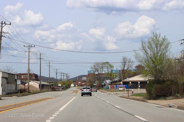 |
| The Orange Belt through New Kensington. |
 |
| Crossing the C.L Schmidt Bridge |
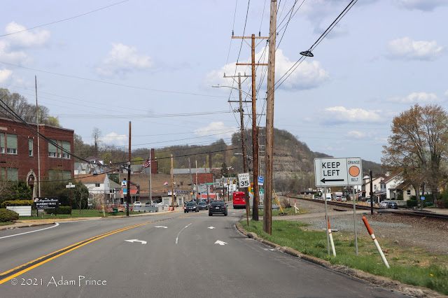 |
| A left turn from Freeport Road onto Crawford Run Road keeps you on the Orange Belt. |
The Orange Belt crosses back into Allegheny County over the C.L Schmidt Bridge onto old PA 28 before turning left and climbing through the Crawford Run Ravine. Here, after another series of turns onto various local roads, the Orange Belt enters the community of Russellton. Russellton is an example of a small mining company "Patch Town" that are found throughout Western Pennsylvania.
 |
| An old storefront and apartment in Russellton. |
 |
| The 1940 County built concrete bridge over Little Deer Creek |
In this case, the Orange Belt makes two quick turns - from my direction - a right from Creighton-Russellton Road onto Little Deer Creek Valley Road and a near-immediate right from Little Deer Creek Valley Road onto Starr Road. I missed that turn.
 |
| One of the features of the Belt System are signs that direct to more local and regional site like - churches, parks, and golf courses. |
I turned back around and followed the Orange Belt past Deer Lakes County Park, Deer Lakes High School to PA 910. Similar to PA 48, the Orange Belt runs along much of PA 910. Through this section, PA 910 is a mix of rural farms, newer suburbs, and shopping centers.
 |
| The Orange Belt makes a sharp left turn from Rochester Road onto Camp Meeting Road and crosses Rippling Run over this old concrete arch bridge. |
 |
| Stone walls along Blackburn Road. These will line the Orange Belt into Sewickley. |
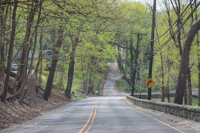 |
| Blackburn Road winding down into Sewickley. |
 |
| The Orange Belt through Sewickley. |
The Northwest Corner of the Orange Belt was the quietest. The Orange Belt goes through the estates of Sewickley Hills and Sewickley Heights before entering the town of Sewickley. Here much of the winding Blackburn and Fern Hollow Roads are lined by stone walls and gated entrances to many large estates. Sewickley is one of the few towns that the Orange Belt routes through - compared to the rural townships, old patch communities, and suburbs through much of its route.
 |
| Entrance to Robert Morris University. |
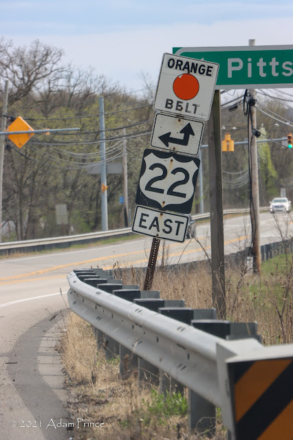 |
| One of about four still standing old style Orange Belt shields in Oakdale. None of the four standing that I saw have fading issues. |
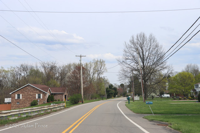 |
| The Orange Belt through South Fayette Township. |
The southwestern corner of the Orange Belt runs through valleys and ridges, hollows, and farmlands to Bridgeville. It was during these final stretches that I began to get frustrated with the drive. Two lanes, winding roads with posted speeds of 30 or 35 miles per hour made driving the route time-consuming. Orange Belt signs would either be faded or turns not marked until the last minute making it difficult to stay on course.
 |
| The Orange Belt exits Bridgeville by way of McLaughlin Run Road. |
The final southern leg of the Orange Belt connects Bridgeville to Libary through the South Hills suburbs. This section is a mix of homes, recreational facilities, older patch towns, high-end homes, older strip malls, and more. The turn from McMurray Road to Clifton Road wasn't marked, and I briefly went off course. In Library at the terminus at Route 88, the end and the approach to the Orange Belt was not signed. Maybe it was the reconstruction of the intersection, but it seemed like the Orange Belt was again an afterthought here.
 |
| The Orange Belt comes to a busy end at the intersection of Clifton Road and Route 88. Like the terminus in Elizabeth Township, it is unsigned. |
Conclusion:
The 91.7-mile drive took over three and a half hours. It was long, slow, and at times I felt like I wasn't getting anywhere. Yet, I did. I saw areas of Pittsburgh I had never been to or hadn't seen in years.
The Belt System in Pittsburgh is unique to the city and is part of the fabric of our town. We all have grown up with it - used it to give directions - and more. Yet, I found this route outdated and possibly no longer necessary. Signage, while for the most part good, was beginning to slip from what I recall growing up. Further, many of the Orange dots that are famously part of the Belt System are faded - to where you could say it is the Black Circle Belt. About 10-15 years ago, Allegheny County replaced nearly all of its older signs with newer shields. Interestingly, the four old-style Orange Belt shields I found on this route were as bright and as vivid as I remember.
This drive brought back old memories, gave me new discoveries, yet it frustrated and annoyed me. I found myself questioning the usefulness of this route, including the entire system. The Belt System is more of a Wayfinding guide for Allegheny County, and I wonder if they should emphasize that more.
Regardless, I hope to drive the remaining Belt System routes on future trips home to Pittsburgh.
Site Navigation:
- Return to SWPA Roads Project Index
- Allegheny County's Day Trip - The Yellow Belt
- The Name Fits - Allegheny County's Green Belt
- Orange Belt Photo Tour --- Full Photo Set from this trip on Flickr.
Further Reading:
- Choose A Color And Buckle Up: Allegheny County's Belt System is Low Tech, But Navigable. ---Katie Blackley, WESA-FM
- Rainbow Connections ---Dawn Patton, Pittsburgh City Paper
- Over the rainbow and through Allegheny County on the belt system ---Sharon Eberson, Pittsburgh Post-Gazette
Sources & Links:
- Allegheny County Belt System @ pghbridges.com ---Bruce Cridlebaugh
- Allegheny County Belt System @ pahighways.com ---Jeff Kitsko


Comments