One of the stranger and more intriguing State Highways of Northern California is California State Route 3.

California State Route 3 ("CA 3") is a 146 mile generally north/south State Highway. CA 3 begins with a hanging end in Montague of Siskiyou County and has a southern terminus near the vicinity of Peanut at CA 36 of Trinity County.

Part 1; the history of California State Route 3
The current CA 3 is the second highway to carry the designation. The original CA 3 was routed between Oxnard-San Juan Capistrano and is presently part of CA 1. Current CA 3 has it's origins as a State Maintained Highway as part of Legislative Route Numbers ("LRN") 35, 20, 3, and 82.
In chronological order the first segment of State Highway that would be later partially adopted as part of the current CA 3 was a route between the communities of Kuntz (now Mad River) and Peanut (approximately) by way of 1907 Legislative Chapter 117. In time this segment of highway between Kuntz and Peanut would come to be known as LRN 35. The original Legislative language of the Kuntz-Peanut State Highway was as follows:
"Locating, surveying, and constructing a state highway connecting the present county road systems of any one or all of the counties of Trinity, Tehama, and Shasta with the road system of Humboldt County."
No known State Highway Maps from 1907 have been published online, further the above description is vague beyond that it was clear that described "present county roads." For graphic fidelity purposes this is approximately what the Peanut-Red Bluff Highway would have looked like.

The 1909 First State Highway Bond Act was approved by voters in 1910. The 1909 First State Highway Bond Act added two future segments of State Highway which would become part of CA 3:
- LRN 20 from Douglas City north to Weaverville.
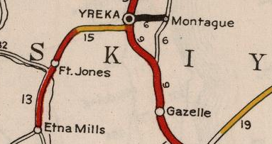
- LRN 3 through Yreka near what is now Moonlit Oaks Avenue north on Front Jones Road and Main Street to Montague Road. This segment of LRN 3 would become part of the Pacific Highway in 1913 and US Route 99 in November 1926.
According to CAhighways in 1933 LRN 35 was extended north from Peanut to LRN 20 in Douglas City. 1933 also saw LRN 82 added by as a new State Highway from Etna Mills north to Montague. The new segments of LRN 35 and LRN 82 later become components of future CA 3. The April 1933 California Highways & Public Works announced the recommendation of a new State Highway between Etna Mills-Montague and extension of LRN 35 to Douglas City.


The 1934 Division of Highways State Map shows segments of State Highway which would later comprise CA 3.
- LRN 35 from Peanut north to Douglas City and LRN 20 from Douglas City to Weaverville.


- LRN 82 from Etna Mills to Montague and LRN 3 through Yreka.


The 1935 Division of Highways Maps of Siskiyou County and Trinity County provide more detail regarding the future route of CA 3 via; LRN 35, LRN 20, LRN 82, and LRN 3.
- LRN 35 from Peanut north to Douglas City and LRN 20 from Douglas City to Weaverville.

- LRN 82 from Etna Mills to Montague and LRN 3 through Yreka.

LRN 82 is discussed in detail in the May/June 1958 California Highways & Public Works. LRN 82 cited to have been largely modernized between Montague-Kidder Creek between 1953-1957.

According to CAhighways.org the definition of LRN 82 was extended from Etna Mills south to a new origin point at LRN 20 in Weaverville via 1959 Legislative Chapter 1062. This new segment of LRN 82 can be seen as a planned highway between Etna Mills and Weaverville on the 1960 Division of Highways State Map.

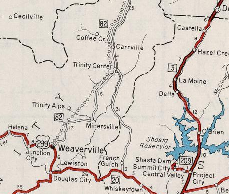

The planned extension of LRN 82 from Etna to Weaverville is discussed in the November/December 1959 California Highways & Public Works.


The March/April 1960 California Highways & Public Works discusses the planned Etna-Weaverville extension of LRN 82. LRN 82 was part of a Federal-aid Secondary County Route 1089 ("FAS") which was borne out of a stimulus from the Trinity Dam reclamation project. FAS 1089 is described as a 124 mile project which would connect the Trinity County Seat of Weaverville to Siskiyou County via a modernized highway. The origin story of LRN 82 is discussed as having historic origins as a segment of the California-Oregon Trail which was routed through; Shasta, French Gulch, Trinity Center, Scott Valley, and Yreka.


For reference the California-Oregon Trail can be seen as a major wagon road between Yreka-Shasta on the 1873 Bancroft's Map of California. The California-Oregon Trail was a popular path of travel given it was routed through numerous established Gold Rush communities. The Siskiyou Trail existed as an alternate to the east from Yreka to Sacramento Valley but didn't become popular until the Southern Pacific Railroad completed a line through the Sacramento River Canyon in the 1880s.


The California-Oregon Trail is still seen as a major highway between Yreka-Shasta (only Redding is shown) on the 1917 California State Automobile Association Map. Note; the Pacific Highway/LRN 3 can be seen to the east following the Southern Pacific Railroad through the Sacramento River Canyon.

The Trinity Dam was completed in 1962. Thusly the Trinity Reservoir appears on the 1963 Division of Highways State Map immediately east of the planned Etna-Weaverville extension of LRN 82.

During the 1964 State Highway Renumbering the Legislative Route Numbers were dropped. What had been LRN 35, LRN 20, LRN 82, and LRN 3 from Peanut-Montague was assigned as the second CA 3. The current CA 3 first appears on the 1964 Division of Highways Map along with the unbuilt Etna-Weaverville segment inherited from LRN 82. CA 3 was initially co-signed with US 99 through downtown Yreka.


The AASHO Renumbering database shows that US 99 was approved to be
truncated out of California by the AASHO Executive Committee on June
29th, 1965. This effectively made CA 3 in Yreka a stand along route but was likely co-signed as Temporary I-5 for a time.
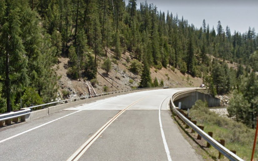
Some of the construction funding of CA 3 between Etna and Weaverville is discussed in the November/December 1965 California Highways & Public Works. CA 3 was to be built on a new alignment from the preexisting highway in the vicinity of Coffee Creek and was to planned be built eventually to expressway standards.

The planned route of CA 3 north of Coffee Creek to the vicinity of Callahan is shown with a generally planned alignment on the 1966 Division of Highways State Map.

CA 3 appears as a completed highway from Weaverville north to the vicinity of Scott Mountain on the 1969 Division of Highways Map. Only a small segment of CA 3 between Scott Mountain and Callahan is shown not to be complete.

The Scott Mountain-Callahan segment of CA 3 is shown completed for the first time on the 1975 Caltrans State Map.

Part 2; a drive on California State Route 3
CA 3 begins in Montague as Ball Mountain-Little Shasta Road becomes Webb Street at the City Limit.


CA 3/Webb Street jogs westward over the Union Pacific Railroad. At 11th Street/Postmile SIS 53.496 CA 3 turns left onto a multiplex with southbound County Route A28.


The Montague Depot Museum can be found on CA 3/A28 on 11th Street. Montague was plotted out as a Southern Pacific Railroad siding in 1887 and was named after a engineer from the Central Pacific Railroad. Montague incorporated as a City in January of 1909. The Montague Depot was constructed over a five week period in 1887 and is presently located at the intersection of 11th Street/King Street. The Montague Depot was originally located on Webb Street on the east side of the Union Pacific tracks.


At Postmile SIS 53.214 CA 3 splits west from A28 towards Yreka via Montague Road. Yreka is signed as 6 miles west from Montague on CA 3.

CA 3/Montague Road enters the City Limits of Yreka at Postmile SIS 49.50.


Before I-5 was constructed CA 3/LRN 82 entered downtown Yreka via what is now Foothill Drive and Lennox Street. Modern CA 3 follows Montague Road west into downtown Yreka north of the original alignment. CA 3/Montague Road has an interchange with I-5 at Postmile SIS R47.50.


CA 3 turns south onto Main Street at Postmile SIS L49.871 (mileage inherited from US 99). Main Street also serves as a junction between CA 3/CA 263. As noted above Main Street is a former segment of US 99 and the Pacific Highway.


CA 3 southbound follows Main Street through downtown Yreka before splitting away onto Fort Jones Road at approximately Postmile SIS L47.50. Yreka is a traditional Gold Rush community of Northern California and is the Siskiyou County Seat. Gold was found in March of 1851 by Abraham Thompson at the present site of Yreka on Rocky Gulch. A month later a small mining community known as "Thompson's Dry Diggings" was settled and eventually mercifully renamed to Yreka. In 1852 Siskiyou County split from parts of Klamath and Shasta Counties which led to Yreka becoming the County Seat. Yreka incorporated as a City in April of 1857.


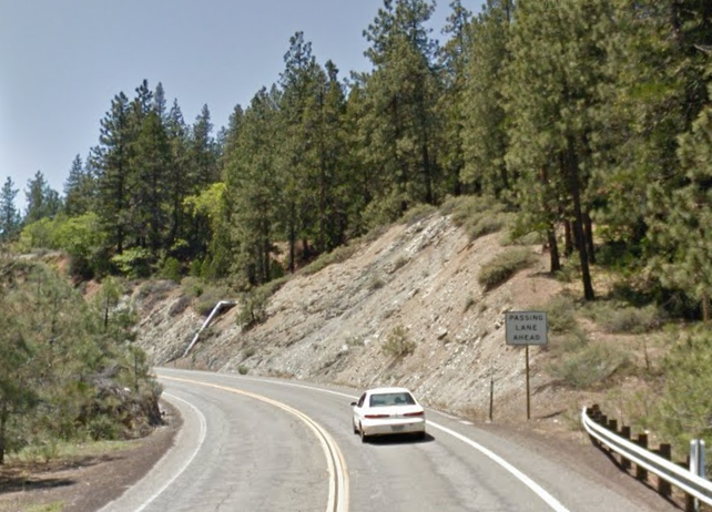
CA 3 southbound leaving Yreka is signed as 15 miles from Fort Jones, 26 miles from Etna, 38 miles from Callahan, and 101 miles from Weaverville. CA 3 traffic is advised of; no gas/services for 25 miles, snow removal doesn't occur on weekends/nights, and that 7% grades are located 48 miles ahead.


CA 3 south of Yreka briefly follows the course of Yreka Creek before winding west/southwest towards Forest Mountain Summit at Postmile SIS 41.65. Forest Mountain Summit lies at elevation of 4,097 feet above sea level.


CA 3 southbound descends from Forest Mountain Summit following Soap Creek towards Scott Valley. At Postmile SIS 38.28 CA 3 south crosses Moffett Creek and beigns to follow itwestward.


CA 3 enters Scott Valley and swings southward again near McAdams Creek Road at approximately Postmile SIS 34.013.

CA 3 south enters the City of Fort Jones via Main Street. Fort Jones was settled in 1850 as Scottsburg but soon came to be known as Scottville. Scottville was renamed to Wheelock in 1852 only to be renamed in Ottitiewa when Post Office was established in 1854. The Army Camp of Fort Jones was established about a mile from Wheelock in 1852 but was quickly disbanded in 1858. Ottitiewa was renamed to "Fort Jones" in 1860 after a local petition to rename the community. Fort Jones would incorporate as a City in 1872. Fort Jones is mostly known historically as being a suppying community for the former mines around Scott Valley.


At Postmile SIS 32.192 CA 3 south intersects Scott River Road.

CA 3 south leaving Fort Jones is signed as 12 miles from Etna.

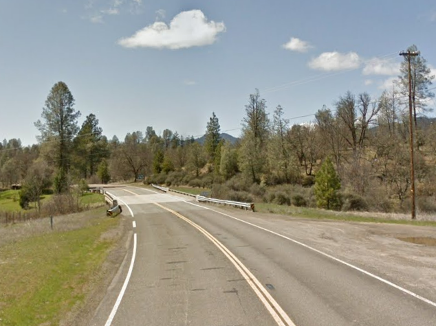
At Postmile SIS 31.73 CA 3 south crosses the Scott River.

At Postmile SIS 27.141 CA 3 south intersects Main Street of the community of Greenview. South of Main Street CA 3 crosses Kidder Creek.

At Postmile SIS 21.543 CA 3 enters the City of Etna and makes a eastern turn at Collier Way. CA 3 traffic is advised that Etna is the end of the signed truck route. Etna was originally known as "Rough & Ready"when settled and became "Etna Mills" when Post Office Service was established in 1861. Etna Mills was named for a nearby flour mill and was known as a center of mining activity in Scott Valley. In 1874 the State Legislature renamed the community simply to "Etna" but the former name often persisted (as seen in Part 1). Etna was incorporated as a City in 1878 and the Postal Service dropped "Etna Mills" in favor of "Etna" in 1924.

CA 3 departing Etna is signed as 12 miles from Callahan.

At Postmile SIS 20.43 CA 3 south crosses Etna Creek.

At Postmile SIS 16.90 CA 3 south crosses French Creek.

CA 3 southbound begins to follow the course of the Scott River towards it's South Fork/East Fort split near Callahan. At Postmile SIS 8.90 CA 3 south crosses the South Fork Scott River and enters Callahan. CA 3 is signed as 63 miles from Weaverville enters Callahan.


CA 3 swings eastward and intersects Gazelle-Callahan Road at Postmile SIS 6.95. Immediately past Gazelle-Callahan Road crosses the East Fork Scott River again.

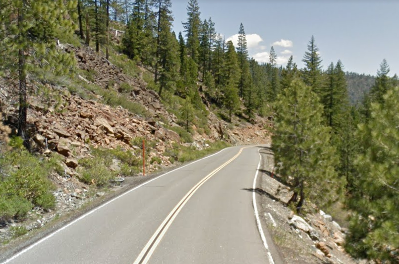
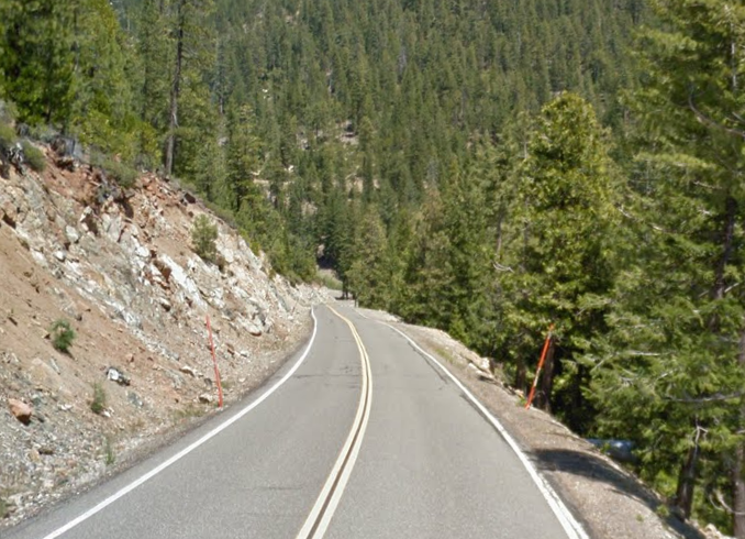
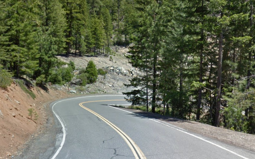
CA 3 south enters Klamath National Forest and begins to climb into the Scott Mountains. CA 3 encounters a sweeping hairpin approaching Mule Creek at Postmile SIS 4.63.


CA 3 south crosses the Trinity River at Postmile TRI 75.83.

The next crossing of the Trinity River on CA 3 south occurs at Postmile TRI 74.15.
CA 3 south crosses the Trinity River at Postmile TRI 70.93.

CA 3 south crosses the Trinity River again at Postmile TRI 69.48 approaching the Trinity River Campground.

Which is followed by another crossing the Trinity River at Postmile TRI 68.53.

At Postmile TRI 67.73 CA 3 south crosses Coffee Creek.

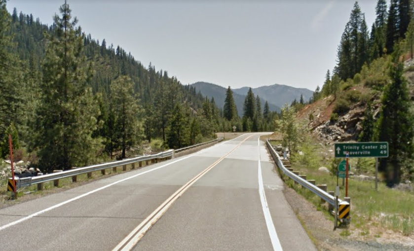
CA 3 south breaks west from the Trinity River and enters Trinity Center at Postmile TRI 59.96. Trinity Center was originally settled in 1851 as a stage stop on the California-Oregon Trail but the community was relocated in 1961 to make way for the Trinity Reservoir. CA 3 south passes through Trinity Center on Trinity Lake Boulevard.


CA 3 south from Trinity Center is signed as 29 miles from Weaverville.

CA 3 south upon crossing East Fork Stuart Creek where it intersects Guy Covington Drive at Postmile TRI 53.64. Guy Covington Drive accesses the community of Covington Mill.

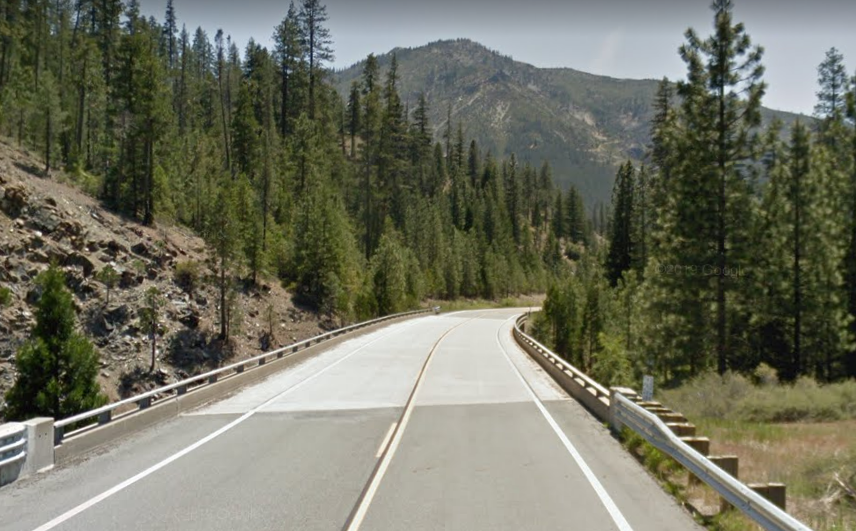
CA 3 south continues to track west around the Trinity Reservoir. At Postmile TRI 49.12 CA 3 south intersects Ridgeville Road which accesses Ridgeville and Estrellita

CA 3 south continues to traverse the edge of the Trinity Reservoir. At Postmile 43.97 CA 3 south crosses the western edge of the Trinity Reservoir via Cummings Creek.

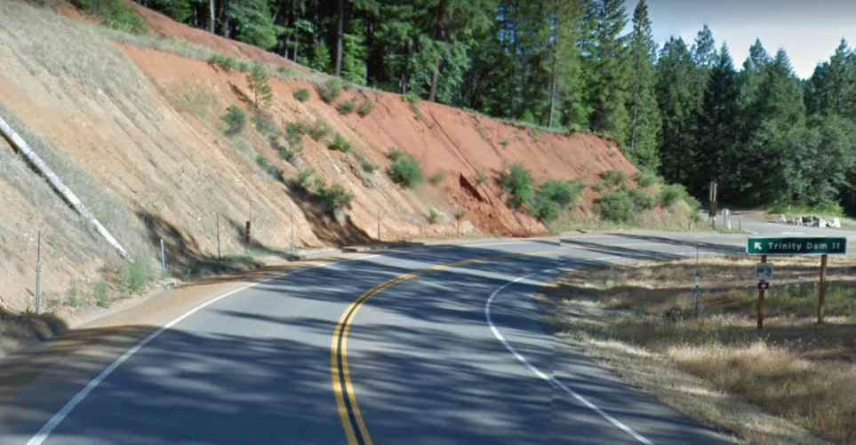
CA 3 south splits southwest from the Trinity Reservoir towards Weaverville. At Postmile TRI 38.77 CA 3 intersects Trinity Dam Boulevard.
CA 3 south enters the outskirts of Weaverville and passes by Lonnnie Pool Field Airport at Postmile TRI 32.34.

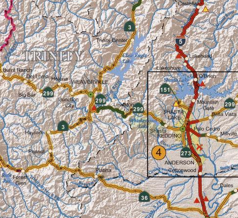
CA 3 south enters downtown Weaverville via Trinity Lake Boulevard and junctions CA 299 Postmile TRI 30.86. CA 3 south turns left to begin a multiplex of CA 299 (former US 299) east on Main Street.

As noted above Weaverville is the Trinity County Seat and by far it's largest community with a population approaching 3,600. Weaverville and the
Klamath Mountains were the site of a large Gold Rush which seems obtuse
considering most Californian mining towns were located in the Sierra
Nevada Range. Weaverville was founded in 1850 and incredibly remote for
the time given it lied west of the California-Oregon Trail. Access to Weaverville by stage route did not come until
1853.


CA 3 south/CA 299 east on Main Street by Weaverville Joss House State Historic Park at Route 299 Postmile TRI 51.64.

CA 3 south/CA 299 east on Main Street crosses East Fork Weaver Creek at Route 299 Postmile TRI 52.14.

CA 3 south/CA 299 east is signed as the Trinity Highway departing Weaverville. CA 3 south/CA 299 east leaving Weaverville is signed with control cities on CA 299 eastbound.


CA 3 south/CA 299 follows Weaver Creek southward towards Douglas City. At Route 299 Postmile R57.87 CA 3 south/CA 299 east intersects Steiner Flat Road which is signed as access to Douglas City. Gold was discovered in the Trinity River at the current site of Douglas City in 1848. Douglas City was settled in 1850 as a mining community and was named for Stephen Douglas.

CA 3 south/CA 299 east crosses the Trinity River. CA 3 south splits from CA 299 east upon crossing the Trinity River towards Hayfork. Hayfork is signed as 24 miles to the south on CA 3.


CA 3 south begins an ascent to Hayfork Summit. At Postmile TRI 18.45 CA 3 south crosses Hayfork Summit which lies at an elevation of 3,660 feet above sea level.


CA 3 south follows a gradual westward descent from Hayfork Summit and enters the community of Hayfork at Postmile TRI 7.12. Hayfork lies at elevation of 2,310 feet above sea level.


CA 3 south makes a southern turn in Hayfork near Hyampom Road at approximately Postmile TRI 6.73. Forest Glen and Eureka are lissted as control cities ahead for traffic following CA 3 south.


CA 3 south follows the course of Salt Creek towards the community of Peanut. At Postmile TRI 0.05 CA 3 south intersects Old Highway 36 in Peanut.

Modern CA 3 south of Old Highway 36 inherited 4.774 miles of what was CA 36 which are carried by "L" suffixed Postmiles. Modern CA 3 south follows the course of Salt Creek and Blue Gulch to a terminus at modern CA 36.


Comments