
California State Route 284


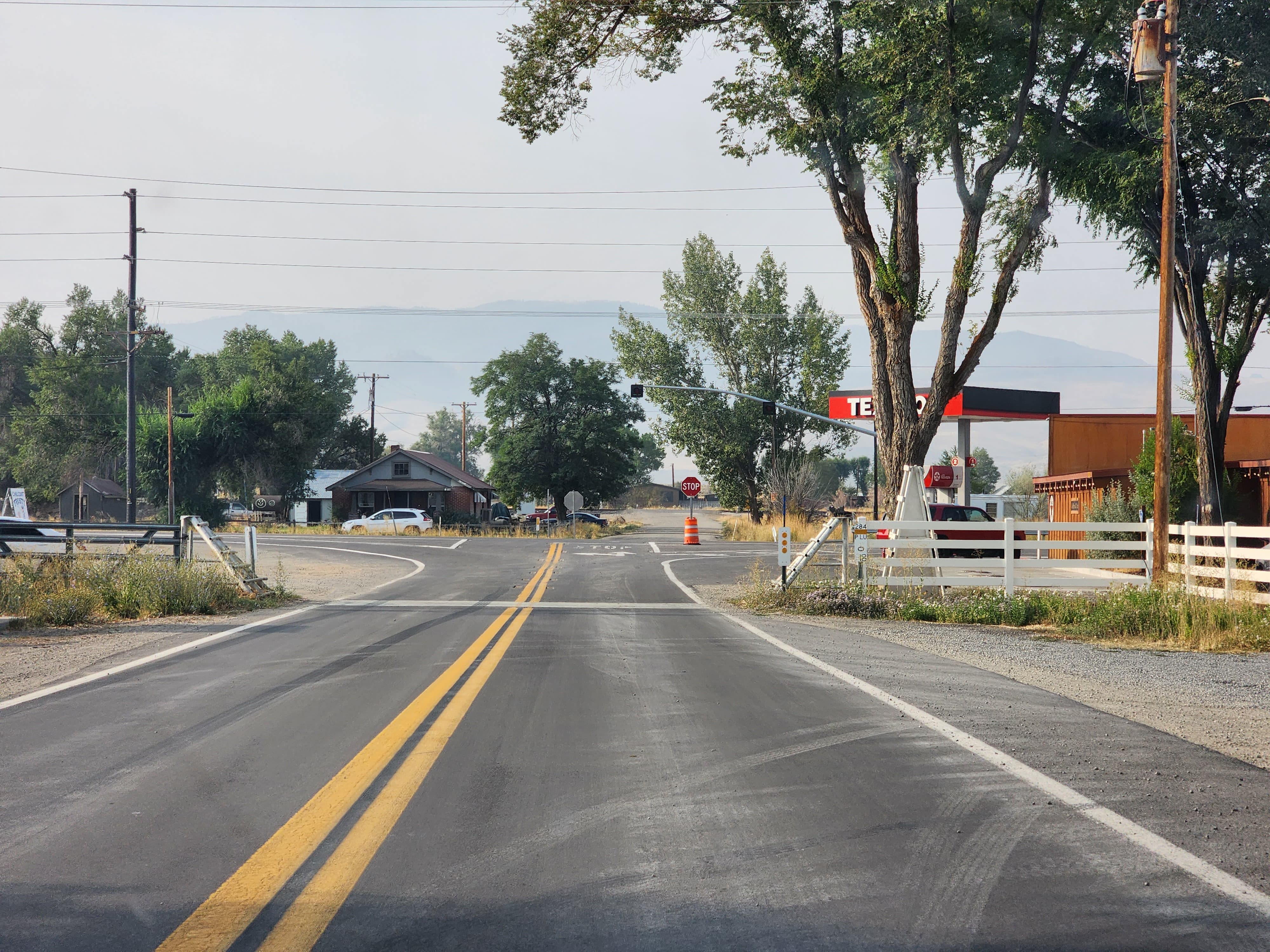
California State Route 284 is an eight-mile State Highway located entirely in Plumas County.  California State Route 284 begins at California State Route 70 in Chilcoot and terminates at Frenchman Reservoir.  California State Route 284 is one of many pre-existing roads which were annexed into the State Highway System by way of 1970 Legislative Chapter 1473.  Above as the blog cover photo is a southward view on California State Route 284 (taken by Josh Schmid) as it descends from Frenchman Reservoir on Frenchman Lake Road.  


Part 1; the history of California State Route 284 and unconstructed California State Route 285

California State Route 284 (CA 284) was adopted as part of 1970 Legislative Chapter 1473.  CA 284 was designated as a highway connecting from Route 70 in Chilhoot to Frenchman Reservoir.  Legislative Chapter 1473 defined numerous State Highways during 1970, some of the others include CA 283, CA 281, CA 271, and CA 270.

Notably the Chapter 1473 State Highways appear to have been contingent that an existing roadway be built to State Highway Standards.  To that end Frenchman Lake was completed as a California Department of Water Resources irrigation project by 1961 along Little Last Chance Creek.  The existing Frenchman Lake Road appears to have been improved during the Frenchman Lake project and was adopted as the alignment of CA 284.  Notably modern Frenchman Lake Road appears on the 1935 Division of Highways Map of Plumas County north of Chilhoot.


On the 1975 Caltrans State Highway Map the full 8-mile route of CA 284 appears as a fully functional State Highway.


Chapter 2; a virtual drive on California State Route 284

From CA 70 west in Chilhoot-Vinton traffic is advised that CA 284 can be found on Frenchman Lake Road.


Below is a northward series of photos by Josh Schmid of CA 284 as it climbs from Chilcoot to a terminus at Frenchman Reservoir.  CA 284 northbound terminates at Post Mile PLU 8.302 at the south shore of Frenchman Lake.


Below of series of photos by Josh Schmid depicts southbound CA 284 descending from Frenchman Reservoir to CA 70 in Chilcoot.  


Update history

-  First published on May 24, 2020.
-  First updated on September 12, 2022.  

Comments

Popular posts from this blog

North Carolina Continues to Move Forward with Rail

2023 and the first half of 2024 have seen continued growth in North Carolina's passenger rail system.  From increased daily trains from Raleigh to Charlotte, federal funds for studying additional corridors, and receiving a historic grant to begin the construction of high-speed rail between Raleigh and Richmond, the last 18 months have been a flurry of activity at NCDOT's Rail Division.  And that's just the tip of the iceberg. As ridership and routes increase - the engine of North Carolina passenger rail trains will become a more common sight. (Adam Prince) Increased Passenger Train Service: On July 10, 2023, a fourth Piedmont round-trip rail service between Raleigh and Charlotte commenced.  The four Piedmont trains plus the daily Carolinian (to Washington, DC, and New York) bring the total of trains serving the two cities daily to five. The current daily Piedmont and Carolinian schedule between Charlotte and Raleigh (NCDOT) The result was over 641,000 passengers utilized pa

US Route 101 in Benbow, Garberville and Redway

The communities of Benbow, Garberville and Redway can all be found along US Route 101 within southern Humboldt County.  The former surface alignment of US Route 101 in Garberville and Redway once crossed the Garberville Bluffs along what is now Redwood Drive via a corridor constructed as part of the Redwood Highway during the 1910s.  US Route 101 through Benbow, Garberville and Redway was modernized by 1935.  US Route 101 would eventually be upgraded to freeway standards in Benbow, Garberville and Redway by extension of the Redwood Freeway during 1966-68.  As the cover photo the original grade of US Route 101 and the Redwood Highway can be seen at the Garberville Bluffs during 1934.  US Route 101 can be seen in the communities of Benbow, Garberville and Redway on the 1935 Division of Highways Map of Humboldt County .   The history of US Route 101 in Benbow, Garberville and Redway Benbow, Garberville and Redway lie on the banks of the South Fork Eel River of southern Humboldt County.  D

The Midway Palm and Pine of US Route 99

Along modern day California State Route 99 south of Avenue 11 just outside the City limits of Madera one can find the Midway Palm and Pine in the center median of the freeway.  The Midway Palm and Pine denotes the halfway point between the Mexican Border and Oregon State Line on what was US Route 99.  The Midway Palm is intended to represent Southern California whereas the Midway Pine is intended to represent Northern California.  Pictured above the Midway Palm and Pine can be seen from the northbound lanes of the California State Route 99 Freeway.   This blog is part of the larger Gribblenation US Route 99 Page.  For more information pertaining to the other various segments of US Route 99 and it's three-digit child routes check out the link the below. Gribblenation US Route 99 Page The history of the Midway Palm and Pine The true timeframe for when the Midway Palm and Pine (originally a Deadora Cedar Tree) were planted is unknown.  In fact, the origin of the Midway Palm and Pine w