Aptos Creek Road is a roadway in Santa Cruz County, California which connects the community of Aptos north to The Forest of Nisene Marks State Parks. Aptos Creek Road north of Aptos is largely unpaved and is where the town site of Loma Prieta can be located. Loma Prieta was a sawmill community which operated from 1883-1923 and reached a peak population of approximately three hundred. Loma Prieta included a railroad which is now occupied by Aptos Creek Road along with a spur to Bridge Creek which now the Loma Prieta Grade Trail. The site of the Loma Prieta Mill and company town burned in 1942.
Part 1; the history of Aptos Creek Road and the Loma Prieta town site
Modern Aptos traces its origin to Mexican Rancho Aptos. Rancho Aptos was granted by the Mexican Government in 1833 Rafael Castro. Rancho Aptos took its name from Aptos Creek which coursed through from the Santa Cruz Mountains to Monterey Bay. Castro initially used Rancho Aptos to raise cattle for their hides. Following California becoming an American State in 1850 the property ownership at Rancho Aptos was recognized and Castro began to lease his lands. Soon a small town emerged on Rancho Aptos which included a wharf, general store and lumber mill.
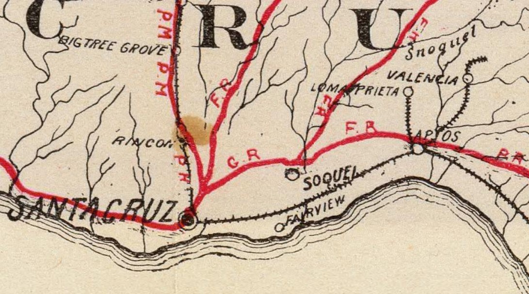
During 1872 sugar magnate Charles Spreckels began purchasing large tracts of Castro's land holdings to make way for a Southern Pacific Railroad line. Aptos came to further prominence when Loma Prieta Lumber Company opened operations and a company town of the same name directly north of Aptos in 1883. The town site of Loma Prieta along with the spur line north of Aptos via Aptos Creek can be seen on the 1896 George Blum Map.
Loma Prieta can be seen in greater detail on the
1914 Weber's Map of Santa Cruz County.

The Loma Prieta Lumber Company would actively log the Santa Cruz Mountains north of Aptos until 1923. During 1924 much of the Loma Prieta Mill was dismantled. At the height of Loma Prieta, the town site included a railroad depot, post office, saloon, company store and hotel. The remains of Loma Prieta burned in 1942 in what is suspected to be an unsolved case of arson.
Following the closure of Loma Prieta much of the former holdings were purchased by Nisene Marks out of Salinas who hoped to locate an oil well. After no oil was found the Marks family donated their 9,700-acre holdings to the Nature Conservancy during 1963. The California State Parks along with the Save the Redwoods League also obtained additional parcels of land which were used to create
The Forest of the Nisene Marks State Park. The Forest of Nisene Marks State Park is largely known for containing numerous mountain bike trails along with new growth Coastal Redwoods which were planted during the declining years of the Loma Prieta Mill.
Part 2; visiting the site of Loma Prieta via Aptos Creek Road
Aptos Creek Road begins in Aptos at Soquel Drive (former California State Route 1).
Aptos Creek Road crosses north over the railroad tracks in Aptos and The Forest of Nisene Marks State Park.
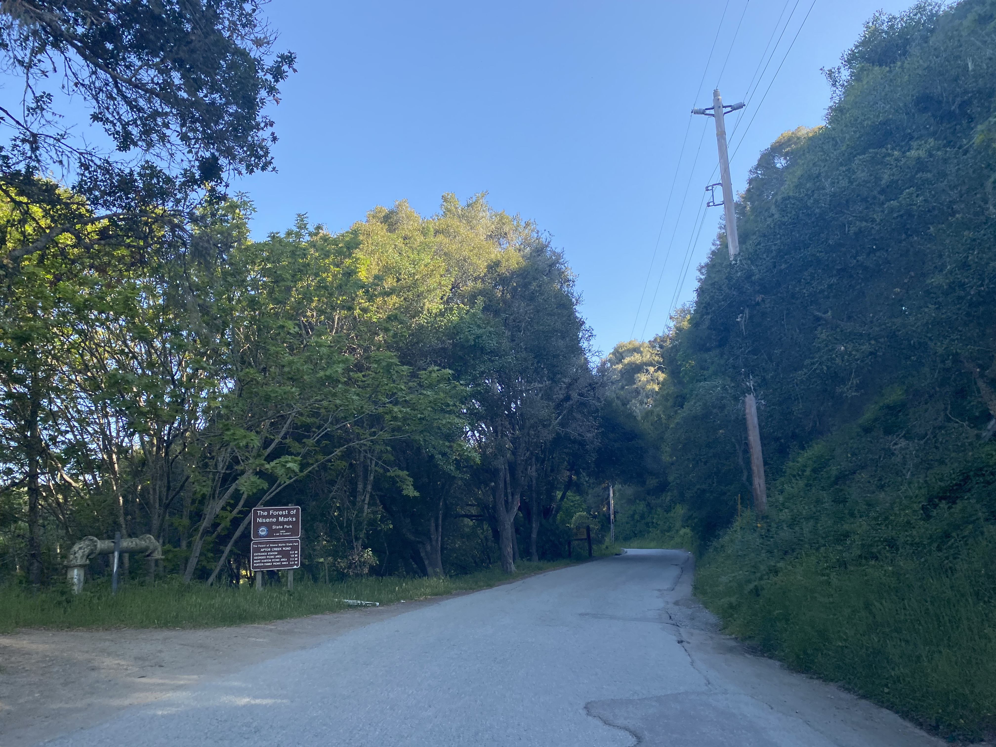
Aptos Creek Road continues north past some private residences as a paved road. The pavement on Aptos Creek Road ends approaching the entry station to The Forest of Nisene Marks State Park.
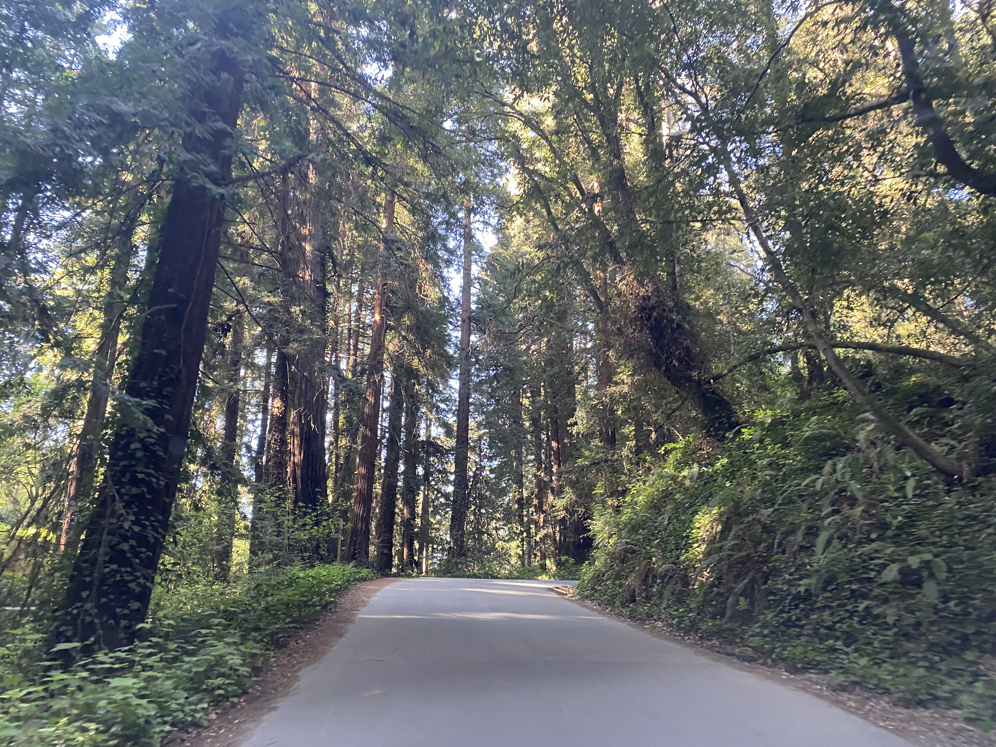
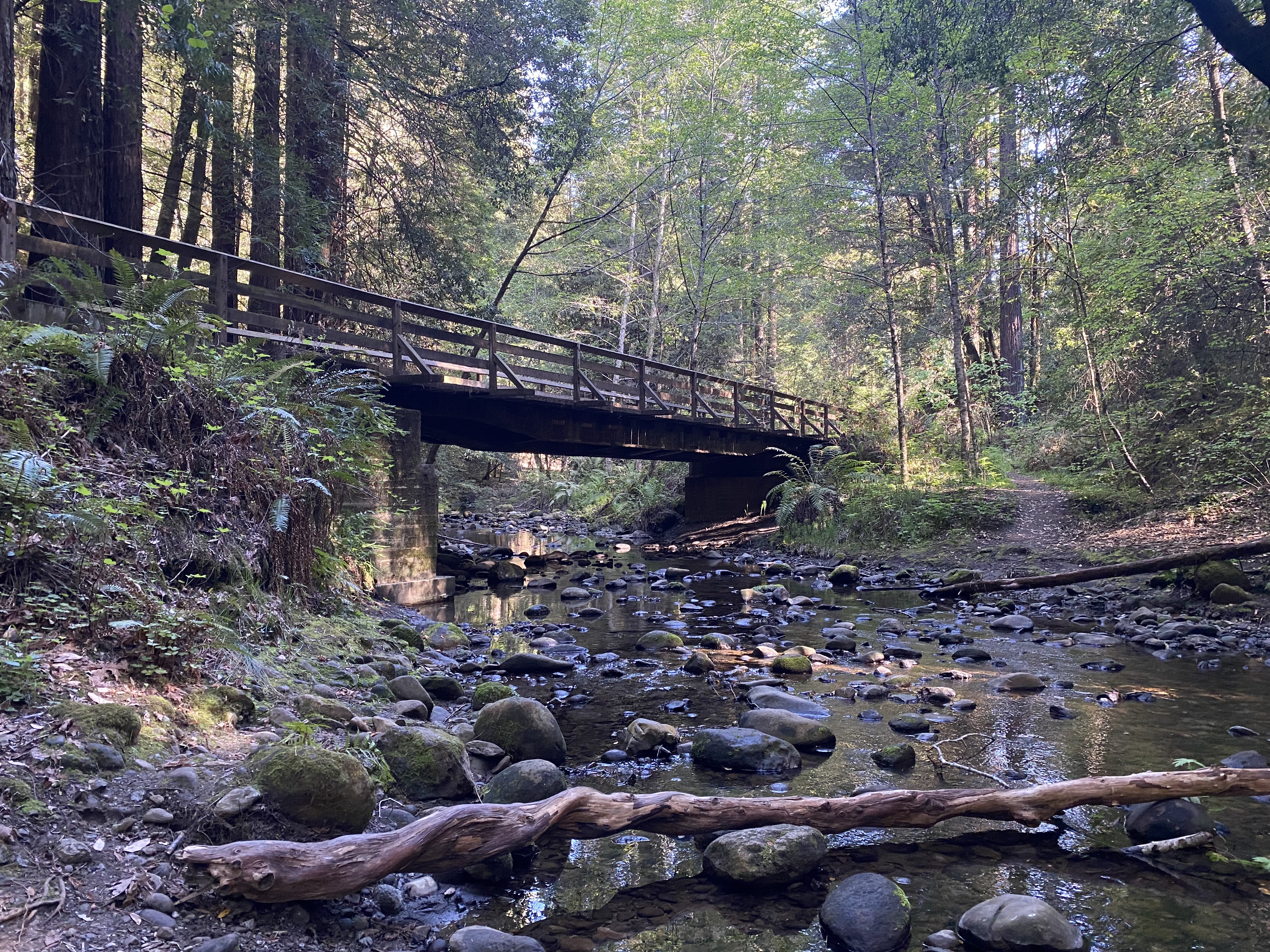
Aptos Creek Road continues north from the State Park entrance station and crosses Aptos Creek at the Steel Bridge. The
Steel Bridge is a 73.2-foot-long Bailey Truss span which was installed during 1955.
Upon crossing the Steel Bridge, the railroad style grade of Aptos Creek Road is obvious to observe. The railroad bed now used by Aptos Creek Road was cut by Chinese mining crews from 1880 to 1883.
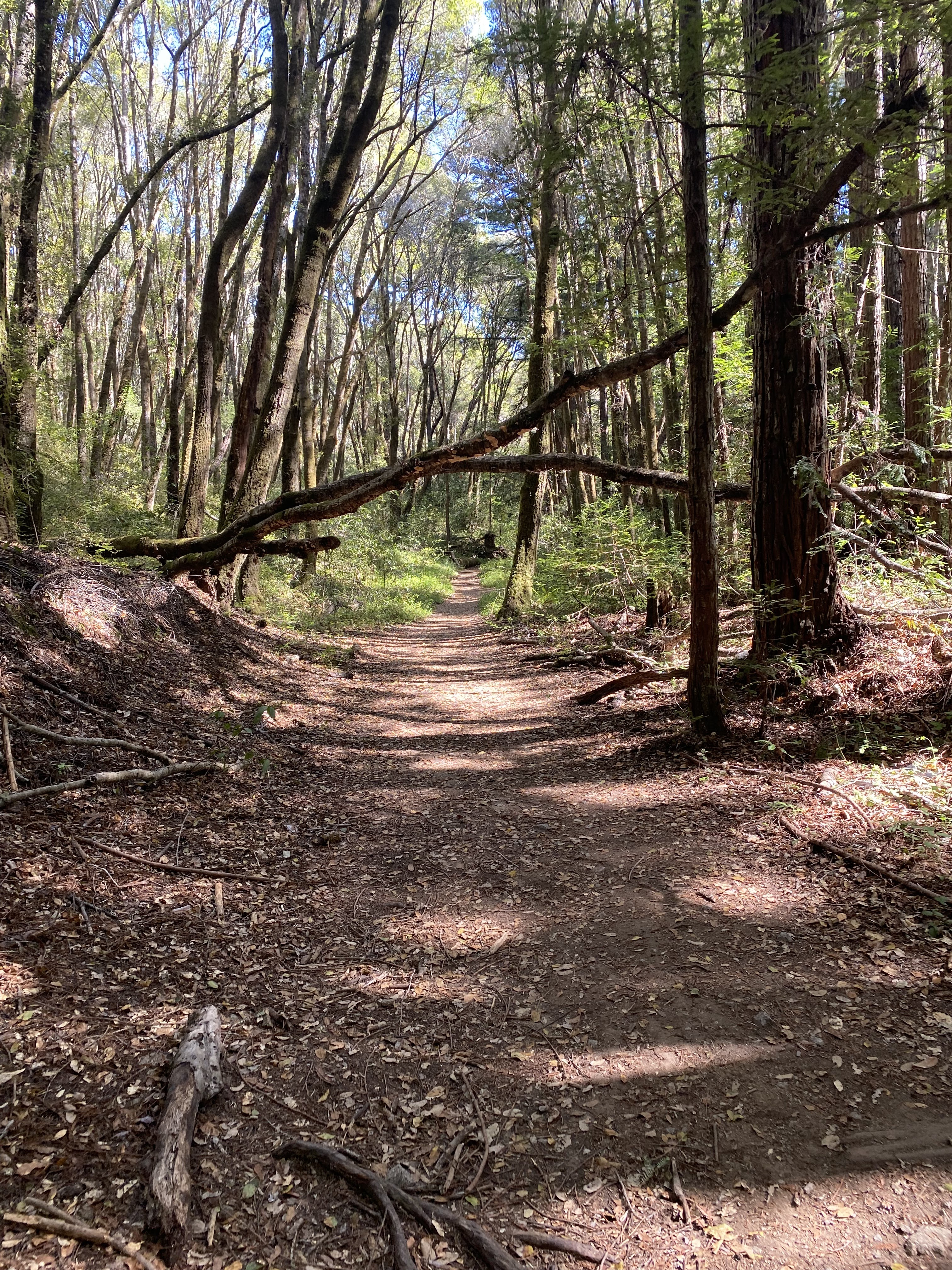
Aptos Creek Road continues northwards to a parking lot which serves as the trailhead for the Aptos Creek Fire Road Trail. The site of Loma Prieta is listed on the trailhead guide sign as being located 0.5 miles to the north on the Aptos Creek Fire Road Trail.
Continuing northward the Aptos Creek Fire Road Trail quickly intersects the Loma Prieta Grade Trail. As noted above the Loma Prieta Grade Trail is part of the spur Southern Pacific Railroad spur from the Loma Prieta Line to Bridge Creek
The Loma Prieta Grade Trail can be used to access the Bridge Creek Historic Site. Numerous railroad ties and evidence of the Bridge Creek spur can be found on the Loma Prieta Grade Trail.
Continuing north the Aptos Creek Fire Road Trail crosses Aptos Creek via Margaret's Bridge. The year Margaret's Bridge was constructed is unclear.
The Aptos Creek Fire Road Trail continues north to the site of Loma Prieta. Upon inspection of the overgrowth burned ruins of the Loma Prieta Mill can be observed. Loma Prieta is the namesake for the October 17, 1989, earthquake which struck the San Francisco Bay area. The Loma Prieta Earthquake epicenter was located at The Nisene of the Marks State Park at Five Finger Falls.
North of the site of Loma Prieta the Mill Pond Trail can be used to reconnect with the Loma Prieta Grade Trail. The Mill Pond Trail descends what the Loma Prieta logging pond site and passes by site of John Porter's home. John Porter would go on to become Lieutenant Governor of California in 1907.
The John Porter home site in Loma Prieta hikers can access Bridge Creek Historic Site via the Loma Prieta Grade Trail or Bridge Creek Trail. Bridge Creek was a lumber camp which operated out of nearby Loma Prieta and was the terminus of the Bridge Creek spur line.


Comments