California State Route 4; west from I-5 through the San Joaquin River Delta and Diablo Range to I-80
This past November I took a drive on California State Route 4 west of Interstate 5 to Interstate 80.

CA 4 west of I-5 traverses the notable terrain of the San Joaquin River Delta and Diablo Range. What was once a largely rural State Highway the corridor of CA 4 has been largely converted to limited access or is being consumed by traffic borne from urban sprawl from the San Francisco Bay Area.

Part 1; the history of CA 4 west of I-5 to I-80
What is now the corridor of CA 4 between I-5 west to Martinez was part of Legislative Route 75 and LRN 106 westward towards Hercules. LRN 75 according to CAhighways was originally defined as State Highway between Oakland and Walnut Creek in 1931. LRN 75 was extended east over the crest of the Sierra Nevada Mountains to Altaville in 1933. LRN 106 according to CAhighways was added to the State Highway System in 1933 with the loose route definition being from Hercules east to the Walnut Creek-Antioch Road.
In an August 1934 Department of Public Works Publication CA 4 was announced as a State Highway originating at US 40 near Pinole. CA 4 was aligned eastward through Stockton towards CA 89 near Markleeville.


While the alignment of CA 4 in San Joaquin County has some of the original surface alignment still in use the route of CA 4 in Contra Costa County is substantially different. The original path of CA 4 in San Joaquin County and Contra Costa Coasta is shown on 1935 Division of Highways Maps.
San Joaquin County

Contra Costa County


From Byron the original route of CA 4 westbound in Contra Costa County was as follows:
- North on Byron Highway to Brentwood Boulevard.
- Brentwood Boulevard northwest to downtown Brentwood.
- Brentwood Boulevard north to Sand Hill.
- Main Street north of Sand Hill to West Cypress Road.
- West on West Cypress Road to Rose Avenue.
- Rose Avenue north to Main Street in Oakley.
- Main Street west to 18th Street in Antioch.
- 18th Street west to A Street.
- A Street west to downtown Antioch likely to 2nd Street.
- Likely 2nd Street west in downtown Antioch to L Street.
- Likely L Street south to 4th Street.
- 4th Street west to Pittsburg-Antioch Highway.
- Pittsburg-Antioch Highway west likely to Harbor Street in Pittburg.
- Likely Habor Street north to 10th Street.
- 10th Street west through downtown Pittsburg to Willow Pass Road.
- Willow Pass Road west to Port Chicago Highway.
- Port Chicago Highway west to Main Street in Port Chicago.
- Main Street north through downtown Port Chicago to Waterfront Road.
- Waterfront Road west to Marina Vista Avenue in Martinez.
- Marina Vista Avenue west to Escobar Street in downtown Martinez where CA 4 would have had access to the Martinez-Benicia Ferry (the original route of US 40) at Ferry Street.
- Escobar Street west to Alhambra Avenue.
- Alhambra Avenue south to H Street.
- H Street west to Canyon Way.
- Canyon Way south to Franklin Canyon Road.
- Franklin Canyon Road west to what is now Sycamore Avenue in Hercules.
- Sycamore Avenue west to Willow Avenue.
- Willow Avenue west to US 40 on San Pablo Avenue.
Of note; Port Chicago as a way point on early CA 4 is interesting due to the 1944 Port Chicago Disaster. Port Chicago was heavily damaged when the nearby Port Chicago Naval Magazine suffered a large explosion of munitions in July 1944. 320 people were killed in the explosion at the Port Chicago Naval Magazine which would ensure the demise of Port Chicago. In 1968 all property in Port Chicago was purchased by the Federal Government as part of a safety buffer for the Concord Naval Weapons loading docks on Suisun Bay. Former CA 4 on; Port Chicago Highway, Main Street and Waterfront Road still exist as military roads which serve as the last evidence of the community of Port Chicago.
In a October 1935 Department of Public Works Guide CA 24 was announced as being extended south to Oakland. This extension included a multiplex of CA 4 near Oakley west through Pittsburg where CA 24 split towards Concord.

Given the complexity of early CA 4 in Contra Costa County it seems to have been a priority for development for the Division of Highways. This is evidenced by the fact that a new planned bypass route for LRN 106 of Port Chicago and Martinez first appears on the 1938 Division of Highways State Map.

In a October of 1939 Department of Public Works Guide the new alignment of CA 4/LRN 106 between Franklin Canyon Road east to CA 24 at Willow Pass was announced as being completed. This new highway which was called "Industrial Highway" served as a bypass of Martinez and Port Chicago. The grade of the Industrial Highway has been incorporated into the freeway grades of John Muir Parkway and California Delta Highway on modern CA 4.


The 1948 Division of Highways State Map shows CA 24 splitting away from CA 4 in Concord at what is now the grade of CA 242 as opposed to the original split at Willow Pass Road.

The 1950 Division of Highways State Map shows CA 4/CA 24 expanded to four lanes over Willow Pass and through Pittsburg.

The 1951 Division of Highways State Map shows the planned bypass route of Antioch and Pittsburg appear for the first time.

A new expressway alignment of CA 4/CA 24 west of Pittsburg is shown completed on the 1952 Division of Highways State Map.

The new expressway segment of CA 4/CA 24 west of Pittsburg is discussed in the March/April 1951 Department of Public Works Guide as the third leg of the Industrial Highway (formally known as Arnold Industrial Highway). The third leg of the Industrial Highway project is cited as beginning in March of 1950 with an origination point at Willow Pass east to Railroad Avenue in Pittsburg. The second segment of the Industrial Highway is cited as freeway grade through Willow Pass completed in August 1947. The March/April 1951 Department of Public Works Guide cites an anticipated completion of the third leg of the Industrial Highway as being in July of said year.


The 1957 Division of Highways State Map is the first edition to show a four lane segment of CA 4 in Franklin Canyon.

The planned interchange between CA 4 and I-680 near Martinez first appears on the 1960 Division of Highways State Map. Interestingly the planned route of the Benicia-Martinez Bridge of I-680 was assigned as a spur of LRN 75.

The 1963 Division of Highways Map State Map shows the interchange of CA 4 and I-680/CA 21 along with the Benicia-Martinez Bridge completed. For reference the Benicia-Martinez Bridge opened to traffic in September 1962.

During the 1964 State Highway Renumbering CA 24 was truncated to CA 4 in Concord, this can be seen on the Division of Highways State Map from said year.

After disappearing upon the completion of the third segment of the Industrial Highway a planned bypass of Antioch appears again on the 1965 Division of Highways Map State Map.

The 1967 Division of Highways State Map shows a planned freeway alignment of CA 4 in Franklin Canyon. CA 4 is shown to be completed to freeway standards eastward to Antioch.

The 1969 Division of Highways Map shows the freeway segment of CA 4 partially completed in Franklin Canyon.

The 1975 Caltrans State Map shows most of CA 4 completed to freeway standards between I-80 east to CA 160. A segment of CA 4 on Franklin Canyon Road remained a normal access highway. CA 4 continued as a freeway to a junction with CA 160 at 18th Street/Main Street near the approach to the Antioch Bridge. CA 4 east of CA 160 split onto it's original surface alignment on Main Street towards Oakley. At the time the priority was to funnel traffic in a higher capacity fashion via CA 160 towards Sacramento.


According to CAhighways the route of CA 4 from Hercules east to Cummings Skyway was converted to freeway standards by May of 2002. The 2005 Caltrans State Highway Map (which was used in the route descriptor photo above) doesn't show a planned freeway extension for CA 4 east of CA 160. The urban sprawl towards Brentwood and Byron truly is a recent development.

According to CAhighways a bypass of Brentwood began in three segments beginning in the early 2000s and were functionally completed circa 2008. The Brentwood Bypass segment of CA 4 added a limited access segment eastward to Vasco Road (planned CA 84) which is where the present freeway grade terminates. In February of 2012 the cities of Oakley and Brentwood accepted the relinquishment of the former surface segments of CA 4. Despite population growth eastward into Byron and commutes to the Bay Area now originating for some in Stockton Area there is now present plan to build a limited access grade for CA 4 towards I-5 through the San Joaquin River Delta.
Part 2; a drive on CA 4 from I-5 west to I-80
CA 4 overall is a 192 mile State Highway which crosses a massive variety of terrain. Previously CA 4 over Ebbetts Pass in the Sierra Nevada Mountains and the Cross Town Freeway in Stockton have been covered on Gribblenation.
Trans-Sierra Highways; CA 4 over Pacific Grade Summit and Ebbetts Pass
CA 4; Stockton Cross Town Freeway
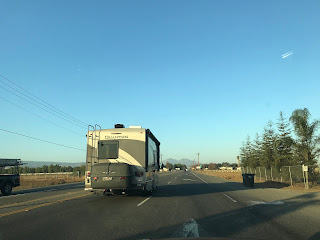
My approach to CA 4 westbound was from I-5 north in Stockton of San Joaquin County. CA 4 is accessed via Exit 471 onto Charter Way.


CA 4 westbound on Charter Way traverses through West Stockton to the 1933 San Joaquin River Swing Bridge at Post Mile SJ 14.179. The 1933 San Joaquin River Bridge carries a truss structure and 301.9 feet in length. The 1933 San Joaquin River Bridge also marks the western City Limit of Stockton and CA 4's emergence into the San Joaquin River Delta. At Tillie Lewis Drive CA 4 westbound is signed as 24 miles from Brentwood.


As CA 4 westbound passes Port of Stockton Expressway there is an advisory that the route of ahead is not meant for commercial trucks.


CA 4 westbound ascends onto a series of levee roads which are a signature of the San Joaquin River Delta and Sacramento River Delta. At Post Mile SJ 4.471 CA 4 westbound crosses the 1915 Middle River Bridge. The 1915 Middle River Bridge is a Howe Through Truss design which is 546.9 feet in length.


Upon crossing the Middle Fork Bridge the route of CA 4 westbound is almost directly aligned with Mount Diablo. At Post Mile SJ 0.05 CA 4 westbound approaches the 1915 Old River Bridge.


The 1915 Old River Bridge is the most impressive looking of the three older structures on CA 4 in the San Joaquin River Delta. The 1915 Old River Bridge is a Howe Through Truss span which is 527.9 feet in length. With the extremely sharp angle approach coupled with a 19.4 foot deck width there is a traffic signal to allow heavy trucks to cross safely. The 1915 Old River Bridge serves at the San Joaquin/Contra Costa County Line which is stray evidence that lends a clue to the fact that Old River is the original course of the San Joaquin River.


At Post Mile CC 46.459 CA 4 west intersects Discovery Bay Boulevard.


At Post Mile CC R44.367 CA 4 westbound intersects County Route J4 on Byron Highway.


CA 4 briefly swings northward on Byron Highway before turning west onto Marsh Creek Road.


CA 4 westbound continues on Marsh Creek Road to Vasco Road at Post Mile CC R37.987. Brentwood is signed as 4 miles to the west as CA 4 turns right onto Vasco Road.


CA 4 west quickly becomes a two lane freeway which is known as the John Marsh Heritage Highway. At Exit 35 CA 4 west accesses Balfour Road.


CA 4 westbound expands to a full four lane freeway approaching Exit 34 for Sand Creek Road.


CA 4 west Exit 33 accesses Lone Tree Way.

CA 4 west enters the City of Antioch, Oakley traffic is directed to take CA 160. At Exit 31 CA 4 west accesses Laurel Road.


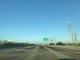
CA 4 west intersects CA 160 at Exit 160. CA 160 eastbound accesses the Antioch Bridge over the San Joaquin River and the Sacramento River Delta.


CA 4 west of CA 160 to I-680 is known as the California Delta Highway. CA 4 west Exit 29 accesses Hillcrest Avenue.


CA 4 west Exit 28 accesses Lone Tree Way and A Street.


From A Street CA 4 westbound is signed as 27 miles from Hercules.

CA 4 west Exit 27 accesses L Street and Contra Loma Boulevard.

The Mount Diablo Coal Field historic marker directs traffic to take Exit 26 onto Somersville Road/Auto Center Drive.


CA 4 west enters Pittsburg and accesses Loveridge Road at Exit 24.

At Exit 23 CA 4 west accesses Railroad Avenue and Harbor Street.

CA 4 west Exit 20A/B accesses Bailey Road.


CA 4 west Exit 19 accesses San Marco Boulevard.


CA 4 westbound begins to ascend over Willow Pass into the Diablo Range. CA 4 west over Willow Pass is signed as part of the De Anza Historic Route. At Exit 17 CA 4 westbound accesses Willow Pass Road descending into Concord.


CA 4 west Exit 15B accesses Port Chicago Highway whereas the split for CA 242 is located at Exit 15A.


CA 4 west Exit 13 accesses Solano Way.


CA 4 west Exit 12 B/C accesses I-680. The present interchange of CA 4 and I-680 is being rebuilt via a project that began in 2019.


CA 4 west of I-680 is known as John Muir Parkway. CA 4 west Exit 12A accesses Pacheco Boulevard.


CA 4 west enters Martinez and accesses Morello Avenue at Exit 11.


CA 4 west Exit 10 accesses Pine Street and Center Avenue.


CA 4 west Exit 9 accesses Alhambra Avenue. Exit 9 is signed as the access point for John Muir National Historic Site.


CA 4 westbound begins to ascend into the Diablo Range via Franklin Canyon. Exit 6 on CA 4 is signed as access to Port Costa via McEwen Road.


CA 4 west Exit 5 is signed as access to I-80 eastbound via Cummings Skyway.


CA 4 west begins to descend in elevation and accesses Franklin Canyon Road at Exit 3.


CA 4 west has an oddly substandard right on/right off Exit at Claeys Lane.


CA 4 west Exit 1C accesses Willow Avenue in Hercules.


CA 4 west accesses I-80 via Exit 1B whereas Exit 1A empties onto San Pablo Avenue.


CA 4 west of I-5 traverses the notable terrain of the San Joaquin River Delta and Diablo Range. What was once a largely rural State Highway the corridor of CA 4 has been largely converted to limited access or is being consumed by traffic borne from urban sprawl from the San Francisco Bay Area.

Part 1; the history of CA 4 west of I-5 to I-80
What is now the corridor of CA 4 between I-5 west to Martinez was part of Legislative Route 75 and LRN 106 westward towards Hercules. LRN 75 according to CAhighways was originally defined as State Highway between Oakland and Walnut Creek in 1931. LRN 75 was extended east over the crest of the Sierra Nevada Mountains to Altaville in 1933. LRN 106 according to CAhighways was added to the State Highway System in 1933 with the loose route definition being from Hercules east to the Walnut Creek-Antioch Road.
In an August 1934 Department of Public Works Publication CA 4 was announced as a State Highway originating at US 40 near Pinole. CA 4 was aligned eastward through Stockton towards CA 89 near Markleeville.

While the alignment of CA 4 in San Joaquin County has some of the original surface alignment still in use the route of CA 4 in Contra Costa County is substantially different. The original path of CA 4 in San Joaquin County and Contra Costa Coasta is shown on 1935 Division of Highways Maps.
San Joaquin County

Contra Costa County


From Byron the original route of CA 4 westbound in Contra Costa County was as follows:
- North on Byron Highway to Brentwood Boulevard.
- Brentwood Boulevard northwest to downtown Brentwood.
- Brentwood Boulevard north to Sand Hill.
- Main Street north of Sand Hill to West Cypress Road.
- West on West Cypress Road to Rose Avenue.
- Rose Avenue north to Main Street in Oakley.
- Main Street west to 18th Street in Antioch.
- 18th Street west to A Street.
- A Street west to downtown Antioch likely to 2nd Street.
- Likely 2nd Street west in downtown Antioch to L Street.
- Likely L Street south to 4th Street.
- 4th Street west to Pittsburg-Antioch Highway.
- Pittsburg-Antioch Highway west likely to Harbor Street in Pittburg.
- Likely Habor Street north to 10th Street.
- 10th Street west through downtown Pittsburg to Willow Pass Road.
- Willow Pass Road west to Port Chicago Highway.
- Port Chicago Highway west to Main Street in Port Chicago.
- Main Street north through downtown Port Chicago to Waterfront Road.
- Waterfront Road west to Marina Vista Avenue in Martinez.
- Marina Vista Avenue west to Escobar Street in downtown Martinez where CA 4 would have had access to the Martinez-Benicia Ferry (the original route of US 40) at Ferry Street.
- Escobar Street west to Alhambra Avenue.
- Alhambra Avenue south to H Street.
- H Street west to Canyon Way.
- Canyon Way south to Franklin Canyon Road.
- Franklin Canyon Road west to what is now Sycamore Avenue in Hercules.
- Sycamore Avenue west to Willow Avenue.
- Willow Avenue west to US 40 on San Pablo Avenue.
Of note; Port Chicago as a way point on early CA 4 is interesting due to the 1944 Port Chicago Disaster. Port Chicago was heavily damaged when the nearby Port Chicago Naval Magazine suffered a large explosion of munitions in July 1944. 320 people were killed in the explosion at the Port Chicago Naval Magazine which would ensure the demise of Port Chicago. In 1968 all property in Port Chicago was purchased by the Federal Government as part of a safety buffer for the Concord Naval Weapons loading docks on Suisun Bay. Former CA 4 on; Port Chicago Highway, Main Street and Waterfront Road still exist as military roads which serve as the last evidence of the community of Port Chicago.
In a October 1935 Department of Public Works Guide CA 24 was announced as being extended south to Oakland. This extension included a multiplex of CA 4 near Oakley west through Pittsburg where CA 24 split towards Concord.

Given the complexity of early CA 4 in Contra Costa County it seems to have been a priority for development for the Division of Highways. This is evidenced by the fact that a new planned bypass route for LRN 106 of Port Chicago and Martinez first appears on the 1938 Division of Highways State Map.

In a October of 1939 Department of Public Works Guide the new alignment of CA 4/LRN 106 between Franklin Canyon Road east to CA 24 at Willow Pass was announced as being completed. This new highway which was called "Industrial Highway" served as a bypass of Martinez and Port Chicago. The grade of the Industrial Highway has been incorporated into the freeway grades of John Muir Parkway and California Delta Highway on modern CA 4.


The 1948 Division of Highways State Map shows CA 24 splitting away from CA 4 in Concord at what is now the grade of CA 242 as opposed to the original split at Willow Pass Road.

The 1950 Division of Highways State Map shows CA 4/CA 24 expanded to four lanes over Willow Pass and through Pittsburg.

The 1951 Division of Highways State Map shows the planned bypass route of Antioch and Pittsburg appear for the first time.

A new expressway alignment of CA 4/CA 24 west of Pittsburg is shown completed on the 1952 Division of Highways State Map.

The new expressway segment of CA 4/CA 24 west of Pittsburg is discussed in the March/April 1951 Department of Public Works Guide as the third leg of the Industrial Highway (formally known as Arnold Industrial Highway). The third leg of the Industrial Highway project is cited as beginning in March of 1950 with an origination point at Willow Pass east to Railroad Avenue in Pittsburg. The second segment of the Industrial Highway is cited as freeway grade through Willow Pass completed in August 1947. The March/April 1951 Department of Public Works Guide cites an anticipated completion of the third leg of the Industrial Highway as being in July of said year.


The 1957 Division of Highways State Map is the first edition to show a four lane segment of CA 4 in Franklin Canyon.

The planned interchange between CA 4 and I-680 near Martinez first appears on the 1960 Division of Highways State Map. Interestingly the planned route of the Benicia-Martinez Bridge of I-680 was assigned as a spur of LRN 75.

The 1963 Division of Highways Map State Map shows the interchange of CA 4 and I-680/CA 21 along with the Benicia-Martinez Bridge completed. For reference the Benicia-Martinez Bridge opened to traffic in September 1962.

During the 1964 State Highway Renumbering CA 24 was truncated to CA 4 in Concord, this can be seen on the Division of Highways State Map from said year.

After disappearing upon the completion of the third segment of the Industrial Highway a planned bypass of Antioch appears again on the 1965 Division of Highways Map State Map.

The 1967 Division of Highways State Map shows a planned freeway alignment of CA 4 in Franklin Canyon. CA 4 is shown to be completed to freeway standards eastward to Antioch.

The 1969 Division of Highways Map shows the freeway segment of CA 4 partially completed in Franklin Canyon.

The 1975 Caltrans State Map shows most of CA 4 completed to freeway standards between I-80 east to CA 160. A segment of CA 4 on Franklin Canyon Road remained a normal access highway. CA 4 continued as a freeway to a junction with CA 160 at 18th Street/Main Street near the approach to the Antioch Bridge. CA 4 east of CA 160 split onto it's original surface alignment on Main Street towards Oakley. At the time the priority was to funnel traffic in a higher capacity fashion via CA 160 towards Sacramento.


According to CAhighways the route of CA 4 from Hercules east to Cummings Skyway was converted to freeway standards by May of 2002. The 2005 Caltrans State Highway Map (which was used in the route descriptor photo above) doesn't show a planned freeway extension for CA 4 east of CA 160. The urban sprawl towards Brentwood and Byron truly is a recent development.

According to CAhighways a bypass of Brentwood began in three segments beginning in the early 2000s and were functionally completed circa 2008. The Brentwood Bypass segment of CA 4 added a limited access segment eastward to Vasco Road (planned CA 84) which is where the present freeway grade terminates. In February of 2012 the cities of Oakley and Brentwood accepted the relinquishment of the former surface segments of CA 4. Despite population growth eastward into Byron and commutes to the Bay Area now originating for some in Stockton Area there is now present plan to build a limited access grade for CA 4 towards I-5 through the San Joaquin River Delta.
Part 2; a drive on CA 4 from I-5 west to I-80
CA 4 overall is a 192 mile State Highway which crosses a massive variety of terrain. Previously CA 4 over Ebbetts Pass in the Sierra Nevada Mountains and the Cross Town Freeway in Stockton have been covered on Gribblenation.
Trans-Sierra Highways; CA 4 over Pacific Grade Summit and Ebbetts Pass
CA 4; Stockton Cross Town Freeway
My approach to CA 4 westbound was from I-5 north in Stockton of San Joaquin County. CA 4 is accessed via Exit 471 onto Charter Way.


CA 4 westbound on Charter Way traverses through West Stockton to the 1933 San Joaquin River Swing Bridge at Post Mile SJ 14.179. The 1933 San Joaquin River Bridge carries a truss structure and 301.9 feet in length. The 1933 San Joaquin River Bridge also marks the western City Limit of Stockton and CA 4's emergence into the San Joaquin River Delta. At Tillie Lewis Drive CA 4 westbound is signed as 24 miles from Brentwood.


As CA 4 westbound passes Port of Stockton Expressway there is an advisory that the route of ahead is not meant for commercial trucks.


CA 4 westbound ascends onto a series of levee roads which are a signature of the San Joaquin River Delta and Sacramento River Delta. At Post Mile SJ 4.471 CA 4 westbound crosses the 1915 Middle River Bridge. The 1915 Middle River Bridge is a Howe Through Truss design which is 546.9 feet in length.


Upon crossing the Middle Fork Bridge the route of CA 4 westbound is almost directly aligned with Mount Diablo. At Post Mile SJ 0.05 CA 4 westbound approaches the 1915 Old River Bridge.


The 1915 Old River Bridge is the most impressive looking of the three older structures on CA 4 in the San Joaquin River Delta. The 1915 Old River Bridge is a Howe Through Truss span which is 527.9 feet in length. With the extremely sharp angle approach coupled with a 19.4 foot deck width there is a traffic signal to allow heavy trucks to cross safely. The 1915 Old River Bridge serves at the San Joaquin/Contra Costa County Line which is stray evidence that lends a clue to the fact that Old River is the original course of the San Joaquin River.


At Post Mile CC 46.459 CA 4 west intersects Discovery Bay Boulevard.


At Post Mile CC R44.367 CA 4 westbound intersects County Route J4 on Byron Highway.


CA 4 briefly swings northward on Byron Highway before turning west onto Marsh Creek Road.


CA 4 westbound continues on Marsh Creek Road to Vasco Road at Post Mile CC R37.987. Brentwood is signed as 4 miles to the west as CA 4 turns right onto Vasco Road.


CA 4 west quickly becomes a two lane freeway which is known as the John Marsh Heritage Highway. At Exit 35 CA 4 west accesses Balfour Road.


CA 4 westbound expands to a full four lane freeway approaching Exit 34 for Sand Creek Road.


CA 4 west Exit 33 accesses Lone Tree Way.

CA 4 west enters the City of Antioch, Oakley traffic is directed to take CA 160. At Exit 31 CA 4 west accesses Laurel Road.


CA 4 west intersects CA 160 at Exit 160. CA 160 eastbound accesses the Antioch Bridge over the San Joaquin River and the Sacramento River Delta.


CA 4 west of CA 160 to I-680 is known as the California Delta Highway. CA 4 west Exit 29 accesses Hillcrest Avenue.


CA 4 west Exit 28 accesses Lone Tree Way and A Street.


From A Street CA 4 westbound is signed as 27 miles from Hercules.

CA 4 west Exit 27 accesses L Street and Contra Loma Boulevard.

The Mount Diablo Coal Field historic marker directs traffic to take Exit 26 onto Somersville Road/Auto Center Drive.


CA 4 west enters Pittsburg and accesses Loveridge Road at Exit 24.


At Exit 23 CA 4 west accesses Railroad Avenue and Harbor Street.

CA 4 west Exit 20A/B accesses Bailey Road.


CA 4 west Exit 19 accesses San Marco Boulevard.


CA 4 westbound begins to ascend over Willow Pass into the Diablo Range. CA 4 west over Willow Pass is signed as part of the De Anza Historic Route. At Exit 17 CA 4 westbound accesses Willow Pass Road descending into Concord.


CA 4 west Exit 15B accesses Port Chicago Highway whereas the split for CA 242 is located at Exit 15A.


CA 4 west Exit 13 accesses Solano Way.


CA 4 west Exit 12 B/C accesses I-680. The present interchange of CA 4 and I-680 is being rebuilt via a project that began in 2019.


CA 4 west of I-680 is known as John Muir Parkway. CA 4 west Exit 12A accesses Pacheco Boulevard.


CA 4 west enters Martinez and accesses Morello Avenue at Exit 11.


CA 4 west Exit 10 accesses Pine Street and Center Avenue.


CA 4 west Exit 9 accesses Alhambra Avenue. Exit 9 is signed as the access point for John Muir National Historic Site.


CA 4 westbound begins to ascend into the Diablo Range via Franklin Canyon. Exit 6 on CA 4 is signed as access to Port Costa via McEwen Road.


CA 4 west Exit 5 is signed as access to I-80 eastbound via Cummings Skyway.


CA 4 west begins to descend in elevation and accesses Franklin Canyon Road at Exit 3.


CA 4 west has an oddly substandard right on/right off Exit at Claeys Lane.


CA 4 west Exit 1C accesses Willow Avenue in Hercules.


CA 4 west accesses I-80 via Exit 1B whereas Exit 1A empties onto San Pablo Avenue.


Comments