
Caliente Creek Road is an approximately 19-mile rural highway located in the Sierra Nevada of eastern Kern County. Caliente Creek Road begins at the intersection of Walker Basin Road and Piute Mountain Road at northern extent of Twin Oaks. From Walker Basin the highway travels in a clockwise direction via canyons along the namesake Caliente Creek to Caliente-Bodfish Road. Caliente Creek Road is maintained as Kern County Road 487.
Much of Caliente Creek Road was developed as part of the larger Baker Stage Road south of Havilah (the original Kern County seat) to Tehachapi Pass. The community of Lorraine would develop where the Baker Stage Road turned south from Caliente Creek along Indian Creek. Following founding of the town of Caliente by the Southern Pacific Railroad a cutoff from Caliente-Bodfish Road in Oiler Canyon to Indian Creek would be developed. This cutoff east of Oiler Creek comprises the canyon lined segment of Caliente Creek Road which is a favorite of driving enthusiasts traveling to the Twin Oaks General Store.

Part 1; the history of Caliente Creek Road
Caliente-Creek Road is a segment of what was Thomas Baker's stage road to Kern River Valley. The Kern River Gold Rush began in 1853 and spurred development in the southern extent of the Sierra Nevada range.
The Stockton-Los Angeles Road came into use to facilitate travel to the then new Kern River mining claims. The Stockton-Los Angeles Road was a replacement of the earlier route known as El Camino Viejo. Unlike the El Camino Viejo the Stockton-Los Angeles Road avoided the dense Tule Marches in San Joaquin Valley. The Stockton-Los Angles Road stayed close to the Sierra Nevada foothills near the new claims on the Kern River watershed. The corridor of Stockton-Los Angeles Road was also part of the 1858-61 alignment of the southern Butterfield Overland Mail Route.
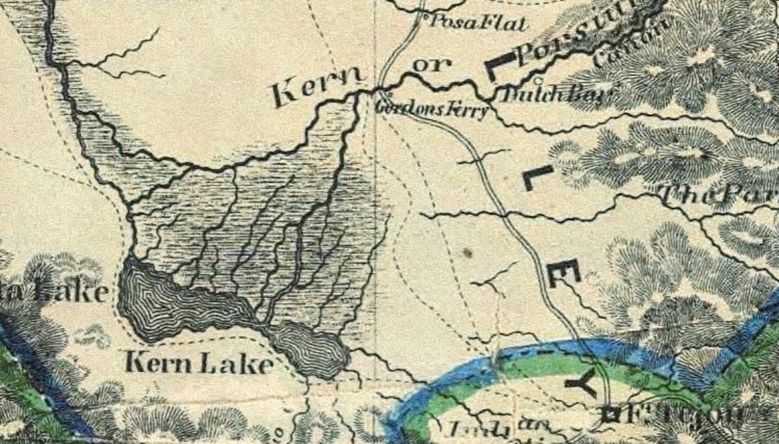
On April 30, 1855, Buena Vista County was formed by the State Legislature out of what had been the dividing line of Township 20 and Township 21 of Tulare County. The Stockton-Los Angeles Road can be seen on the 1857 Britton & Rey's Map of California heading south from the vicinity of Visalia to the Buena Vista County line via Woodville. The Stockton-Los Angeles Road in Buena Vista County continued south over the Tule River to Stickney's Ferry near Tailholt (displayed as Whites). A trail connecting Tailholt to Linn Valley and the Kern River via Greenhorn Summit is displayed branching from the Stockton-Los Angeles Road.


Buena Vista County was dissolved during 1859 and reabsorbed back into Tulare County. During 1860 a stage road would be created out of the previous trail from Tailholt to the Kern River by way of state funds utilized by Thomas Baker. Thomas Baker's stage road is sometimes referred to in historic record as the "the old Bull Road." The Baker Stage Road continued south from the Kern River towards Tehachapi Pass via Havilah.
Another attempt to split southern Tulare County occurred during 1864 in the form of proposed Coso County. Coso County would have comprised lands which make up present-day Kern County and Inyo County. The proposed Coso County was to be voted upon during 1864 but the election never took place.
Kern County would be formed out of southern Tulare County on April 2, 1866. Kern County comprised the former lands of Tulare County below the Township 24 and Township 25 line. The new Tulare County/Kern County line was located just south of Tailholt and near the Stockton-Los Angeles Road/Baker Stage Road junction. Havilah located on portion of the Baker Stage Road south of the Kern River was selected the original Kern County Seat.
The presence of a stable population in Walker Basin led to the Baker Stage Road being extended southward to Tehachapi Pass. The extended corridor followed what is now Caliente Creek Road to Indian Creek. From Indian Creek the stage road continued southward to Tehachapi Pass emerging near the site of the Monolith Mine.


The small mining community of Paris would begin to develop at the confluence of Caliente Creek and Indian Creek. Paris had initially been settled by miners hailing from eastern France. Paris would receive Post Office service in 1903 but would rename to Lorrain in 1912. The Lorraine Post Office would close for the second and final time in 1926.


As Caliente Creek Road tracks west from Lorraine it picks up to the course of Caliente Creek. The highway winds through the canyon terrain and passes over numerous low water bridges. The western terminus of Caliente Creek Road is located in Oiler Canyon where it merges into the Lion's Trail descent of Caliente-Bodfish Road.


The popularity of the Stockton-Los Angeles Road began to decline rapidly as the Central Pacific Railroad line through San Joaquin Valley was built during the 1870s. Farm diversions for irrigation in San Joaquin Valley and the presence of various rail sidings along the Central Pacific Railroad spurred infrastructure development which made travel through previous wetlands easier.
The 1873 Bancroft's Map of California shows White River (previously Tailholt) located south of the main junction of the Stockton-Los Angeles Road and Baker Stage Road. The primary junction of the Stockton-Los Angeles Road and Baker Stage Road is displayed branching at Fountain Springs. The Baker Stage Road con be seen heading south over Greenhorn Summit towards Kernville, Isabella, Bodfish and Havilah. From Havilah the Baker Stage Road is seen branching through Walker Basin towards Willow Springs via the community of Joe Walker. The Baker Stage Road passed through the future town site of Tehachapi and crossed the Tehachapi Mountains roughly where Tehachapi-Willow Springs Road is now located.

During 1874 Havilah would lose the Kern County seat to Bakersfield. During April 1875 the Southern Pacific Railroad would plot Caliente siding at the site of Allen's Camp. The development of Caliente would have a significant impact on the development of the Baker Stage Road due to it serving as the temporary railroad terminus for sixteen months.
A new spur of the Baker Stage Road south of Rankin Ranch in Walker Basin to Caliente via Oiler Canyon was subsequently constructed. This nine-mile spur contained numerous curves and steep grades which led to it being known as the "Lion's Trail." The Lion's Trail can be seen connecting Caliente and Havilah on the 1882 Bancroft's Map of California. The completion of the Lion's Trail was the final development in what now known is Caliente-Bodfish Road.

Eventually an eastward cutoff from Oiler Canyon to Indian Creek via the canyons of Caliente Creek was constructed by Kern County. This cutoff road would become the final segment of modern Caliente Creek Road to be constructed. The Oiler Canyon-Indian Creek Road can be seen beginning in Township 30 South, Range 32 East on the 1898 W.B. Walkup map of Kern County.


Caliente Creek Road is displayed as a minor local highway on the 1935 Division of Highways map of Kern County. The highway is shown diverging east from Caliente-Bodfish Road at Oiler Canyon to Lorraine at Indian Creek. From Lorraine the highway is shown forming a semi-counterclockwise circle through Piute until reaching a terminus at Walker Basin Road and Piute Mountain Road.

Caliente Creek Road would see a minor population boom when the community of Twin Oaks was founded east of Lorraine in 1934. In 1935 the Twin Oaks Schoolhouse was constructed and would serve the community into the 1960s. The building reopened as the Twin Oaks General Store in 1979 and remains in operation into modern times. Twin Oaks as an unincorporated community comprises much of the ranching lands alongside Caliente Creek Road between the Twin Oaks General Store northward to Walker Basin Road.
Caliente Creek Road is currently maintained as Kern County Road 487 and is 19 miles in length. The highway from Caliente-Bodfish Road east to the Twin Oaks General Store is popular with car and motorcycle enthusiasts due to the winding course it takes through Caliente Creek.
Part 2; a drive on Caliente Creek Road
Caliente Creek Road begins as the eastern terminus of Walker Basin Road intersects Piute Mountain Road. Traffic is greeted by a "Welcome to Twin Oaks." The sign also notes the elevation to be 4,250 feet above sea level.


Caliente Creek Road begins with a largely southward descent from Walker Basin to the course of Caliente Creek. The highway passes by the Twin Oaks General Store approaching the southern terminus of Sand Canyon Road. The Twin Oaks Church is also another prominent building which is easily observed turning westward along Caliente Creek.


Westbound Caliente Creek Road enters Lorraine and picks up Indian Creek Road. Lorrain lies an at elevation of 2,671 feet above sea level and once was where the Baker Stage Road turned south towards Tehachapi Pass. The road along Indian Creek is no longer open to the public as it is blocked by the Monolith Mine and Cement Plant. The mine was originally known as Aqueduct when it received Post Office Service in 1908 but assumed the name Monolith in 1910.


Comments