
On November 5th, I headed down with Chris Allen to Charleston to the roadmeet hosted by Billy Riddle. We had lunch at the well known Hyman's Seafood on Meeting Street and the highlight of the tour was a close up view of the spectacular Arthur Ravenel, Jr. Bridge.
The entire set can be found here.
But before we get to the meet what about the route down. Well it was US 64, I-440, I-40, I-95, SC 327, US 301, US 52 into Charleston.
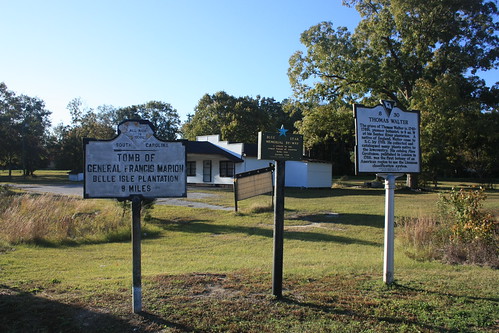
On US 52 near St. Charles was this interesting set of signs. First, that may be the smallest Blue Star Memorial Highway sign I've seen, and secondly the Francis Marion tomb historical marker sign reads "All Rich in Iodine" what does that mean?
I would love to have seen this overhead in the original button copy.
Hyman's Seafood did not disappoint and i you like Shrimp 'n Grits as much as I do, I highly recommend the Carolina Delight.
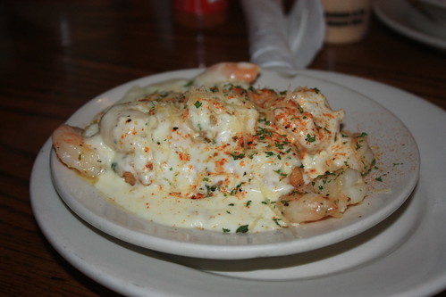
It's delicious!
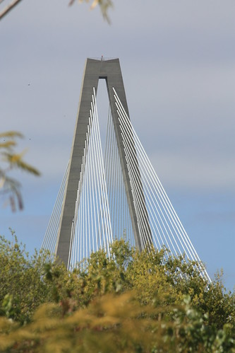
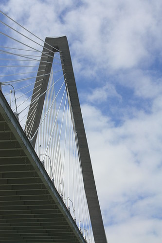
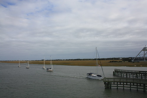
After lunch we headed over to Mount Pleasant Memorial Waterfront Park for some great views of the Ravenel Bridge. About two weeks earlier, I was fortunate to take some shots of the stunning structure at sunset from Patriot's Point. In this instance, we were able to park at a convenience store near the park and walk over to it. The convenience store allows Park/Bridge visitors two hours of free parking.
On the walk to the park, I came across this trailblazer for the East Coast Greenway.
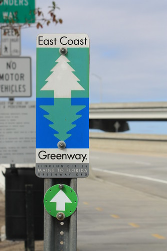
The East Coast Greenway is a network of nearly 3000 miles of bike paths and rail trails in various forms of development stretching from Florida to Maine. This was the first I had ever seen anything for the Greenway. Oddly enough, the next day along Water Street in Wilmington, NC I would see another.
The bridge itself is amazing...and there are so many ways to shoot and frame it.


There is also plenty to do at the Memorial Park. Fishing of course is very popular, but the open areas seem very popular for events as even a wedding ceremony and reception was being set up while we were there. Not a bad backdrop for a special event and evening.
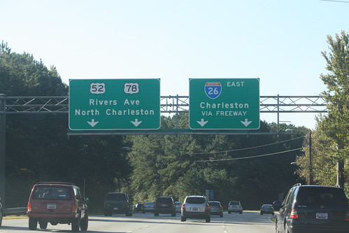
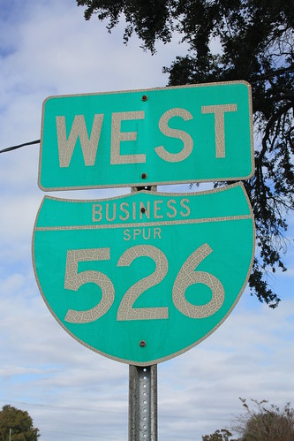
Next was a quick stop at the start of I-526 Business Spur West and a nearly 20 year old shield.
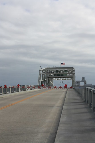
Someone suggested to check out the swing bridge on SC 703 over the Intracoastal. As luck would have it, we were able to get to the bridge right when it closed to allow boats to pass through. (Thank that red light at 526 Spur and 703 for that!)
From there we headed back towards US 17 where I headed to Wilmington via US 17, US 701, SC 90 and US 17. Fortunately, there were a few more sights on the trip home.
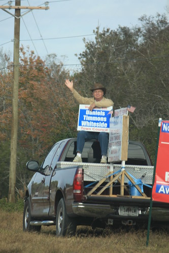
Like this guy, running for town council in Awendaw. No idea if he or his fellow candidates won.
Older shield overheads in Conway.
But finally, a contractor made set of US 17 shields that goes back to an older era.
These shields at a construction project in Brunswick County follow a design more popular 50-60 years ago. NC used this design once.
All in all a great road trip with some new roads and a great excuse to visit Charleston again. A nod to Billy Riddle for hosting a great meet!
The entire set can be found here.
But before we get to the meet what about the route down. Well it was US 64, I-440, I-40, I-95, SC 327, US 301, US 52 into Charleston.
On US 52 near St. Charles was this interesting set of signs. First, that may be the smallest Blue Star Memorial Highway sign I've seen, and secondly the Francis Marion tomb historical marker sign reads "All Rich in Iodine" what does that mean?
I would love to have seen this overhead in the original button copy.
Hyman's Seafood did not disappoint and i you like Shrimp 'n Grits as much as I do, I highly recommend the Carolina Delight.
It's delicious!
After lunch we headed over to Mount Pleasant Memorial Waterfront Park for some great views of the Ravenel Bridge. About two weeks earlier, I was fortunate to take some shots of the stunning structure at sunset from Patriot's Point. In this instance, we were able to park at a convenience store near the park and walk over to it. The convenience store allows Park/Bridge visitors two hours of free parking.
On the walk to the park, I came across this trailblazer for the East Coast Greenway.
The East Coast Greenway is a network of nearly 3000 miles of bike paths and rail trails in various forms of development stretching from Florida to Maine. This was the first I had ever seen anything for the Greenway. Oddly enough, the next day along Water Street in Wilmington, NC I would see another.
The bridge itself is amazing...and there are so many ways to shoot and frame it.
There is also plenty to do at the Memorial Park. Fishing of course is very popular, but the open areas seem very popular for events as even a wedding ceremony and reception was being set up while we were there. Not a bad backdrop for a special event and evening.
Next was a quick stop at the start of I-526 Business Spur West and a nearly 20 year old shield.
Someone suggested to check out the swing bridge on SC 703 over the Intracoastal. As luck would have it, we were able to get to the bridge right when it closed to allow boats to pass through. (Thank that red light at 526 Spur and 703 for that!)
From there we headed back towards US 17 where I headed to Wilmington via US 17, US 701, SC 90 and US 17. Fortunately, there were a few more sights on the trip home.
Like this guy, running for town council in Awendaw. No idea if he or his fellow candidates won.
Older shield overheads in Conway.
But finally, a contractor made set of US 17 shields that goes back to an older era.
These shields at a construction project in Brunswick County follow a design more popular 50-60 years ago. NC used this design once.
All in all a great road trip with some new roads and a great excuse to visit Charleston again. A nod to Billy Riddle for hosting a great meet!
Comments
Iodine State - For high iodine content in plants. In the late 1920s, the South Carolina Natural Resources Commission began a public relations campaign to advertise the high iodine levels found in fruits and vegetables grown in the state. Even South Carolina milk was promoted as containing extraordinarily high levels of iodine. Promotional tracts sought to expand the national market for South Carolina produce by warning midwestern and west coast residents of the consequences of iodine deficiency in the young, including enlarged thyroids, mental and physical birth defects, and even sterility. The campaign placed the motto �Iodine� on South Carolina automobile license plates in 1930, then expanded the phrase in subsequent years to �The Iodine State� and �The Iodine Products State.� Columbia radio station WIS took its call letters to promote the �Wonderful Iodine State.� Even lowcountry moonshiners around Hell Hole Swamp jumped on the iodine bandwagon, advertising their brand of liquid corn with the slogan: �Not a Goiter in a Gallon.�
"The Iodine State South Carolina has been referred to as "The Iodine State" because of the large percentages of iodine found in the vegetation growing in the state." http://www.netstate.com/states/intro/sc_intro.htm
"with $112.00 I have had made two aluminum signs to direct travelers to the tomb of Francis Marion. These signs have a mpa of the state at the top and the map is bordered with raised designs of fruits and vegetables. Across the face of the map is the legend "All rich in Iodine." One marker is on the Costal Highway..." This was from the historical commission of south carolina reporting to the general assembly in 1931