
Trona-Wildrose Road and Trona Road is a combined highway corridor which traverses some of the most remote regions of the Mojave Desert. Both roads are heavily tied to the founding of the community of Trona in 1913 but functionally existed all the way back to the plight of the Death Valley 49ers. The combined highway corridor is approximately 66.7 miles long from Panamint Valley Road in Inyo County and US Route 395 near Johannesburg of Kern County. Trona Road from Poison Canyon westward approximately 7.8 miles is carried as part of California State Route 178.

Part 1; the history of Trona-Wildrose Road and Trona Road
The rough path taken by the corridors of Trona-Wildrose Road and Trona Road is tied to the story of the Death Valley 49ers. Said 49ers had arrived in Salt Lake City following during the fall of 1849. The then recent events of the Donner Party being waylaid in the Sierra Nevada during the winter of 1846-1847 was still a fresh memory. Rumors had persisted of a shortcut through the largely then uncharted Mojave Desert from the Old Spanish Trail to Walker Pass.
A party led by guide Jefferson Hunt set out from Salt Lake City in search of the rumored shortcut to Walker Pass. The party would split while trying to find Walker Pass with the so-called Jayhawkers arriving at Travertine Springs near the floor of Death Valley on Christmas 1849. The Jayhawkers would become trapped for a time in Death Valley while attempting to find a path through the Panamint Mountains. The group would eventually find what is now Emigrant Canyon and follow it to Panamint Valley. The Jayhawkers would ascend a narrow pass to Searles Valley near modern day Trona before turning west to Indian Wells Valley near the site of present-day Ridgecrest.
Ultimately the Death Valley 49ers would overshoot Walker Pass and would arrive at Rancho San Francisco near San Fernando Valley by February 1850. The expedition of the Death Valley 49ers was the first-time people of European descent documented much of the remote Mojave Desert. The path taken during the expedition would become a known path of travel for emigrants attempting to reach Southern California. John Searles began mining Borax in the valley what would go onto bear his name beginning in 1862.
The 1882 Bancroft's map of California displays the path of the Death Valley 49ers expanded into a wagon road. The wagon road is shown originating near Stovepipe Wells and descend into Panamint Valley via Wildrose Station. From Wildrose Station the highway continued south towards Layton Canyon via Tates Station. The highway is shown crossing Searles Lake and continuing west to Indian Wells.

Mining claims would begin being established in near Panamint Valley during the 1870s. Panamint Valley would begin to come to prominence in 1897 following the founding of Ballarat. Ballarat would reach a peak population of approximately 400-500 residents by 1905. Nearby Harrisburg would be established in Emigrant Canyon in 1905 following the discovery of gold claims. The community of Skidoo would be founded near mining claims north of Harrisburg in 1906.
During 1913 the company town of Trona would be established at the northwest corner of Searles Lake. The community would be connected to the Southern Pacific Railroad at Searles following the construction of the Trona Railway circa 1913-1914. The emergence of Trona would be hastened by the decline in mining in Ballarat and the Panamint Mountains around 1917. By 1918 the Ballarat Post Office would close.
The corridor of Trona-Wildrose Road and Trona Road can be seen in detail on the 1917 California State Automobile Association map. Trona-Wildrose Road at the time is shown passing through Ballarat and likely was aligned on what is now Indian Ranch Road.

Modern Trona-Wildrose Road appears on the 1935 Division of Highways map of Inyo County. The corridor is shown originating at Panamint Valley Road near Wildrose Station and heading south via a bypass of Ballarat excavated into the Argus Mountains to the San Bernardino County line.


An approximately 7.8-mile portion of Trona Road would become part of the State Highway System in 1947 following the addition of Legislative Route Number 212.
Legislative Route Number 212 would be defined as a State Highway between the "Nevada-California state line in the southern portion of Pahrump Valley to Legislative Route Number 23 (US Route 395) near Freeman." The 1948 Division of Highways Map displays Legislative Route Number 212 continuing east of Ridgecrest via a portion of Trona Road to Searles Valley where an unconstructed portion can be seen planned to cross Searles Valley towards Wingate Pass.

The 1947 United States Geological Survey map displays Trona Road realigned away from Searles to US Route 395 near Johannesburg.

Legislative Route Number 212 would be assigned as a segment of California State Route 178 as part of the wider 1964 State Highway Renumbering. California State Route 178 can be seen serving Searles Valley as part of Trona Road for the first time on the 1964 Division of Highways Map.

Part 2; a drive on Trona-Wildrose Road and Trona Road
Southbound Trona-Wildrose Road begins in Inyo County at the intersection of Panamint Valley Road and Wildrose Road.


Trona-Wildrose Road is often subject to dust storms from the frequent high-speed winds in Panamint Valley.

As Trona-Wildrose Road traverses south through Panamint Valley it approaches the Argus Mountains separating it from Searles Valley. The highway intersects Ballarat Road where numerous historic plaques regarding the history of the Ballarat community can be found. A secondary plaque regarding the history of Panamint City can also be found. Panamint City was located in Surprise Canyon off of Wildrose Road and was plotted around silver claims discovered in late 1872.


Trona-Wildrose Road climbs out of Panamint Valley via an unnamed pass in the Argus Mountains and enters Searles Valley.


Trona-Wildrose Road continues south to the community of Trona and enters San Bernardino County. The roadway continues south in San Bernadino County as Trona Road. Trona is denoted as a census designated community both Inyo County and San Bernardino County.


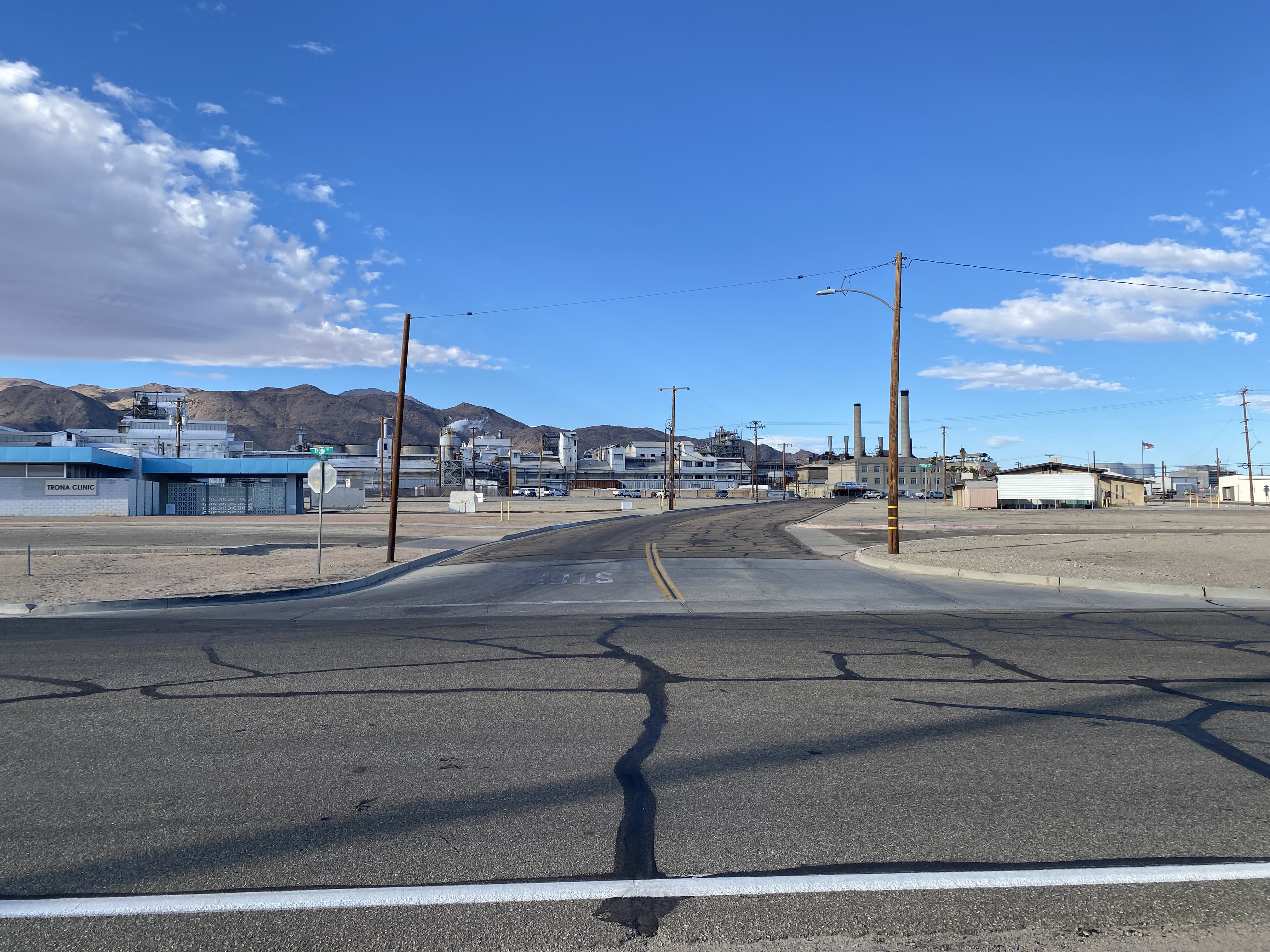
Southbound Trona Road passes by Center Street in Trona where a rest area can be found. A historic plaque regarding the Borax discovery of John Searles can be found at the rest area.


Pictured below are views northward on Center Street in Trona. The community was originally owned and operated by American Potash & Chemical Corporation. American Potash would be sold to Kerr-McGee Corporation in 1974. Kerr-McGee initially did not want to maintain Trona a company town and sold off the homes. Despite being sold off the community persisted but declined from a peak population of approximately 6,000 to 1,941 by the 2020 census.


A plaque at the site of Austin Hall can be found along Main Street in Trona. Said hall was constructed in 1912 and was intended to be the commercial hub of what was of Trona. The structure was ultimately demolished in 1965.


Trona Road beyond Trona crosses the Trona Railway and passes through the community of Argus. Argus like Trona is also a former company town.
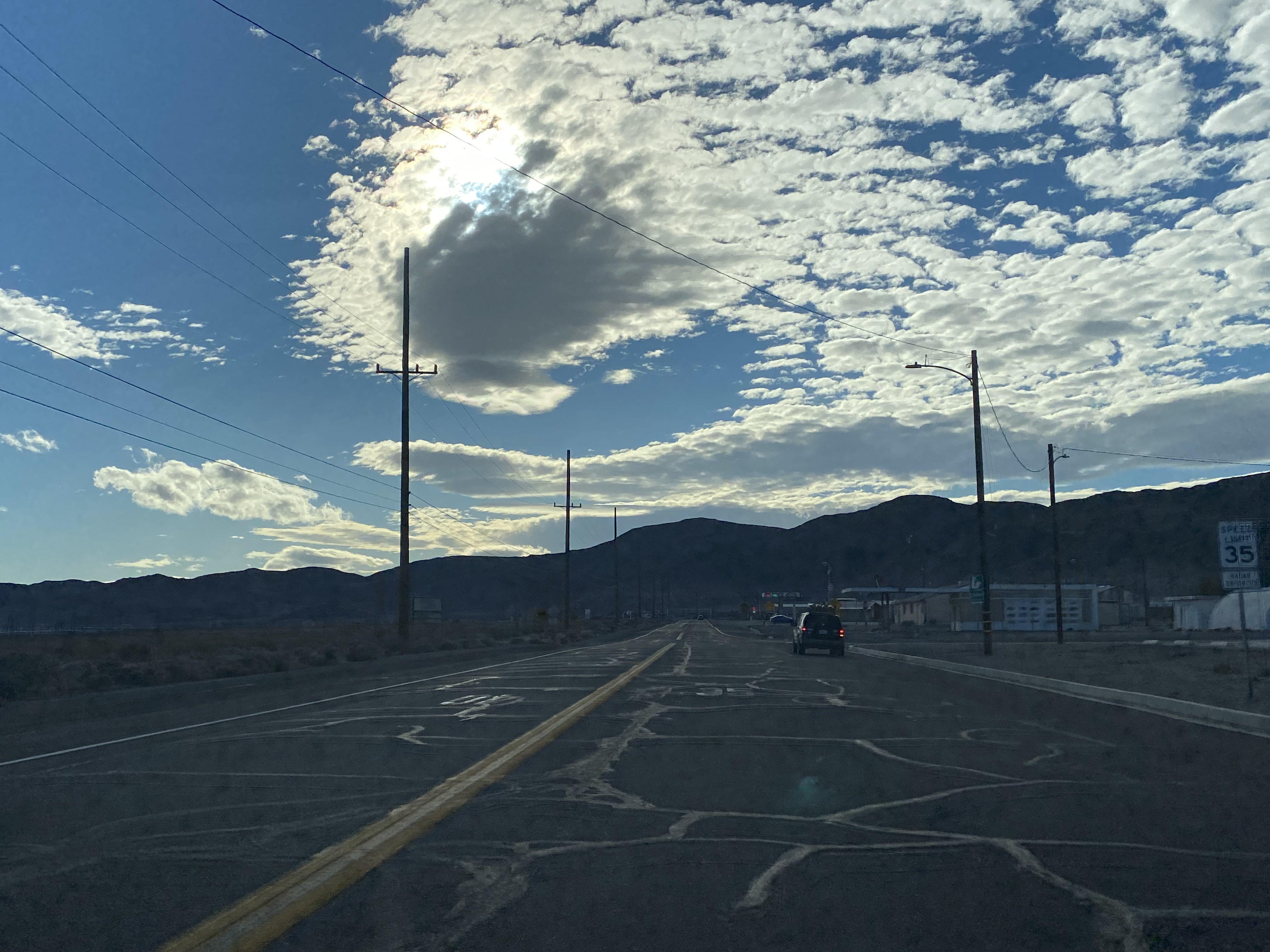


Trona Road passes through the communities of South Trona and Westend approaching the southern extent of Searles Valley.


Trona Road enters Poison Canyon and becomes part of California State Route 178 at Pinnacle Road (Postmile 14.778).


Pinnacle Road serves as the entrance to the Trona Pinnacles located five miles to the south. Two plaques are located at the intersection. One plaque discusses the history of the Searles Brothers stage roads which formed the basis of modern Trona Road and the Trona Railway. The second details the history of the Epsom Salts Monorail. Said monorail originated at the Trona Railway six miles south of Trona and was constructed in 1922. The line crossed Searles Lake, Layton Canyon and Wingate Pass to an Epsom Salt mine which had been discovered in southern Death Valley circa 1917. The monorail closed in 1927 but would go on to form much of the basis for the planned continuation of California State Route 178 over Wingate Pass.


Trona Road follows California State Route 178 westward. Trona Road splits towards US Route 395 and Kern County at Postmile SBD 7.352.
Comments