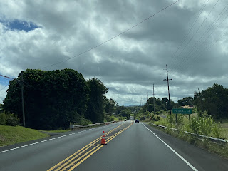
Hawaii Route 211 was a short-lived State Route corridor located north of Hilo on the Hawaiian Big Island. The highway was designated in the early 1960s as providing a 0.2-mile connection from Hawaii Route 19 to Honolii Cove. Hawaii Route 211 may have been planned as a northern extension of Hawaii Route 21 and had 0.3 miles of unconstructed mileage prior to be recommended for deletion in 1967.
This page is part of the Gribblenation Hawaii Roads series. A compellation of all Hawaii-related media from both Gribblenation and RoadwayWiz can be found by clicking here.
The history of Hawaii Route 211
According to Oscar Voss's hawaiihighways.com Hawaii Route 211 first appears on Hawaii Department of Transportation documents in the early 1960s. The corridor was designated as being only 0.2 miles comprised of then existing Honolii Place and Paukaa Drive to Hawaii Route 19. The roadway was intended to provide a State Route corridor to Honolii Cove and had a 0.3-mile planned extension following an unnamed corridor.
Hawaii Route 211 only appears on the 1966 United States Geological Survey map of Papaikou. The map displays the highway (perhaps in error) as running along Kulana Street west of Hawaii Route 19 near Hololii Cove.
The designated number "Hawaii Route 211" appears to imply the corridor was intended to be some sort of extension of Hawaii Route 21 north of Wainuku Street. Regardless Hawaii Route 211 appeared in a 1967 Hawaii Department of Transportation document as being recommended for deletion.
Below the former beginning of Hawaii Route 211 along Hawaii Route 19 approaching Paukaa Drive can be seen.


Comments