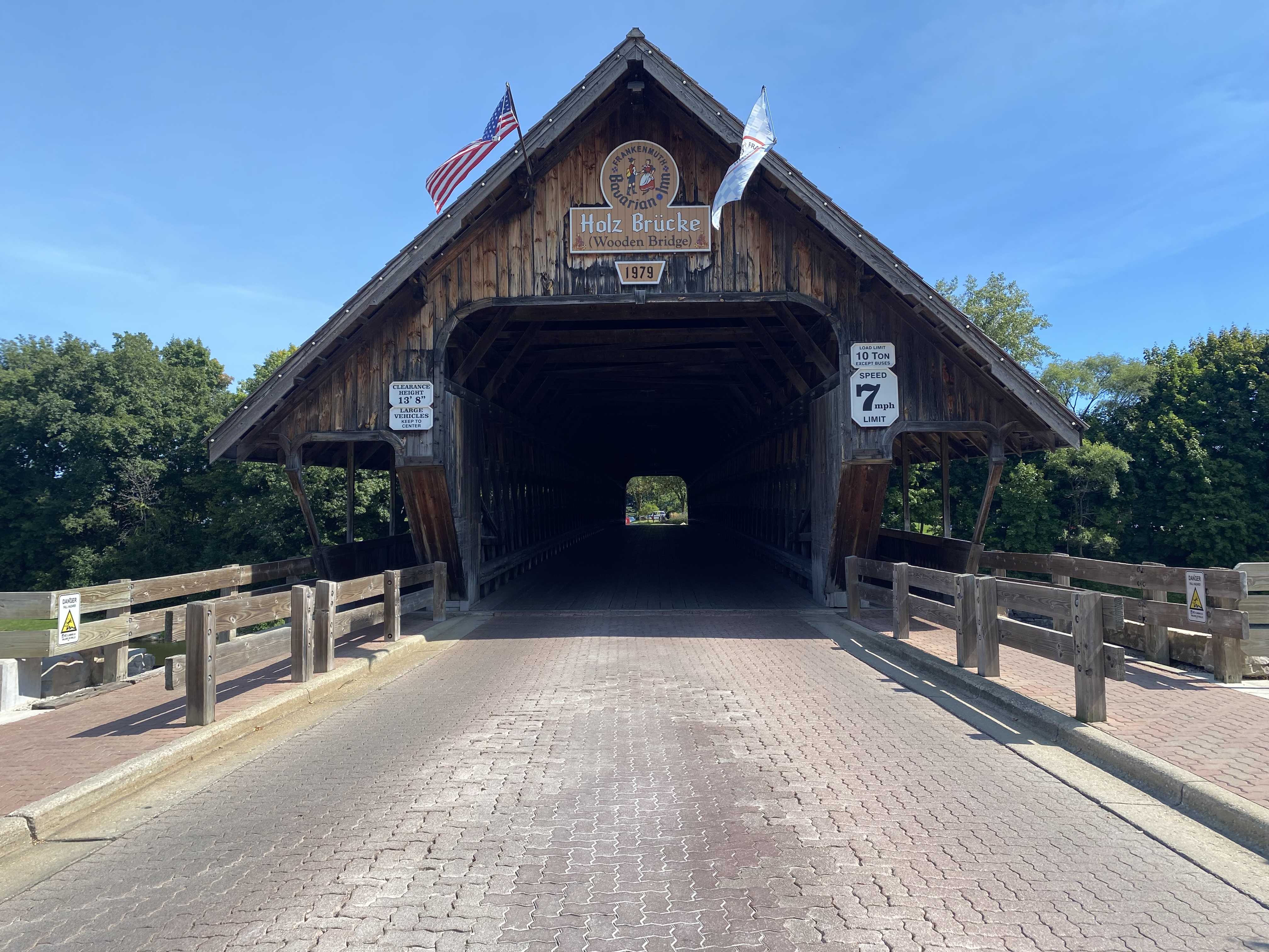
Zehnder's Holzbrücke (Zehnder's Wooden Bridge)


Zehnder's Holzbrücke (German for Wooden Bridge) is a covered bridge located on the Cass River on Covered Bridge Lane in the city of Frankenmuth, Michigan.  This structure was completed in 1979 and hauled into place by a team of oxen during 1980.  Unlike many modern covered bridges, the structure is not a facade and is constructed fully of wooden materials.  The span was installed promote tourism in Frankenmuth and provide access to the lands own by the Bavarian Inn south of the Cass River. 


Part 1; the history of Zehnder's Holzbrücke

Zehnder's Holzbrücke (German for wooden bridge) is a structure located on Covered Bridge Lane along the Cass River in the city of Frankenmuth River.  The structure is currently part of the Bavarian Inn complex.  Eddie (the Zehnder's of Frankenmuth family) and William Zehnder (Bavarian Inn family) originally began to explore the prospects of installing a covered bridge in 1962.  Both brothers owned portions of land along the eastern half of the Cass River.  The purpose of a new bridge was to serve as a tourist attraction and expand the parking capacity for the Bavarian Inn south of the Cass River.  

By 1979 the Zehnder brothers hired Milton Grade which was one of the last construction firms which specialized in building authentic covered bridges.  The 239-foot-long structure was completed during 1979 but had to installed at the Cass River.  Beginning during 1980 a team of oxen was used to pull the structure into place on the Cass River.  The bridge was dedicated on September 9, 1980. 

In 1985 the first phase of the Bavarian Inn Lodge complex completed east of the Cass River.  Much of the attractions south of the river were either built or purchased by Eddie Zehnder's family during the remaining balance of the 1980s.  During 2015 ownership of Zehnder's Holzbrücke was transferred to Frankenmuth Bavarian Inn Incorporated.  


Part 2; visiting Zehnder's Holzbrücke

Zehnder's Holzbrücke is located immediately east of M-83 in Frankenmuth along Covered Bridge Lane.  The structure is located next to the Covered Bridge Shop west of the Cass River.  


Zehnder's Holzbrücke facing east over the Cass River from a stylized pedestrian bridge.  


Zehnder's Holzbrücke facing northeast from the Bavarian Belle Riverboat


Zehnder's Holzbrücke facing was along Covered Bridge Lane.  The structure is rated for 10 tons and has an overhead clearance of 13'8 feet.  


Facing northeast on the Cass River from one of the pedestrian walkways on the bridge.  


Comments

Popular posts from this blog

Cajon Pass; Cajon Pass Toll Road, National Old Trails Road, US Route 66/91/395 and Interstate 15

This past weekend I spent some time in Cajon Pass traversing the many historic road alignments. Cajon Pass is located in San Bernardino County, California along the San Andreas Fault.  Cajon Pass  serves the boundary line between the Mojave Desert, the San Gabriel Mountains, San Bernardino Mountains and San Bernardino Valley.  Cajon Pass is historically one of the most traveled transportation corridors in American California and presently is served by four rail lines, Interstate 15 and California State Route 138. While Cajon Pass is known mostly for carrying US Route 66 it has carried numerous other signed highways that have had a significant impact on regional and national road travel.  While this is my best attempt to compile everything from the best sources I could find into one single transportation history blog regarding road travel in Cajon Pass I suspect as time goes on this article will be frequently updated.  If you have any information that you ...

Pardee Dam Road

Pardee Dam is a 358-foot-high concrete structure located near Campo Seco at the Calaveras County and Amador County Line.  Pardee Dam impounds the Mokelumne River which forms the namesake Pardee Reservoir.  Pardee Dam was completed during 1929 and is part of the East Bay Municipal Utility District.  Pardee Dam is accessed by the namesake Pardee Dam Road which crosses the structure via the one-lane road seen as the blog cover photo.   Part 1; the history of Pardee Dam Road The closest community to Pardee Dam is that of Campo Seco on the Calaveras County side of the Mokelumne River.  Campo Seco was founded in 1850 by Mexican Miners who worked placer claims in Oregon Gulch during the height of the California Gold Rush.  Campo Seco would reach a population of about three hundred by 1860 spurred by the numerous mining claims in the area.  Main Street of Campo Seco flowed directly into the Campo Seco Turnpike which had been authorized by the California L...

California State Route 82/Old US Route 101 on the El Camino Real from San Francisco to Interstate 380

After completing Interstate 380 I made my way northward into the City Limits of San Francisco to drive the northernmost portion of California State Route 82. CA 82 is 52 mile State Route between I-280 in San Francisco southward to Interstate 880 in San Jose.  CA 82 is significant due to it being part of the historical surface alignment of US Route 101 and the El Camino Real. The "El Camino Real" was a Spanish Highway in Las Californias and Alta California which connected the 21 Catholic Missions along the coast.  Essentially the route of the El Camino Real was plotted out in the late 1700s from two Spanish survey expeditions.  The Missions were plotted approximately 30 miles apart along the 600 mile route so that they would be a single day journey by horse.  The El Camino Real name fell into disuse after the Mexican Revolution of 1821 but was revived by American highway promoters in the 1890s and 1900s.  Today the El Camino Real is mostly associated...