

The decade of the 1930s brought unprecedented growth and
development to Louisiana’s transportation infrastructure as the cities of New
Orleans and Baton Rouge cemented their place as leading urban centers on the
Gulf Coast. In the immediate aftermath of the success garnered by the
construction of the massive bridge on the Mississippi River near New Orleans in
1935, planning and construction commenced on the state’s second bridge over the
great river. This new bridge, located on the north side of Baton Rouge, was to
be similar in design and form to its downriver predecessor.
Completed in 1940 as the second bridge across the Mississippi River in Louisiana and the first to be built in the Baton Rouge area, this bridge is one of two bridges on the Mississippi named for Huey P. Long, a Louisiana politician who served as the 40th Governor of the State from 1928 to 1932, then as U.S. Senator from 1932 until his death by assassination at the state capitol in Baton Rouge on September 10, 1935. One of Long’s greatest contributions to the state was his advocacy for investment in infrastructure across the state of Louisiana, with thousands of miles of paved roads and bridges being built throughout the state in the years during and immediately following his administration. This bridge is sometimes referred to as the “Long-Allen” Bridge, a name that also refers to Oscar K. Allen, who served as Louisiana’s 42nd Governor from 1932 until his death while in office in January 1936. Allen was a strong supporter of Huey Long’s vision for Louisiana and his administration oversaw the continued expansion of the state’s economy and transportation system that had been initiated earlier in the decade. There are many bridges and other landmarks across Louisiana that are named for one or both of Governors Long and Allen, due in part to their heavy political influence that helped transform Louisiana into a modern state during the years of the Great Depression.

Above: Huey P. Long (1893-1935)
Below: Oscar K. Allen (1882-1936)

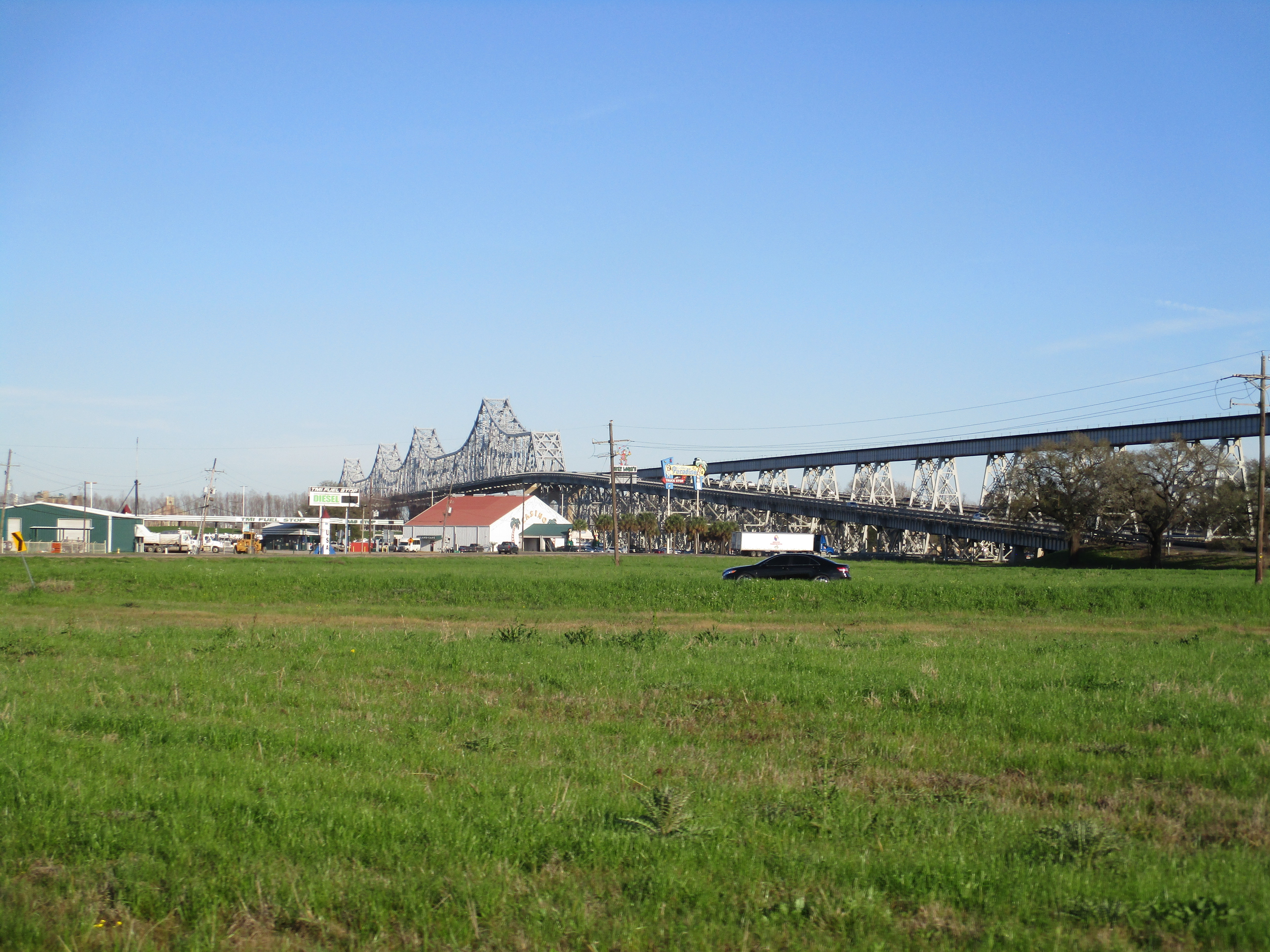
As far as the bridge is concerned, it carries both
road and rail traffic across the Mississippi River like its predecessor outside
of New Orleans. The multi-span truss superstructure is around 3,300 ft long and
the overall length of the much-longer railroad structure is around 2 ½ miles.
While not as long of a structure as its similar counterpart downriver, the vast
railroad trestles on both sides of the main superstructure are still impressive
to view from the highways beneath and are nearly impossible to view in full
without the means of aerial photography. The bridge’s railroad tracks pass
through the central steel superstructure while its roadways are cantilevered
outside the main steel truss. These roadways are quite narrow by today’s
standards, with each direction having two narrow travel lanes and no shoulders.
Safety has long been an issue with this bridge however its dimensions remain
largely the same today as it was when it was built.
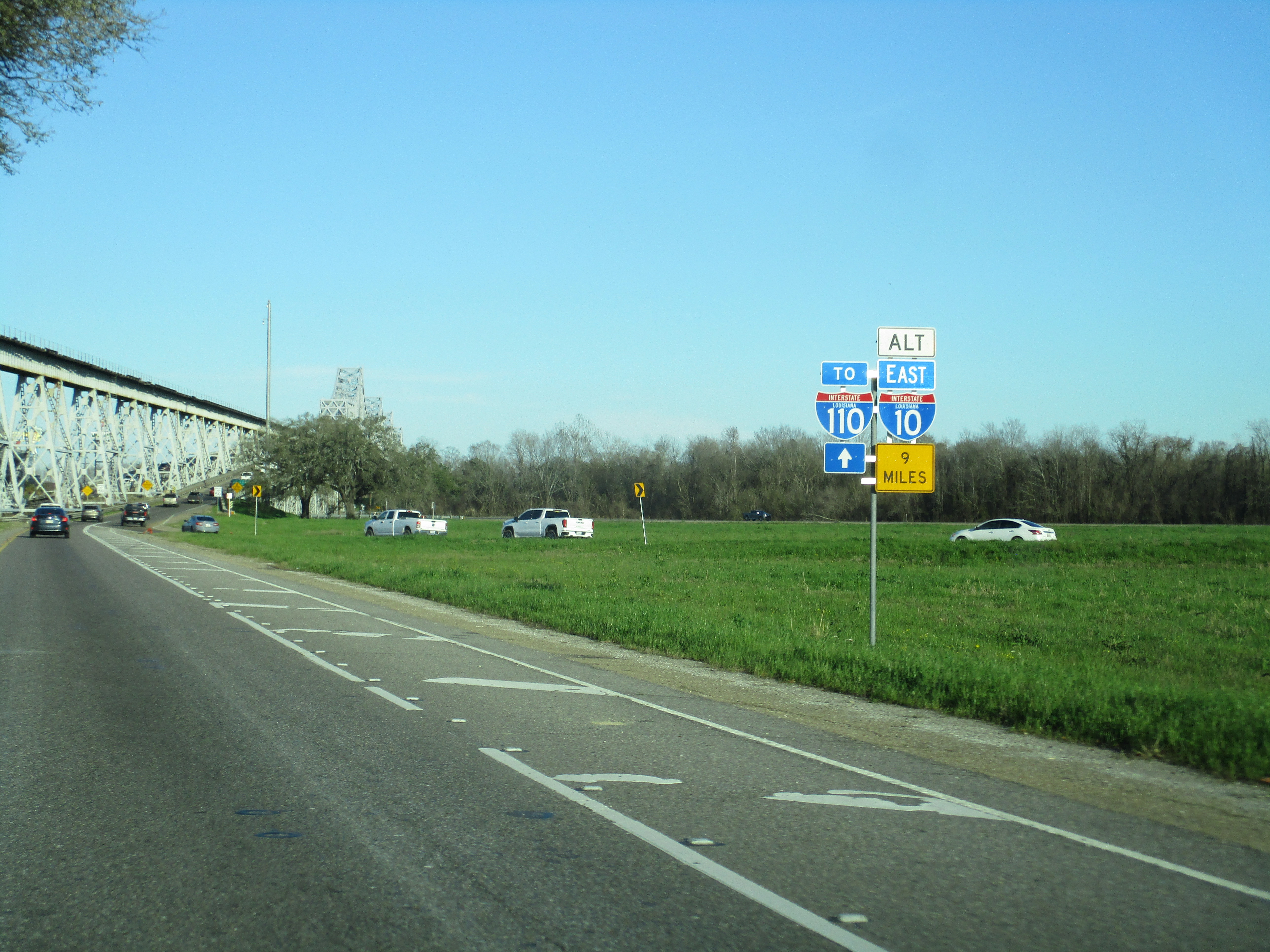
The bridge has been part of the US 190 corridor
since its completion in 1940. In the late 1950s, a short-lived proposal existed
that would have seen this bridge added to the interstate highway system as part
of a northern loop highway for Baton Rouge, known as Interstate 410. This
highway would have utilized existing segments of Airline Highway (US 190), the
Mississippi River Bridge, and the north-south Baton Rouge Expressway to form a
northern freeway arc for the city. By the mid-1960s, this proposal had fallen
out of favor, perhaps due to the fact that the existing bridge is not built to
modern freeway standards and would have likely needed to be replaced for this
project. In the end, the Baton Rouge Expressway was added to the interstate
system and is currently signed as Interstate 110.
In the decades since the removal of this proposal and the construction of Interstate 10 across the region, the population of Baton Rouge metro has more than doubled. The increasing importance of Interstates 10 and 12 as long-distance freeway corridors for the Gulf Coast has only led to further increases in traffic congestion in this part of Louisiana. Given these realities, plus the fact that the Huey P. Long and Horace Wilkinson Bridges (the latter being the I-10 Mississippi River Bridge nearby) are rapidly becoming aging relics in no position to handle the amount of cross-river traffic in the region, it may be time for Louisiana to reconsider the addition of a new Mississippi River Bridge at Baton Rouge. This new bridge, which would serve as a supplement to the existing two bridges over the river between East & West Baton Rouge Parishes, should be designed and intended as an additional freeway-grade facility that can serve as part of a much-needed long-distance bypass of the city for traffic along the I-10 corridor.

This excerpt from the 1961 Rand McNally map of the state of Louisiana shows the proposed alignment of Interstate 410 as it shares an alignment with Airline Highway (US 190) in the vicinity of and including the Huey P. Long Bridge. This short-lived idea had fallen out of favor by the mid-1960s due to high costs and minimal traffic-related benefits.
In general, this is a difficult bridge to photograph. The east bank of the river here is lined with high-security industrial areas, while the west bank of the river has few decent viewing points of the steel structure, and practically none where the view is not obstructed by the adjacent river levee. Only through the use of a drone or other means of aerial photography can the full structure of the bridge be viewed and appreciated all at once.


Further Reading:
Huey P. Long Bridge (Baton Rouge) by John Weeks
Huey P. Long Bridge (Baton Rouge) at historicbridges.org
Bridges, Crossings, and Structures of the Lower Mississippi River
Next Crossing upriver: John James Audubon Bridge (New Roads, LA)
Next Crossing downriver: Horace Wilkinson Bridge (Baton Rouge, LA)
Return to the Bridges of the Lower Mississippi River Home Page
__________________________________________________
Comments