
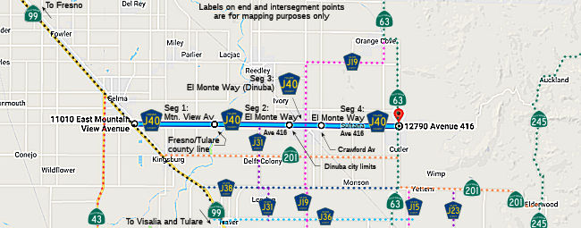
Fresno/Tulare County Route J40 is 17.19 miles and was defined in 1974. County Route J40 begins at California State Route 99 near Selma. From California State Route 99 the routing of County Route J40 follows Mountain View Avenue, El Monte Way and Avenue 416 to California State Route 63 in Orosi.
Part 1; the history of County Route J40
Mountain View Avenue east of US Route 99 to Zediker Avenue is displayed as a minor roadway on the 1935 Division of Highways Map of Fresno County.

El Monte Way east of Road 40 to Orosi is shown as a major county highway on the 1935 Division of Highways Map of Tulare County. El Monte Way west of Road 40 is shown without a bridge over the Kings River to Mountain View Avenue in Fresno County.

The March/April 1947 California Highways & Public Works announced a contract advertisement to construct new bridge over the Kings River between Kingsburg and Dinuba. The new bridge over the Kings River was one of fifty-five projects selected for State and Federal Aid due to the economic benefit they would provide following World War II.

The original bridge over the Kings River was completed during 1948 and connected El Monte Way to Mountain View Avenue. The Kings River Bridge permitted Dinuba traffic with direct access to US Route 99 which at the time was located on Golden State Boulevard. The original Kings River Bridge can be seen in a photo on the cover on the Final Environmental Impact Report for the Mountain View Avenue/Avenue 416/El Monte Way Wideningfrom Bethel Avenue in Fresno County to Road 92 in Tulare County, California (courtesy Kelly Hobbs).

A contract to resurface El Monte Way east of Dinuba to Orosi was awarded during August 1950 via Federal Aid Secondary Program 1142 (seen in the November/December 1950 California Highways & Public Works).

Fresno/Tulare County Route J40 (J40) was defined in 1974 with a 17.19-mile length. J40 began at California State Route 99 between Selma and Kingsburg. From California State Route 99 the routing of J40 followed Mountain View Avenue and El Monte Way to California State Route 63 in Orosi. J40 can be seen illustrated below in a map by cahighways.org.
During the 1990s Tulare County began to deemphasize and remove County Sign Route shields. The Tulare County Road System outside of incorporated cities was replaced with numbered avenues and roads which formed a county grid. El Monte Way outside of Dinuba became Avenue 416. The only known County Sign Route shields left in Tulare County as of the publishing of this blog are from County Route J37 along Balch Park Road (Mountain Road 239).
During October 2008 the Final Environmental Impact Report for the Mountain View Avenue/Avenue 416/El Monte Way Wideningfrom Bethel Avenue in Fresno County to Road 92 in Tulare County, California was published. As the report name implies the corridor of J40 from Bethel Avenue east over the Kings River to Road 92 was to be widened. The project corridor included a new four lane Kings River Bridge which would replace the original 1948 span. The new Kings River Bridge was completed during 2014. The widening of Mountain View Avenue west of the Kings River Bridge to Golden State Boulevard (former US Route 99) was completed between 2016-2018. At some point between 2018-2022 the Fresno County Department of Transportation placed a new J40 shield on eastbound Mountain View Avenue.

Part 2; a drive on County Route J40
J40 eastbound begins in Fresno County from California State Route 99 Exit 115 to Mountain View Avenue. Dinuba is signed as 12 miles away on eastbound J40 whereas Orosi is signed as 18 miles away.


Eastbound J40 along Mountain View Avenue intersects former US Route 99 at Golden State Boulevard.


As eastbound J40 passes Bethel Avenue a County Route J40 shield can be observed.


Eastbound J40 enters Tulare County and transitions onto Avenue 416. Eastbound J40 crosses the 2014 Kings River Bridge.


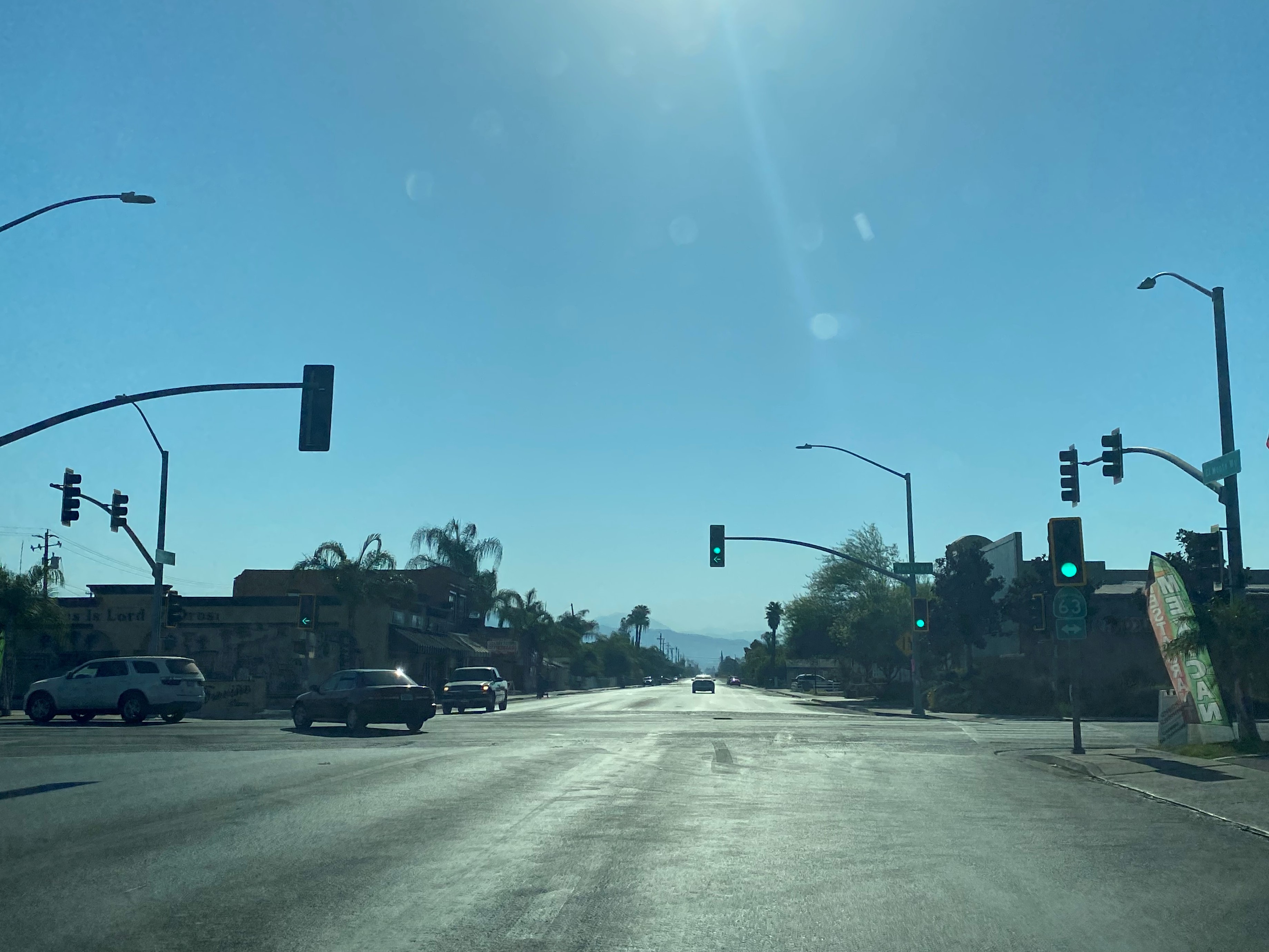
Eastbound J40 enters the city of Dinuba and transitions onto El Monte Way. J40 intersects County Route J19 at Alta Avenue north of downtown Dinuba.


Dinuba was plotted as "Sibleyville" during 1890 along the Stockton & Tulare Railroad operating line of the Southern Pacific Railroad. Sibleyville was named in honor of James Sibley who donated 240 acres of land to the Southern Pacific Railroad. Sibleyville in time came to be known as "Dinuba." The source of the Dinuba name is unknown, but the community incorporated as a city on January 6, 1906. During 1916 the Southern Pacific Railroad constructed a new depot at the southwest corner of Tulare Street and M Street. The 1916 Southern Pacific Railroad Depot has since been moved to K Street where it became the headquarters of the Alta District Museum.


The original location of the 1916 Southern Pacific Railroad Depot can be seen just beyond the tracks in this eastbound photo of Tulare Street.

J40 eastbound departing Dinuba transitions back onto Avenue 416 and passes through the community of Sultana. Sultana was a siding along the Atchison, Topeka & Santa Fe Railway line in eastern San Joaquin Valley.


J40 eastbound follows Avenue 416 to a terminus at California State Route 63 in Orosi. Orosi was founded in 1888 by Daniel Shafter and received Post Office Service in 1892.


Comments