
As presently constructed California State Route 57 is a 25.84-mile State Highway following the Orange Freeway between Interstate 210 near San Dimas to Interstate 5 at the Orange Crush Interchange near Santa Ana. California State Route 57 and the Orange Freeway has an unconstructed segment south of California State Route 22 to California State Route 1. The Orange Freeway corridor was largely adopted by the California Highway Commission during 1956 as the Brea Canyon Freeway. The Orange Freeway corridor would be assigned as California State Route 57 just prior to the 1964 State Highway Renumbering. The constructed corridor of California State Route 57 was constructed during the late 1960s through the mid-1970s. California State Route 57 was extended north of Interstate 10 to Interstate 210 during 1998. California State Route 57 north of Interstate 10 is still defined by the Federal Highway Administration as a segment of Interstate 210.

The history of California State Route 57
The first portion of what was to become California State Route 57 was defined as an extension of Legislative Route Number 19 (LRN 19) during 1931. During said year a segment of LRN 19 was extended between Pomona to US Route 101/LRN 2 in Fullerton via Brea Canyon. The extended definition of LRN 19 first appears on the 1932 Division of Highways Map.
The completion of LRN 19 between Pomona and Fullerton was announced in the July/August 1933 California Highways & Public Works. LRN 19 west of Pomona through the Puente Hills is noted to be paved in 20 foot wide concrete and was opened to traffic on July 15, 1933.


LRN 19 between Pomona and Fullerton was not assigned one of the initial Sign State Routes announced in the August 1934 California Highways & Public Works. LRN 19 can be seen branching away from US Route 101/LRN 2 in Fullerton via Pomona Avenue (now Brea Boulevard) and Sparda Road (now Brea Canyon Road) on the 1935 Division of Highways Map of Orange County.

The alignment of LRN 19 between the Orange County line to Pomona can be seen on the 1935 Division of Highways Map of Los Angeles County. Upon entering Los Angeles County LRN 19 emerged from the Orange County line along Brea Canyon Road. LRN 19 is seen following Brea Canyon Road and 5th Street into downtown Pomona where it intersected US Route 60 at Garey Avenue.

The first mention of a proposed Brea Canyon Freeway appears in a September/October 1955 California Highways & Public Works articles regarding a California Highway Commission tour of the southern counties.

The January/February 1957 California Highways & Public Works announced the California Highway Commission had selected an alignment of the US 101-Route 19 Freeway (alternatively the Brea Canyon Freeway) on February 15, 1956.

The next component of what was to become California State Route 57 between Pomona and San Dimas was defined as part of LRN 240 by way of 1957 Legislative Chapter 24. Following passage of the 1956 Federal Highway Aid LRN 240 was assigned as the chargeable corridor of Interstate 210. The original definition of LRN 240 was as follows:
"US Route 99/LRN 4 near Glendale to US Route 99-60-70/LRN 26 near the east boundary of Los Angeles County on a route to be selected by the California Highway Commission, which route may include all portions of any existing state highway route or routes."
The remaining segments of what was to become California State Route 57 were defined by 1959 Legislative Chapter 1062. LRN 273 was defined as "US Route 101A/LRN 60 near Huntington Beach to California State Route 22/LRN 179 near Santa Ana." LRN 272 was defined as "LRN 19 near the City of Industry to US Route 99-60-70/LRN 26 near Pomona."

The January/February 1960 California Highways & Public Works announced an agreement to construct the Brea Canyon Freeway/LRN 19 had been executed with Los Angeles County. The Brea Canyon Freeway is noted to be planned to pass through the cities of Orange, Santa Ana, Placentia, Anaheim, Fullerton and Brea.


1961 Legislative Chapter 1146 changed the northern terminus of LRN 272 to "LRN 240." The updated description of LRN 272 first appears on the 1962 Division of Highways Map.
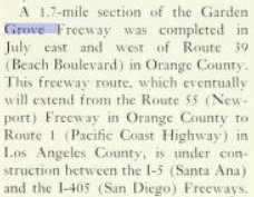
The March/April 1962 California Highways & Public Works announced the contract to construct the California State Route 22/Garden Grove Freeway, Interstate 5/US Route 101/Santa Ana Freeway and the Orange Freeway Interchange (formerly the Brea Canyon Freeway).


The January/February 1963 California Highways & Public Works announced 8.7 miles of Interstate 210/LRN 240 and LRN 272 in the cities of Pomona, San Dimas and Glendora was selected for adoption during the last four California Highway Commission meetings of 1962.


The March/April 1963 California Highways & Public Works provides an update to the California State Route 22/Garden Grove Freeway. The article stub notes the Garden Grove Freeway/Santa Ana Freeway/Orange Freeway Interchange was anticipated to be completed by the summer of 1964.


The March/April 1963 California Highways & Public Works announced the entire Orange Freeway would be signed as California State Route 57. The Santa Ana Freeway-San Bernardino Freeway portion of the Orange Freeway is noted to have 19.8 miles adopted by the California Highway Commission. The segment of the Orange Freeway on LRN 273 to Huntington Beach is noted to not have been yet adopted.


The November/December 1964 California Highways & Public Works noted the Garden Grove Freeway/Santa Ana Freeway/Orange Freeway Interchange as being completed during September 1964. The Garden Grove Freeway/Santa Ana Freeway/Orange Freeway Interchange came to be known in time unofficially as the Orange Crush Interchange. The "Orange Crush Interchange" nickname allegedly was coined by KNX Radio traffic reporter Bill Keene as a play on Orange Crush soda.

As part of the 1964 California State Highway Renumbering the Legislative Route Numbers were dropped. The entire planned corridor of the Orange Freeway was legislatively defined as California State Route 57. California State Route 57 was originally defined as:
1. Route 1 near Huntington Beach to Route 22 near Santa Ana.
2. Route 5 near Santa Ana to Route 210 near Route 10 and Pomona, passing near Industry.
California State Route 57 appears for the first time on the 1964 Division of Highways Map. California State Route 57 appears as unadopted freeway between California State Route 1 and California State Route. California State Route 57 appears with an adopted freeway alignment between Interstate 5 to Brea. California State Route 57 appears with an interim surface alignment between Fullerton to Pomona which was inherited from LRN 19. California State Route 57 is shown with a planned freeway connection to Interstate 210 north of California State Route 60.


The November/December 1965 California Highways & Public Works announced 0.8-mile first unit of the California State Route 57/Orange Freeway had been budgeted for construction east of Anaheim and Placentia.

The November/December 1966 California Highways & Public Works announced several portions of the California State Route 57/Orange Freeway were budgeted for construction. Within Los Angeles County the Orange Freeway/Pomona Freeway (California State Route 60) had been budgeted for the 1968-69 Fiscal Year. Within Orange County 1.4 miles of the Orange Freeway from Orangethorpe Avenue in Placentia to Nutwood Avenue in Fullerton was budgeted for the 1967-68 Fiscal Year.


The first segment of the Orange Freeway between California State Route 91 to Nutwood Avenue was dedicated on May 16, 1969 (Wikipedia Reference #32 the Independent Press Telegram). The California State Route 91-Nutwood Avenue segment of the California State Route 57/Orange Freeway appears on the 1970 Division of Highways Map.

California State Route 57/Orange Freeway was completed through Brea Canyon on March 13, 1972 (Wikipedia Citation #33 the Los Angeles Times). California State Route 57 was connected to the completed Kellogg Hill Interchange with Interstate 10/Interstate 210/California State Route 71 on May 1, 1972 (Wikipedia Citation #34 Montclair Tribune). California State Route 57 and the Orange Freeway appear complete between Katella Avenue north to Interstate 210 on the 1975 Caltrans Map.


California State Route 57 is shown completed between Katella Avenue and the Orange Crush Interchange on the 1977 Caltrans Map. Planned California State Route 57/Orange Freeway south of California State Route 22 would never have a formal alignment adoption.

According to CAhighways California State Route 30 was moved to a freeway alignment between Highland and Interstate 10 in Redlands during July 1993. In 1997 the remaining Los Angeles County freeway segment of California State Route 30 began being constructed. Through 1998 the remaining segments of the California State Route 30 freeway west from the Interstate 15 interchange began construction. 1998 Assembly Bill 2388, Chapter 221 reassigned California State Route 30 as an extension of Route 210. Assembly Bill 2388, Chapter 221 stipulated the corridor of California State Route 30 would be signed as California State Route 210 upon being completed to freeway standards. Further Assembly Bill 2388, Chapter 221 extended California State Route 57 from Interstate 10 north to Interstate 210 near San Dimas.
The undated/unsubmitted application by Caltrans to the AASHTO to extend Interstate 210 to Redlands can be seen below. The application to extend Interstate 210 notes a requested reclassification of the highway between California State Route 30 and Interstate 10 as an extension of California State Route 57. The below application is stored in the 1997 files in the AASHTO database files.


Caltrans submitted a request to extend Interstate 210 to Redlands to the AASHTO on September 16, 1998. The request was heard by the AASHTO Executive Committee on November 7, 1999. The AASHTO deferred acting on extending Interstate 210 requesting clarification from Caltrans.


A letter from the Caltrans Direction to AASHTO Executive Director dated March 4, 1999, noted California State Route 30 had been reclassified as part of Route 210 by way of 1998 Assembly Bill 2388, Chapter 221. The Caltrans Director noted the intention to sign California State Route 210 as part of Interstate 210 upon completion of the corridor to Interstate standards. The Caltrans Director noted the agency requested the Federal Highway Administration reclassify existing Interstate 210 between San Dimas-Pomona as California State Route 57 and included it as an attachment (dated February 19, 1999).


A letter by the AASHTO Executive Director to the Director of Caltrans dated March 19, 1999, noted receipt of a request to extend Interstate 210 to Redlands. A handwritten attachment notes Caltrans withdrew the request to extend Interstate 210 by phone call to AASHTO on March 24, 1999.


It is unclear if Caltrans submitted a withdrawal of the submission to the Federal Highway Administration to delete existing Interstate 210 between San Dimas-Pomona. The segment still appears in the current Federal Highway Administration Interstate Route Log. Essentially by Federal Highway Administration classification California State Route 57 between San Dimas-Pomona is still Interstate 210.
Comments