
Ayers Road Extension (Hernando County Route 576)


During April 2022 the Ayers Road Extension opened in southern Hernando County as a new segment of Hernando County Route 576.  The Ayers Road Extension is part of a 10.8-mile corridor which is intended to create a four-lane highway between US Route 19 in Spring Hill and US Route 41 in Masaryktown.  The Ayers Road Extension functionally acts as a bypass of Masaryktown.  


Part 1; the history of the Ayers Road Extension

The Ayers Road Extension (Hernando County Route 576) was discussed in detail in the July 18, 2021, Hernando Sun.  The Ayers Road Extension is noted to be the first of three planned projects which would form a 10.8 mile long four-lane highway in Hernando County spanning from US Route 19 in Spring Hill east to US Route 41 near Masaryktown.  The second and third units are noted to comprise existing segments of County Line Road (Hernando County Route 578).  The article notes all three projects were to be constructed by the Florida Department of Transportation and turned over to Hernando County for maintenance.  

On March 2, 2021, the Florida Department of Transportation announced Trillium Boulevard would close from County Line Road on March 9, 2021.  Traffic would be required to detour on the recently completed segment of Ayers Road Extension from Trillium Boulevard east to US Route 41/Broad Street.  


The southern segment of the Ayers Road Extension was reported as being accepted by the Florida Department of Transportation on April 12, 2022.  The southern end of the Ayers Road Extension tied into a realigned County Line Road and Trillium Boulevard.  


Part 2; a drive on the Ayers Road Extension

From US Route 41/Broad Street north of Masaryktown traffic can access the Ayers Road Extension by turning west on County Route 576.  


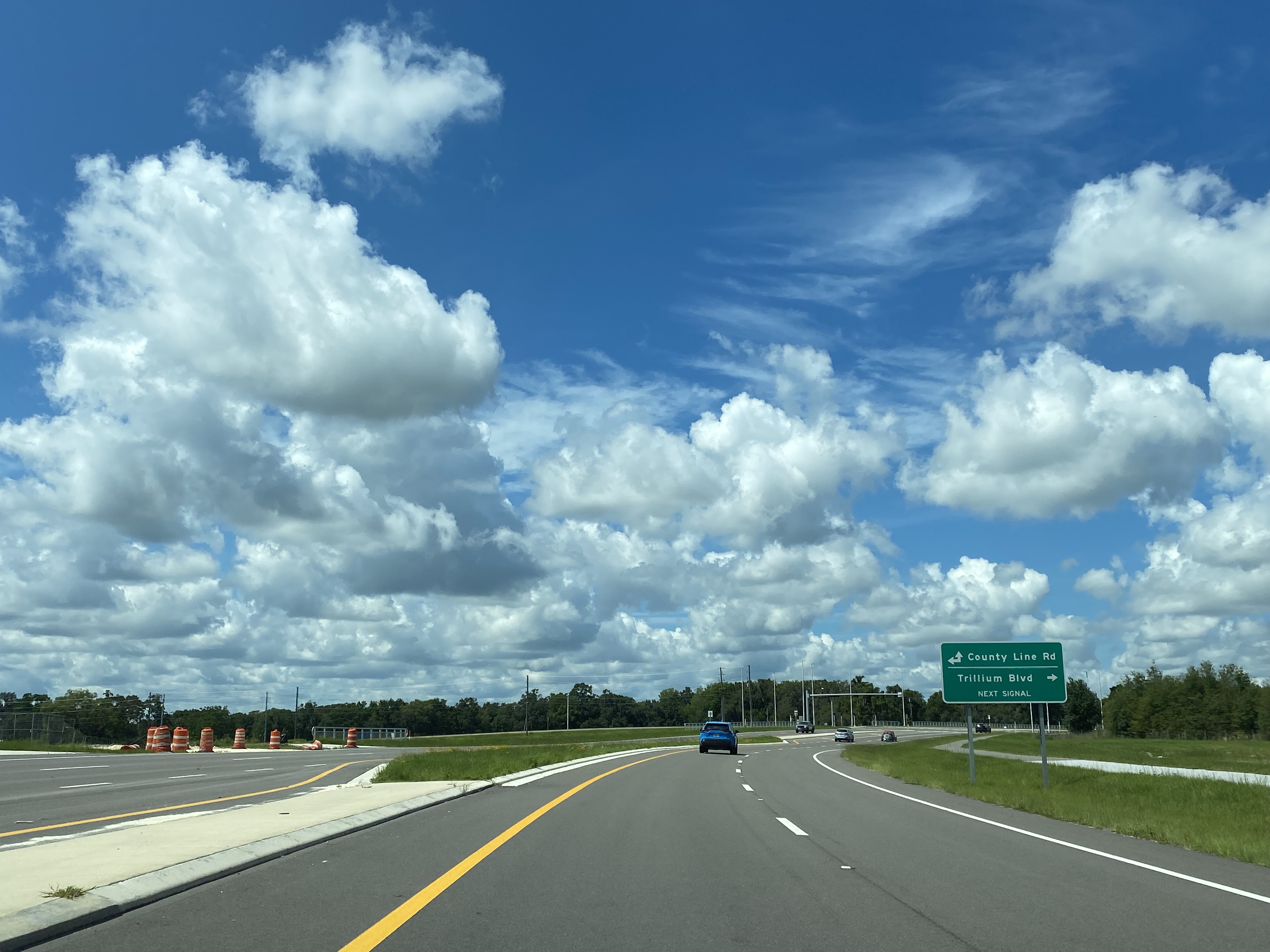
The westbound Ayers Road Extension bypasses Masaryktown and intersects the northern end of Trillium Boulevard.  


The Ayers Road Extension terminates at the intersection of County Line Road (Hernando County Route 578) and the southern end of Trillium Boulevard.  Traffic continuing west to US Route 19 transitions onto County Line Road/Hernando County Route 578. 


Comments

Popular posts from this blog

Paper Highways: The Unbuilt New Orleans Bypass (Proposed I-410)

  There are many examples around the United States of proposed freeway corridors in urban areas that never saw the light of day for one reason or another. They all fall somewhere in between the little-known and the infamous and from the mundane to the spectacular. One of the more obscure and interesting examples of such a project is the short-lived idea to construct a southern beltway for the New Orleans metropolitan area in the 1960s and 70s. Greater New Orleans and its surrounding area grew rapidly in the years after World War II, as suburban sprawl encroached on the historically rural downriver parishes around the city. In response to the development of the region’s Westbank and the emergence of communities in St. Charles and St. John the Baptist Parishes as viable suburban communities during this period, regional planners began to consider concepts for new infrastructure projects to serve this growing population.  The idea for a circular freeway around the southern perimeter of t

Hernando de Soto Bridge (Memphis, TN)

The newest of the bridges that span the lower Mississippi River at Memphis, the Hernando de Soto Bridge was completed in 1973 and carries Interstate 40 between downtown Memphis and West Memphis, AR. The bridge’s signature M-shaped superstructure makes it an instantly recognizable landmark in the city and one of the most visually unique bridges on the Mississippi River. As early as 1953, Memphis city planners recommended the construction of a second highway bridge across the Mississippi River to connect the city with West Memphis, AR. The Memphis & Arkansas Bridge had been completed only four years earlier a couple miles downriver from downtown, however it was expected that long-term growth in the metro area would warrant the construction of an additional bridge, the fourth crossing of the Mississippi River to be built at Memphis, in the not-too-distant future. Unlike the previous three Mississippi River bridges to be built the city, the location chosen for this bridge was about two

Huey P. Long Bridge (New Orleans, LA)

Located on the lower Mississippi River a few miles west of New Orleans, the Huey P. Long Bridge is an enormous steel truss bridge that carries both road and rail traffic on an old-time structure that is a fascinating example of a bridge that has evolved in recent years to meet the traffic and safety demands of modern times. While officially located in suburban Jefferson Parish near the unincorporated community of Bridge City, this bridge’s location is most often associated with New Orleans, given that it’s the largest and most recognizable incorporated population center in the nearby vicinity. For this reason, this blog article considers the bridge’s location to be in New Orleans, even though this isn’t 100% geographically correct. Completed in 1935 as the first bridge across the Mississippi River in Louisiana and the first to be built in the New Orleans area, this bridge is one of two bridges on the Mississippi named for Huey P. Long, a Louisiana politician who served as the 40th Gove