This January I visited the eastern annex of Pinnacles National Park in San Benito County. Given that I had driven almost conceivable roadway in the Gabilan Range and Diablo Range I wanted to something new. I found what I was looking for on the dirt grades of La Gloria Road and Gloria Road headed west through the Gabilan Range to Salinas Valley.
Part 1; the background of La Gloria Road and Gloria Road
La Gloria Road and Gloria Road function as a singular highway which connects CA 25 in San Benito County west to US Route 101 in Monterey County. Within San Benito County the route of La Gloria Road is maintained as County Road 116. La Gloria Road west of CA 25 crosses through Bickmore Canyon and Willamson Valley approximately 8 miles to the Monterey County Line at the crest of the Gabilan Range. Upon entering Monterey County the through route is signed as Gloria Road. Gloria Road descends from an elevation of approximately 2,300 feet above sea level to 1,000 feet above sea level in 5 miles. Upon entering Henry Sands Canyon the remaining 5 miles of Gloria Road west to US 101 are paved.

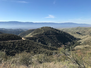
The descent from the Monterey County Line west on Gloria Road to Henry Sands Canyon is the highlight of the highway over the Gabilans. The descent from the Monterey County Line is a massive single lane winding roadway that has an impressive view of Salinas Valley and the Santa Lucia Range. As intimidating as Gloria Road can be, it along with La Gloria Road have well maintained dirt grades which can be navigated easily by a normal car.
Both La Gloria Road and Gloria Road are named after La Gloria Valley which is located in the Gabilan Range immediately of west of Pinnacles National Park in San Benito County. La Gloria Valley is accessible from La Gloria Road by way of Chalone Road in San Benito County and unnamed spur of Gloria Road in Monterey County. The location of La Gloria Valley is marked on the map below.

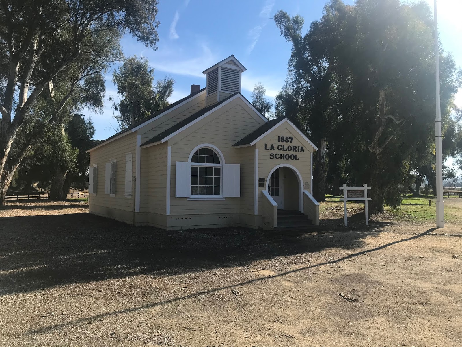
The grade of La Gloria Road and Gloria Road is very old, but I'm not exactly sure when it was built. What I do know is that La Gloria Valley has been inhabited at least since the 1870s. La Gloria Valley was populated enough by 1878 to warrant a schoolhouse being built at the intersection of what is now Gloria Road and Camphora-Gloria Road in Monterey County. By 1887 a new schoolhouse was built upon the site of the original. Residents of La Gloria Valley sending their children to the 1887 La Gloria School would have to descend the approximately 5 mile winding Gloria Road into Salinas Valley. The 1887 La Gloria Road is presently preserved at San Lorenzo Park in King City.


La Gloria Road and Gloria Road appear on numerous early highway maps such as this 1917 CSAA California State Map.
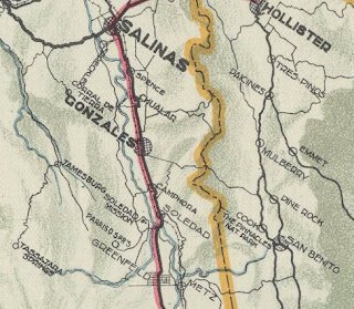
La Gloria Road and Gloria Road make an appearance on the 1920 Clason Highway Map of California.

La Gloria Road appears in detail on the 1920 Denny's Pocket Map of San Benito County.

La Gloria Road appears on the 1935 Division of Highway Map of San Benito County as a major county road.

Conversely Gloria Road appears on the 1935 Division of Highways Map of Monterey County as a major county road.

Part 2; a drive on La Gloria Road and Gloria Road
My approach to La Gloria Road was from CA 25 northbound from CA 146 out of Pinnacles National Park. From CA 25 northbound La Gloria Road is marked only with a simple street blade.

Facing La Gloria Road from CA 25 south offers much more details as it is signed as a highway to Gonzales 18 miles to the west.

Looking west on La Gloria Road into Bickmore Canyon there isn't much to suggest that a massive downhill grade lies ahead.

La Gloria Road passes over a cattle guard, an advisory sign states "no access to public lands." La Gloria Road lies close to the north boundary of Pinnacles National Park. I'm to understand that people try to use La Gloria Road reach the Old Pinnacles Trail on foot on occasion. I actually encountered a National Park Service Police vehicle heading eastbound upon crossing the cattle guard.

La Gloria Road is signed with Post Mile Paddles as San Benito County Road 116.

La Gloria Road winds through Bickmore Canyon which on occasion had washboarding. Upon crossing a second cattle guard La Gloria Road westbound became much more evenly graded.


La Gloria Road westbound begins to wind through private ranches straddling the northern boundary of Pinnacles National Park before emerging into Williamson Valley.


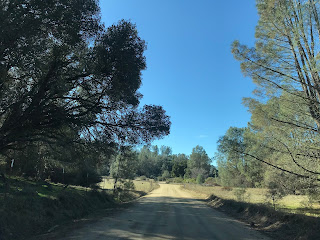

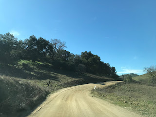

Some of the ranches in Williamson Valley have some interesting automotive wreckage that can be seen along La Gloria Road.


La Gloria Road westbound ascends to approximately 2,300 feet above sea level in Williamson Valley. As La Gloria Road approaches the Monterey County Line it intersects Chalone Road.


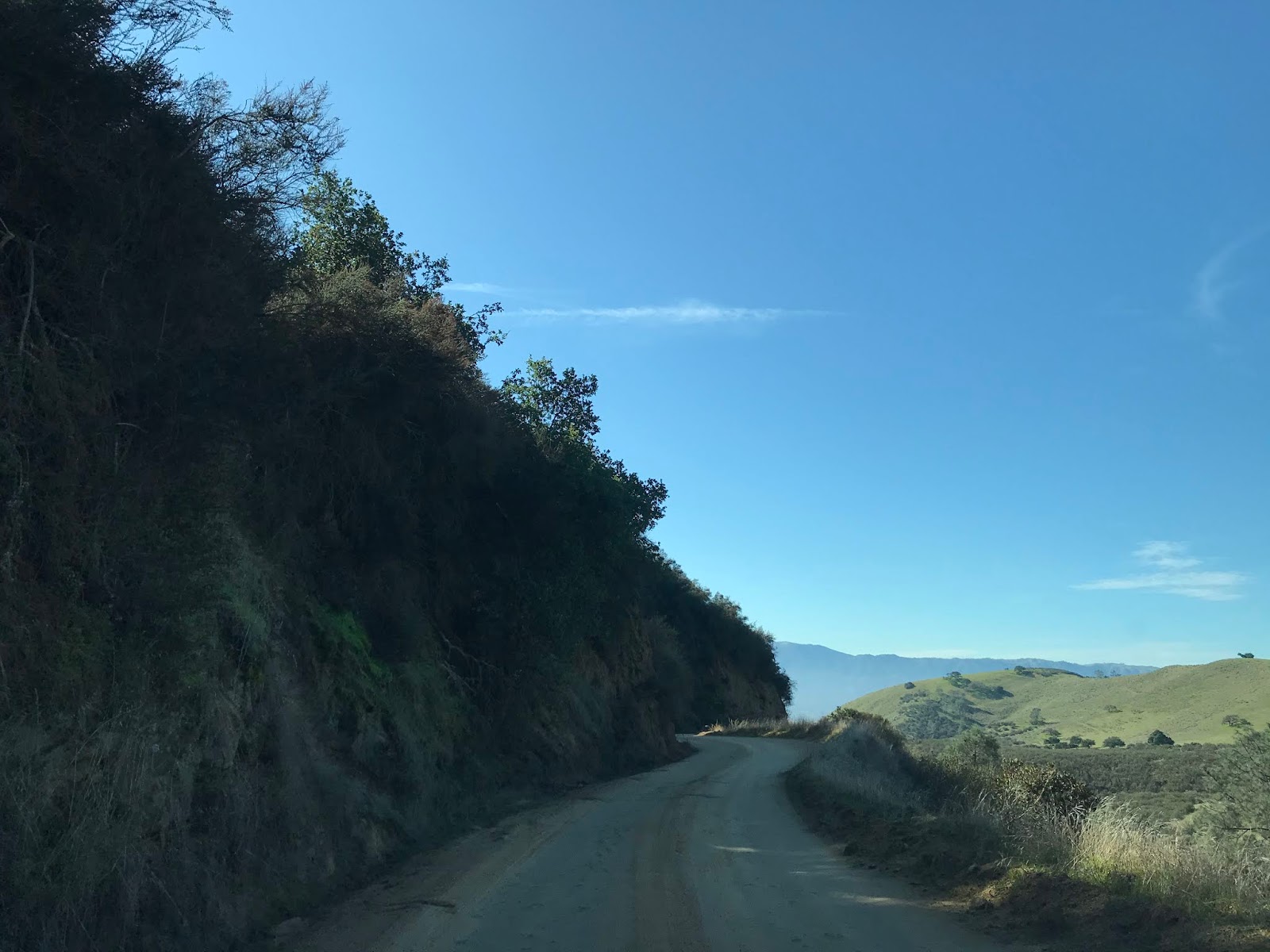
Crossing the Monterey County Line the route ahead westward becomes Gloria Road and narrows immediately. Traffic on westbound on Gloria Road is advised there are curves ahead which has to be an all time understatement. Gloria Road westbound begins to descend alongside a cliff face that overlooks Salinas Valley and has grades in excess of 10%.


The grade of Gloria Road by dirt road standards isn't bad but is in need of repair. There are minor washouts along some of the hairpins which most likely occurred in the current winter.


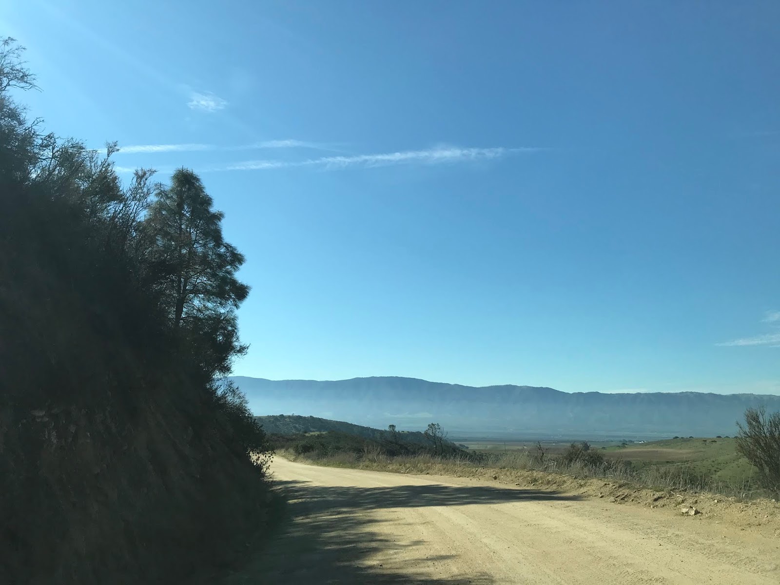
Gloria Road begins to descend faster and opens up to a clear vista of Salinas Valley.


From Gloria Road one can see; Salinas Valley, the Santa Lucia Mountains, and even Monterey Bay.


I took this panoramic which really illustrates how vast the grade of Gloria Road really is. The connecting road to La Gloria Valley can be seen on the left below.

The final drop on westbound Gloria Road is the steepest and most weathered. The cut of Gloria Road is mostly upright which probably doesn't channel water very well. Upon entering Henry Sands Canyon at approximately 1,000 feet above sea level the alignment of Gloria Road becomes paved.


The paved portion of Gloria Road is weathered but nothing too unusual by the standards of Monterey County road maintenance. Gloria Road westbound continues to descend out of the Gabilan Range and meets Camphora-Gloria Road which as mentioned above was the site of the 1887 La Gloria School.


Gloria Road westbound descends into Salinas Valley and runs up to the flank of the northbound lanes of US 101 on the outskirts of Gonzales. Traffic headed to northbound US 101 is directed to take a right hand turn whereas US 101 south traffic along with traffic headed to Gonzales is directed to turn left to continue on Gloria Road. The City of Gonzales lies of at an elevation of 135 feet above sea level.


Gloria Road take a brief southward jog and ends at Alta Street.


Part 1; the background of La Gloria Road and Gloria Road
La Gloria Road and Gloria Road function as a singular highway which connects CA 25 in San Benito County west to US Route 101 in Monterey County. Within San Benito County the route of La Gloria Road is maintained as County Road 116. La Gloria Road west of CA 25 crosses through Bickmore Canyon and Willamson Valley approximately 8 miles to the Monterey County Line at the crest of the Gabilan Range. Upon entering Monterey County the through route is signed as Gloria Road. Gloria Road descends from an elevation of approximately 2,300 feet above sea level to 1,000 feet above sea level in 5 miles. Upon entering Henry Sands Canyon the remaining 5 miles of Gloria Road west to US 101 are paved.

The descent from the Monterey County Line west on Gloria Road to Henry Sands Canyon is the highlight of the highway over the Gabilans. The descent from the Monterey County Line is a massive single lane winding roadway that has an impressive view of Salinas Valley and the Santa Lucia Range. As intimidating as Gloria Road can be, it along with La Gloria Road have well maintained dirt grades which can be navigated easily by a normal car.
Both La Gloria Road and Gloria Road are named after La Gloria Valley which is located in the Gabilan Range immediately of west of Pinnacles National Park in San Benito County. La Gloria Valley is accessible from La Gloria Road by way of Chalone Road in San Benito County and unnamed spur of Gloria Road in Monterey County. The location of La Gloria Valley is marked on the map below.

The grade of La Gloria Road and Gloria Road is very old, but I'm not exactly sure when it was built. What I do know is that La Gloria Valley has been inhabited at least since the 1870s. La Gloria Valley was populated enough by 1878 to warrant a schoolhouse being built at the intersection of what is now Gloria Road and Camphora-Gloria Road in Monterey County. By 1887 a new schoolhouse was built upon the site of the original. Residents of La Gloria Valley sending their children to the 1887 La Gloria School would have to descend the approximately 5 mile winding Gloria Road into Salinas Valley. The 1887 La Gloria Road is presently preserved at San Lorenzo Park in King City.


La Gloria Road and Gloria Road appear on numerous early highway maps such as this 1917 CSAA California State Map.

La Gloria Road and Gloria Road make an appearance on the 1920 Clason Highway Map of California.

La Gloria Road appears in detail on the 1920 Denny's Pocket Map of San Benito County.

La Gloria Road appears on the 1935 Division of Highway Map of San Benito County as a major county road.

Conversely Gloria Road appears on the 1935 Division of Highways Map of Monterey County as a major county road.

Part 2; a drive on La Gloria Road and Gloria Road
My approach to La Gloria Road was from CA 25 northbound from CA 146 out of Pinnacles National Park. From CA 25 northbound La Gloria Road is marked only with a simple street blade.

Facing La Gloria Road from CA 25 south offers much more details as it is signed as a highway to Gonzales 18 miles to the west.

Looking west on La Gloria Road into Bickmore Canyon there isn't much to suggest that a massive downhill grade lies ahead.

La Gloria Road passes over a cattle guard, an advisory sign states "no access to public lands." La Gloria Road lies close to the north boundary of Pinnacles National Park. I'm to understand that people try to use La Gloria Road reach the Old Pinnacles Trail on foot on occasion. I actually encountered a National Park Service Police vehicle heading eastbound upon crossing the cattle guard.

La Gloria Road is signed with Post Mile Paddles as San Benito County Road 116.

La Gloria Road winds through Bickmore Canyon which on occasion had washboarding. Upon crossing a second cattle guard La Gloria Road westbound became much more evenly graded.


La Gloria Road westbound begins to wind through private ranches straddling the northern boundary of Pinnacles National Park before emerging into Williamson Valley.


Some of the ranches in Williamson Valley have some interesting automotive wreckage that can be seen along La Gloria Road.


La Gloria Road westbound ascends to approximately 2,300 feet above sea level in Williamson Valley. As La Gloria Road approaches the Monterey County Line it intersects Chalone Road.


Crossing the Monterey County Line the route ahead westward becomes Gloria Road and narrows immediately. Traffic on westbound on Gloria Road is advised there are curves ahead which has to be an all time understatement. Gloria Road westbound begins to descend alongside a cliff face that overlooks Salinas Valley and has grades in excess of 10%.


The grade of Gloria Road by dirt road standards isn't bad but is in need of repair. There are minor washouts along some of the hairpins which most likely occurred in the current winter.


Gloria Road begins to descend faster and opens up to a clear vista of Salinas Valley.


From Gloria Road one can see; Salinas Valley, the Santa Lucia Mountains, and even Monterey Bay.


I took this panoramic which really illustrates how vast the grade of Gloria Road really is. The connecting road to La Gloria Valley can be seen on the left below.

The final drop on westbound Gloria Road is the steepest and most weathered. The cut of Gloria Road is mostly upright which probably doesn't channel water very well. Upon entering Henry Sands Canyon at approximately 1,000 feet above sea level the alignment of Gloria Road becomes paved.






The paved portion of Gloria Road is weathered but nothing too unusual by the standards of Monterey County road maintenance. Gloria Road westbound continues to descend out of the Gabilan Range and meets Camphora-Gloria Road which as mentioned above was the site of the 1887 La Gloria School.


Gloria Road westbound descends into Salinas Valley and runs up to the flank of the northbound lanes of US 101 on the outskirts of Gonzales. Traffic headed to northbound US 101 is directed to take a right hand turn whereas US 101 south traffic along with traffic headed to Gonzales is directed to turn left to continue on Gloria Road. The City of Gonzales lies of at an elevation of 135 feet above sea level.


Gloria Road take a brief southward jog and ends at Alta Street.


Comments
Like someone above said, I wasn't sure that it was passable in a front wheel drive econobox such as mine, but now seeing the pictures I'm feeling pretty good about it. I know it's going to add some time to my drive, but it'll be worth it a couple times.
Also, I've lived in the Salinas Valley (King City) for nearly 15 years now, and I never knew there was a road connecting 101 to the 25.
Lastly, as a teacher in King City, I take my students on a guided tour of that old schoolhouse every year. I had no idea that it came from the road you're describing. It must have been quite a chore to get that thing down the mountain.
Thanks again. - Jason