Since 2012 I've frequented the Generals Highway which connects Kings Canyon National Park and Sequoia National Park on the western flanks of the Sierra Nevada Mountains.

The Generals Highway is an approximately 46 Mile National Park Highway. The Generals Highway connects the Grant Grove annex of Kings Canyon National Park south to the Foothills Entrance of Sequoia National Park at the eastern terminus of California State Route 198 in Three Rivers. Despite what Google thinks on their map images the Generals Highway is not part of CA 198 but more or less acts as a continuation of it. The Generals Highway lies entirely within Tulare County and crosses through portions of the Giant Sequoia National Monument within Sequoia National Forest.

Part 1; History of the reaching the Giant Forest and the advent of the Generals Highway
In 1886 the Kaweah Colony was established along the North Fork Kaweah River. The Kaweah Colony's economy was based on logging which led to the construction of the first 18 miles of what was known as the Colony Mill Road. The Colony Mill Road and Kaweah Colony sought to harvest timber from the Redwood Sequoia Trees of the Giant Forest. The alarm raised by conservationists at the prospect of the Kaweah Colony harvesting the Giant Forest played a large part in the creation of Sequoia National Park in September of 1890. In October of 1890 General Grant National Park was created to the north around the Grant Grove of Giant Redwood Sequoias.
Subsequent to the creation of Sequoia National Park all logging operations within the park boundaries were terminated. The Kaweah Colony continued lumber operations outside the National Park Boundary but ultimately the logging operation was shuttered in 1892. This led to the Colony Mill Road largely being abandoned despite it being well engineered with an 8% grade that was constructed with the prospect of a railroad in mind. In 1903 the Colony Mill Road was extended by 8 miles into the Giant Forest by the U.S. Army to facilitate wagon travel into Sequoia National Park.
In 1905 Sequoia National Park ceded some of the water rights of the Kaweah River watershed to the Mount Whitney Power Company. In exchange the Mount Whitney Power Company would improve the Colony Mill Road in addition to building better roadway access to the Giant Forest. The yield of the construction by the Mount Whitney Power Company was the Middle Fork Road which later became a central feature of the alignment of the Generals Highway. By 1913 a roadway had been constructed to Wolverton to the north of the Giant Forest.
During the 1919 Third State Highway Bond Act Legislative Route 10 was extended east from Visalia to the Colony Mill Road of Sequoia National Park. The Colony Mill Road ascending to the Giant Forest of Sequoia National Park from the eastern terminus of LRN 10 at Three Rivers can be seen on a 1919 Tulare County Road Atlas.

Starting in 1921 traffic headed to the Giant Forest would make a one-way ascent on the Colony Mill Road and a one-way descent on the Middle Fork Road. From 1921 to 1926 Tulare County improved the Colony Mill Road and Middle Fork Road for better automotive travel. Traffic heading down the Middle Fork Road would cross the Kaweah River at the confluence of the East Fork Kaweah River and Middle Fork Kaweah River via the 1922 Pumpkin Hollow Bridge. The Pumpkin Hollow Bridge can be seen in this sketch below (from this Library of Congress article) with an incorrect completion date of 1924. The Pumpkin Hollow Bridge is now part of CA 198.

Beginning in 1926 construction of a new highway to connect Grant Grove of General Grant National Park south to the Giant Forest of Sequoia National Park began. Construction of the new highway heavily improved the Middle Fork Road which allowed for two-way traffic and negated the need to use the Colony Mill Road. In 1935 the Generals Highway was completed and a dedication ceremony was held on June 23rd. Much of the information as described above was taken to the National Park Service article "When Two Parks Meet; History of the Generals Highway."
The 1935 Division of Highways Map of Tulare County shows the partially completed Generals Highway. Note; the Colony Mill Road is shown to be a somewhat well traveled County Highway despite the improvements to the Middle Fork Road.


As a side note; General Grant National Park was reorganized and expanded into Kings Canyon National Park in March of 1940. The creation of Kings Canyon National Park effectively and somewhat ironically killed two Trans-Sierra Highways; CA 168/Piute Pass Highway and CA 180/Kings Canyon Highway.
Part 2; The fate of the Colony Mill Road
Much of what was once the Colony Mill road exists north of Three Rivers today. The Colony Mill Road north from CA 198 is known as Mountain Road 357/North Fork Road. Mountain Road 357 is an active roadway north to the Sequoia National Park boundary where it becomes the Old Colony Mill Trail. The Old Colony Mill Trail ends at Crystal Cave Road in the Giant Forest. Crystal Cave Road east to the Generals Highway was built on the alignment of the Colony Mill Road.
The Colony Mill Road is still shown as an active highway on a 1948 Tulare County Road Map.

The Colony Mill Road appears to have been in use even after 1964 as it appears on this undated Tulare County Road Map. Kaweah Lake appears on the map below and was created after Terminus Dam was completed in 1962. CA 216 also appears on the map below which was numbered during the 1964 State Highway Renumbering.

Back in 2016 I explored some of the Colony Mill Road during a rainy morning. From CA 198 I turned onto the Colony Mill Road alignment via Mountain Road 357/North Fork Road.

Headed north on Mountain Road 357 I passed through Kaweah. Kaweah never truly disappeared after the logging operations shuttered in 1892 which is likely due to tourism to Sequoia National Park keeping the community afloat. The 1910 Kaweah Post Office is still along the Colony Mill Road/Mountain Road 357 along with a historic marker.


Mountain Road 357 is paved or several miles north of Kaweah. The paved section of Mountain Road 357 is in terrible shape and is only 8-10 feet in places. Encountering another vehicle coming the opposite way would require someone backing up. Despite the narrow grade Mountain Road 357 is well marked with Post Mile paddles.


A small ghost town known as Advance can be found on Mountain Road 357 just before the pavement ends. Advance was part of the Kaweah Colony but unlike Kaweah died out shortly after the creation of Sequoia National Park.

The paved portion of Mountain Road 357 ends about 8 miles north of CA 198 and continues as a dirt road to the Old Colony Mill Trailhead.

Part 3; a trip on the Generals Highway
My approach to the Generals Highway was from the implied continuation of CA 180 eastbound through Grant Grove of Kings Canyon National Park. The Generals Highway begins with a right-hand southbound turn off of implied CA 180 eastbound. Traffic is immediately advised of conditions where the Generals Highway is not plowed.


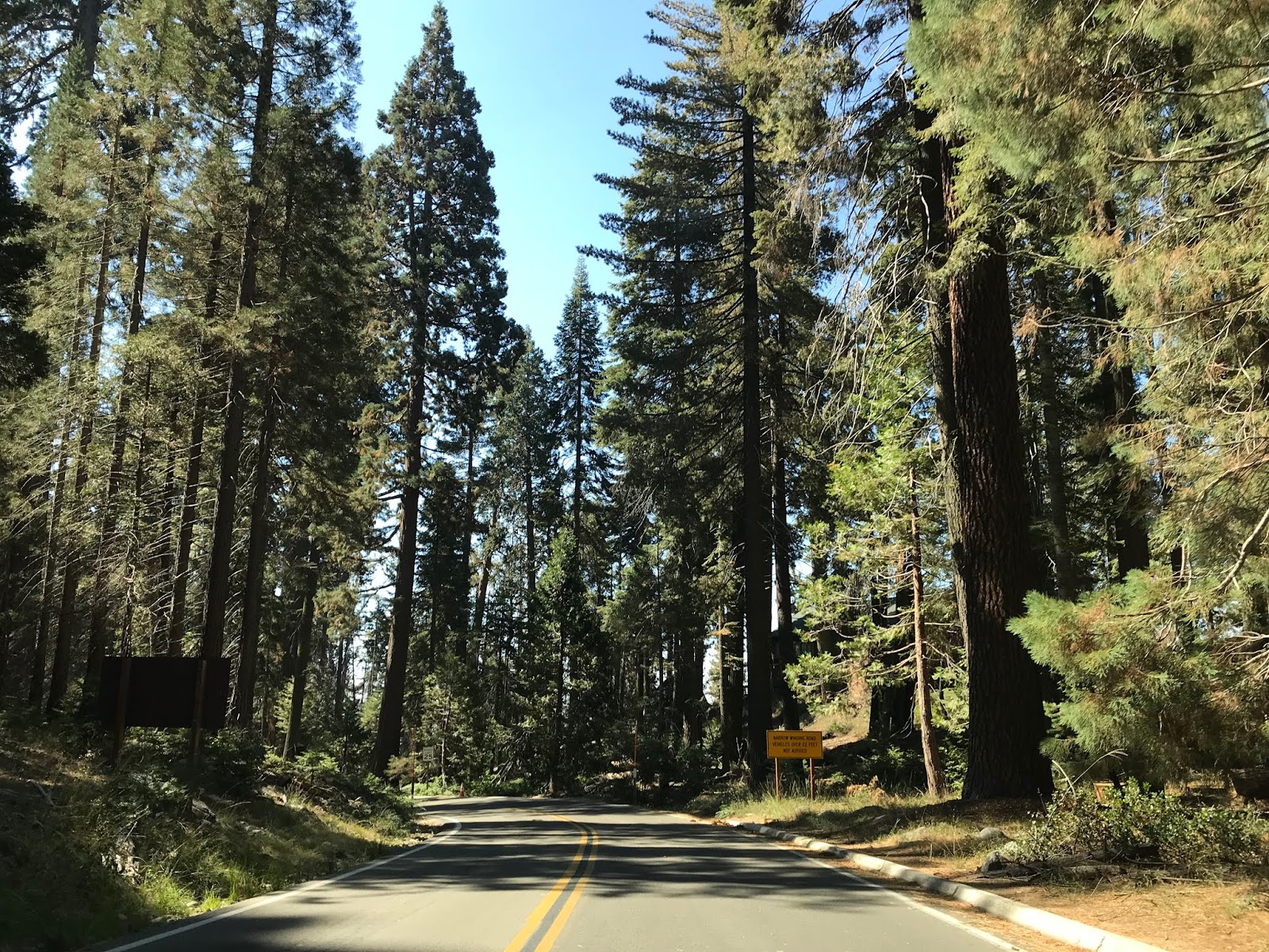
Vehicles over 22 feet in length advised against proceeding south of the Giant Forest on the Generals Highway.

The Generals Highway quickly leaves the boundary of Kings Canyon National park and enters Sequoia National Forest.


Almost immediately entering Sequoia National Forest the Generals Highway passes by the Redwood Mountain Vista.


South of the Redwood Mountain Vista the Generals Highway intersects Ten Mile Creek Road/Forest Route 30 and Forest Route 14S75. Ten Mile Creek Road heads northward towards Hume Lake whereas Forest Route 14S75 accesses the Redwood Canyon Trailhead.


I have a particular affinity of Hume Lake and Ten Mile Creek Road given that I asked my wife to marry me there. One of my favorite photos of Ten Mile Creek Road came from earlier in 2019 when it was still covered with snow.

Forest Road 14S75 descends two miles atop a steep dirt grade into Redwood Canyon amid the Redwood Mountain Grove of Sequoias to a parking lot and trailhead. Forest Road 14S75 continues outside the boundary of Kings Canyon National Park through Sequoia National Forest where it becomes Whitaker Forest Road. Whitaker Forest Road ends at CA 245 in the ghost town of Badger.


The Redwood Mountain Grove is the largest of all Sequoia Groves and is accessible via the Redwood Canyon Trailhead. The Redwood Canyon Trailhead lies at 6,215 feet above sea level. The Redwood Canyon Trailhead splits into the Sugar Bowl Loop and Hart Tree/Fallen Goliath Loop.


During my visit to Redwood Mountain I used the Hart Tree Trail branch from the Redwood Canyon Trailhead. The Hart Tree is shown at the Redwood Canyon Trailhead as 2.9 miles away but in reality is closer to 3.5 miles away.

The Hart Trail intersects the Redwood Creek Trail after approximately 0.3 miles.


The Hart Trail bears evidence of previous logging endeavors on Redwood Mountain.


After approximately 1 mile the Hart Trail crosses Redwood Creek and passes by a fallen Sequoia which was once used as logger's cabin.


After approximately 2 miles the Hart Trail emerges onto a clearing which overlooks Redwood Canyon.

The Hart Trail crosses near Buena Vista Peak and enters another large grove of Sequoias. During my visit to the Hart Trail I stopped at a Tunnel Log and made my way back to the Redwood Canyon Trailhead with my hiking party.


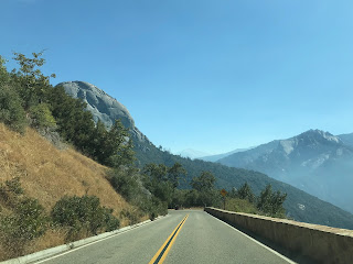
The Generals Highway south of Ten Mile Creek Road/Forest Road 14S75 begins to approach Buena Vista Peak which can be seen directly ahead in the photo below.

The Generals Highway approaches the Kings Canyon Overlook south of Ten Mile Creek Road.


Across from the Kings Canyon Overlook is the Buena Vista Trailhead.

The Buena Vista Trail is an approximately 2 mile round trip and is a somewhat easy climb to the top of Buena Vista Peak.


The top of Buena Vista Peak is well worth the effort to reach. From the top of Buena Vista Peak the following can be seen; Kings Canyon, the Generals Highway, Redwood Canyon, Redwood Mountain, and San Joaquin Valley can be seen.

South of the Buena Vista Trail the Generals Highway has access to the Big Baldy Trail.


The Big Baldy Trail is a 2.2 mile trek to the top of Big Baldy. I've seen typically seen the Big Baldy Trail to be one of the more highly rated on the Generals Highway but it is one of the few I haven't done. Big Baldy lies at an elevation of 8,209 feet above sea level and has a vista of the Great Western Divide.

The Generals Highway south of the Big Baldy Trailhead intersects Forest Route 14S11 which is signed as access to the Big Meadows Horse Corral.


The Generals Highway south of Forest Route 14S11 intersects the Montecito-Sequoia Lodge.


The Organization Camps are located on the Generals Highway south of the Montecito-Sequoia Lodge.


The Stony Creek Recreation Area is located south of the Organization Camps on the Generals Highway.

Stony Creek Lodge is located within the Stony Creek Recreation Area.


The Generals Highway south of the Stony Creek Recreation Area enters Sequoia National Park.


The Generals Highway continues southward passing by Wuksachi Village. At Wuksachi Village there is an elevation marker denoting the Generals Highway is at 7,000 feet above sea level.


The Generals Highway continues southward crossing the Clover Creek Bridge.


The Clover Creek Bridge crosses the namesake creek and despite the high water warnings is well worth heading to creek bed to see. The Clover Creek Bridge was completed in 1930 and at least in my opinion is the signature bridge on the Generals Highway. The Clover Creek Bridge is a concrete arch bridge which is 89.9 feet in length.


The Clover Creek Bridge was part of the ribbon cutting ceremony marking the opening the Generals Highway on June 23rd, 1935 as seen in this photo below from "When Two Parks Meet."

As evidenced from this photo the Clover Creek Bridge is essentially is the same as it was when the Generals Highway opened.

The Clover Creek Bridge along with the nearby Lodgepole can be seen on the sketch below from the Library of Congress.

From the Clover Creek Bridge the Lodgepole Visitor Center is signed as 0.6 miles to the south on the Generals Highway and the Giant Forest Museum as 5 miles away.

The Generals Highway passes by the Lodgepole Picnic Area before crossing the 1930 Lodgepole Bridge.


The Lodgepole Bridge is an identical design to the Clover Creek Bridge albeit smaller at 44.9 feet in length. The Lodgepole Bridge crosses the Marble Fork Kaweah River.

Across the Lodgepole Bridge lies the Lodgepole Vistor Center.


South of the Lodgepole Visitor Center the Generals Highway intersects Wolverton Road. Wolverton Road accesses Wolverton Ski area and the General Sherman Tree.


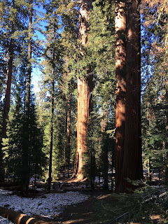
The General Sherman Tree is the largest of the Redwood Sequoias and is accessible from the easy (if you don't mind a steep uphill climb on a paved trail) Sherman Tree Trail. These photos from the Sherman Tree Trail are from the winter of 2019.

The General Sherman Tree is 274.9 feet tall, has a 36.5 foot diameter base and was estimated to weight 2,472,000 pounds. While the General Sherman Tree isn't even close to the tallest tree in the world it does have the largest mass at a bole volume of 52,513 cubic feet. The General Sherman Tree of the Giant Forest and General Grant Tree are the namesake trees which are referred to the name "Generals Highway." General Grant and General Sherman are named after the famous Union Generals from the American Civil War.


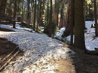
The Sherman Tree Trail connects to the Congress Trail which connects to the interior of the Giant Forest. Suffice to say it is somewhat easy to get turned around in the snow since the Congress Trail isn't well traveled in the winter.


The Generals Highway south of the General Sherman Tree accesses Crescent Meadow Road and the Giant Forest Museum.


Crescent Meadow Road accesses several notable features of the Giant Forest. Most of Crescent Meadow Road is a single lane and is open seasonally.


The first major feature on Crescent Meadow Road is the Auto Log. The Auto Log fell in 1917 and was converted into a visitor attraction. Cars would park atop the Auto Log which would make for a photographic opportunity. While visitors can park close to the Auto Log it has rotted to the point where it will no longer support vehicle weight.


The photo below of the Auto Log was taken during the 1920s.

Crescent Meadow Road splits into two branch routes; the southern branch accesses Moro Rock.


Moro Rock is a granite dome which peaks out at 6,725 feet above sea level. The Moro Rock Trail is climbs a series of stairs to the top of Moro Rock. The first stairwell on Moro Rock was a wooden structure which was built in 1917 and was replaced by the current carved stairway in 1931. In total the Moro Rock Trail ascends over 400 steps and 797 feet. There are views of the Great Western Divide and Generals Highway which can be seen on the climb up Moro Rock.


From the top of Moro Rock the following can be seen looking east-to-west; the Great Western Divide, Middle Fork Kaweah River, Generals Highway, Kaweah River and Lake Kaweah.

My personal opinion the top of Moro Rock looks even better in the winter. Moro Rock is accessible from the Generals Highway in the winter by way of the Moro Rock Trail or hiking Crescent Meadow Road.

From Moro Rock the branch in Crescent Meadow Road rejoins it's main alignment towards the Tunnel Log and Crescent Meadow.

The Tunnel Log was a 275 foot Redwood Sequoia which fell in 1937. When the Tunnel Log fell it obstructed Crescent Meadow Road and a tunnel was carved through in 1938 to reopen it. The Tunnel Log has an 8 foot vertical clearance and is 17 feet wide. A bypass road to the tunnel log is available for tall vehicles wishing to visit Crescent Meadow.


The photo below is of the Tunnel Log in the 1940s.

Crescent Meadow is located at the eastern terminus of Crescent Meadow Road. The High Sierra Trail begins the log sixty mile journey towards Mount Whitney.

The trails in Crescent Meadow connect to all the major locales of the Giant Forest.


Returning to the Generals Highway it begins to descend south of Crescent Meadow Road and the Giant Forest Museum. The City of Visalia is signed as 53 miles away.

Traffic on the Generals Highway is again advised that vehicles over 30 feet in length are not encouraged.

The Generals Highway begins to snake through switchbacks and dips below 6,000 feet above sea level.


The Generals Highway is aligned through the Giant Forest in such a way that it even has a one-way split to avoid interfering with the Redwood Sequoias. The last photo below is actual scale and wasn't altered with a panoramic.


The Generals Highway intersects Crystal Cave Road and the alignment of the Colony Mill Road just below the Redwood Sequoia treeline.


The Generals Highway begins to snake downhill on the Middle Fork Road alignment. As the Generals Highway opens up into the Kaweah River watershed it crosses paths with the Eleven Range Overlook.


The Generals Highway snakes downhill below the 5,000 foot elevation line.


As the Generals Highway further descends southward traffic is advised to shift to low gear. The Generals Highway on the Middle Fork Road grade is a sustained 8% downhill.


The Generals Highway southward opens up onto a vista of Moro Rock at Amphitheater Point.


Amphitheater Point can be seen in 1933 when it was still on the Middle Fork Road on the When Two Parks Meet article above.

Amphitheater Point is the portion of the Generals Highway which is visible from Moro Rock as seen above.

From Amphitheater Point the Generals Highway descends below 4,000 feet above sea level.


The Generals Highways continues to wind through 8% downhill grade to Hospital Rock. Hospital Rock was once home to a Potwisha settlement that was inhabited as early as the 1300s. The settlement at Hospital Rock was thought to have a population as high as 500 people. Hospital Rock lies at an elevation of approximately 3,000 feet above sea level.


South of Hospital Rock the grade of the Generals Highway begins to flatten as it starts to follow the course of the Middle Fork Kaweah River. At the Potwisha Campground the Generals Highway crosses the Marble Fork Kaweah River.


The Generals Highway continues southwest towards the Foothill Visitor Center passing the Tunnel Rock along the way.


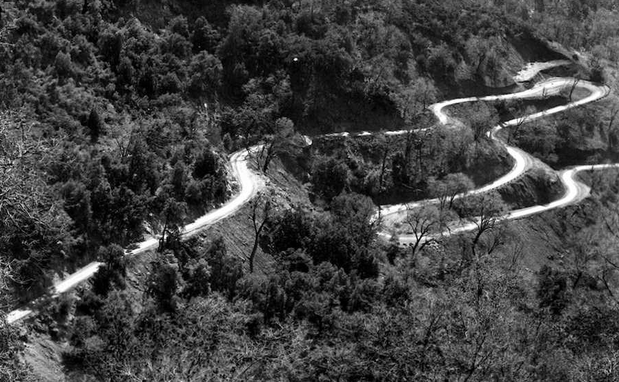
The Tunnel Rock was excavated in 1934 and made for a more direct alignment than the previous Middle Fork Road. The Tunnel Rock was reinforced with concrete in 1938 to stabilize the structure. The Tunnel Rock has long been bypassed in favor allowing for taller vehicles to pass by.

The Tunnel Rock as a through highway can be seen on the Library of Congress sketch below.

Beyond the Tunnel Rock the General Highway reaches the Foothills Visitor Center. The Foothills Visitor Center is open year-round due to the low elevation of 1,706 feet above sea level.


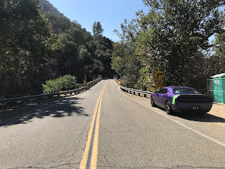
The Generals Highway reaches the Foothills Entrance to Sequoia National Park and terminates at the start of CA 198 in Three Rivers. CA 198 is signed as 34 miles from Visalia from the southern terminus of the Generals Highway.


As noted above CA 198 just past the terminus of the Generals Highway crosses the Kaweah River on the highly scenic Pumpkin Hollow Bridge.


The Generals Highway is an approximately 46 Mile National Park Highway. The Generals Highway connects the Grant Grove annex of Kings Canyon National Park south to the Foothills Entrance of Sequoia National Park at the eastern terminus of California State Route 198 in Three Rivers. Despite what Google thinks on their map images the Generals Highway is not part of CA 198 but more or less acts as a continuation of it. The Generals Highway lies entirely within Tulare County and crosses through portions of the Giant Sequoia National Monument within Sequoia National Forest.

Part 1; History of the reaching the Giant Forest and the advent of the Generals Highway
In 1886 the Kaweah Colony was established along the North Fork Kaweah River. The Kaweah Colony's economy was based on logging which led to the construction of the first 18 miles of what was known as the Colony Mill Road. The Colony Mill Road and Kaweah Colony sought to harvest timber from the Redwood Sequoia Trees of the Giant Forest. The alarm raised by conservationists at the prospect of the Kaweah Colony harvesting the Giant Forest played a large part in the creation of Sequoia National Park in September of 1890. In October of 1890 General Grant National Park was created to the north around the Grant Grove of Giant Redwood Sequoias.
Subsequent to the creation of Sequoia National Park all logging operations within the park boundaries were terminated. The Kaweah Colony continued lumber operations outside the National Park Boundary but ultimately the logging operation was shuttered in 1892. This led to the Colony Mill Road largely being abandoned despite it being well engineered with an 8% grade that was constructed with the prospect of a railroad in mind. In 1903 the Colony Mill Road was extended by 8 miles into the Giant Forest by the U.S. Army to facilitate wagon travel into Sequoia National Park.
In 1905 Sequoia National Park ceded some of the water rights of the Kaweah River watershed to the Mount Whitney Power Company. In exchange the Mount Whitney Power Company would improve the Colony Mill Road in addition to building better roadway access to the Giant Forest. The yield of the construction by the Mount Whitney Power Company was the Middle Fork Road which later became a central feature of the alignment of the Generals Highway. By 1913 a roadway had been constructed to Wolverton to the north of the Giant Forest.
During the 1919 Third State Highway Bond Act Legislative Route 10 was extended east from Visalia to the Colony Mill Road of Sequoia National Park. The Colony Mill Road ascending to the Giant Forest of Sequoia National Park from the eastern terminus of LRN 10 at Three Rivers can be seen on a 1919 Tulare County Road Atlas.

Starting in 1921 traffic headed to the Giant Forest would make a one-way ascent on the Colony Mill Road and a one-way descent on the Middle Fork Road. From 1921 to 1926 Tulare County improved the Colony Mill Road and Middle Fork Road for better automotive travel. Traffic heading down the Middle Fork Road would cross the Kaweah River at the confluence of the East Fork Kaweah River and Middle Fork Kaweah River via the 1922 Pumpkin Hollow Bridge. The Pumpkin Hollow Bridge can be seen in this sketch below (from this Library of Congress article) with an incorrect completion date of 1924. The Pumpkin Hollow Bridge is now part of CA 198.

Beginning in 1926 construction of a new highway to connect Grant Grove of General Grant National Park south to the Giant Forest of Sequoia National Park began. Construction of the new highway heavily improved the Middle Fork Road which allowed for two-way traffic and negated the need to use the Colony Mill Road. In 1935 the Generals Highway was completed and a dedication ceremony was held on June 23rd. Much of the information as described above was taken to the National Park Service article "When Two Parks Meet; History of the Generals Highway."
The 1935 Division of Highways Map of Tulare County shows the partially completed Generals Highway. Note; the Colony Mill Road is shown to be a somewhat well traveled County Highway despite the improvements to the Middle Fork Road.


As a side note; General Grant National Park was reorganized and expanded into Kings Canyon National Park in March of 1940. The creation of Kings Canyon National Park effectively and somewhat ironically killed two Trans-Sierra Highways; CA 168/Piute Pass Highway and CA 180/Kings Canyon Highway.
Part 2; The fate of the Colony Mill Road
Much of what was once the Colony Mill road exists north of Three Rivers today. The Colony Mill Road north from CA 198 is known as Mountain Road 357/North Fork Road. Mountain Road 357 is an active roadway north to the Sequoia National Park boundary where it becomes the Old Colony Mill Trail. The Old Colony Mill Trail ends at Crystal Cave Road in the Giant Forest. Crystal Cave Road east to the Generals Highway was built on the alignment of the Colony Mill Road.
The Colony Mill Road is still shown as an active highway on a 1948 Tulare County Road Map.

The Colony Mill Road appears to have been in use even after 1964 as it appears on this undated Tulare County Road Map. Kaweah Lake appears on the map below and was created after Terminus Dam was completed in 1962. CA 216 also appears on the map below which was numbered during the 1964 State Highway Renumbering.

Back in 2016 I explored some of the Colony Mill Road during a rainy morning. From CA 198 I turned onto the Colony Mill Road alignment via Mountain Road 357/North Fork Road.

Headed north on Mountain Road 357 I passed through Kaweah. Kaweah never truly disappeared after the logging operations shuttered in 1892 which is likely due to tourism to Sequoia National Park keeping the community afloat. The 1910 Kaweah Post Office is still along the Colony Mill Road/Mountain Road 357 along with a historic marker.


Mountain Road 357 is paved or several miles north of Kaweah. The paved section of Mountain Road 357 is in terrible shape and is only 8-10 feet in places. Encountering another vehicle coming the opposite way would require someone backing up. Despite the narrow grade Mountain Road 357 is well marked with Post Mile paddles.


A small ghost town known as Advance can be found on Mountain Road 357 just before the pavement ends. Advance was part of the Kaweah Colony but unlike Kaweah died out shortly after the creation of Sequoia National Park.

The paved portion of Mountain Road 357 ends about 8 miles north of CA 198 and continues as a dirt road to the Old Colony Mill Trailhead.

Part 3; a trip on the Generals Highway
My approach to the Generals Highway was from the implied continuation of CA 180 eastbound through Grant Grove of Kings Canyon National Park. The Generals Highway begins with a right-hand southbound turn off of implied CA 180 eastbound. Traffic is immediately advised of conditions where the Generals Highway is not plowed.


Vehicles over 22 feet in length advised against proceeding south of the Giant Forest on the Generals Highway.

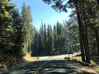
The Generals Highway quickly leaves the boundary of Kings Canyon National park and enters Sequoia National Forest.


Almost immediately entering Sequoia National Forest the Generals Highway passes by the Redwood Mountain Vista.


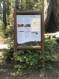
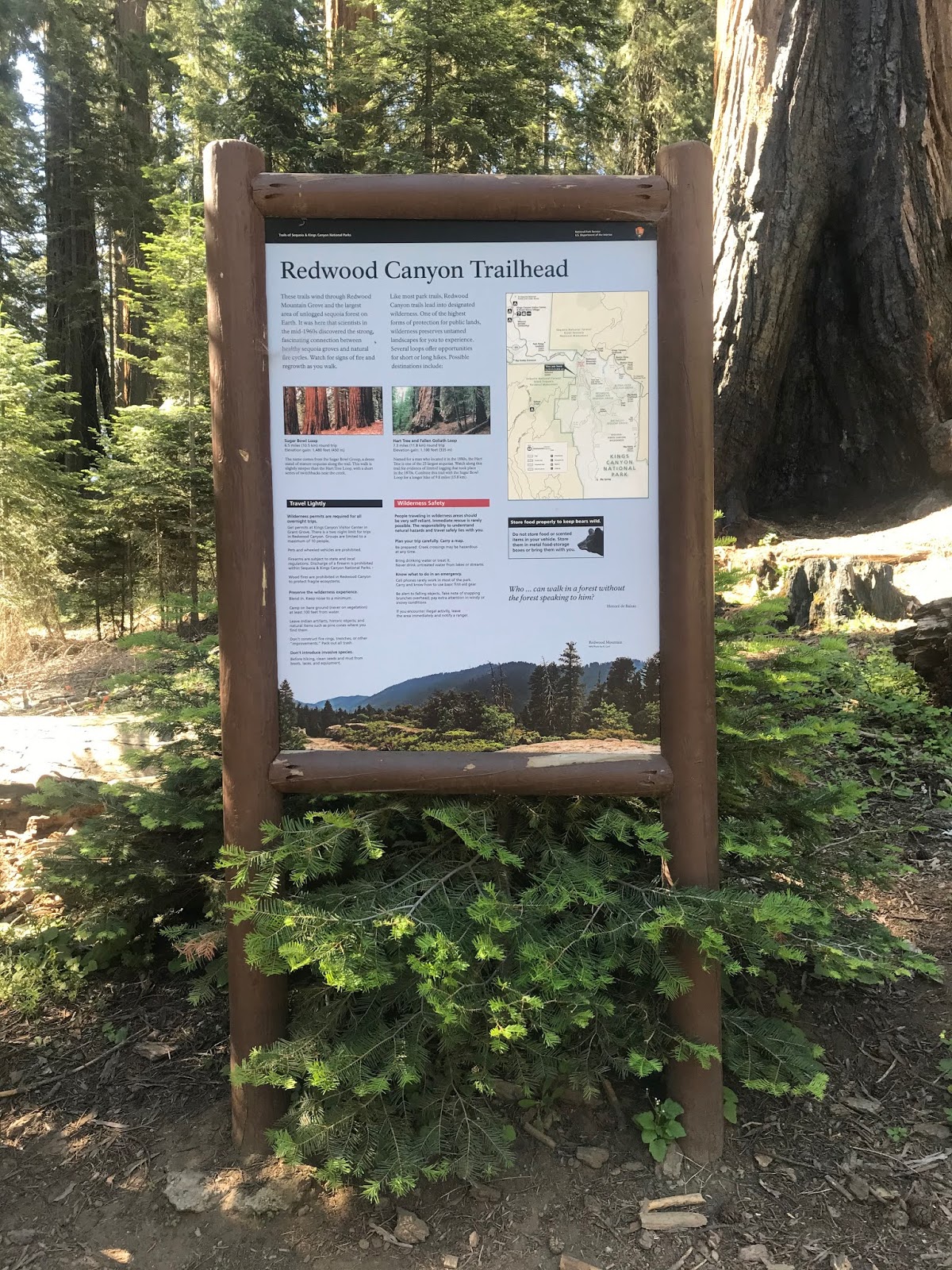
South of the Redwood Mountain Vista the Generals Highway intersects Ten Mile Creek Road/Forest Route 30 and Forest Route 14S75. Ten Mile Creek Road heads northward towards Hume Lake whereas Forest Route 14S75 accesses the Redwood Canyon Trailhead.


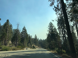
I have a particular affinity of Hume Lake and Ten Mile Creek Road given that I asked my wife to marry me there. One of my favorite photos of Ten Mile Creek Road came from earlier in 2019 when it was still covered with snow.

Forest Road 14S75 descends two miles atop a steep dirt grade into Redwood Canyon amid the Redwood Mountain Grove of Sequoias to a parking lot and trailhead. Forest Road 14S75 continues outside the boundary of Kings Canyon National Park through Sequoia National Forest where it becomes Whitaker Forest Road. Whitaker Forest Road ends at CA 245 in the ghost town of Badger.


The Redwood Mountain Grove is the largest of all Sequoia Groves and is accessible via the Redwood Canyon Trailhead. The Redwood Canyon Trailhead lies at 6,215 feet above sea level. The Redwood Canyon Trailhead splits into the Sugar Bowl Loop and Hart Tree/Fallen Goliath Loop.


During my visit to Redwood Mountain I used the Hart Tree Trail branch from the Redwood Canyon Trailhead. The Hart Tree is shown at the Redwood Canyon Trailhead as 2.9 miles away but in reality is closer to 3.5 miles away.

The Hart Trail intersects the Redwood Creek Trail after approximately 0.3 miles.


The Hart Trail bears evidence of previous logging endeavors on Redwood Mountain.


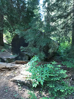
After approximately 1 mile the Hart Trail crosses Redwood Creek and passes by a fallen Sequoia which was once used as logger's cabin.


After approximately 2 miles the Hart Trail emerges onto a clearing which overlooks Redwood Canyon.

The Hart Trail crosses near Buena Vista Peak and enters another large grove of Sequoias. During my visit to the Hart Trail I stopped at a Tunnel Log and made my way back to the Redwood Canyon Trailhead with my hiking party.


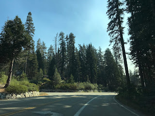
The Generals Highway south of Ten Mile Creek Road/Forest Road 14S75 begins to approach Buena Vista Peak which can be seen directly ahead in the photo below.

The Generals Highway approaches the Kings Canyon Overlook south of Ten Mile Creek Road.


Across from the Kings Canyon Overlook is the Buena Vista Trailhead.

The Buena Vista Trail is an approximately 2 mile round trip and is a somewhat easy climb to the top of Buena Vista Peak.


The top of Buena Vista Peak is well worth the effort to reach. From the top of Buena Vista Peak the following can be seen; Kings Canyon, the Generals Highway, Redwood Canyon, Redwood Mountain, and San Joaquin Valley can be seen.

South of the Buena Vista Trail the Generals Highway has access to the Big Baldy Trail.


The Big Baldy Trail is a 2.2 mile trek to the top of Big Baldy. I've seen typically seen the Big Baldy Trail to be one of the more highly rated on the Generals Highway but it is one of the few I haven't done. Big Baldy lies at an elevation of 8,209 feet above sea level and has a vista of the Great Western Divide.

The Generals Highway south of the Big Baldy Trailhead intersects Forest Route 14S11 which is signed as access to the Big Meadows Horse Corral.


The Generals Highway south of Forest Route 14S11 intersects the Montecito-Sequoia Lodge.


The Organization Camps are located on the Generals Highway south of the Montecito-Sequoia Lodge.


The Stony Creek Recreation Area is located south of the Organization Camps on the Generals Highway.

Stony Creek Lodge is located within the Stony Creek Recreation Area.


The Generals Highway south of the Stony Creek Recreation Area enters Sequoia National Park.


Upon entering Sequoia National Park the Generals Highway passes through a Redwood Grove.

The Generals Highway continues through Sequoia National Park and crosses Cabin Creek.


The Generals Highway passes by Dorst Campgound south of Cabin Creek.


The Little Baldy Trailhead is located south Dorst Creek Campground along the Generals Highway.


The Little Baldy Trail is a 3.3 mile loop the top of the namesake formation. Almost all of the Little Baldy Trail is a uphill ascent but the trail is in a good state of repair. The Great Western Divide is easily observed from the top of the Little Baldy Trail.

The Generals Highway south of the Little Baldy Trail crosses Suwanee Creek.


The Generals Highway continues southward passing through Halstead Meadow.


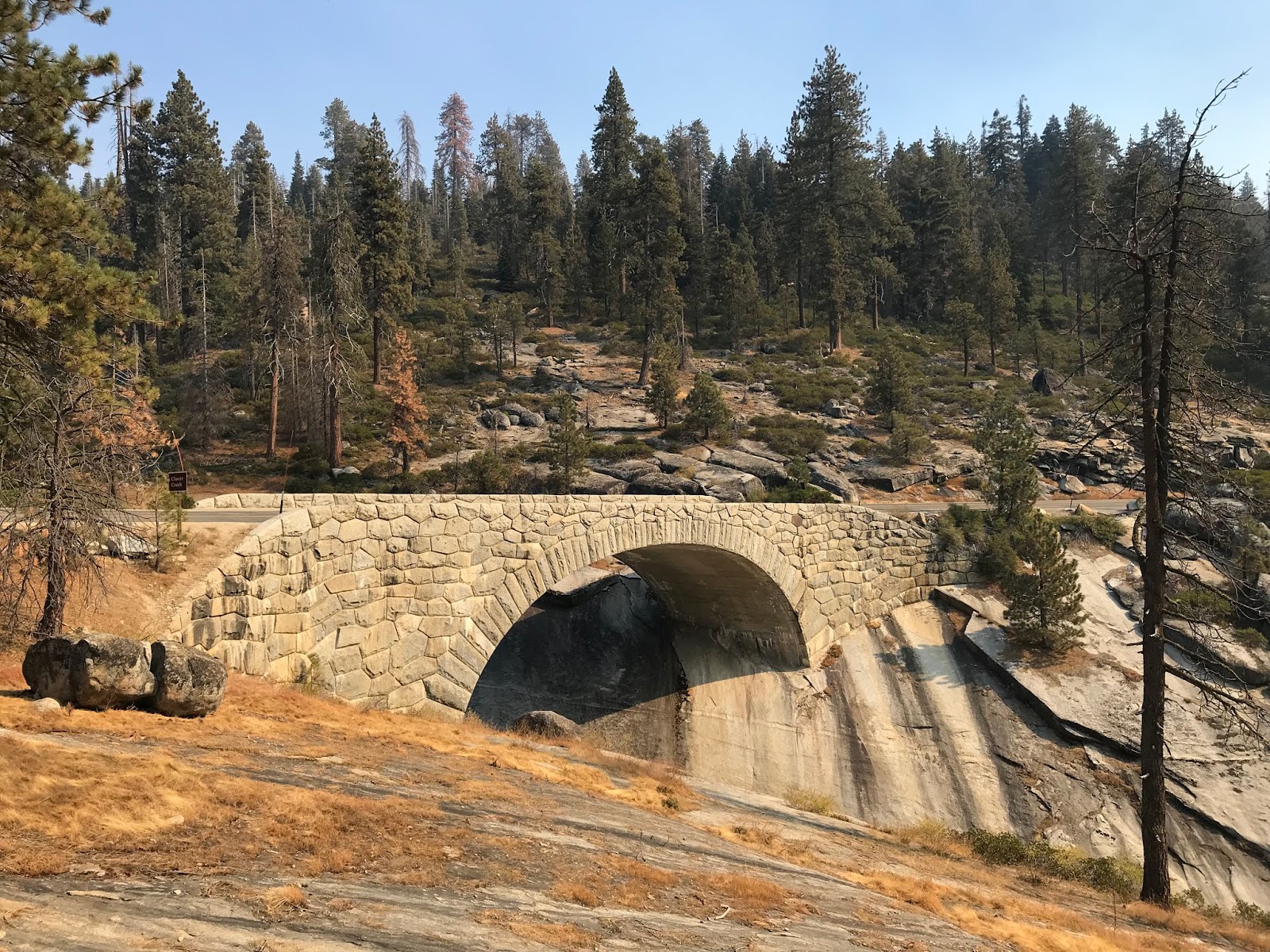
The Generals Highway continues southward crossing the Clover Creek Bridge.


The Clover Creek Bridge crosses the namesake creek and despite the high water warnings is well worth heading to creek bed to see. The Clover Creek Bridge was completed in 1930 and at least in my opinion is the signature bridge on the Generals Highway. The Clover Creek Bridge is a concrete arch bridge which is 89.9 feet in length.


The Clover Creek Bridge was part of the ribbon cutting ceremony marking the opening the Generals Highway on June 23rd, 1935 as seen in this photo below from "When Two Parks Meet."

As evidenced from this photo the Clover Creek Bridge is essentially is the same as it was when the Generals Highway opened.

The Clover Creek Bridge along with the nearby Lodgepole can be seen on the sketch below from the Library of Congress.

From the Clover Creek Bridge the Lodgepole Visitor Center is signed as 0.6 miles to the south on the Generals Highway and the Giant Forest Museum as 5 miles away.

The Generals Highway passes by the Lodgepole Picnic Area before crossing the 1930 Lodgepole Bridge.


The Lodgepole Bridge is an identical design to the Clover Creek Bridge albeit smaller at 44.9 feet in length. The Lodgepole Bridge crosses the Marble Fork Kaweah River.

Across the Lodgepole Bridge lies the Lodgepole Vistor Center.


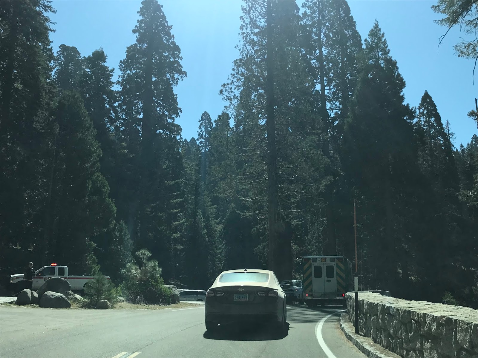
South of the Lodgepole Visitor Center the Generals Highway intersects Wolverton Road. Wolverton Road accesses Wolverton Ski area and the General Sherman Tree.


The General Sherman Tree is the largest of the Redwood Sequoias and is accessible from the easy (if you don't mind a steep uphill climb on a paved trail) Sherman Tree Trail. These photos from the Sherman Tree Trail are from the winter of 2019.

The General Sherman Tree is 274.9 feet tall, has a 36.5 foot diameter base and was estimated to weight 2,472,000 pounds. While the General Sherman Tree isn't even close to the tallest tree in the world it does have the largest mass at a bole volume of 52,513 cubic feet. The General Sherman Tree of the Giant Forest and General Grant Tree are the namesake trees which are referred to the name "Generals Highway." General Grant and General Sherman are named after the famous Union Generals from the American Civil War.


The Sherman Tree Trail connects to the Congress Trail which connects to the interior of the Giant Forest. Suffice to say it is somewhat easy to get turned around in the snow since the Congress Trail isn't well traveled in the winter.


The Generals Highway south of the General Sherman Tree accesses Crescent Meadow Road and the Giant Forest Museum.


Crescent Meadow Road accesses several notable features of the Giant Forest. Most of Crescent Meadow Road is a single lane and is open seasonally.


The first major feature on Crescent Meadow Road is the Auto Log. The Auto Log fell in 1917 and was converted into a visitor attraction. Cars would park atop the Auto Log which would make for a photographic opportunity. While visitors can park close to the Auto Log it has rotted to the point where it will no longer support vehicle weight.


The photo below of the Auto Log was taken during the 1920s.

Crescent Meadow Road splits into two branch routes; the southern branch accesses Moro Rock.


Moro Rock is a granite dome which peaks out at 6,725 feet above sea level. The Moro Rock Trail is climbs a series of stairs to the top of Moro Rock. The first stairwell on Moro Rock was a wooden structure which was built in 1917 and was replaced by the current carved stairway in 1931. In total the Moro Rock Trail ascends over 400 steps and 797 feet. There are views of the Great Western Divide and Generals Highway which can be seen on the climb up Moro Rock.


From the top of Moro Rock the following can be seen looking east-to-west; the Great Western Divide, Middle Fork Kaweah River, Generals Highway, Kaweah River and Lake Kaweah.

My personal opinion the top of Moro Rock looks even better in the winter. Moro Rock is accessible from the Generals Highway in the winter by way of the Moro Rock Trail or hiking Crescent Meadow Road.

From Moro Rock the branch in Crescent Meadow Road rejoins it's main alignment towards the Tunnel Log and Crescent Meadow.

The Tunnel Log was a 275 foot Redwood Sequoia which fell in 1937. When the Tunnel Log fell it obstructed Crescent Meadow Road and a tunnel was carved through in 1938 to reopen it. The Tunnel Log has an 8 foot vertical clearance and is 17 feet wide. A bypass road to the tunnel log is available for tall vehicles wishing to visit Crescent Meadow.


The photo below is of the Tunnel Log in the 1940s.

Crescent Meadow is located at the eastern terminus of Crescent Meadow Road. The High Sierra Trail begins the log sixty mile journey towards Mount Whitney.

The trails in Crescent Meadow connect to all the major locales of the Giant Forest.


Returning to the Generals Highway it begins to descend south of Crescent Meadow Road and the Giant Forest Museum. The City of Visalia is signed as 53 miles away.

Traffic on the Generals Highway is again advised that vehicles over 30 feet in length are not encouraged.
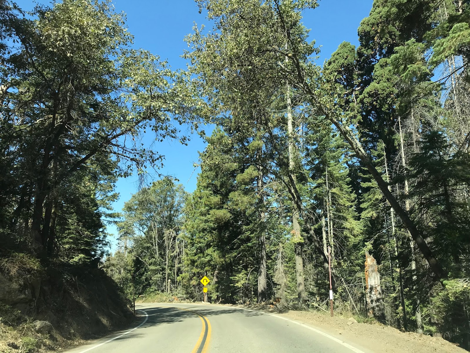
The Generals Highway begins to snake through switchbacks and dips below 6,000 feet above sea level.


The Generals Highway is aligned through the Giant Forest in such a way that it even has a one-way split to avoid interfering with the Redwood Sequoias. The last photo below is actual scale and wasn't altered with a panoramic.


The Generals Highway intersects Crystal Cave Road and the alignment of the Colony Mill Road just below the Redwood Sequoia treeline.


The Generals Highway begins to snake downhill on the Middle Fork Road alignment. As the Generals Highway opens up into the Kaweah River watershed it crosses paths with the Eleven Range Overlook.


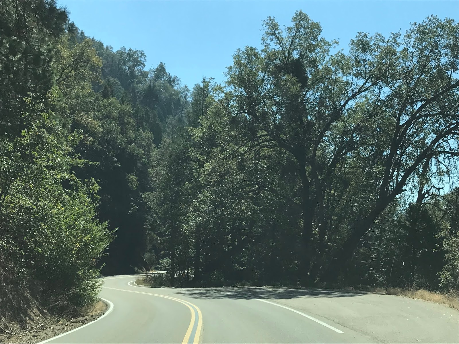


The Generals Highway snakes downhill below the 5,000 foot elevation line.


As the Generals Highway further descends southward traffic is advised to shift to low gear. The Generals Highway on the Middle Fork Road grade is a sustained 8% downhill.


The Generals Highway southward opens up onto a vista of Moro Rock at Amphitheater Point.


Amphitheater Point can be seen in 1933 when it was still on the Middle Fork Road on the When Two Parks Meet article above.
Amphitheater Point is the portion of the Generals Highway which is visible from Moro Rock as seen above.

From Amphitheater Point the Generals Highway descends below 4,000 feet above sea level.


The Generals Highways continues to wind through 8% downhill grade to Hospital Rock. Hospital Rock was once home to a Potwisha settlement that was inhabited as early as the 1300s. The settlement at Hospital Rock was thought to have a population as high as 500 people. Hospital Rock lies at an elevation of approximately 3,000 feet above sea level.


South of Hospital Rock the grade of the Generals Highway begins to flatten as it starts to follow the course of the Middle Fork Kaweah River. At the Potwisha Campground the Generals Highway crosses the Marble Fork Kaweah River.


The Generals Highway continues southwest towards the Foothill Visitor Center passing the Tunnel Rock along the way.


The Tunnel Rock was excavated in 1934 and made for a more direct alignment than the previous Middle Fork Road. The Tunnel Rock was reinforced with concrete in 1938 to stabilize the structure. The Tunnel Rock has long been bypassed in favor allowing for taller vehicles to pass by.

The Tunnel Rock as a through highway can be seen on the Library of Congress sketch below.

Beyond the Tunnel Rock the General Highway reaches the Foothills Visitor Center. The Foothills Visitor Center is open year-round due to the low elevation of 1,706 feet above sea level.


The Generals Highway reaches the Foothills Entrance to Sequoia National Park and terminates at the start of CA 198 in Three Rivers. CA 198 is signed as 34 miles from Visalia from the southern terminus of the Generals Highway.


As noted above CA 198 just past the terminus of the Generals Highway crosses the Kaweah River on the highly scenic Pumpkin Hollow Bridge.


Comments