This past October I drove a segment of California State Route 74 on the Pines to Palms Highway from CA 371 eastward to former CA 111 in Palm Desert.

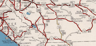
CA 74 as of 1995 had 112 miles of State Maintained roadway along with 5 un-constructed miles. CA 74 presently connects I-5 from San Juan Capistrano in Orange County eastward to the City Limits of Palm Desert of Riverside County The segment of CA 74 from Perris east to former CA 111 is traditionally known as the Pines to Palms Highway.

Part 1; the history of California State Route 74 and California State Route 740...wait what?
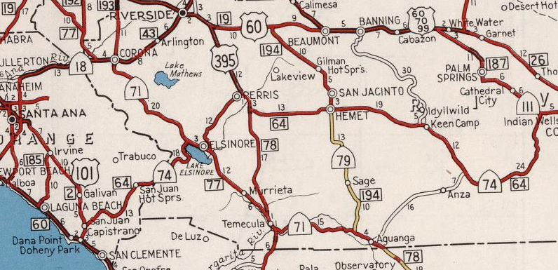
The majority of present CA 74 consists of the Ortega Highway between I-5 east to Perris and the Pines to Palms Highway east of Perris to Coachella Valley. The Ortega Highway built by Orange County and Riverside County beginning in 1929 which concluded in 1933. What became the Pines to Palms Highway was constructed in a joint project by Riverside County and the National Forest Service in the 1920s. The Pines to Palms Highway was officially designated by Riverside County in 1930 according to a desertsun.com article. The Pines to Palms Highway opening ceremony was held on June 18th 1932 according to a July 1932 Department of Public Works Publication.

The entire present route of CA 74 was brought into the State Highway System as part of a westward extension of Legislative Route 64 according to CAhighways. On a 1934 Department of Public Works Guide CA 74 was announced as a highway running from US 101 near San Juan Capistrano east on the Ortega Highway to CA 740 in Perris. CA 740 was added as a Signed State Route from US 60 in Riverside east to CA 111 in Coachella Valley.


According to CAhighways US Route 395 was officially extended into California during a June 1934 AASHTO meeting. US 395 annexed what was CA 740 on LRN 78 between Riverside and Perris. US 395 multiplexed CA 74 west of Perris before turning south towards Temecula on what previously had been CA 71. Interestingly CA 740 east of Perris wasn't immediately consolidated into CA 74 as it appears east of CA 74/US 395 on a 1935 Goshua Highway Map of California.

Straying into speculative territory (which I rarely do in these blogs) regarding the remaining segment of CA 740 east of Perris. It seems that some Sign State Route numbers assigned during 1934 were deliberately set aside for future US Routes. For example; CA 440 was seemingly set aside in anticipation of CA 44 to the north becoming US Route 299. It seems highly probably that CA 740 east of Perris was intended also to be a US Routes at some point. That said, have never seen a AASHTO of Department of Public Works document to support that theory. My assumption would be that CA 740 and possibly CA 74 were at one point considered to be the route of US 70. In a way this would make sense since it would slot the western terminus between US 60 and US 80.
Regardless of speculation CA 740 east of Perris was annexed into CA 74 no later than 1938. CA 74 appears as a singular route between San Juan Capistrano and Coachella Valley on the 1938 Division of Highways State Map.

On the 1952 Division of Highways State Map a new planned route of US 395/LRN 78 south of Perris appears for the first time.

On the 1953 Division of Highways Map the new route of US 395 south of Perris and Case Road appears for the first time. The US 395 Bypass Route of Perris still is shown as a proposed highway in 1953.

The 1954 Division of Highways Map shows the US 395 bypass of Perris completed. It appears that CA 74 is still aligned through downtown Perris via; 4th Street, D Street, 11th Street and Case Road.

The 1955 Division of Highways Map shows the former surface route of CA 74 in Perris largely eliminated. CA 74 was moved to a new alignment directly on 4th Street where it multiplexed US 395 south to Romoland. This multiplex route for CA 74 is still present on I-215.
CA 74 largely went through the 1964 State Highway Renumbering unchanged. According to CAhighways CA 74 was legislatively extended in 1965 to I-10 in Coachella Valley. This new legislative east terminus of CA 74 is present on the 1966 Division of Highways Map along with a new multiplex with CA 79 west of Hemet on Florida Avenue to Winchester Road.

According to the desertsun article above CA 74 east of San Jancinto to Palm Desert was added as a scenic byway known as "Palms to Pines Scenic Byway" by the State in 1971/1972. In 1993 San Bernardino National Forest made their portion of CA 74 a National Forest Scenic Byway. In recent years there have been numerous recent moves by the State Legislature to relinquish surface segments of CA 74 according CAhighways:
- In 2005 the surface route of CA 74 in the City of Palm Desert was authorized. The relinquishment of CA 74 within Palm Desert was made official in February of 2008.
- In 2008 the surface route of CA 74 in the City of Lake Elsinore was authorized. As of 2019 Lake Elsinore has yet to accept the relinquishment of CA 74 within their City Limits.
- In 2008 the surface route of CA 74 in the City of Perris was authorized. The relinquishment of CA 74 within Perris was officially relinquished in August of 2009.
- In 2013 the legislative definition of CA 74 was changed to reflect a terminus at the City Limit of Palm Desert which eliminated the legislative extension to I-10. The same legislation authorized the relinquishment of CA 74 within in the City of Hemet which has not presently been accepted as of 2019.
Part 2; a drive on CA 74 on the Pines to Palms Highway to former CA 111 in Palm Desert
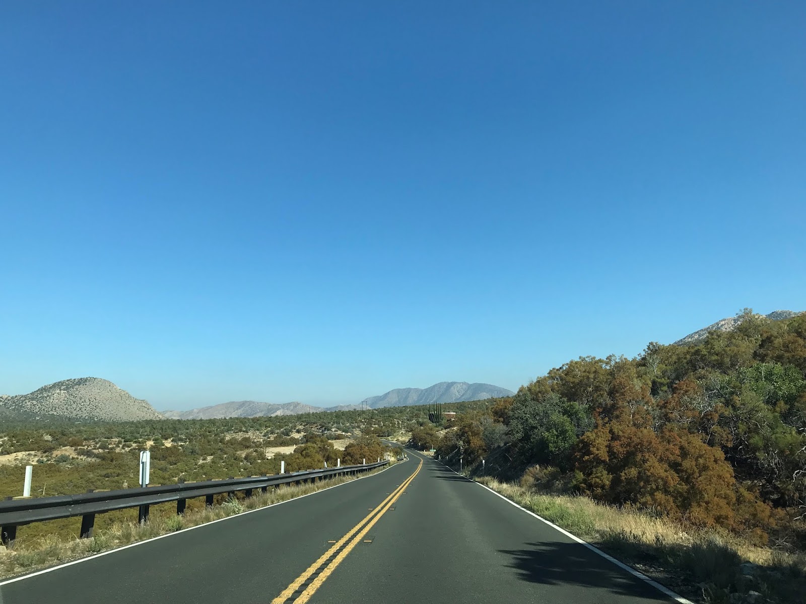
In February of 2019 there was damage to CA 74 east of Hemet due to winter storms. Even though I was traveling in October much CA 74 east of Hemet to CA 243 was still closed. To reach the Pines to Palm Highway descent in Palm Desert I took CA 371 eastbound to CA 74 east. Specifically I joined CA 74 eastbound at Post Mile RIV 71.744, Indio is signed as 31 miles away.


CA 74 traffic east of CA 371 is advised that the Pines to Palms Highway is not a recommended route for trucks for the remaining 16 miles to Palm Desert.

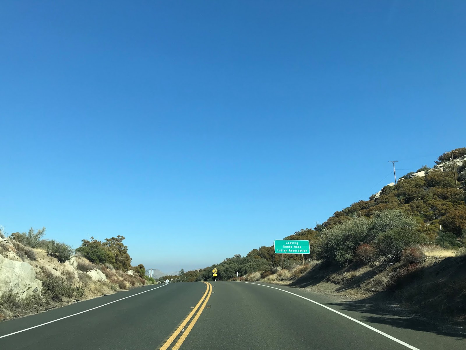
CA 74 eastbound essentially slots a gap between the San Jacinto Mountains to the north and the Santa Rosa Mountains to the south. At Post Mile RIV 73.000 CA 74 east briefly leaves San Bernardino National Forest and enters the Santa Rosa Indian Reservation.


At Post Mile RIV 76.434 CA 74 eastbound reenters San Bernardino National Forest and Santa Rosa & San Jacinto National Monument.


Traffic on CA 74 eastbound is advised of 15 miles of curves ahead.

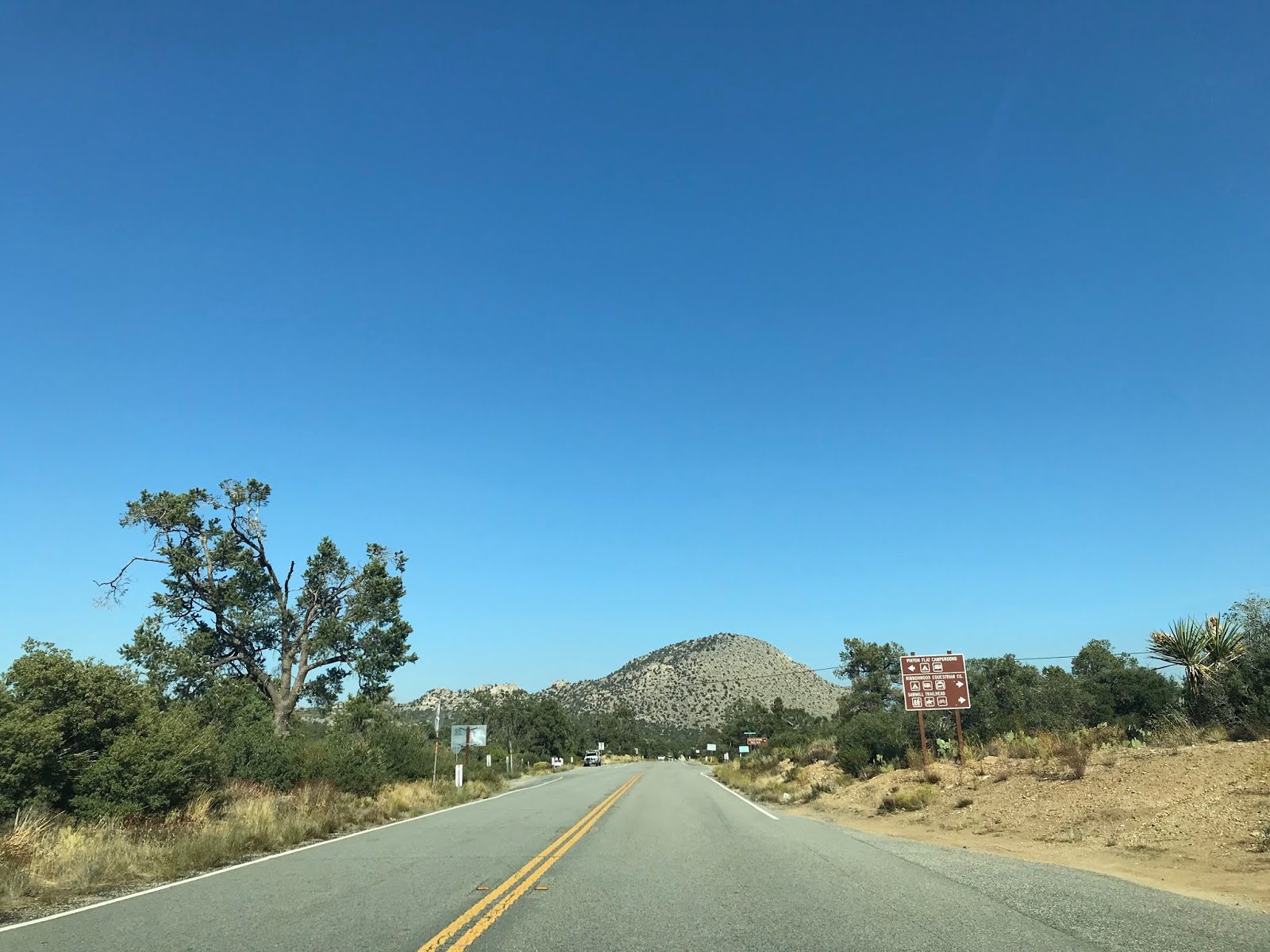
The Santa Rosa Mountain Truck Trail is accessible from CA 74 at Post Mile RIV 76.924.


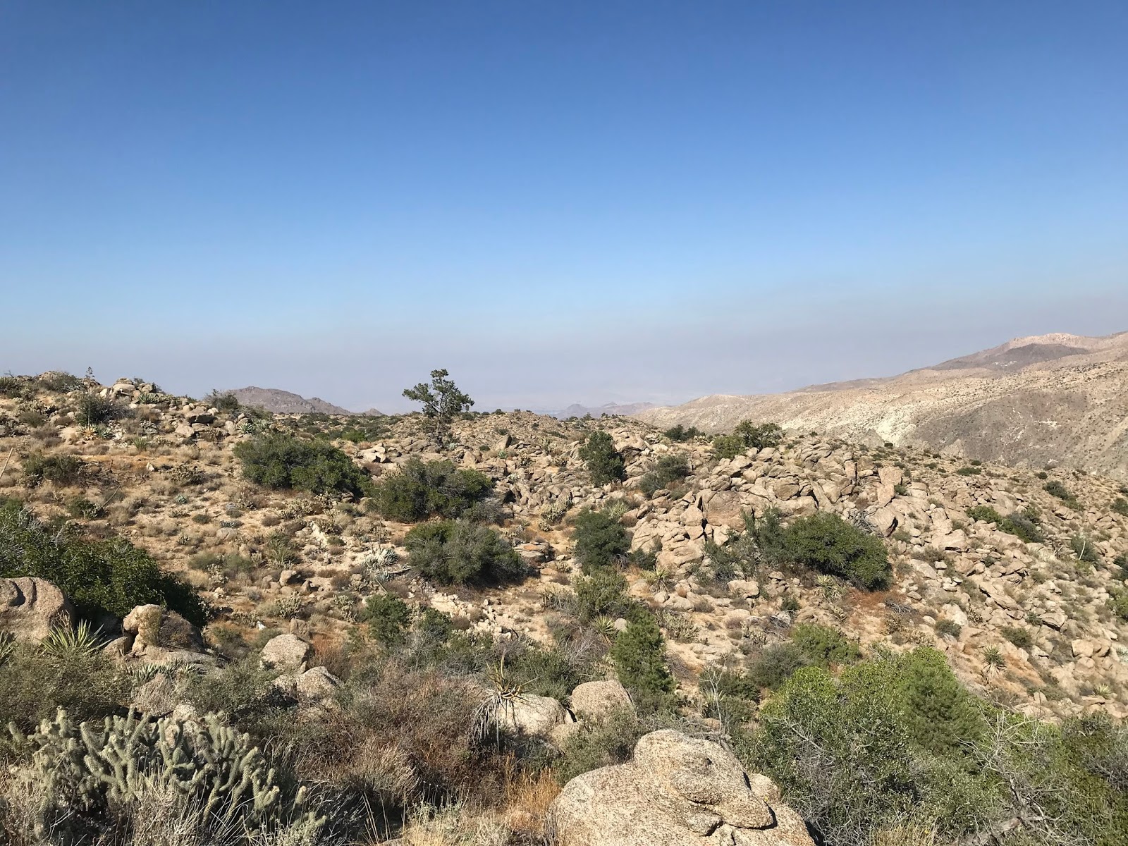
The terrain of the Pines to Palms Highway becomes increasingly arid and desert like. CA 74 eastbound traffic is advised of 11 miles of downhill grades.


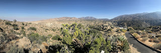
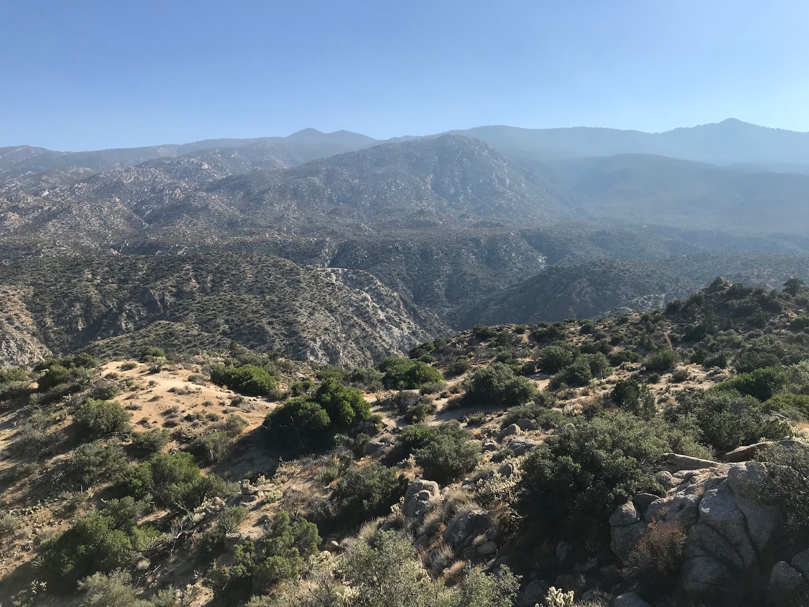
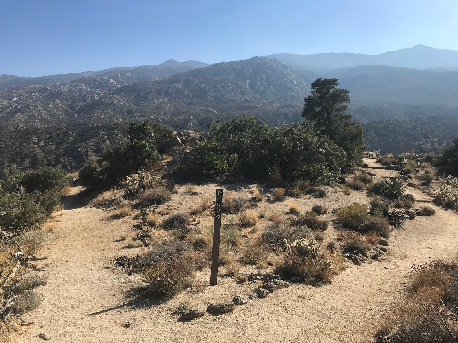
At Post Mile RIV 82.419 I stopped at the Cahuilla-Tewanet Vista Point above Horse Thief Creek.


The Cahuilla-Tewanet Vista Point overlooks the traditional homeland of the Cahuilla Tribe. The Sonoran Desert can be seen out in the Salton Sink to the east along with the tallest mountain in the Santa Rosa Mountains; Toro Peak at 8,716 feet above sea level directly south.


CA 74 eastbound beyond the Cahuilla-Tenwanet Vista is signed as the CHP Officer Michael Allen Brandt Memorial Highway.


CA 74 east begins to descend the Pines to Palms Highway rapidly and dips below the 3,000 foot elevation line.


CA 74 east traffic is advised again of steep downhill grades. There is a big horn sheep advisory sign at Post Mile RIV 86.670.


At Post Mile RIV 87.468 CA 74 eastbound accesses the Coachella Valley Vista Point.


The Coachella Valley Vista Point overlook as the name implies overlooks Coachella Valley. There is a hell of a view of the downhill grade of the Pines to Palms Highway which I used as the cover photo for this blog.


From the Coachella Valley Vista Point CA 74 east is signed as the Roy Wilson Memorial Highway.


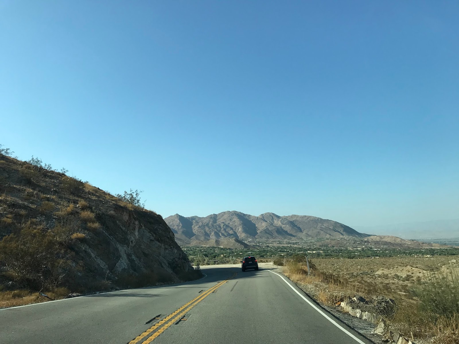
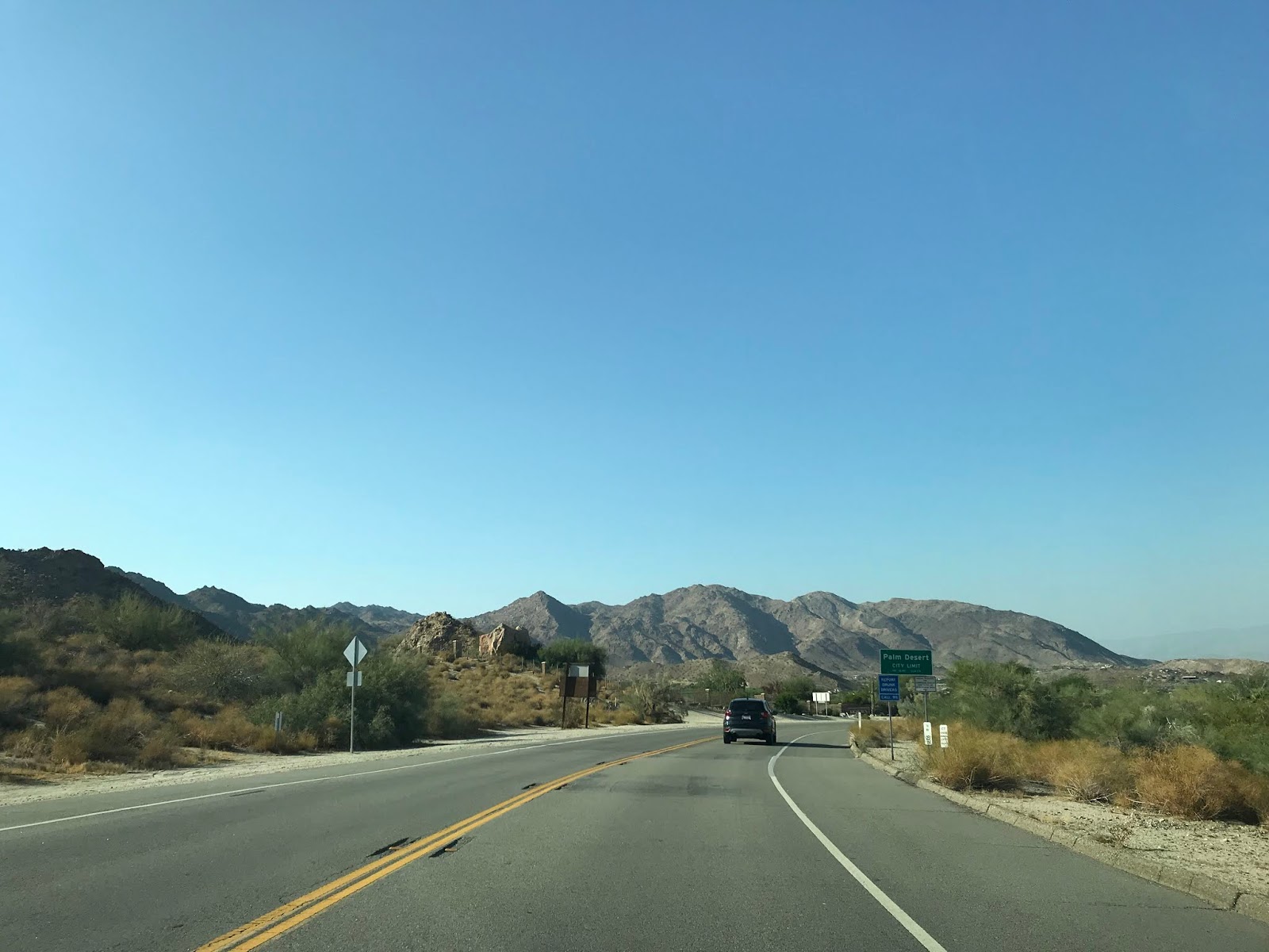
CA 74 eastbound snakes through the Pines to Palms Highway and enters Palm Desert at Post Mile RIV 92.34.


The present eastern terminus of CA 74 can be observed on the Caltrans Post Mile Tool.

Former CA 74 eastbound within Palm Desert is signed as the S. Roy Wilson Scenic Highway.

Former CA 74 continues downhill on the Pines to Palm Highway where it terminates at former CA 111. Interestingly the street blade at former CA 111 still refers to it as "Highway 111." The former implied right of way of un-built CA 74 connecting to I-10 is ahead on Monterey Avenue.


CA 74 as of 1995 had 112 miles of State Maintained roadway along with 5 un-constructed miles. CA 74 presently connects I-5 from San Juan Capistrano in Orange County eastward to the City Limits of Palm Desert of Riverside County The segment of CA 74 from Perris east to former CA 111 is traditionally known as the Pines to Palms Highway.

Part 1; the history of California State Route 74 and California State Route 740...wait what?
The majority of present CA 74 consists of the Ortega Highway between I-5 east to Perris and the Pines to Palms Highway east of Perris to Coachella Valley. The Ortega Highway built by Orange County and Riverside County beginning in 1929 which concluded in 1933. What became the Pines to Palms Highway was constructed in a joint project by Riverside County and the National Forest Service in the 1920s. The Pines to Palms Highway was officially designated by Riverside County in 1930 according to a desertsun.com article. The Pines to Palms Highway opening ceremony was held on June 18th 1932 according to a July 1932 Department of Public Works Publication.
The entire present route of CA 74 was brought into the State Highway System as part of a westward extension of Legislative Route 64 according to CAhighways. On a 1934 Department of Public Works Guide CA 74 was announced as a highway running from US 101 near San Juan Capistrano east on the Ortega Highway to CA 740 in Perris. CA 740 was added as a Signed State Route from US 60 in Riverside east to CA 111 in Coachella Valley.

According to CAhighways US Route 395 was officially extended into California during a June 1934 AASHTO meeting. US 395 annexed what was CA 740 on LRN 78 between Riverside and Perris. US 395 multiplexed CA 74 west of Perris before turning south towards Temecula on what previously had been CA 71. Interestingly CA 740 east of Perris wasn't immediately consolidated into CA 74 as it appears east of CA 74/US 395 on a 1935 Goshua Highway Map of California.

Straying into speculative territory (which I rarely do in these blogs) regarding the remaining segment of CA 740 east of Perris. It seems that some Sign State Route numbers assigned during 1934 were deliberately set aside for future US Routes. For example; CA 440 was seemingly set aside in anticipation of CA 44 to the north becoming US Route 299. It seems highly probably that CA 740 east of Perris was intended also to be a US Routes at some point. That said, have never seen a AASHTO of Department of Public Works document to support that theory. My assumption would be that CA 740 and possibly CA 74 were at one point considered to be the route of US 70. In a way this would make sense since it would slot the western terminus between US 60 and US 80.
Regardless of speculation CA 740 east of Perris was annexed into CA 74 no later than 1938. CA 74 appears as a singular route between San Juan Capistrano and Coachella Valley on the 1938 Division of Highways State Map.

On the 1952 Division of Highways State Map a new planned route of US 395/LRN 78 south of Perris appears for the first time.

On the 1953 Division of Highways Map the new route of US 395 south of Perris and Case Road appears for the first time. The US 395 Bypass Route of Perris still is shown as a proposed highway in 1953.

The 1954 Division of Highways Map shows the US 395 bypass of Perris completed. It appears that CA 74 is still aligned through downtown Perris via; 4th Street, D Street, 11th Street and Case Road.

The 1955 Division of Highways Map shows the former surface route of CA 74 in Perris largely eliminated. CA 74 was moved to a new alignment directly on 4th Street where it multiplexed US 395 south to Romoland. This multiplex route for CA 74 is still present on I-215.
CA 74 largely went through the 1964 State Highway Renumbering unchanged. According to CAhighways CA 74 was legislatively extended in 1965 to I-10 in Coachella Valley. This new legislative east terminus of CA 74 is present on the 1966 Division of Highways Map along with a new multiplex with CA 79 west of Hemet on Florida Avenue to Winchester Road.

According to the desertsun article above CA 74 east of San Jancinto to Palm Desert was added as a scenic byway known as "Palms to Pines Scenic Byway" by the State in 1971/1972. In 1993 San Bernardino National Forest made their portion of CA 74 a National Forest Scenic Byway. In recent years there have been numerous recent moves by the State Legislature to relinquish surface segments of CA 74 according CAhighways:
- In 2005 the surface route of CA 74 in the City of Palm Desert was authorized. The relinquishment of CA 74 within Palm Desert was made official in February of 2008.
- In 2008 the surface route of CA 74 in the City of Lake Elsinore was authorized. As of 2019 Lake Elsinore has yet to accept the relinquishment of CA 74 within their City Limits.
- In 2008 the surface route of CA 74 in the City of Perris was authorized. The relinquishment of CA 74 within Perris was officially relinquished in August of 2009.
- In 2013 the legislative definition of CA 74 was changed to reflect a terminus at the City Limit of Palm Desert which eliminated the legislative extension to I-10. The same legislation authorized the relinquishment of CA 74 within in the City of Hemet which has not presently been accepted as of 2019.
Part 2; a drive on CA 74 on the Pines to Palms Highway to former CA 111 in Palm Desert
In February of 2019 there was damage to CA 74 east of Hemet due to winter storms. Even though I was traveling in October much CA 74 east of Hemet to CA 243 was still closed. To reach the Pines to Palm Highway descent in Palm Desert I took CA 371 eastbound to CA 74 east. Specifically I joined CA 74 eastbound at Post Mile RIV 71.744, Indio is signed as 31 miles away.


CA 74 traffic east of CA 371 is advised that the Pines to Palms Highway is not a recommended route for trucks for the remaining 16 miles to Palm Desert.

CA 74 eastbound essentially slots a gap between the San Jacinto Mountains to the north and the Santa Rosa Mountains to the south. At Post Mile RIV 73.000 CA 74 east briefly leaves San Bernardino National Forest and enters the Santa Rosa Indian Reservation.


At Post Mile RIV 76.434 CA 74 eastbound reenters San Bernardino National Forest and Santa Rosa & San Jacinto National Monument.


Traffic on CA 74 eastbound is advised of 15 miles of curves ahead.

The Santa Rosa Mountain Truck Trail is accessible from CA 74 at Post Mile RIV 76.924.


The terrain of the Pines to Palms Highway becomes increasingly arid and desert like. CA 74 eastbound traffic is advised of 11 miles of downhill grades.


At Post Mile RIV 82.419 I stopped at the Cahuilla-Tewanet Vista Point above Horse Thief Creek.


The Cahuilla-Tewanet Vista Point overlooks the traditional homeland of the Cahuilla Tribe. The Sonoran Desert can be seen out in the Salton Sink to the east along with the tallest mountain in the Santa Rosa Mountains; Toro Peak at 8,716 feet above sea level directly south.


CA 74 eastbound beyond the Cahuilla-Tenwanet Vista is signed as the CHP Officer Michael Allen Brandt Memorial Highway.


CA 74 east begins to descend the Pines to Palms Highway rapidly and dips below the 3,000 foot elevation line.


CA 74 east traffic is advised again of steep downhill grades. There is a big horn sheep advisory sign at Post Mile RIV 86.670.


At Post Mile RIV 87.468 CA 74 eastbound accesses the Coachella Valley Vista Point.


The Coachella Valley Vista Point overlook as the name implies overlooks Coachella Valley. There is a hell of a view of the downhill grade of the Pines to Palms Highway which I used as the cover photo for this blog.


From the Coachella Valley Vista Point CA 74 east is signed as the Roy Wilson Memorial Highway.


CA 74 eastbound snakes through the Pines to Palms Highway and enters Palm Desert at Post Mile RIV 92.34.


The present eastern terminus of CA 74 can be observed on the Caltrans Post Mile Tool.

Former CA 74 eastbound within Palm Desert is signed as the S. Roy Wilson Scenic Highway.

Former CA 74 continues downhill on the Pines to Palm Highway where it terminates at former CA 111. Interestingly the street blade at former CA 111 still refers to it as "Highway 111." The former implied right of way of un-built CA 74 connecting to I-10 is ahead on Monterey Avenue.


Comments