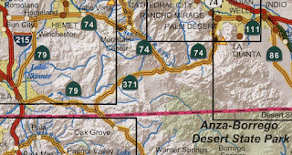
This past October I drove the entirety of California State Route 371 from CA 79 northeast to CA 74.

CA 371 is a 21 mile east/west State Highway which serves as a connector between CA 79 and CA 74. CA 371 is entirely located within Riverside County.
Part 1; the history of California State Route 371
The current alignment that is now CA 371 was added to the State Highway System in 1959 as Legislative Route 277 according to CAhighways. The planned alignment of LRN 277 first appears on the 1960 Division of Highways State Map. Cahuilla Road and Kenworthy-Bautista Road are shown to be more or less the existing through route.

It appears that instead of building a new alignment for LRN 277 the Division of Highways opted to assume maintenance of Cahuilla Road and Kenworthy-Bautista Road. LRN 277 can be seen aligned over Cahuilla Road and Kenworthy-Bautista Road on the 1962 Division of Highways State Map.

During the 1964 State Highway Renumbering LRN 277 was reassigned as an eastern extension of CA 71. The new assignment of CA 71 over what was LRN 277 can be seen on the 1964 Division of Highways Map.

According to CAhighways CA 71 was truncated in 1974 to I-15 near Murrieta. This truncation led to CA 71 between CA 79 and CA 74 being reassigned as CA 371. CA 371 can be seen for the first time on the 1975 Caltrans State Highway Map. CA 371 as an assigned number was a simple adding of a "3" to the previous CA 71 designation.

Part 2; a drive on California State Route 371
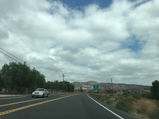
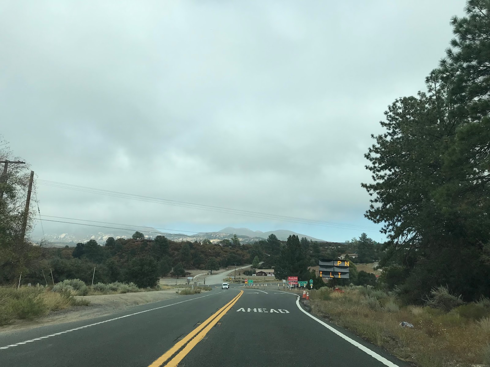
My approach to CA 371 eastbound was from CA 79 southbound. CA 371 is signed as a cut-off road to Indio.


Interestingly Post Mileage on CA 371 begins at RIV 56.469 which is a trace vestige of the previous CA 71 designation. CA 371 eastbound is immediately signed as a Daytime Headlight Safety Corridor for the next 18 miles. Truck traffic on CA 371 is advised against 30 foot or longer loads. Traffic is further advised that CA 371 is susceptible to chain restrictions.


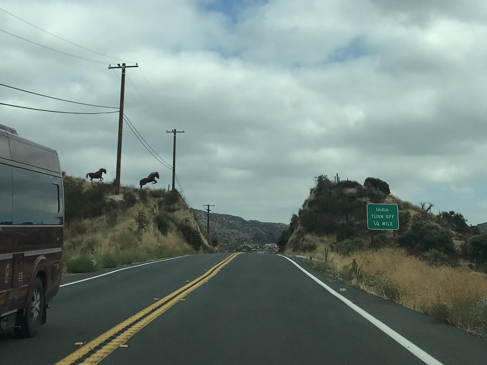
Anza is signed as 14 miles away on CA 371 east. Palm Desert is signed as 43 miles away and Indio is signed at 53 miles.

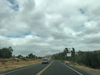
CA 371 eastbound traverses the semi-arid terrain of the Santa Rosa Mountain foothills and enters the Cahuila Indian Reservation at Post Mile RIV 67.145.


CA 371 east passes through the Cahuila Reservation and enters the community of Anza.


Anza lies at an elevation of 3,921 feet above sea level in Anza Valley. The community of Anza is named after Spanish explorer Juan Bautista de Anza which explored Anza Valley in 1774 and 1775. CA 371 passes through Anza on Cahuilla Road where it transitions onto Kenworthy-Bautista Road.


CA 371 east of Anza begins to ascend into the Santa Rosa Mountains, traffic is advised the Safety Corridor ceases.


CA 371 east enters San Bernardino National Forest at Post Mile RIV 75.264. CA 371 ascends through the Santa Rosa Mountains to an east terminus at CA 74/Pines-to-Palms Highway at Post Mile RIV 77.143.


CA 371 is a 21 mile east/west State Highway which serves as a connector between CA 79 and CA 74. CA 371 is entirely located within Riverside County.

Part 1; the history of California State Route 371
The current alignment that is now CA 371 was added to the State Highway System in 1959 as Legislative Route 277 according to CAhighways. The planned alignment of LRN 277 first appears on the 1960 Division of Highways State Map. Cahuilla Road and Kenworthy-Bautista Road are shown to be more or less the existing through route.

It appears that instead of building a new alignment for LRN 277 the Division of Highways opted to assume maintenance of Cahuilla Road and Kenworthy-Bautista Road. LRN 277 can be seen aligned over Cahuilla Road and Kenworthy-Bautista Road on the 1962 Division of Highways State Map.

During the 1964 State Highway Renumbering LRN 277 was reassigned as an eastern extension of CA 71. The new assignment of CA 71 over what was LRN 277 can be seen on the 1964 Division of Highways Map.

According to CAhighways CA 71 was truncated in 1974 to I-15 near Murrieta. This truncation led to CA 71 between CA 79 and CA 74 being reassigned as CA 371. CA 371 can be seen for the first time on the 1975 Caltrans State Highway Map. CA 371 as an assigned number was a simple adding of a "3" to the previous CA 71 designation.

Part 2; a drive on California State Route 371
My approach to CA 371 eastbound was from CA 79 southbound. CA 371 is signed as a cut-off road to Indio.


Interestingly Post Mileage on CA 371 begins at RIV 56.469 which is a trace vestige of the previous CA 71 designation. CA 371 eastbound is immediately signed as a Daytime Headlight Safety Corridor for the next 18 miles. Truck traffic on CA 371 is advised against 30 foot or longer loads. Traffic is further advised that CA 371 is susceptible to chain restrictions.


Anza is signed as 14 miles away on CA 371 east. Palm Desert is signed as 43 miles away and Indio is signed at 53 miles.

CA 371 eastbound traverses the semi-arid terrain of the Santa Rosa Mountain foothills and enters the Cahuila Indian Reservation at Post Mile RIV 67.145.


CA 371 east passes through the Cahuila Reservation and enters the community of Anza.


Anza lies at an elevation of 3,921 feet above sea level in Anza Valley. The community of Anza is named after Spanish explorer Juan Bautista de Anza which explored Anza Valley in 1774 and 1775. CA 371 passes through Anza on Cahuilla Road where it transitions onto Kenworthy-Bautista Road.


CA 371 east of Anza begins to ascend into the Santa Rosa Mountains, traffic is advised the Safety Corridor ceases.


CA 371 east enters San Bernardino National Forest at Post Mile RIV 75.264. CA 371 ascends through the Santa Rosa Mountains to an east terminus at CA 74/Pines-to-Palms Highway at Post Mile RIV 77.143.


Comments
It is part of an east-west corridor formed by parts of California 79, California 371, and California 74 between Temecula and the Palm Springs-Coachella Valley area.The same east-west corridor serves as a popular short cut for motorists traveling between San Diego County and Palm Springs-Coachella Valley regions for the spectacular scenery and shorter distance (by 25 miles) versus the heavily congested freeway route via Interstates 10, 15 and 215.