Lake Tahoe Circle Tour Part 1; CA 89, former CA 188 to Fallen Leaf Lake, Emerald Bay State Park, and the mouth of the Truckee River
Upon my arrival to Lake Tahoe during the Fall Season it was my intention to drive the entire perimeter. Given that my starting point in South Tahoe the obvious route was through California State Route 89 to get in an early hike at Emerald Bay State Park. Along the way I made a detour on the former alignment of CA 188 to Fallen Leaf Lake.

The morning started out on US Route 50 west with a quick turn on CA 89 north in South Lake Tahoe.


CA 89 follows Emerald Bay Road for approximately 27 on the south and west shore of Lake Tahoe to CA 28 in Tahoe City. CA 89 is by far the most rugged of all the highways traversing the shores of Lake Tahoe with high grades and steep drop offs. Leaving South Lake Tahoe the route of CA 89 northbound quickly enters El Dorado National Forest.

CA 89 northbound is quickly advised that bears may be present and enters Camp Richardson.


CA 89 is subject periodic winter closures given the west shore of Lake Tahoe is subjected to far more snow fall than the east shore. There is a small traffic advisory sign altering travelers if CA 89 northbound is open in Camp Richardson.

At Fallen Leaf Road CA 89 encounters the former alignment of the first CA 188 which turned south towards Fallen Leaf Lake. I turned off of CA 89 and headed south on former CA 188.

CA 188 was an approximately 5 mile State Highway which traversed the east shore of Fallen Leaf Lake to it's southern tip. CA 188 was assigned to Legislative Route Number 94 in 1964 but was the route was deleted one year later. LRN 94 was adopted in 1933 and appeared to have stayed in the State Highway system as long as it did due to the fact that off-grid political meetings were often held during the winter at Fallen Leaf Lake. More information regarding CA 188 can be found on CAhighways.org.
CAhighways.org on CA 188
Former CA 188 on Fallen Leaf Road is paved but is very haggard and in poor condition. The roadway is single lane but fortunately most local residents had left for the winter by the time I arrived. Traffic is quickly advised that Fallen Leaf Road is not subject to snow removal.

The Fallen Leaf National Forest Campground is quickly encountered southbound on Fallen Leaf Road.


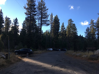
While the northern parts of Fallen Leaf Road are some wide enough to allow for comfortable passing the route south of the Fallen Leaf Campground is often 8-12 feet wide. The white SUV in front of me quickly gave up wherever he was going and turned around.


As Fallen Leaf Road approaches the eastern shore of Fallen Leaf Lake there is a truck advisory sign.

Fallen Leaf Lake apparently even has it's own fire department which I found interesting.

Fallen Leaf Road becomes extremely narrow on the east shore of Fallen Leaf Lake which has numerous seasonal residences.


I'm not exactly certain where CA 188 terminated at the south shore of Fallen Leaf Lake but Fallen Leaf Lake Road does continue to the Stanford Sierra Conference Center. At stopped at the Fallen Leaf Lake Store parking lot to check out Fallen Leaf Lake which has a hell of a view of Mount Tallac. Fallen Leaf Lake lies at 6,377 feet above sea level and is 1 mile wide by 2.9 miles long. Fallen Leaf Lake is surprisingly deep at 415 feet. Fallen Leaf Lake was carved out by glaciers, the primary inflow is via Glen Alpine Creek with outflow into Lake Tahoe via Taylor Creek.


Pay phones are still a thing at the Fallen Leaf Lodge.


After returning to CA 89 I turned northbound. CA 89 quickly crosses Taylor Creek and Tallac Creek heading northward along Eagle Point. CA 89 northbound crosses Cascade Creek and traverses several switchbacks before rising above Emerald Bay to the west and Cascade Lake to the east.


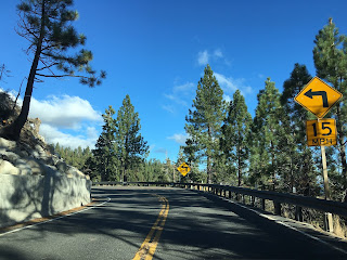


I stopped at Inspiration Point to view Emerald Bay located in Emerald Bay State Park.


This small display at Inspiration Point briefs the history of the State Highways on Emerald Bay Road. The display discusses the first the first automobiles to traverse Emerald Bay on the new State Highway built in 1913.

Emerald Bay Road may have opened as a State Highway in 1913 but it was rooted in a Legislative Act in Chapter 158 which created a highway from the proximity of Truckee south to Meyers. This roadway eventually was assigned LRN 38 which became CA 89 in 1934. The legislative history behind LRN 38 can be observed on CAhighways.org.
CAhighways.org on Early California Highways
CAhighways.org on LRN 38
From Inspiration Point I followed CA 89 along the south shore of Emerald Bay to the Eagle Falls Trailhead.


The Eagle Falls Trail follows Eagle Creek up to Eagle Falls. Eagle Falls flows out of the nearby Eagle Lake down into Emerald Bay. From the top of the trail there is a small vista overlooking Emerald Bay and Lake Tahoe, Mount Tallac is also easily observed.


From the western overlook of Emerald Bay the entire width is very apparent. Emerald Bay was shaped by glaciers much like nearby Fallen Leaf Lake. Unlike Fallen Leaf Lake the glaciers at Emerald Bay punched into the waters of Lake Tahoe. The island in the center of Emerald Bay is known as Fannette Island. The Vikingsholm Mansion is located on the south shore of Emerald Bay and was completed in 1929.

North of Emerald Bay on CA 89 quickly rises in elevation along the west shore of Lake Tahoe and approaches D.L. Bliss State Park.


North of D.L. Bliss State Park the alignment of CA 89 enters the community of Rubicon Bay followed by Meeks Bay.


Sugar Pine Point State Park is located along CA 89 in Meeks Bay.

North of Sugar Pine Point State Park CA 89 enters Tahoma and crosses the Placer County Line.


Upon entering Placer County the alignment of CA 89 northbound crosses through Homewood. There is a small guide sign informing northbound CA 89 traffic that Tahoe City is only 6 miles away.


Upon entering Tahoe Pines there is public beach access points along CA 89 at the west shore of Lake Tahoe.


Upon entering Tahoe City the alignment of CA 89 northbound approaches CA 28 at the mouth of the Truckee River.


I stopped at the Gatekeeper's Museum located at the Truckee River Outlet.

The Gatekeepers Museum is a great place to observe the Lake Tahoe Dam which was completed in 1913 and the 1928 Fanny Bridge on CA 28.


The Lake Tahoe Dam replaced a structure that had been place since 1870 and was under construction from 1909 to 1913. The Lake Tahoe Dam can potentially raise the level of Lake Tahoe by 10.2 feet from it's natural height of 6,223 feet above sea level. Given the surface area of Lake Tahoe is 191 square miles the amount of water that can be stored by a 10.2 elevation rise is massive. The Lake Tahoe Dam was likely used when Emerald Bay Road opened as a State Highway in 1913.


The 1928 Fanny Bridge has been the stalwart replacement of the Lake Tahoe Dam over the Truckee River since 1928.

The Fanny Bridge was slated to be replaced by a new span to the west on the Truckee River. Construction was supposed to be well underway by this month but the project has been pushed back to 2019. Renderings of the new span and news can be found here:
Tahoetranportation.org New Fanny Bridge
Part 2 of the Lake Tahoe Circle Tour series covers CA 28/NV 28 along the north and eastern shore:
Lake Tahoe Circle Tour Part 2
Part 3 of the Lake Tahoe Circle Tour covers US Route 50 and Cave Rock:
Lake Tahoe Circle Tour Part 3

The morning started out on US Route 50 west with a quick turn on CA 89 north in South Lake Tahoe.


CA 89 follows Emerald Bay Road for approximately 27 on the south and west shore of Lake Tahoe to CA 28 in Tahoe City. CA 89 is by far the most rugged of all the highways traversing the shores of Lake Tahoe with high grades and steep drop offs. Leaving South Lake Tahoe the route of CA 89 northbound quickly enters El Dorado National Forest.

CA 89 northbound is quickly advised that bears may be present and enters Camp Richardson.


CA 89 is subject periodic winter closures given the west shore of Lake Tahoe is subjected to far more snow fall than the east shore. There is a small traffic advisory sign altering travelers if CA 89 northbound is open in Camp Richardson.

At Fallen Leaf Road CA 89 encounters the former alignment of the first CA 188 which turned south towards Fallen Leaf Lake. I turned off of CA 89 and headed south on former CA 188.

CA 188 was an approximately 5 mile State Highway which traversed the east shore of Fallen Leaf Lake to it's southern tip. CA 188 was assigned to Legislative Route Number 94 in 1964 but was the route was deleted one year later. LRN 94 was adopted in 1933 and appeared to have stayed in the State Highway system as long as it did due to the fact that off-grid political meetings were often held during the winter at Fallen Leaf Lake. More information regarding CA 188 can be found on CAhighways.org.
CAhighways.org on CA 188
Former CA 188 on Fallen Leaf Road is paved but is very haggard and in poor condition. The roadway is single lane but fortunately most local residents had left for the winter by the time I arrived. Traffic is quickly advised that Fallen Leaf Road is not subject to snow removal.

The Fallen Leaf National Forest Campground is quickly encountered southbound on Fallen Leaf Road.


While the northern parts of Fallen Leaf Road are some wide enough to allow for comfortable passing the route south of the Fallen Leaf Campground is often 8-12 feet wide. The white SUV in front of me quickly gave up wherever he was going and turned around.


As Fallen Leaf Road approaches the eastern shore of Fallen Leaf Lake there is a truck advisory sign.

Fallen Leaf Lake apparently even has it's own fire department which I found interesting.

Fallen Leaf Road becomes extremely narrow on the east shore of Fallen Leaf Lake which has numerous seasonal residences.


I'm not exactly certain where CA 188 terminated at the south shore of Fallen Leaf Lake but Fallen Leaf Lake Road does continue to the Stanford Sierra Conference Center. At stopped at the Fallen Leaf Lake Store parking lot to check out Fallen Leaf Lake which has a hell of a view of Mount Tallac. Fallen Leaf Lake lies at 6,377 feet above sea level and is 1 mile wide by 2.9 miles long. Fallen Leaf Lake is surprisingly deep at 415 feet. Fallen Leaf Lake was carved out by glaciers, the primary inflow is via Glen Alpine Creek with outflow into Lake Tahoe via Taylor Creek.


Pay phones are still a thing at the Fallen Leaf Lodge.


After returning to CA 89 I turned northbound. CA 89 quickly crosses Taylor Creek and Tallac Creek heading northward along Eagle Point. CA 89 northbound crosses Cascade Creek and traverses several switchbacks before rising above Emerald Bay to the west and Cascade Lake to the east.


I stopped at Inspiration Point to view Emerald Bay located in Emerald Bay State Park.


This small display at Inspiration Point briefs the history of the State Highways on Emerald Bay Road. The display discusses the first the first automobiles to traverse Emerald Bay on the new State Highway built in 1913.

Emerald Bay Road may have opened as a State Highway in 1913 but it was rooted in a Legislative Act in Chapter 158 which created a highway from the proximity of Truckee south to Meyers. This roadway eventually was assigned LRN 38 which became CA 89 in 1934. The legislative history behind LRN 38 can be observed on CAhighways.org.
CAhighways.org on Early California Highways
CAhighways.org on LRN 38
From Inspiration Point I followed CA 89 along the south shore of Emerald Bay to the Eagle Falls Trailhead.


The Eagle Falls Trail follows Eagle Creek up to Eagle Falls. Eagle Falls flows out of the nearby Eagle Lake down into Emerald Bay. From the top of the trail there is a small vista overlooking Emerald Bay and Lake Tahoe, Mount Tallac is also easily observed.


From the western overlook of Emerald Bay the entire width is very apparent. Emerald Bay was shaped by glaciers much like nearby Fallen Leaf Lake. Unlike Fallen Leaf Lake the glaciers at Emerald Bay punched into the waters of Lake Tahoe. The island in the center of Emerald Bay is known as Fannette Island. The Vikingsholm Mansion is located on the south shore of Emerald Bay and was completed in 1929.

North of Emerald Bay on CA 89 quickly rises in elevation along the west shore of Lake Tahoe and approaches D.L. Bliss State Park.


North of D.L. Bliss State Park the alignment of CA 89 enters the community of Rubicon Bay followed by Meeks Bay.


Sugar Pine Point State Park is located along CA 89 in Meeks Bay.

North of Sugar Pine Point State Park CA 89 enters Tahoma and crosses the Placer County Line.


Upon entering Placer County the alignment of CA 89 northbound crosses through Homewood. There is a small guide sign informing northbound CA 89 traffic that Tahoe City is only 6 miles away.


Upon entering Tahoe Pines there is public beach access points along CA 89 at the west shore of Lake Tahoe.


Upon entering Tahoe City the alignment of CA 89 northbound approaches CA 28 at the mouth of the Truckee River.


I stopped at the Gatekeeper's Museum located at the Truckee River Outlet.

The Gatekeepers Museum is a great place to observe the Lake Tahoe Dam which was completed in 1913 and the 1928 Fanny Bridge on CA 28.


The Lake Tahoe Dam replaced a structure that had been place since 1870 and was under construction from 1909 to 1913. The Lake Tahoe Dam can potentially raise the level of Lake Tahoe by 10.2 feet from it's natural height of 6,223 feet above sea level. Given the surface area of Lake Tahoe is 191 square miles the amount of water that can be stored by a 10.2 elevation rise is massive. The Lake Tahoe Dam was likely used when Emerald Bay Road opened as a State Highway in 1913.


The 1928 Fanny Bridge has been the stalwart replacement of the Lake Tahoe Dam over the Truckee River since 1928.

The Fanny Bridge was slated to be replaced by a new span to the west on the Truckee River. Construction was supposed to be well underway by this month but the project has been pushed back to 2019. Renderings of the new span and news can be found here:
Tahoetranportation.org New Fanny Bridge
Part 2 of the Lake Tahoe Circle Tour series covers CA 28/NV 28 along the north and eastern shore:
Lake Tahoe Circle Tour Part 2
Part 3 of the Lake Tahoe Circle Tour covers US Route 50 and Cave Rock:
Lake Tahoe Circle Tour Part 3
Comments