Leaving Lake Tahoe this weekend I took the entirety of California State Route 267 north towards Truckee and Donner Pass.

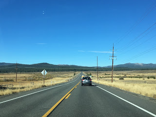
CA 267 is a relatively short state highway traversing north from the shore of Lake Tahoe in Placer County 13 miles to I-80/CA 89 located in Truckee in Nevada County. The entirety of CA 267 is signed on Shore Road. Heading north from CA 28 there is a small guide sign showing the distance to Truckee and I-80.


The southern part of CA 267 is known as the Senator Paul J. Lunardi Memorial Highway.

CA 267 northbound ascends on a steep grade to the 7,179 foot Brockway Summit.


CA 267 north from Brockway Summit has a 5 mile downhill grade at 9% to the Truckee River watershed.


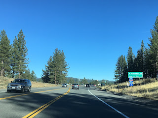
The Truckee-Tahoe Airport is on CA 267 just south of the Truckee Town limits at Truckee-Tahoe Airport Road.

A couple hundred feet north of Truckee-Tahoe Airport Road CA 267 enters Nevada County and the town limits of Truckee.

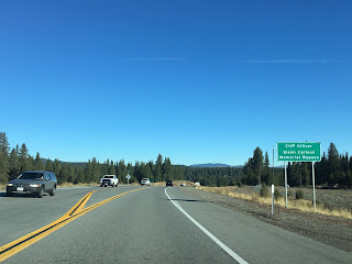
CA 267 northbound traffic is directed towards I-80 in Truckee on the CHP Officer Glenn Carlson Memorial Bypass. The original alignment of CA 267 continued into downtown Truckee on Old Brockway Road and to I-80/CA 89 on Donner Pass Road.

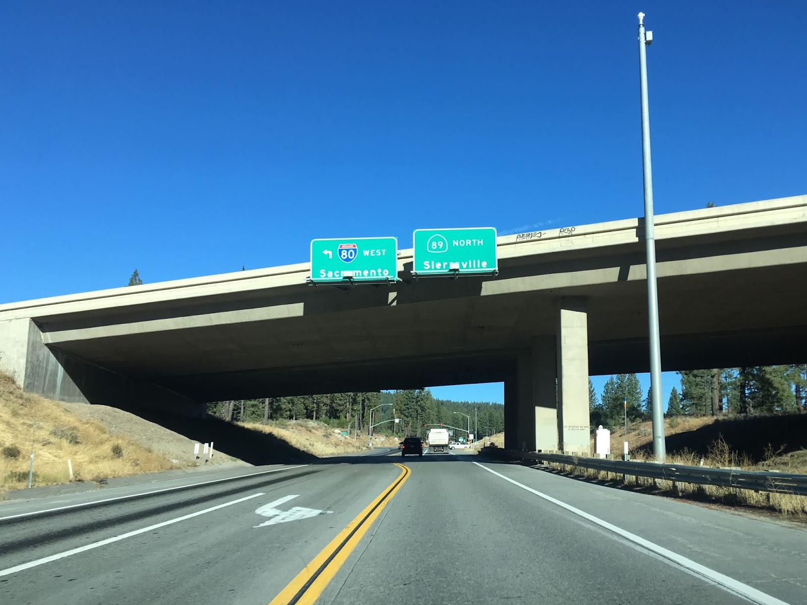
CA 267 crosses the Truckee River and Union Pacific Railroad descending Donner Pass before terminating at I-80/CA 89.


CA 267 is a relatively new State Highway designation having been adopted in Legislative Chapter 1425 in 1965.
CAhighways.org on CA 267
CA 267 first appears on the 1966 State Highway map as a complete State Route but unsigned.
1966 State Highway Map
CA 267 appears to have been signed by 1967.
1967 State Highway Map
According to historicaerials.com the alignment of CA 267 switched from Old Brockway Road/Donner Pass to the CHP Officer Glenn Carlson Memorial Bypass some time between 1994 and 2003.
The future alignment of CA 267 appears as a well maintained county route between Truckee over Brockway Summit to Lake Tahoe on the California Division of Highways maps of Nevada/Placer County in 1935.
1935 Nevada County Highway Map
1935 Placer County Highway Map

CA 267 is a relatively short state highway traversing north from the shore of Lake Tahoe in Placer County 13 miles to I-80/CA 89 located in Truckee in Nevada County. The entirety of CA 267 is signed on Shore Road. Heading north from CA 28 there is a small guide sign showing the distance to Truckee and I-80.


The southern part of CA 267 is known as the Senator Paul J. Lunardi Memorial Highway.

CA 267 northbound ascends on a steep grade to the 7,179 foot Brockway Summit.


CA 267 north from Brockway Summit has a 5 mile downhill grade at 9% to the Truckee River watershed.


The Truckee-Tahoe Airport is on CA 267 just south of the Truckee Town limits at Truckee-Tahoe Airport Road.

A couple hundred feet north of Truckee-Tahoe Airport Road CA 267 enters Nevada County and the town limits of Truckee.

CA 267 northbound traffic is directed towards I-80 in Truckee on the CHP Officer Glenn Carlson Memorial Bypass. The original alignment of CA 267 continued into downtown Truckee on Old Brockway Road and to I-80/CA 89 on Donner Pass Road.


CA 267 crosses the Truckee River and Union Pacific Railroad descending Donner Pass before terminating at I-80/CA 89.


CA 267 is a relatively new State Highway designation having been adopted in Legislative Chapter 1425 in 1965.
CAhighways.org on CA 267
CA 267 first appears on the 1966 State Highway map as a complete State Route but unsigned.
1966 State Highway Map
CA 267 appears to have been signed by 1967.
1967 State Highway Map
According to historicaerials.com the alignment of CA 267 switched from Old Brockway Road/Donner Pass to the CHP Officer Glenn Carlson Memorial Bypass some time between 1994 and 2003.
The future alignment of CA 267 appears as a well maintained county route between Truckee over Brockway Summit to Lake Tahoe on the California Division of Highways maps of Nevada/Placer County in 1935.
1935 Nevada County Highway Map
1935 Placer County Highway Map
Comments