After making my way off of Dante's View my destination for the night was in downtown Las Vegas. Reaching Las Vegas from Death Valley National Park has a surprisingly large amount of options, my path was on Nevada Route 159.

This blog serves as a continuation from Part 4 of the 2016 Fall Mountain Trip which can be found here.
2016 Fall Mountain Trip Part 4; Death Valley and Dante's View Road
After leaving Dante's View Road and making it back to CA 190 I took it east to it's terminus at CA 127 in Death Valley Junction.


CA 127 intersects State Line Road in Death Valley Junction.

I took State Line Road east to the Nevada State Line where I entered Nye County. On the Nevada side State Line Road had recently been repaved, when I last visited in 2012 it was in really bad shape. Eventually I made my way to Pahrump and joined NV 160 east towards Las Vegas.

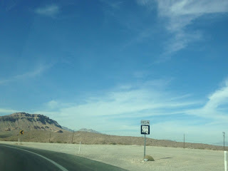
The Clark County Line isn't too far east of Pahrump on NV 160.
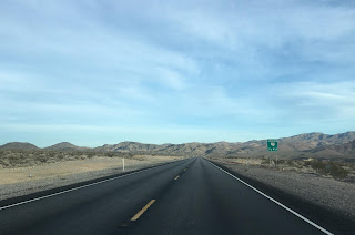
NV 160 climbs eastward over the 5,502 foot Mountain Springs Pass before descending into Las Vegas Valley. Near Blue Diamond NV 160 meets the western terminus of NV 159.
NV 159 is an approximately 31 mile state highway completely contained within Clark County. NV 159 is largely an east/west route but has a large north/south jog from NV 160. From NV 160 the routing of NV 159 follows Blue Diamond Road and Red Rock Canyon Road to the Red Rock Canyon National Conservation Area where it intersects the Red Rock Canyon Scenic Loop Drive.

Red Rock Canyon National Conservation Area is managed by the Bureau of Land Management. The Red Rock Canyon National Conservation Area was established in 1967 and has become a highly popular hiking destination for the Las Vegas Valley. The Red Rock Canyon Scenic Loop is 13 miles long, the high point of the Conservation Area is La Madre Mountain at 8,154 feet above sea level.


As NV 159 enters Las Vegas it becomes Charleston Boulevard and far as I could tell was unsigned. On the outskirts of Las Vegas NV 159 intersects Clark County Route 215 which serves as a continuation of I-215.

NV 159 intersects I-15 near Las Vegas Boulevard and downtown.

From NV 159/Charleston Boulevard east of I-15 I turned south on Main Street in downtown Las Vegas to reach Las Vegas Boulevard and the Stratosphere. NV 159 actually continues east of downtown where it intersects I-515/US 93/95. NV 159 continues east to the city limits of Las Vegas where it terminates at NV 612 at Nellis Boulevard.
Before the 1970s Nevada State Highway Renumbering NV 159 was part of NV 85. The State Highway grid as it was prior to the State Highway Renumbering can be seen on the this 1956 Nevada State Highway Map.
1956 State Highway Map
Part 6 of the 2016 Fall Mountain Trip Series can be found here:
2016 Fall Mountain Trip Part 6; The Stratosphere

This blog serves as a continuation from Part 4 of the 2016 Fall Mountain Trip which can be found here.
2016 Fall Mountain Trip Part 4; Death Valley and Dante's View Road
After leaving Dante's View Road and making it back to CA 190 I took it east to it's terminus at CA 127 in Death Valley Junction.


CA 127 intersects State Line Road in Death Valley Junction.

I took State Line Road east to the Nevada State Line where I entered Nye County. On the Nevada side State Line Road had recently been repaved, when I last visited in 2012 it was in really bad shape. Eventually I made my way to Pahrump and joined NV 160 east towards Las Vegas.

The Clark County Line isn't too far east of Pahrump on NV 160.

NV 160 climbs eastward over the 5,502 foot Mountain Springs Pass before descending into Las Vegas Valley. Near Blue Diamond NV 160 meets the western terminus of NV 159.

NV 159 is an approximately 31 mile state highway completely contained within Clark County. NV 159 is largely an east/west route but has a large north/south jog from NV 160. From NV 160 the routing of NV 159 follows Blue Diamond Road and Red Rock Canyon Road to the Red Rock Canyon National Conservation Area where it intersects the Red Rock Canyon Scenic Loop Drive.

Red Rock Canyon National Conservation Area is managed by the Bureau of Land Management. The Red Rock Canyon National Conservation Area was established in 1967 and has become a highly popular hiking destination for the Las Vegas Valley. The Red Rock Canyon Scenic Loop is 13 miles long, the high point of the Conservation Area is La Madre Mountain at 8,154 feet above sea level.


As NV 159 enters Las Vegas it becomes Charleston Boulevard and far as I could tell was unsigned. On the outskirts of Las Vegas NV 159 intersects Clark County Route 215 which serves as a continuation of I-215.

NV 159 intersects I-15 near Las Vegas Boulevard and downtown.

From NV 159/Charleston Boulevard east of I-15 I turned south on Main Street in downtown Las Vegas to reach Las Vegas Boulevard and the Stratosphere. NV 159 actually continues east of downtown where it intersects I-515/US 93/95. NV 159 continues east to the city limits of Las Vegas where it terminates at NV 612 at Nellis Boulevard.
Before the 1970s Nevada State Highway Renumbering NV 159 was part of NV 85. The State Highway grid as it was prior to the State Highway Renumbering can be seen on the this 1956 Nevada State Highway Map.
1956 State Highway Map
Part 6 of the 2016 Fall Mountain Trip Series can be found here:
2016 Fall Mountain Trip Part 6; The Stratosphere
Comments